 Block
From the record
One of 621 National Register listings published here for Cook County · listed in 1998 · category: Building.
Sources: the case file at the National Archives · the National Register database, National Park Service

Listed on the National Register of Historic Places in 1998.
One of 621 National Register listings published here for Cook County · listed in 1998 · category: Building.
Sources: the case file at the National Archives · the National Register database, National Park Service
Regional context, not property-specific evidence. The federal mineral resources record lists 5 workings within 5 miles of Hangar 1, Naval Air Station-Glenview: 5 past producers. None of them still produces. What was taken out: Stone, Crushed/Broken. Distance is straight-line from the map coordinates, so a quarry counted here may appear on a neighbouring settlement's page as well.
| Where | Site | Commodity | Status | Recorded |
|---|---|---|---|---|
| Glencoe City Engr. - Own Crews | Stone, Crushed/Broken | Past Producer | ||
| Morton Grove City Eng. - Own Crews | Stone, Crushed/Broken | Past Producer | ||
| Niles City Dept of Public Works | Stone, Crushed/Broken | Past Producer | ||
| Northbrook City Dept of Public Work | Stone, Crushed/Broken | Past Producer | ||
| Winnetka City Eng. - Own Crews | Stone, Crushed/Broken | Past Producer |
Regional context, not property-specific evidence. The National Weather Service names Glenview, the town this property stands in, in 19 storm reports between 2006 and 2025: 9 hail, 5 thunderstorm wind, 2 flash flood, 2 flood. The reports record 1 injury. Each account below is quoted exactly as the forecast office filed it, from the NOAA Storm Events Database, and each date opens the federal record of that event.
| When | Event | Place named | Harm | What the report says |
|---|---|---|---|---|
| August 2007 | Thunderstorm Wind | Glenview | 1 hurt, $50,000 | A large tree was blown down onto a vehicle near Lyons School. The vehicle was destroyed. A three year old girl was trapped inside but suffered only minor injuries. Numerous other trees, tree limbs and power lines were blown down. |
| August 2025 | Thunderstorm Wind | Glenview | - | Trees were downed and numerous tents were blown around and destroyed during Niles Founders Day in Golf Mill Park. |
| April 2023 | Hail | Glenview | - | A photo shared on social media showed hail to the size of walnuts. |
| July 2022 | Thunderstorm Wind | Glenview | - | A large tree limb was blown down onto a road. |
| October 2021 | Flood | Glenview | - | Lake Avenue was closed due to flooding at an underpass near Lehigh Avenue. Measured rainfall of 2.80 inches was reported in 24 hours near Northfield. |
| May 2018 | Flood | West Glenview | - | Standing water a few inches deep covered portions of Beckwith Road. |
| August 2018 | Heavy Rain | Glenview | - | Rainfall of 1.50 inches was measured in 45 minutes. |
| June 2013 | Flash Flood | West Glenview | - | Demster Street was flooded and closed between Harlem Avenue and Waukegan Road. |
| May 2012 | Hail | West Glenview | - | Dime to penny size hail was reported near the intersection of Golf Road and Shermer Road. |
| May 2012 | Flash Flood | West Glenview | - | Dempster Street was flooded between Waukegan Road and Ozark Street. |
| May 2006 | Hail | Glenview | - | Penny size hail was reported at Greenwood and Milwaukee Roads. |
| September 2006 | Thunderstorm Wind | Glenview | - | Large tree limbs were blown down. |
| April 2023 | Hail | Glenview | - | no account filed |
| April 2023 | Hail | Glenview | - | no account filed |
| July 2021 | Thunderstorm Wind | Glenview | - | no account filed |
| July 2017 | Hail | Glenview | - | no account filed |
| April 2016 | Hail | Glenview | - | no account filed |
| October 2006 | Hail | West Glenview | - | no account filed |
| October 2006 | Hail | West Glenview | - | no account filed |
No historic map-sheet match is published for this property yet. That does not mean no map exists. This record needs a coordinate-quality review before it can be joined to a sheet boundary. Browse the county's mapped places while that work is pending.
Other National Register properties close enough to walk or drive between, ordered by distance from this one. Both positions come from the same geocoding pass that matched these properties to their map sheets.
| Photograph | Property | Distance | Listed |
|---|---|---|---|
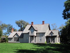 | Kennicott's Grove | 1.9 miles | 1973 |
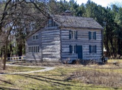 | Anita Willets Burnham Log House | 3.9 miles | 2005 |
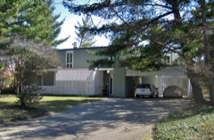 | Robert and Suzanne Drucker House | 4.1 miles | 2013 |
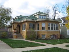 | Herbert A. Dilg House | 4.1 miles | 2009 |
| Eli and Jeanne Lipman House | 4.3 miles | 2025 | |
| Louis B. Kuppenheimer Jr. House | 4.3 miles | 2017 |
| National Archives record | The nomination case file for reference 98001357 in Record Group 79. |
| Cook County | All 621 listed properties in this county. |