 Block
From the record
15 National Register listings published here.
Sources: the county history on the Internet Archive · the National Register database, National Park Service
61 topographic sheets cover 49 settlements here, and 15 properties are on the National Register of Historic Places.
15 National Register listings published here.
Sources: the county history on the Internet Archive · the National Register database, National Park Service
Every property in this county listed on the National Register of Historic Places, with the year it was listed and the federal nomination document.
| Photograph | Property | Type | Listed | Reference |
|---|---|---|---|---|
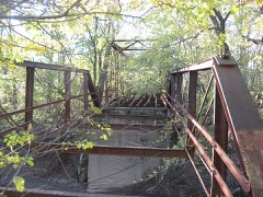 | Aqueduct Bridge | structure | 2000 | 00000209 |
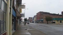 | Brazil Downtown Historic District | district | 1997 | 97000601 |
 | Clay County Courthouse | building | 1999 | 99001109 |
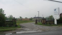 | Clay County Hospital | building | 1999 | 99001154 |
 | Eaglefield Place | building | 1998 | 98001104 |
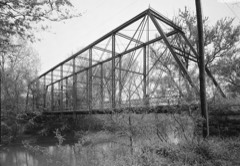 | Feeder Dam Bridge | structure | 2000 | 00000215 |
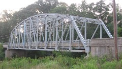 | Indiana State Highway Bridge 42-11-3101 | structure | 2000 | 00000210 |
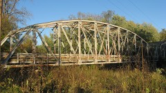 | Indiana State Highway Bridge 46-11-1316 | structure | 2000 | 00000211 |
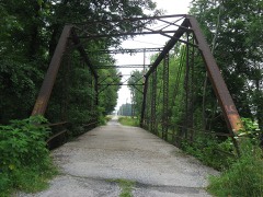 | Jeffers Bridge | structure | 2000 | 00000213 |
| Kennedy-Hoffa House | building | 2024 | 100010746 | |
 | Meridian-Forest Historic District | district | 1997 | 97000600 |
 | Poland Presbyterian Church and Cemetery | building | 1990 | 90001932 |
 | Shakamak State Park Historic District | district | 2000 | 00000199 |
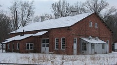 | Tide Water Pumping Station | district | 1999 | 99001076 |
 | US Post Office-Brazil | building | 1994 | 94001132 |
Every wildfire the federal occurrence database records inside this county: 3 of them, burning about 41 acres. 1 started naturally and none was recorded as arson. Each settlement page carries the fires within five miles of it.
| Reported cause | Fires |
|---|---|
| Natural | 1 |
| Debris and open burning | 1 |
| Missing data/not specified/undetermined | 1 |
The five largest, by the area the report gives. None of them was recorded as arson.
| Date | Cause | Size | Reported by | Name on the report |
|---|---|---|---|---|
| 3 October 2001 | Missing data/not specified/undetermined | 40 acres | Indiana State Fire Marshal's Office | not named |
| 10 November 2003 | Debris and open burning | under an acre | Indiana State Fire Marshal's Office | not named |
| 15 July 2003 | Natural | under an acre | Indiana State Fire Marshal's Office | not named |
Every settlement page carries the fires within five miles of it - see the settlement index below.
The NOAA Storm Events Database holds 203 reports for this county, causing no deaths, 2 injuries and about $47,176,000 in recorded property damage. Each settlement page carries the reports that name it.
| Kind of event | Reports |
|---|---|
| Thunderstorm Wind | 114 |
| Hail | 44 |
| Flash Flood | 20 |
| Flood | 14 |
| Tornado | 8 |
| Lightning | 2 |
| Heavy Rain | 1 |
The most serious of them, by death, then injury, then recorded damage. The accounts are quoted exactly as the forecast office filed them.
| When | Event | Place named | Harm | What the report says |
|---|---|---|---|---|
| September 1988 | Tornado (F1) | not stated | 2 hurt, $2,500 | no account filed |
| June 2008 | Flood | Bowling Green | $45,000,000 | Flooding occurred along the Eel River in Clay County, including near Bowling Green, due to heavy rainfall. |
| June 2023 | Thunderstorm Wind | Brazil | $600,000 | Numerous reports of downed trees with structural damage caused by thunderstorm wind gusts. Over 10000 power outages reported across the county with the extensive damage to both vegetation and power poles. |
| May 1996 | Tornado (F1) | Brazil | $250,000 | no account filed |
| April 2025 | Flash Flood | Art | $100,000 | Numerous roads closed across the county with several cars stranded in Brazil. Total rainfall ranged from 2.5 to 4.1 inches. |
| June 2024 | Thunderstorm Wind | Old Hill | $100,000 | Numerous trees and powerlines snapped or damaged by thunderstorm wind gusts. |
| June 2024 | Thunderstorm Wind | Clay City | $100,000 | Strong thunderstorm wind gusts knocked over corn crop and snapped large old growth trees over plus several large limbs of others landing on power lines with enough force to snap the cables. 1 tree landed across a lane of in sr 246. |
| May 2024 | Thunderstorm Wind | Coalmont | $75,000 | Several trees uprooted, a couple snapped, some power lines down from trees, and a little structural damage mainly from trees falling on homes caused by thunderstorm wind gusts. |
| June 2008 | Flash Flood | Brazil | $75,000 | Homes, vehicles, and bridges have been destroyed due to heavy rain that caused flash flooding. There was a 100 foot section of the road missing on County Road 200 South. Sixty percent of the roads in the county have sustained some form of damage with thirty percent suffering severe damage, meaning being totally washed out. The streets in Brazil also have experienced some damage. |
| May 2002 | Flash Flood | Countywide | $75,000 | Numerous roads flooded |
| June 2008 | Flash Flood | Turner | $50,000 | Interstate 70 was closed due to heavy rain that caused flash flooding. |
| June 2007 | Tornado (EF0) | Ashboro | $50,000 | An EF0 tornado touched down near the town of Ashboro in Clay County at approximately 630 PM EDT on the evening of June 4, 2007. The tornado tracked towards the southeast, and produced several areas of minor to moderate tree damage. Some of the damage to structures included three homes sustaining minor damage, a carport lifted off of the ground and damaged, a mini barn moved off of its blocks, and trees blown down onto a trampoline and a truck. |
| June 2006 | Lightning | Clay City | $50,000 | A lightning strike set a home ablaze and killed a breeder calf standing 60 yards away from the home. |
| May 2002 | Flash Flood | Countywide | $50,000 | no account filed |
| May 2002 | Flash Flood | Harmony | $50,000 | no account filed |
| May 2002 | Flash Flood | Countywide | $50,000 | no account filed |
| May 1994 | Hail | Royal | $50,000 | no account filed |
| July 2023 | Thunderstorm Wind | Brazil | $40,000 | Tree downed onto home by thunderstorm wind gusts. |
| June 2023 | Thunderstorm Wind | Prairie City | $25,000 | Part of roof ripped off by thunderstorm wind gusts. |
| June 1998 | Tornado (F0) | Billville | $25,000 | no account filed |
| June 1973 | Tornado (F1) | not stated | $25,000 | no account filed |
| April 2018 | Thunderstorm Wind | Bogle Corner | $20,000 | Trees and power lines were downed and a camper was turned over due to damaging thunderstorm wind gusts. This report was relayed by dispatch. |
| July 2016 | Flash Flood | Brazil | $20,000 | A culvert was washed out on County Road 1100 North, about 0.5 miles east of State Road 59, due to thunderstorm heavy rainfall. |
| June 2008 | Flash Flood | Brazil | $20,000 | A Cocorahs observer reported flash flooding due to heavy rainfall. |
| July 2001 | Flash Flood | Clay City | $20,000 | no account filed |
| May 2000 | Thunderstorm Wind | Brazil | $20,000 | no account filed |
| August 2000 | Thunderstorm Wind | Brazil | $20,000 | no account filed |
| March 2008 | Flood | Bowling Green | $15,000 | Flooding occurred along the Eel River in Clay County, including near Bowling Green, due to heavy rain. |
| April 2025 | Thunderstorm Wind | Knightsville | $10,000 | Trees downed by thunderstorm wind gusts near the intersection of US Highway 40 and County Road 100 East along with structural damage to a 3 car garage. |
| June 2019 | Thunderstorm Wind | Clay City | $10,000 | Several large trees were uprooted and numerous tree limbs were snapped with power outages reported in Clay City due to damaging thunderstorm wind gusts. |
| July 2014 | Thunderstorm Wind | Cardonia | $10,000 | Numerous trees were downed across northern Clay County due to damaging thunderstorm wind gusts. |
| February 2008 | Flood | Bowling Green | $10,000 | Flooding occurred along the Eel River in Clay County, including near Bowling Green, due to heavy rain and snow melt. |
| October 2007 | Thunderstorm Wind | Brazil | $10,000 | Damaging thunderstorm winds caused a tree to fall onto a garage and back porch. |
| July 2004 | Thunderstorm Wind | Brazil | $10,000 | no account filed |
| April 2000 | Thunderstorm Wind | Clay City | $10,000 | no account filed |
| August 2000 | Thunderstorm Wind | Brazil | $10,000 | no account filed |
| June 2019 | Thunderstorm Wind | Coalmont | $8,000 | Dispatch reported several trees down in Coalmont due to damaging thunderstorm wind gusts. |
| May 2010 | Thunderstorm Wind | Coalmont | $7,000 | Trees were reported down in the southern portion of Shakamak State Park. |
| July 2002 | Thunderstorm Wind | Brazil | $7,000 | Trees down. Gas station sign fell on vehicle. |
| December 2021 | Thunderstorm Wind | Cardonia | $5,000 | Numerous trees and power lines down by thunderstorm wind gusts across northern Clay County. |
| July 2020 | Thunderstorm Wind | Bowling Green | $5,000 | Several power lines and large trees downed due to thunderstorm wind gusts in Bowling Green. Additional damage was reported in surrounding areas with 2 trees downed on vehicles. |
| September 2018 | Flash Flood | Center Pt | $5,000 | Several county roads were closed in portions of Clay County with water flowing over them due to heavy rainfall. Portions of County Roads 300 East and 400 East were closed. |
| January 2008 | Thunderstorm Wind | Brazil | $5,000 | Trees and power poles were reported down across the county due to damaging thunderstorm winds. |
| June 2008 | Flash Flood | Hoffman Crossing | $5,000 | Roadways were covered and previous flooding conditions were exacerbated due to heavy rainfall that caused renewed flash flooding. |
| June 2008 | Flash Flood | Carbon | $5,000 | Roadways were covered and previous flooding conditions were exacerbated due to heavy rainfall that caused renewed flash flooding. |
| June 2008 | Flash Flood | Brazil | $5,000 | Many roads are closed due to flash flooding caused by heavy rainfall. |
| May 1998 | Thunderstorm Wind | Brazil | $5,000 | Trees blown down and few shed roofs blown off. |
| June 1998 | Thunderstorm Wind | Countywide | $5,000 | no account filed |
| May 2013 | Thunderstorm Wind | Brazil | $4,000 | Multiple trees were reported down in the area due to damaging thunderstorm wind gusts. |
| April 2025 | Thunderstorm Wind | Brazil | $3,000 | Trees damaged by thunderstorm wind gusts on the west side of Brazil. |
| June 2025 | Thunderstorm Wind | Asherville | $3,000 | Thunderstorm wind gusts caused tree damage near I-70 north of Center Point. Report via social media. |
| February 2024 | Thunderstorm Wind | Bowling Green | $3,000 | A 22 foot Coleman pool was lifted and caved in by thunderstorm wind gusts. |
| May 2012 | Tornado (EF0) | Old Hill | $3,000 | A small storm, with a weak radar signature, produced a brief tornado near Cory in Clay County. This EF-0 tornado had a path length of 0.1 mile and was 50 yards wide, touching down at 2:33 PM EDT. A few trees and some corn stalks were damaged from this tornado. |
| October 2010 | Thunderstorm Wind | Coalmont | $3,000 | A tree was reported down on a garage at 1973 E State Route 48. Power lines were also reported down. |
| April 2007 | Tornado (EF0) | Knightsville | $3,000 | The initial tornado touchdown was reported by a storm spotter at 4:20 P.M. EDT in Harmony, about 22 miles east of Terre Haute . Minor tree damage resulted from this storm in addition to damage to a metal carport and a shed. This tornado was rated EF0 on the Enhanced Fujita intensity scale with winds estimated around 70 mph. |
| June 2021 | Thunderstorm Wind | Prairie City | $2,000 | Numerous trees downed by thunderstorm wind gusts near the area of Interstate 70 and State Road 42. |
| June 2021 | Thunderstorm Wind | Smithville | $2,000 | Several trees downed along State Road 59 north of Clay City. |
| July 2020 | Thunderstorm Wind | Art | $2,000 | Power lines and power poles downed due to thunderstorm wind gusts near this location. |
| July 2020 | Thunderstorm Wind | Harmony | $2,000 | Multiple trees were downed due to thunderstorm wind gusts along US 40 east of Brazil. |
| July 2020 | Thunderstorm Wind | Saline City | $2,000 | Power lines were downed due to thunderstorm wind gusts. Exact locations were not noted. |
The Survey's mineral resources record lists 18 workings inside this county. 10 still produce and 8 are closed or unrecorded. Each settlement page carries the workings within five miles of it.
| Commodity | Workings |
|---|---|
| Fire Clay (Refractory) | 7 |
| Clay | 6 |
| Zinc | 2 |
| Sulfur | 2 |
| Coal | 2 |
| Clay, Stone | 1 |
| Clay, Coal | 1 |
| Coal, Clay | 1 |
The least common of them first, because a county's hundredth gravel pit says nothing its first ten did not.
| Where | Site | Commodity | Status | Recorded |
|---|---|---|---|---|
| C & F Shale Pit 1 | Clay, Stone | Producer | ||
| Indiana Clay Sales Pit | Coal, Clay | Past Producer | ||
| S. L. Turner Coal & Clay Pit | Clay, Coal | Producer | ||
| Ashboro North Pit | Clay, Coal | Producer | ||
| Cardonia Pit | Clay, Coal | Past Producer | ||
| Sphalerite Occurrence | Zinc, Sulfur | Occurrence | Stratabound | |
| Sphalerite Occurrence Z83 | Zinc, Sulfur | Occurrence | Stratabound | |
| Ashboro Pit | Clay | Past Producer | ||
| C & F Shale Pit 2 | Clay | Producer | ||
| E and E Clay Pit | Clay | Producer | ||
| Hoosierville Pit | Clay | Past Producer | ||
| Arketex Ceramic Plant #2 | Fire Clay (Refractory) | Producer | ||
| Arketex Ceramic Plants #'s 3 & 4 | Fire Clay (Refractory) | Producer | ||
| Brazil Brick Plant | Fire Clay (Refractory) | Producer | ||
| Clay City Plant | Fire Clay (Refractory) | Producer | ||
| Irwin Clay Plant | Fire Clay (Refractory) | Producer | ||
| Logan Clay and Shale Plant | Fire Clay (Refractory) | Past Producer | ||
| Marion Brick Clay and Shale Plant | Fire Clay (Refractory) | Past Producer |
One book written about this county, cut here where the book itself is cut, at its printed chapters: 1 chapter in all. Every chapter is public domain, machine-read from the scan and reproduced complete. A chapter already given under one of the county's towns is not repeated in this list.
| Chapter | Length |
|---|---|
| The whole text | 328,207 words in 21 parts |
Named settlements recorded in the Geographic Names Information System, each with the topographic sheets covering it. Villages, hamlets and abandoned places alike. Each is shown with the nearest named watercourse or landform and the survey quadrangle it falls on.
Dick Johnson township · 47834 · On Bee Creek · Brazil West quadrangle
14 sheets, 1950 to 1986
Van Buren township · 47834 · On Van Buren Creek · Brazil East quadrangle
14 sheets, 1950 to 1986
Washington township · 47833 · On Jordan Creek · Center Point quadrangle
16 sheets, 1908 to 1986
Lewis township · 47438 · On Susan Brothers Creek · Coal City quadrangle
18 sheets, 1938 to 1986
Van Buren township · 47834 · On Van Buren Creek · Brazil East quadrangle
14 sheets, 1950 to 1986
Posey township · 47834 · On Cottage Run · Brazil West quadrangle
14 sheets, 1950 to 1986
Brazil township · 47834 · On Harm Run · Brazil East quadrangle
14 sheets, 1950 to 1986
Harrison township · 47841 · On Turkey Creek · Clay City quadrangle
16 sheets, 1908 to 1986
Harrison township · 47841 · On Susan Brothers Creek · Coal City quadrangle
18 sheets, 1938 to 1986
Dick Johnson township · 47837 · On Fairwood Drain · Brazil West quadrangle
14 sheets, 1950 to 1986
Jackson township · 47834 · On East Fork Birch Creek · Center Point quadrangle
16 sheets, 1908 to 1986
Brazil township · 47834 · On Stunkard Run · Brazil West quadrangle
14 sheets, 1950 to 1986
Dick Johnson township · 47837 · On Orchard Run · Brazil West quadrangle
14 sheets, 1950 to 1986