 Block
Acton, Indiana
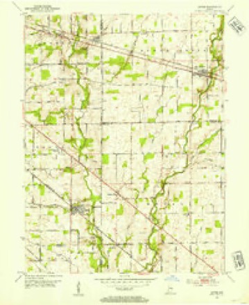
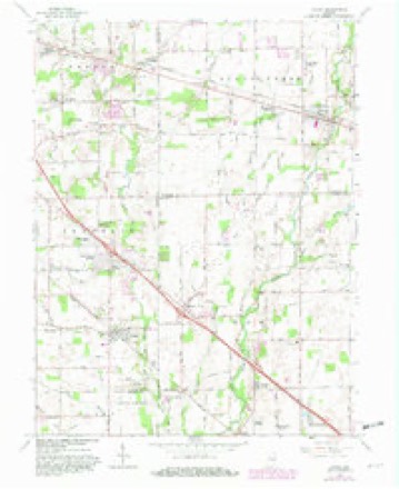
11 topographic sheets cover this place, the earliest surveyed in 1953 and the latest in 1986. It stands in Franklin Township. It lies in ZIP code area 46259. It stands on Acton Run. The Survey maps it on the Acton quadrangle. 4,938 people lived here at the 2022 count. It stands 791 feet above sea level.
Topographic sheets covering this place
5 surveys from 11 printed sheetsMatched by testing this settlement's coordinate against the published boundary of every sheet in the United States Geological Survey's historical collection. Each opens the scanned sheet at the Survey.
- 1953 USGS Acton quadrangle1:24000
- 1953 USGS Cincinnati quadrangle1:250000, 3 printings
- 1957 USGS Cincinnati quadrangle1:250000
- 1962 USGS Acton quadrangle1:24000, 4 printings
- 1986 USGS New Castle quadrangle1:100000, 2 printings



In the county-history sources
9,666 words on this townshipHistory of Indianapolis and Marion County, Indiana, published 1884 names this settlement in its chapter on Franklin Township. These are the passages that mention it, exactly as the scans read.
The village of Acton is situated in the southeastern part of Franklin township, on the line of the Cincinnati, Indianapolis, St, Louis and Chicago Railway. The land which forms the site of the village is a part of the tract originally owned by the pioneer settler, Peter Carbery, but which in 1852 was owned by Thomas Wallace. The village was laid out in that year by John E. Stretcher, surveyor, for Thomas Wallace and Thomas Ferguson, the town plat being recorded October 22d in the year named. There would probably never have been any village at that point but for the building of the railroad, which was at that time approaching completion, and which was opened for travel in September of the following year. The original name of the town was Farmersville, which was afterwards changed to Acton, to avoid confusion in the mail service, as there was already a post-office named Farmersville in the State.
Passage source: History of Indianapolis and Marion County, Indiana, published 1884.
Upon the establishment of the post-office at Acton, John Daily was appointed postmaster ; and his successors in the office have been (in the order named) Joseph Pierson, Samuel Rosengarten, Reuben Conway, Joseph Brenton, George W. Morgan, N. T. Parker, George W. Vaughn, D. W. Pierson, John Foley, and (again) D. W. Pierson, who is the present incumbent.
Passage source: History of Indianapolis and Marion County, Indiana, published 1884.
Salathiel T. Pierson commenced merchandising at Acton in 1853, and continued till his death in September, 1855. Dugald McDougall commenced in 1854, and continued about one year. James Morgan and Peter Swigart commenced at about the same time. John Threlkill commenced in 1855, and continued in trade about three years. N. J. Parker commenced about 1858 and continued till 1864. Rev. Thomas Ray was a merchant in Acton from 1858 to 1860, and Warren Stacy from 1860 to 1866. The three general stores of the village at the present time (January, 1884) are carried on respectively by D. W. Pierson, George W. Swails, and James W. Swaila. The first physician of Acton was Dr. William Scott, who came in 1855, and remained but a short time.
Passage source: History of Indianapolis and Marion County, Indiana, published 1884.
Machine-read from a century-old scan, so expect the errors a machine makes: misspelled names, dropped words, stray characters.
Read the whole chapter on Franklin Township - it names this place 13 more 13 times.
Mines and quarries near this place
1 within 5 milesRegional context, not property-specific evidence. The federal mineral resources record lists 1 working within 5 miles of Acton: 1 producer. All of them still produce. What was taken out: Sand and Gravel, Construction. Distance is straight-line from the map coordinates, so a quarry counted here may appear on a neighbouring settlement's page as well.
| Where | Site | Commodity | Status | Recorded |
|---|---|---|---|---|
| Indianapolis Aggregates Division | Sand and Gravel, Construction | Producer |
Storms near this place
11 since 2000Regional context, not property-specific evidence. The National Weather Service names Acton in 11 storm reports between 2000 and 2024: 6 thunderstorm wind, 5 hail. No death or injury is recorded in these reports. Each account below is quoted exactly as the forecast office filed it, from the NOAA Storm Events Database, and each date opens the federal record of that event.
| When | Event | Place named | Harm | What the report says |
|---|---|---|---|---|
| June 2024 | Thunderstorm Wind | Acton | $20,000 | Thunderstorm winds snapped or uprooted several large and mature trees in far southeastern Marion County, with power poles also damaged. |
| December 2015 | Thunderstorm Wind | Acton | $15,000 | A semi-truck was blown over on Interstate 74 near mile marker 101 due to damaging thunderstorm wind gusts. |
| August 2019 | Thunderstorm Wind | Acton | $10,000 | Gazebo was ripped out of the ground and thrown against a house due to thunderstorm wind gusts. |
| May 2013 | Thunderstorm Wind | Acton | $5,000 | Trees and limbs were downed near the intersection of Franklin and Shelbyville Roads due to damaging thunderstorm wind gusts. |
| June 2023 | Hail | Acton | - | Thunderstorm hail continued into Acton. |
| May 2014 | Hail | Acton | - | Dime to nickel sized hail was observed in this location. |
| May 2016 | Hail | Acton | - | no account filed |
| May 2014 | Hail | Acton | - | no account filed |
| May 2014 | Hail | Acton | - | no account filed |
| July 2001 | Thunderstorm Wind | Acton | - | no account filed |
| June 2000 | Thunderstorm Wind | Acton | - | no account filed |
Nearest settlements
The eight closest, with where each one stands in the county. Distances are straight-line, computed from the Geographic Names Information System coordinates.
| Map | Place | Distance | Sheets |
|---|---|---|---|
| Indian Creek Estates | 1.6 miles | 11 | |
| Charle Sumac Estates | 1.6 miles | 11 | |
| Charlesmac Village | 2.1 miles | 11 | |
| Wanamaker | 4.1 miles | 17 | |
| Belle Arbor | 4.6 miles | 11 | |
| Sun Down | 5.0 miles | 11 | |
| Julietta | 5.7 miles | 11 | |
| Poplar Grove | 6.0 miles | 17 |
Elsewhere
Matched on this settlement's Geographic Names Information System number rather than its name, so it cannot be a different place of the same name in another state.
| Wikipedia article on Acton | An encyclopaedic summary. Its text is share-alike, so it is linked here rather than copied. |
| Wikidata item Q344394 | The structured record the population and elevation above come from. Public domain (CC0). |
Provenance
This settlement is recorded in the Geographic Names Information System as feature 429999. The sheet list is computed by point-in-boundary test against the United States Geological Survey's historical topographic inventory. Both are works of the United States government and carry no copyright under 17 U.S.C. 105.
Mines and quarries. USGS Mineral Resources Data System (MRDS) https://mrdata.usgs.gov/mrds/ A work of the United States government, no copyright under 17 U.S.C. 105.
Storms. NOAA National Centers for Environmental Information, Storm Events Database https://www.ncei.noaa.gov/stormevents/ A work of the United States government, no copyright under 17 U.S.C. 105. Narratives are quoted verbatim from the National Weather Service report and are not edited or summarised.