 Block
Bluff Creek, Indiana
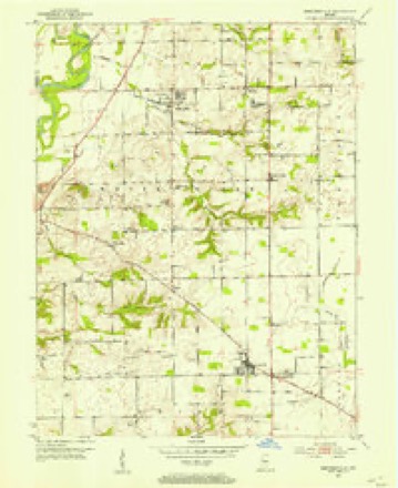
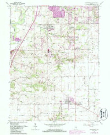
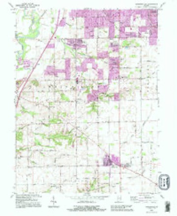
16 topographic sheets cover this place, the earliest surveyed in 1952 and the latest in 1992. It stands in White River Township. It lies in ZIP code area 46143. It stands on Mallow Run. The Survey maps it on the Bargersville quadrangle.
Topographic sheets covering this place
8 surveys from 16 printed sheetsMatched by testing this settlement's coordinate against the published boundary of every sheet in the United States Geological Survey's historical collection. Each opens the scanned sheet at the Survey.
- 1952 USGS Bargersville quadrangle1:24000
- 1953 USGS Indianapolis quadrangle1:250000, 4 printings
- 1956 USGS Indianapolis quadrangle1:250000
- 1957 USGS Indianapolis quadrangle1:250000, 2 printings
- 1962 USGS Bargersville quadrangle1:24000, 4 printings
- 1962 USGS Indianapolis quadrangle1:250000
- 1986 USGS Indianapolis quadrangle1:100000, 2 printings
- 1992 USGS Bargersville quadrangle1:24000





In the county-history sources
25,754 words on this townshipA Historical Sketch of Johnson County, Indiana, published 1881 names this settlement in its chapter on White River Township. These are the passages that mention it, exactly as the scans read.
White River Township originally extended across the north part of Johnson County, but is now restricted to its northwest corner. It includes forty-eight sections of land. Its length, which lies north and south, is eight miles and its breadth six. It is situate in the basin of White River, and about one thousand acres lie on the west bank of that stream. Three or four sections in the southeast corner are included in the valley of Young's Creek. The valley of White River, through and over the gravelly and sandy stratum of the drift, is about twenty miles wide, and has a depth of sixty or seventy feet. There are only two terraces to the river, the nearer being about twelve feet above low water and a mile in width, and overflows to a depth of about three feet. The farther is still fifteen feet higher and of equal breadth. With this terrace the level portions of its valley cease and are succeeded north of the bluffs by sandy and gravelly ridges a mile and more in width, and which extend for long distances parallel with the river having an elevation often equal to the greatest depth of the valley, proving to any observer that they were formed by moving waters confined to the valley of the river, and which were then equally extensive with its whole width and depth. Across this inclined plane, with its great fall throughout the whole township, except half a dozen sections in the southeast corner, situate in the basin of Young's Creek, Pleasant Run, Honey Creek, Bluff Creek, Crooked Creek and other smaller streams rush down to the river, thus giving an unsurpassed drainage to the township. The township has a greater variety of soils than any other in the county, and of unequaled productiveness. When Whetzel, in cutting his trace with the purpose of going still further, looked down into the rich valley of White River, he said " This is good enough for me," and there erected a permanent camp. And those who have resided in White River Township and having left in search of other eligible points, have sought in vain for its equal. Its rich, dry soil attracted emigration at a very early day, which continued to pour in until the township was soon densely populated. The greater part of the emigrants were from the Southern States, three-fourths at least from Virginia, a few from Kentucky, North Carolina and Ohio. The emigrants were men of small means, seldom able to enter more than eighty acres of land, and dependent entirely upon personal efforts for the improvement of their lands and for the subsistence of themselves and families. And this one feature, that is, the slender means of the emigrants - although at first thought it seems paradoxical - accounts for the rapid advancement of Indiana more than any other. There were no idlers. The men worked, the women worked, the children worked.
Passage source: A Historical Sketch of Johnson County, Indiana, published 1881.
But often the emigrant did not wait to build a cabin, but, if he came in the spring, he built a camp, leaving the cabin to be erected during the summer and fall. The first indispensable object was bread, and to reach it required long days of patient labor. But the pioneer came fully advised of what was to be met and overcome. His bread was in the ground beneath the forest trees. He did not sit down and repine, or reload his wagon and return whence he came ; he was a man. The first thing was to remove the small undergrowth. It was the universal practice to cut down everything "eighteen inches and under''. When felled, it was cut up into sections twelve to fifteen feet in length, and the brush piled around larger trees for the purpose of killing them by burning. Ten to fifteen settlers had an understanding that they would act together and assist one another. It mattered little if ten miles apart, that was not too far to travel to assist or to be assisted. Every man had his day, and when that day came, rain or shine, none of the expected assistants were absent. They did not wait till the dews were dissipated; they came as soon as the sun rose and often sooner. I yet see them, and how I regret that we have not a photographic view of the company, our fathers and mothers, just as they were then. True, they were not fashionably dressed, for in nine cases out of ten, each man wore a pair of buckskin pants, partly from necessity and partly from convenience, for a man dressed in leather moves through brush and briers with little inconvenience. Each wore moccasins instead of boots ; and old hats, coonskin or buckskin caps made up the head gear. There was no time lost. Every man was a veteran and hastened on to the work to be done with precision and skillfulness. If the company was large enough it was divided. Eight men made a good strong company, and quite as many as could act together. Every squad had a captain or leader, not by election, but he was such by pre-eminence and skill in the business. And now the work begins. The leader casts his experienced eye over the logs as they were fallen by accident, or, more probably, by design, and at a single glance takes in the situation over an acre. A half-dozen logs are lying a few feet apart, and in a parallel position. They can be readily thrown together and constitute a nice pile for burning. The leader speaks, and they seem to have suddenly acquired locomotion, and are in a pile. And thus on and on for fifteen or twenty days every spring, before each man has had his day. The mothers were there also assisting, in cooking, not in patent metal stoves with a half a dozen apartments to stow away everything nicely, but in Dutch ovens and sugar kettles before a hot burning logpile. If anything was wanting, and the want was made known, it was kindly contributed, and a rich, hearty meal was provided, and then eaten with a zest unknown to the present lazy shadows of manhood. And thus the day was spent in useful necessary labor and friendly chat. But the pioneer, during the busy season, did not go home to rest and to sleep from a log rolling, but to his own clearing, where he continued to heap brush on the burning heaps till the snapping and uproar could be heard in the distance, and the light lit up the heavens for a half a mile away, then retiring to snatch from labor a few hours of rest, he soon found the coming day, bringing with it the busy scenes already described. But there was a good woman, a faithful mother left behind, and so soon as the morning meal was over, she did not while away the day in reading novels or fingering a piano, but she took all the children to the clearing, and securing baby in a safe position, she and the older ones continued to pile on the brush and combustibles, and thus the work went on by day and night. In early spring, when the trees were being felled to be cut up for piling and burning on some elevated place in the midst of a pioneer settlement, my attention has been often arrested by the busy scene around me. In old age the mind wanders back to brighter days, and often finds pleasure even in youthful sports.
Passage source: A Historical Sketch of Johnson County, Indiana, published 1881.
Brown and Etter were brothers-in-law. He finally located on on Bluff Creek, in Section 29, Township 13 north, of Range 3 east, on a very pleasant piece of land, and improved it well. Thirty years ago, he sold this farm and emigrated to Illinois, to better his circumstances. He was an honest and industrious man.
Passage source: A Historical Sketch of Johnson County, Indiana, published 1881.
Machine-read from a century-old scan, so expect the errors a machine makes: misspelled names, dropped words, stray characters.
Mines and quarries near this place
7 within 5 milesRegional context, not property-specific evidence. The federal mineral resources record lists 7 workings within 5 miles of Bluff Creek: 6 producers, 1 past producer. 6 still produce. What was taken out: Sand and Gravel, Construction. Distance is straight-line from the map coordinates, so a quarry counted here may appear on a neighbouring settlement's page as well.
| Where | Site | Commodity | Status | Recorded |
|---|---|---|---|---|
| Central Aggregates Pit | Sand and Gravel, Construction | Producer | ||
| Central Aggregates Pit | Sand and Gravel, Construction | Producer | ||
| Hill #1 | Sand and Gravel, Construction | Producer | ||
| Hoosier Dredge | Sand and Gravel, Construction | Producer | ||
| Hoosier Gravel Pit | Sand and Gravel, Construction | Producer | ||
| Port Royal Pit | Sand and Gravel, Construction | Past Producer | ||
| Waverly Sand & Gravel | Sand and Gravel, Construction | Producer |
Storms near this place
3 since 2000Regional context, not property-specific evidence. The National Weather Service names Bluff Creek in 3 storm reports between 2000 and 2023: 2 thunderstorm wind, 1 tornado. The reports record 1 injury. Each account below is quoted exactly as the forecast office filed it, from the NOAA Storm Events Database, and each date opens the federal record of that event.
| When | Event | Place named | Harm | What the report says |
|---|---|---|---|---|
| August 2000 | Thunderstorm Wind | Bluff Creek | 1 hurt, $20,000 | no account filed |
| June 2023 | Tornado (EF2) | Bluff Creek | $1,200,000 | A rotating supercell thunderstorm spawned the tornado just west of the intersection of Travis and Mullinix Roads. Moving east, it intensified quickly while producing mainly high-end EF1 damage (winds up to 110 mph) near and around this intersection, with bricks blown off of a large house, roof damage, a trailer moved into an adjacent yard, trees snapped, and a few snapped power poles. Spotty low-end EF-2 (up to 115 mph) damage was also probable here.||The tornado continued east and went through parts of the Kensington Grove subdivision causing substantial roof damage to some homes while several trees were downed and snapped, indicative of EF1 intensity (95-110 mph). The tornado continued east through the Waters Edge neighborhood and over the area's pond while maintaining EF1 strength (90-100 mph). The tornado continued past the Old Marsh by Indiana Route 135, just before impacting portions of an apartment complex under construction. Here the roof was torn off the length of one of the apartment buildings while many windows were broken and even a few pieces of debris were impaled into the ground, indicative of low-end EF2 winds (115 mph).||The tornado then started to turn southeast and pass over an open field where a narrow debris swath was deposited. In this area the tornado may have skipped off the surface a bit. The tornado then came down and snapped and uprooted numerous trees along West County Road 600 North just south of the Restoration Church. More high-end EF1 damage was evident here (100-110 mph). The tornado lifted about 1500 feet southeast of the church. |
| July 2017 | Thunderstorm Wind | Bluff Creek | $250 | A measured 65 mph thunderstorm wind gust was observed in this location. Tree debris was also noted on an unknown road. |
Nearest settlements
The eight closest, with where each one stands in the county. Distances are straight-line, computed from the Geographic Names Information System coordinates.
| Map | Place | Distance | Sheets |
|---|---|---|---|
| Al-Mar | 1.2 miles | 16 | |
| Waterloo | 1.3 miles | 16 | |
| Kinder | 1.6 miles | 16 | |
| Pennington Estates | 1.6 miles | 16 | |
| Horizon Estates | 1.7 miles | 16 | |
| Deerwood | 1.8 miles | 16 | |
| Clearview | 1.8 miles | 16 | |
| Waters Edge | 2.0 miles | 16 |
Provenance
This settlement is recorded in the Geographic Names Information System as feature 431260. The sheet list is computed by point-in-boundary test against the United States Geological Survey's historical topographic inventory. Both are works of the United States government and carry no copyright under 17 U.S.C. 105.
Mines and quarries. USGS Mineral Resources Data System (MRDS) https://mrdata.usgs.gov/mrds/ A work of the United States government, no copyright under 17 U.S.C. 105.
Storms. NOAA National Centers for Environmental Information, Storm Events Database https://www.ncei.noaa.gov/stormevents/ A work of the United States government, no copyright under 17 U.S.C. 105. Narratives are quoted verbatim from the National Weather Service report and are not edited or summarised.