 Block
Brookside Estates, Indiana
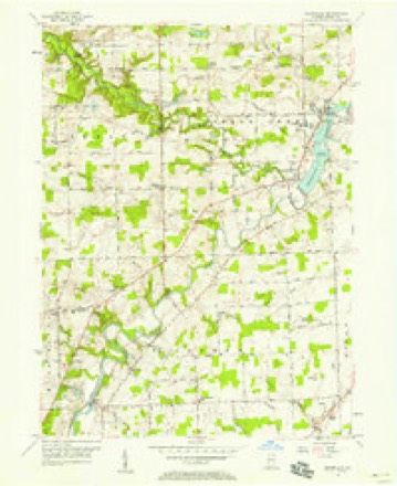
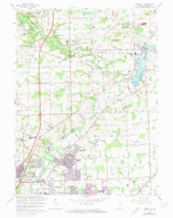
12 topographic sheets cover this place, the earliest surveyed in 1953 and the latest in 1994. It stands in St. Joseph Township. It lies in ZIP code area 46835. It stands on Becketts Run. The Survey maps it on the Cedarville quadrangle.
Topographic sheets covering this place
6 surveys from 12 printed sheetsMatched by testing this settlement's coordinate against the published boundary of every sheet in the United States Geological Survey's historical collection. Each opens the scanned sheet at the Survey.
- 1953 USGS Fort Wayne quadrangle1:250000, 4 printings
- 1956 USGS Cedarville quadrangle1:24000
- 1956 USGS Fort Wayne quadrangle1:250000, 2 printings
- 1963 USGS Cedarville quadrangle1:24000, 3 printings
- 1984 USGS Fort Wayne quadrangle1:100000
- 1994 USGS Fort Wayne quadrangle1:100000




In the county-history sources
5,065 words on this townshipHistory of Allen County, Indiana., published 1880 has no passage naming this settlement, which was common for smaller places. Its township is covered in full.
The chapter on St. Joseph Township covers the township.
Read the chapter on St. Joseph Township - 5,065 words.
Mines and quarries near this place
1 within 5 milesRegional context, not property-specific evidence. The federal mineral resources record lists 1 working within 5 miles of Brookside Estates: 1 producer. All of them still produce. What was taken out: Sand and Gravel, Construction. Distance is straight-line from the map coordinates, so a quarry counted here may appear on a neighbouring settlement's page as well.
| Where | Site | Commodity | Status | Recorded |
|---|---|---|---|---|
| Brudi Pit #3 | Sand and Gravel, Construction | Producer |
Storms near this place
19 since 2011Regional context, not property-specific evidence. The National Weather Service names Brookside Estates in 19 storm reports between 2011 and 2022: 11 thunderstorm wind, 6 hail, 1 tornado, 1 lightning. The reports record 1 death and 1 injury. Each account below is quoted exactly as the forecast office filed it, from the NOAA Storm Events Database, and each date opens the federal record of that event.
| When | Event | Place named | Harm | What the report says |
|---|---|---|---|---|
| August 2020 | Thunderstorm Wind | Brookside Estates | 1 killed, 1 hurt | A mobile home rolled due to a failure of 1 or more properly secured straps from strong winds. A 74 year old woman was critically injured and later died at a nearby hospital. The woman was holding a 4 year old boy that only suffered minor injuries. The home rolled into an adjacent double wide mobile home. The initial mobile home was destroyed but all debris remained near the site. The adjacent mobile home suffered damage to the side and roof due to the home striking it. Other damage in the area was limited to some skirting of the mobile homes. |
| June 2022 | Lightning | Brookside Estates | $25,000 | Local media reported lightning struck a building at the Canterbury Green apartment complex. While no specific details or amount was provided, an estimate of $25,000 has been entered. |
| April 2011 | Thunderstorm Wind | Brookside Estates | $25,000 | Law enforcement officials reported the awning at a strip mall, located in the 6600 block of St. Joe Road, was ripped off. Businesses affected included Bikes -and- Boards, Mamma Mia's Pizza and New Republic Tattoo. |
| August 2022 | Thunderstorm Wind | Brookside Estates | - | A trained spotter recorded a 57 knot wind gust. |
| June 2020 | Thunderstorm Wind | Brookside Estates | - | Trained spotter estimated 60 mph at Interstate 69 and State Route 1. |
| June 2020 | Hail | Brookside Estates | - | Report from MPing. Ping Pong Ball size hail. |
| August 2020 | Thunderstorm Wind | Brookside Estates | - | The public reported the top half of a one foot diameter was snapped at the intersection of Leo Road and Arapaho Passover. |
| April 2017 | Thunderstorm Wind | Brookside Estates | - | Wind gusts to 65 mph were estimated with sustained winds of 50 to 55 mph lasting at least 2 minutes. |
| August 2016 | Tornado (EF0) | Brookside Estates | - | An EF-0 tornado touched down just to the south of the intersection of Flutter and Young Roads in north central Allen county Indiana. The tornado caused damage to large tree limbs in this area along with an extensive area of flattened corn. Weak convergence of the crop damage in spots suggested rotation. Sporadic damage continued to the northeast with a pine tree uprooted at a residence on Eby Road, or about a 1 mile northeast of the touchdown location. A nearby residence on Eby Road also had minor shingle damage. Approximately 1.3 miles to the northeast of the Eby Road damage, a wooden swing set structure from the backyard was pushed to the front of the yard at a residence on Notestine Road. Cuts in the yard suggested the swing set rolled or bounced from the backyard to the front yard. The tornado lifted approximately 2.4 miles northeast from the touchdown location. |
| July 2014 | Thunderstorm Wind | Brookside Estates | - | The public reported a tree was blown down on State Roud 1 and Tonkel Road. Other smaaller limbs were observed on the road. |
| July 2012 | Thunderstorm Wind | Brookside Estates | - | A trained spotter measured a 59 mph wind gust along the gust front of the storm. Small tree limbs were blown down in the area. |
| March 2012 | Hail | Brookside Estates | - | Dime size hail lasted about five minutes on the northeast side of Fort Wayne. |
| August 2012 | Thunderstorm Wind | Brookside Estates | - | A trained spotter recorded a 71 mph wind gust at the intersection of Maplecrest and Interstate 469. |
| June 2012 | Thunderstorm Wind | Brookside Estates | - | A 64 mph wind gust was recorded by a local mesonet site. |
| June 2012 | Thunderstorm Wind | Brookside Estates | - | A trained spotter recorded a 87 mph wind gusts. Large oak trees limbs were blown down, with siding blown off local residences. |
| June 2019 | Hail | Brookside Estates | - | no account filed |
| April 2017 | Hail | Brookside Estates | - | no account filed |
| June 2015 | Hail | Brookside Estates | - | no account filed |
| July 2012 | Hail | Brookside Estates | - | no account filed |
Nearest settlements
The eight closest, with where each one stands in the county. Distances are straight-line, computed from the Geographic Names Information System coordinates.
| Map | Place | Distance | Sheets |
|---|---|---|---|
| Sunnybrook Acres | 0.8 miles | 12 | |
| Sunnymeadow | 1.4 miles | 12 | |
| Royal Oaks | 1.4 miles | 12 | |
| Concordia Gardens | 1.5 miles | 12 | |
| Golden Acres | 1.7 miles | 12 | |
| Greendale | 2.4 miles | 13 | |
| Crestwood | 2.4 miles | 12 | |
| Maplewood Park | 2.5 miles | 13 |
Provenance
This settlement is recorded in the Geographic Names Information System as feature 431582. The sheet list is computed by point-in-boundary test against the United States Geological Survey's historical topographic inventory. Both are works of the United States government and carry no copyright under 17 U.S.C. 105.
Mines and quarries. USGS Mineral Resources Data System (MRDS) https://mrdata.usgs.gov/mrds/ A work of the United States government, no copyright under 17 U.S.C. 105.
Storms. NOAA National Centers for Environmental Information, Storm Events Database https://www.ncei.noaa.gov/stormevents/ A work of the United States government, no copyright under 17 U.S.C. 105. Narratives are quoted verbatim from the National Weather Service report and are not edited or summarised.