 Block
Bunker Hill, Indiana
13 topographic sheets cover this place, the earliest surveyed in 1951 and the latest in 1985. It stands in Pipe Creek Township. It lies in ZIP code area 46914. The Survey maps it on the Bunker Hill quadrangle. 814 people lived here at the 2020 count. It stands 820 feet above sea level.
Population over time
2 figuresBunker Hill fell from 888 to 814 between 2010 and 2020. These are the recorded population figures Wikidata holds for this place, reached through the Geographic Names Information System number this page is keyed on rather than by name, so they belong to this place and not to another of the same name. Most are census counts, but not all are: an early figure may be a founding or settlement estimate, and an estimate published within five years of a census is left out. The change column is computed, and is left blank where more than 20 years separate a figure from the one before it, because a gap that long is not a change between two counts.
| Year | People | Change |
|---|---|---|
| 2010 | 888 | |
| 2020 | 814 | -74 (-8%) |
Topographic sheets covering this place
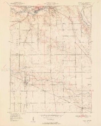
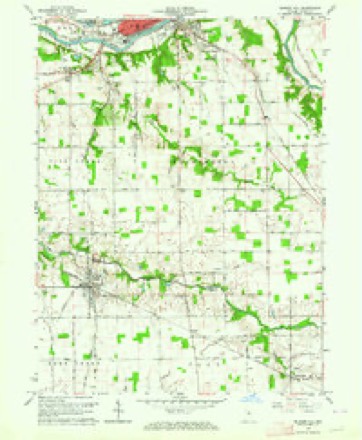
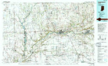
6 surveys from 13 printed sheetsMatched by testing this settlement's coordinate against the published boundary of every sheet in the United States Geological Survey's historical collection. Each opens the scanned sheet at the Survey.
- 1951 USGS Bunker Hill quadrangle1:24000, 2 printings
- 1953 USGS Danville quadrangle1:250000, 3 printings
- 1955 USGS Danville quadrangle1:250000
- 1956 USGS Danville quadrangle1:250000
- 1963 USGS Bunker Hill quadrangle1:24000, 4 printings
- 1985 USGS Logansport quadrangle1:100000, 2 printings



In the county-history sources
19,156 words on this townshipHistory of Miami County, published 1896 names this settlement in its chapter on Pipe Creek Township. These are the passages that mention it, exactly as the scans read.
The first house built on the origiaal town site was a small dwelling erected in 1851, by James Myers on lot 13, which is in north Bunker Hill, and ie known at present 43 the Sammy Galbraith property. Dr. Hubbard was one of the earliest settlers of the town. He was aot only a practicioner of medicine, but was the first merchant in Bunker Hill. His building was located on Elm street near the Galbraith property. 'The Dr. was a singular genius. He was a great trader, and it is said that often, when called in a hurry to see a patient, he stopped on his way to buy a yearling calf or trade horses. Returning from a sick call, he would dismount from his horse anywhere near home, pull off saddle and bridle throw them on the ground, and let his hurse run, and upon being called again he would hunt up the fragments, put them together und off he'd go to see his patient, provided no one bantered him for a trade along the way. He was the first and only doctor [ ever know who carried his medicines in a quart tin pail. But with all his eccentricities he made money. In the year 1858, Bunker Hill numbered ten or a dozen houses. On the 23rd of April of that year when { located in the village, the only business building was a blackmith shop owned by R. T. Jones and Charles Mason. Leonda was, at that time, in its zenith, and it was very humiliating for Bunker Hillians to be compelled to go there for their mail, tobacco, coffee or any of the necessities of life. But 'tis said +-Distance lends enchantment to the view." We had plenty of enchantment, for we went four miles to vote and a mile to church, while our log school house was way out in the '*bush." But this state of affairs soon changed. 'Fhe postoffice was moved to Bunker Hill in 1859. Ewing & Howard sold goods in 1861 at the corner of Fourth and Main streets, in the building recently owned by J. G. Hederick. This building was for years continuously used by different merchants, viz; D. Duckwall, J. Arnold, D. H. & John. Cain; A. Bell, James Cain, Frank Hartman and Simon Kalter.
Passage source: History of Miami County, published 1896.
In the meantime John Finney had erected a building at the corner of the L. E. & W. Railroad grounds and Fifth street, which was occupied as a store room by Eli Hochstedler, and afterwards used for a postoffice By dae Liston, P. M. About this time Bunker Hill began showing signs of prosperity and the prospects for the building of the Pan Handle R. R. began to brighten. The origioal survey had been made some fifteen years previous, and the citizens: had given up all hopes of its completion, but rumors became rife that the road would be built and from 1866 to 1873, Bunker Hill was on a boom, and more veal estate changed hands during that time than did before and since in the history of the town.
Passage source: History of Miami County, published 1896.
The following is a list of names of some of the earlier business men of the town since the completion of the Pan Handle road: C. T. Miller started the first hardware store in 1871, and afterward sold the same to Patterson & Meek. In, August, 1871. Kalter & Keegan started the first boot and shoe store; Patterson the first drug store. Other business men were identified with the commercial interests of Bunker Hill from 1868 to 1873, viz: W.T. Wilson, S. J. Hockman. D. T. Gilmore, J. B. McKinney, N. W. Trissal, J. F. Busey, S. Somers, T. Scott, J. F. Reynold, G. W. Biue, and others.
Passage source: History of Miami County, published 1896.
Machine-read from a century-old scan, so expect the errors a machine makes: misspelled names, dropped words, stray characters.
Read the whole chapter on Pipe Creek Township - it names this place 12 more 12 times.
Mines and quarries near this place
1 within 5 milesRegional context, not property-specific evidence. The federal mineral resources record lists 1 working within 5 miles of Bunker Hill: 1 producer. All of them still produce. What was taken out: Stone, Crushed/Broken. Distance is straight-line from the map coordinates, so a quarry counted here may appear on a neighbouring settlement's page as well.
| Where | Site | Commodity | Status | Recorded |
|---|---|---|---|---|
| Mill Creek Stone & Gravel Corp. | Stone, Crushed/Broken | Producer |
Storms near this place
29 since 1993Regional context, not property-specific evidence. The National Weather Service names Bunker Hill in 29 storm reports between 1993 and 2021: 17 thunderstorm wind, 6 hail, 3 flash flood, 2 tornado. No death or injury is recorded in these reports. Each account below is quoted exactly as the forecast office filed it, from the NOAA Storm Events Database, and each date opens the federal record of that event.
| When | Event | Place named | Harm | What the report says |
|---|---|---|---|---|
| July 2005 | Tornado (F2) | Bunker Hill | $350,000 | A NWS survey confirmed that a tornado that had caused damage across extreme eastern Cass county in Indiana crossed into Miami county and continued to cause damage as it moved just north of the Grissom Air Force base. The tornado dropped into a river valley and flipped over some conveyor machines in a quarry located in the valley. Damage to these was consistent with an F1 tornado. The tornado intensified as it moved into a area of houses in this valley. The first house that was struck suffered extensive damage with its garage and porch destroyed. Damage from the first home impacted a second home, also causing extensive damage to the west side of the house. This damage was consistent with an F2 tornado. As the tornado lifted out of the valley, it quickly dissipated. The tornado was on the ground for 3 miles in Miami county with a total track of 4 miles during its lifetime. No injuries were reported as one house was unoccupied and the residents of the other house, had sought shelter in their basement. |
| June 2008 | Thunderstorm Wind | Bunker Hill | $15,000 | Emergency management officials reported a large tree and power lines down, blocking the road, near Bunker Hill. |
| December 1998 | Thunderstorm Wind | Bunker Hill | $10,000 | SEVERAL TREES BLOWN DOWN. ONE BARN LOST A THIRD OF ITS ROOF. |
| April 1993 | Thunderstorm Wind | Bunker Hill | $5,000 | Trees were downed. |
| June 2006 | Thunderstorm Wind | Bunker Hill | $1,000 | Indiana State Police patrol vehicle had a window broken out by an airborne sign which had been pulled out of the ground. |
| September 2021 | Thunderstorm Wind | Bunker Hill | - | Several six to eight inch diameter live limbs broken. |
| June 2020 | Thunderstorm Wind | Bunker Hill | - | A six to eight inch diameter tree fell. |
| August 2016 | Thunderstorm Wind | Bunker Hill | - | Emergency management officials reported a 10 inch tree down at the intersection of Main Street and Elm Street. |
| June 2015 | Flood | Bunker Hill | - | County Road 500S closed due to flooding. |
| November 2013 | Tornado (EF1) | Bunker Hill | - | A survey of damage by NWS and emergency management officials indicated a EF1 tornado occurred northeast of the Grissom Air Reserve base. The tornado touched down in a field southeast of the intersection of US 31 and County Road 500 South and then took the roof off of a hog barn. The tornado continued to travel east where it hit another hog barn and took off the roof and collapsed the walls (DI: SBO DOD: 6). One piece of wall (estimated near 1/2 ton) was thrown back into the eastern side of the building and smashed the exhaust system. The tornado then turned NE and did extensive tree damage to a grove of trees on county Road 50 West before hitting a trailer home where half of the walls were collapsed (DI: MHSW DOD:4) and insulation and pieces of debris were strewn out for a half mile to the NE. The tornado then lifted about a third of a mile northeast of the trailer. Maximum winds are estimated around 110 mph. Although the distance between the 2 points was around 2.6 miles, a somewhat wavy track caused the actual distance to be closer to 2.9 miles long. |
| June 2012 | Thunderstorm Wind | Bunker Hill | - | A trained spotter estimated wind gusts to 70 mph near the Grissom Air Reserve base. Shingles were observed blown off a roof in the local area. |
| August 2011 | Thunderstorm Wind | Bunker Hill | - | Emergency management officials reported several tree limbs down onto power lines in the Bunker Hill area as well as remaining portions of southern Miami county. |
| June 2010 | Flash Flood | Bunker Hill | - | Law enforcement officials reported numerous roads flooded with some closures as a result of flowing water from Bunker Hill to the county line. This was the result of one to three inches of rain falling over a short period. |
| June 2006 | Thunderstorm Wind | Bunker Hill | - | Tractor trailer blown off the road on U.S. route 31. |
| May 2006 | Thunderstorm Wind | Bunker Hill | - | Several large tree limbs down. |
| July 2004 | Hail | Bunker Hill | - | Hail observed at Route 18 and Interstate 31. |
| July 2003 | Thunderstorm Wind | Bunker Hill | - | Law enforcement reported trees down in Bunker Hill. |
| July 2003 | Flash Flood | Bunker Hill | - | Emergency management reported trailer park evacuated and roads closed in and around Bunker Hill. |
| July 2003 | Flash Flood | Bunker Hill | - | Emergency management reported Pipe Creek and Little Pipe Creek both flooding near Bunker Hill. |
| July 2002 | Thunderstorm Wind | Bunker Hill | - | Emergency management reported tress down in Bunker Hill. |
| April 2001 | Hail | Bunker Hill | - | Several cars were reported damaged by the large hail. |
| July 2001 | Thunderstorm Wind | Bunker Hill | - | Several trees down blocking road. |
| July 2001 | Thunderstorm Wind | Bunker Hill | - | Numerous trees and power lines down. |
| August 2016 | Hail | Bunker Hill | - | no account filed |
| June 2013 | Hail | Bunker Hill | - | no account filed |
| June 2006 | Hail | Bunker Hill | - | no account filed |
| June 2006 | Thunderstorm Wind | Bunker Hill | - | no account filed |
| May 2001 | Hail | Bunker Hill | - | no account filed |
| May 2000 | Thunderstorm Wind | Bunker Hill | - | no account filed |
Nearest settlements
The eight closest, with where each one stands in the county. Distances are straight-line, computed from the Geographic Names Information System coordinates.
| Map | Place | Distance | Sheets |
|---|---|---|---|
| Loree | 2.6 miles | 13 | |
| Miami | 3.2 miles | 10 | |
| Nead | 3.5 miles | 12 | |
| Wells | 5.0 miles | 13 | |
| Flora | 5.1 miles | 13 | |
| McGrawsville | 5.1 miles | 13 | |
| Bennetts Switch | 5.2 miles | 10 | |
| Oakley | 5.6 miles | 13 |
Elsewhere
Matched on this settlement's Geographic Names Information System number rather than its name, so it cannot be a different place of the same name in another state.
| Wikipedia article on Bunker Hill | An encyclopaedic summary. Its text is share-alike, so it is linked here rather than copied. |
| Wikidata item Q3293343 | The structured record the population and elevation above come from. Public domain (CC0). |
Provenance
This settlement is recorded in the Geographic Names Information System as feature 449627. The sheet list is computed by point-in-boundary test against the United States Geological Survey's historical topographic inventory. Both are works of the United States government and carry no copyright under 17 U.S.C. 105.
Mines and quarries. USGS Mineral Resources Data System (MRDS) https://mrdata.usgs.gov/mrds/ A work of the United States government, no copyright under 17 U.S.C. 105.
Storms. NOAA National Centers for Environmental Information, Storm Events Database https://www.ncei.noaa.gov/stormevents/ A work of the United States government, no copyright under 17 U.S.C. 105. Narratives are quoted verbatim from the National Weather Service report and are not edited or summarised.