 Block
Centennial, Indiana
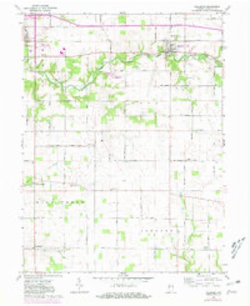
9 topographic sheets cover this place, the earliest surveyed in 1953 and the latest in 1987. It stands in Millcreek Township. It lies in ZIP code area 47952. The Survey maps it on the Hillsboro quadrangle. It stands 692 feet above sea level.
Topographic sheets covering this place
6 surveys from 9 printed sheetsMatched by testing this settlement's coordinate against the published boundary of every sheet in the United States Geological Survey's historical collection. Each opens the scanned sheet at the Survey.
- 1953 USGS Danville quadrangle1:250000, 3 printings
- 1955 USGS Danville quadrangle1:250000
- 1956 USGS Danville quadrangle1:250000
- 1962 USGS Hillsboro quadrangle1:24000, 2 printings
- 1984 USGS Danville quadrangle1:100000
- 1987 USGS Danville quadrangle1:100000



In the county-history sources
13,616 words on this townshipHistory of Fountain County : Together with Historic Notes on the Wabash Valley, Gleaned from Early Authors, Old Maps and Manuscripts, published 1881 names this settlement in its chapter on Millcreek Township. These are the passages that mention it, exactly as the scans read.
RELIGION. The United Brethren church seems to have been the pioneer church of Mill Creek township. Classes were organized in different parts of the townsliip, meeting at the dwellings of the members and at log gchool-houses. A class was organized about ISS-t, hy Eev. Cook, called the sample class. Another class was organized by Jacob "VYajmyer, at the Corey school-house ; prominent among the members were John and Levina Mayhew, Levi and Jane Johnson, Jacob and Jeriisha Teegarden, "William and Christina Newnum, Amariah and Caroline Elwell. Joseph Sines was class-leader, and Jacob Teegarden steward. "When the class became large it divided, part going to the Myers class and a part to the Harveysburg class. The Harveysburg class was organized prior to the civil war. Ira Maber and Jackson Griffith were the early preachers, who probably organized the Harveysburg class. John P. Ephlin was the first local preacher, and has preached in nearly every school-house and dwelling in the township. Tiiey then, in connection with the Methodists, built a union church, and about 1ST2 built a church which tliey still occupy. It cost $1,900, and was dedicated by Bishop Edwards. Present membership about seventy ; classleader, J. P. Ephlin ; steward, Joseph Marshall ; preacher in charge, Wm. Vail ; trustees, J. P. Ephlin, Andrew Marshall, James Eatcliff, Philip Weaver, and John Marshall. A class was organized at Abraham Myers' about 1837 by John Hoobler. This was on Scott's prairie. Here George Redenbaugh, David Simons, Jonatlian Wolf, Wm. Myers, and others met for worship. Iii 18il Wm. Myers settled on his present farm, and meetings were soon held at his home; also at George Redenbaugh's and other private houses. This was known as the Myers class, and was organized by John Hoobler and John Dunham, a visitor here. James Griffith and Wm. Hoobler were early itinerants. About 1843 a log school-house was built, about 20x22, round logs, puncheon benches, etc. This was then used as a meeting-house. The church numbered at that time twelve or fifteen members. David Simons was class-leader and Wm. Myers steward ; then Wm. Myers class-leader and David Simons steward. George Redenbaugh was also an early class-leader. In about ten years after, a new schoolhouse was built, this time frame. Meetings were held here for a time. In 1871, feeling sufficiently strong, it was decided to build a house of worship. A contract was let to Wm. Ervin to build a house 31x40, for which he received §913. It was dedicated by Thomas M. Hamilton. Ira Mater was present. The membership at that time was about 100. The church prospered for four years, when, in February 1876, while a protracted meeting was just finished, and the people at dinner, a fire broke out in the church, entirely destroying it. Nothing daunted, the members went immediately to work, and the timbers were soon on the ground for a new and larger church. Meetings were held in the meantime at the jSTew Light ciini-ch near by- A contract waa let to Miirphey Lewis to erect an edifice 31x46, 15 feet to tlie eaves. This cost $1,852.12^; is nicely furnished and well finished. It was dcflicated the first Sunday in August 1870, by Elder Nye, assisted by Elder Warren, of the Christian church. The land on which the church is built was donated by Wm. Myers. Levi Rcdenbaugh is class-leader Peter and Edward ISTewnum stewards, and Wm. Vail preacher. The trustees are "VVm. Myei's, Calvin Myers, Amariah Elwell, F. J. Eedonbaugh, John M. Bailey, and Peter Newnum. The church is called Centennial, from the fact that the new church was built on the oiio liundredth anniversary of the denomination.
Passage source: History of Fountain County : Together with Historic Notes on the Wabash Valley, Gleaned from Early Authors, Old Maps and Manuscripts, published 1881.
Machine-read from a century-old scan, so expect the errors a machine makes: misspelled names, dropped words, stray characters.
Mines and quarries near this place
1 within 5 milesRegional context, not property-specific evidence. The federal mineral resources record lists 1 working within 5 miles of Centennial: 1 producer. All of them still produce. What was taken out: Sand and Gravel, Construction. Distance is straight-line from the map coordinates, so a quarry counted here may appear on a neighbouring settlement's page as well.
| Where | Site | Commodity | Status | Recorded |
|---|---|---|---|---|
| Triple G Gravel | Sand and Gravel, Construction | Producer |
Nearest settlements
The eight closest, with where each one stands in the county. Distances are straight-line, computed from the Geographic Names Information System coordinates.
| Map | Place | Distance | Sheets |
|---|---|---|---|
| Yeddo | 0.9 miles | 9 | |
| Steam Corner | 2.2 miles | 9 | |
| Harveysburg | 3.4 miles | 13 | |
| Kingman | 3.5 miles | 13 | |
| Lake Holiday Hideaway | 3.8 miles | 13 | |
| Mackie | 4.0 miles | 9 | |
| Wooley Corner | 4.1 miles | 9 | |
| Cates | 5.1 miles | 13 |
Elsewhere
Matched on this settlement's Geographic Names Information System number rather than its name, so it cannot be a different place of the same name in another state.
| Wikipedia article on Centennial | An encyclopaedic summary. Its text is share-alike, so it is linked here rather than copied. |
| Wikidata item Q5059107 | The structured record the population and elevation above come from. Public domain (CC0). |
Provenance
This settlement is recorded in the Geographic Names Information System as feature 452114. The sheet list is computed by point-in-boundary test against the United States Geological Survey's historical topographic inventory. Both are works of the United States government and carry no copyright under 17 U.S.C. 105.
Mines and quarries. USGS Mineral Resources Data System (MRDS) https://mrdata.usgs.gov/mrds/ A work of the United States government, no copyright under 17 U.S.C. 105.