 Block
Centerton, Indiana
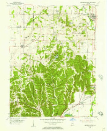
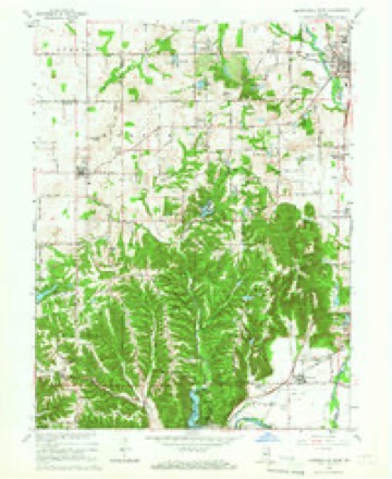
14 topographic sheets cover this place, the earliest surveyed in 1953 and the latest in 1986. It stands in Clay Township. It lies in ZIP code area 46151. It lies near Robb Hill. The Survey maps it on the Mooresville West quadrangle. It stands 627 feet above sea level.
Topographic sheets covering this place
7 surveys from 14 printed sheetsMatched by testing this settlement's coordinate against the published boundary of every sheet in the United States Geological Survey's historical collection. Each opens the scanned sheet at the Survey.
- 1953 USGS Indianapolis quadrangle1:250000, 4 printings
- 1955 USGS Mooresville West quadrangle1:24000
- 1956 USGS Indianapolis quadrangle1:250000
- 1957 USGS Indianapolis quadrangle1:250000, 2 printings
- 1962 USGS Indianapolis quadrangle1:250000
- 1965 USGS Mooresville West quadrangle1:24000, 3 printings
- 1986 USGS Indianapolis quadrangle1:100000, 2 printings





In the county-history sources
16,970 words on this townshipCounties of Morgan, Monroe, and Brown, Indiana. Historical and Biographical, published 1884 names this settlement in its chapter on Clay Township. These are the passages that mention it, exactly as the scans read.
IN the month of December, 1819, Benjamin Barnes, a resident of Connersville, Ind., packed what little household goods he owned in a wagon drawn by a yoke of oxen, and with his wife and family of two sons and four daughters started westward for the "White River Country." This country, or that portion of it known as the New Purchase, had been secured by treaty from the Indians only a little more than a ySar before, and was already attracting the attention of settlers seeking homes. Mr. Barnes and family were accompanied by John Butterfield, Sr., and Hiatt Butterfield (who was not a relative of John Butterfield's), both of whom came out with him to look at the country with a view to future settlement. Not a hog, sheep, horse or a head of cattle except the yoke of oxen, was brought out. Mr. Barnes was poor, and had not even enough money to enter a tract of land had the same been in market, which was not yet the case. The family crossed White River, either at the bluifs, or, which is more likely, at the Stotts settlement, a few miles farther down the river, and soon arrived at a point about two miles southeast of Centerton, where Mr. Barnes decided to make a permanent location. The weather was cold, and a temporary camp was prepared for the comfort of the family, and the men immediately afterward began to cut logs for a cabin. The rude building was completed in two or three days, and the family were soon ensconced therein, and made as comfortable as possible. The floor was the bare earth, the roof was bark and clap-boards h,astily cut out, and the door was of the same material. The most important feature in the room was a big fire-place, filled with blazing logs which imparted heat, cheerfulness and comfort to the small room. A floor of puncheons was afterward added as soon as possible. Mr. Barnes and all the members of his family, as soon as their home was made comfortable, went to work to clear and deaden a tract of land for a crop for the coming season. By April, 1820, they had thirty acres deadened, and partly cleared, the greater portion of which was planted with corn and vegetables, the former having been brought out the December before, and the latter about seeding time. Here the Barnes family lived for several years. Their first land was bought on the 5th of September, 1820, the second day of the sale.
Passage source: Counties of Morgan, Monroe, and Brown, Indiana. Historical and Biographical, published 1884.
As soon as the Barnes cabin had been built, John Butterfield went back to Connorsville where his family resided. In the following September, he went to Terre Haute, and bought 160 acres of land on Section 1, Township 12 north. Range 1 east, lying about a mile and a half southeast of Centerton, and early the following spring (1821) came out with his sons Velorns and John H., and three hired men, named respectively Adams, Sanford and Bliven, and in a few weeks cleared about six acres, and erected a cabin. A crop of corn was cultivated during the summer by one of the boys, who boarded with the Barnes family. In the fall of 1821, the Butterfield family, consisting of the father, mother, five sons and one daughter, took up their permanent residence in this new
Passage source: Counties of Morgan, Monroe, and Brown, Indiana. Historical and Biographical, published 1884.
Some time after the establishment of the Stotts settlement in Green Township in 1819, the date not being known, but certainly prior to the 1st of March, 1820, Maj. James Stotts and his son Robert C. built a cabin, and permanently located on atract of land about three miles southeast of Centerton. It is likely that this occurred during the fall of 1819, or the winter of 1819-20. About the same time the family of John Hodge located in the same neighborhood. On Tuesday the 3d of April, 1820, George Matthews and his three sons, John, Alfred and Calvin, accompanied by a man named William Dorman, came in a wagon drawn by a yoke of oxen to the cabin oi Maj. Stotts. There the rude wagon road that had been cut out ended, and the men were obliged to cut their way onward. After several hours they reached the present site of Centerton, where Mr. Matthews concluded to locate permanently. A log cabin was built and the work of clearing and deadening was begun. John Matthews says that there were but three families in Clay Township when he arrived as above stated, and they lived on the east side of White Lick Creek. They were those of Benjamin Barnes, Maj. James Stotts and John Hodge. Several other families arrived later in 1820, among them being those of Jacob Case, John Clark, Isaiah Drury, Elijah Lang. Within the next three or four years there came John Stipp, George A. Phelps, Alexander Cox, Jonathan Lyon, Ezekiel Slaughter, James Lang, David Matlock, Benjamin and Enoch McCarty, Francis Brock, Martin McDaniel, William Jones, John McMahon, William Matlock, Hiram Matthews,: John A. Stipp, Abraham Stipp, Da.vid Spencer, Lewis Deaton, William Powell, G. W. Bryant, John, David, Samuel and William Scott, Michael Stipp, Edward Brady, John McDaniel, Moses Slaughter,' Dr. Eli Runnels and many others. Still later came William Morgan, Eli Rinker, David Collins, Jesse and Eli Overton, Abraham Griggs, James Noble, J. B. Maxwell, Dabney Gooch, John Robb, John Albertson, Adam Spoon, Jesse, William and Jeremiah Poe, Jesse Gooch, William Moss, Levi Collins, William Collins and others. The sons of John Butterfield were Velorus, John H. and Merannoe. Those of Alexander Cox were John, Paul and William. Those of George Matthews were John, Alfred, Calvin, James and George. Those of Jonathan Lyon were Harrison and Jonathan, Jr.
Passage source: Counties of Morgan, Monroe, and Brown, Indiana. Historical and Biographical, published 1884.
Machine-read from a century-old scan, so expect the errors a machine makes: misspelled names, dropped words, stray characters.
Read the whole chapter on Clay Township - it names this place 6 more 6 times.
Mines and quarries near this place
10 of 13 shownRegional context, not property-specific evidence. The federal mineral resources record lists 13 workings within 5 miles of Centerton: 7 producers, 5 past producers, 1 plant. 8 still produce. What was taken out: Clay, Sand and Gravel, Construction, Fire Clay (Refractory), Flagstone. Distance is straight-line from the map coordinates, so a quarry counted here may appear on a neighbouring settlement's page as well.
| Where | Site | Commodity | Status | Recorded |
|---|---|---|---|---|
| High Bluff Quarry | Flagstone | Past Producer | ||
| Gen Shale Prdts Brick Plnt/Brooklyn | Fire Clay (Refractory) | Producer | ||
| Hydraulic Press Brick Plant | Fire Clay (Refractory) | Producer | ||
| Indiana Tile Plant | Fire Clay (Refractory) | Past Producer | ||
| Jones Sand and Gravel Pit | Sand and Gravel, Construction | Past Producer | ||
| Morgan County Gravel Mill | Sand and Gravel, Construction | Plant | ||
| Morgan County Gravel Pit | Sand and Gravel, Construction | Past Producer | ||
| Port Royal | Sand and Gravel, Construction | Producer | ||
| Adams Pit | Clay | Producer | ||
| Bethany Park Clay & Shale Pit | Clay | Past Producer |
Storms near this place
11 since 2001Regional context, not property-specific evidence. The National Weather Service names Centerton in 11 storm reports between 2001 and 2016: 9 flood, 2 hail. No death or injury is recorded in these reports. Each account below is quoted exactly as the forecast office filed it, from the NOAA Storm Events Database, and each date opens the federal record of that event.
| When | Event | Place named | Harm | What the report says |
|---|---|---|---|---|
| June 2008 | Flood | Centerton | $80,000,000 | Flooding occurred along the White River in Morgan County, including near Centerton, due to heavy rain. |
| March 2006 | Flood | Centerton | $100,000 | no account filed |
| June 2008 | Flood | Centerton | $20,000 | Flooding occurred along the White River in Morgan County, including near Centerton, due to heavy rain. |
| March 2008 | Flood | Centerton | $15,000 | Flooding occurred along the White River in Morgan County, including near Centerton, due to heavy rain and snow melt. |
| March 2008 | Flood | Centerton | $15,000 | Flooding occurred on the White River in Morgan County, including near Centerton, due to heavy rain. |
| January 2007 | Flood | Centerton | $10,000 | The White River in Morgan County flooded during the middle portion of January. Crests were as high as nearly 4 feet above flood stage. |
| March 2007 | Flood | Centerton | $10,000 | The White River flooded in Morgan County. Crests were nearly 4 feet above flood stage. |
| March 2007 | Flood | Centerton | $1,000 | The White River flooded in Morgan County. Crests were nearly three feet above flood stage. |
| March 2007 | Flood | Centerton | $1,000 | The White River flooded in Morgan County. Crests were nearly 2 feet above flood stage. |
| March 2016 | Hail | Centerton | - | no account filed |
| October 2001 | Hail | Centerton | - | no account filed |
Nearest settlements
The eight closest, with where each one stands in the county. Distances are straight-line, computed from the Geographic Names Information System coordinates.
| Map | Place | Distance | Sheets |
|---|---|---|---|
| Center Valley | 0.7 miles | 14 | |
| Bethany | 1.6 miles | 14 | |
| Brooklyn | 2.2 miles | 14 | |
| Foxcliff Estates | 2.6 miles | 18 | |
| Beech Grove | 2.7 miles | 14 | |
| Country Manor Estates | 2.8 miles | 14 | |
| Stines Mill Corner | 2.9 miles | 16 | |
| Willowbrook Estates | 3.0 miles | 16 |
Elsewhere
Matched on this settlement's Geographic Names Information System number rather than its name, so it cannot be a different place of the same name in another state.
| Wikipedia article on Centerton | An encyclopaedic summary. Its text is share-alike, so it is linked here rather than copied. |
| Wikidata item Q5060068 | The structured record the population and elevation above come from. Public domain (CC0). |
Provenance
This settlement is recorded in the Geographic Names Information System as feature 449636. The sheet list is computed by point-in-boundary test against the United States Geological Survey's historical topographic inventory. Both are works of the United States government and carry no copyright under 17 U.S.C. 105.
Mines and quarries. USGS Mineral Resources Data System (MRDS) https://mrdata.usgs.gov/mrds/ A work of the United States government, no copyright under 17 U.S.C. 105.
Storms. NOAA National Centers for Environmental Information, Storm Events Database https://www.ncei.noaa.gov/stormevents/ A work of the United States government, no copyright under 17 U.S.C. 105. Narratives are quoted verbatim from the National Weather Service report and are not edited or summarised.