 Block
Ellison, Indiana
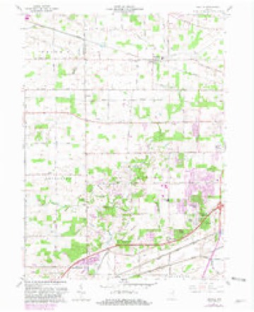
10 topographic sheets cover this place, the earliest surveyed in 1953 and the latest in 1994. It stands in Aboite Township. It lies in ZIP code area 46804. It stands on Robinson Creek. The Survey maps it on the Arcola quadrangle.
Topographic sheets covering this place
5 surveys from 10 printed sheetsMatched by testing this settlement's coordinate against the published boundary of every sheet in the United States Geological Survey's historical collection. Each opens the scanned sheet at the Survey.
- 1953 USGS Fort Wayne quadrangle1:250000, 4 printings
- 1956 USGS Fort Wayne quadrangle1:250000, 2 printings
- 1961 USGS Arcola quadrangle1:24000, 2 printings
- 1984 USGS Fort Wayne quadrangle1:100000
- 1994 USGS Fort Wayne quadrangle1:100000




Mines and quarries near this place
9 within 5 milesRegional context, not property-specific evidence. The federal mineral resources record lists 9 workings within 5 miles of Ellison: 6 producers, 2 occurrences, 1 past producer. 6 still produce. What was taken out: Sand and Gravel, Construction, Stone, Crushed/Broken, Zinc, Fluorine-Fluorite, Sulfur. Distance is straight-line from the map coordinates, so a quarry counted here may appear on a neighbouring settlement's page as well.
| Where | Site | Commodity | Status | Recorded |
|---|---|---|---|---|
| Sphalerite and Fluorite Occurrence Z79 | Zinc, Fluorine-Fluorite, Sulfur | Occurrence | Fluorite, Sphalerite | |
| Unnamed Fluorite Occurrence | Fluorine-Fluorite | Occurrence | Fluorite | |
| Ardmore Stone Plant #2 | Stone, Crushed/Broken | Producer | ||
| Ft. Wayne Quarry & Mill | Stone, Crushed/Broken | Producer | ||
| Ardmore Sand Plant #1 | Sand and Gravel, Construction | Producer | ||
| Brudi #1 | Sand and Gravel, Construction | Producer | ||
| Brudi #4 | Sand and Gravel, Construction | Producer | ||
| Midwest Aggregates Pit 2 | Sand and Gravel, Construction | Past Producer | ||
| Roanoke Pit and Mill | Sand and Gravel, Construction | Producer |
Storms near this place
11 since 2000Regional context, not property-specific evidence. The National Weather Service names Ellison in 11 storm reports between 2000 and 2025: 6 thunderstorm wind, 3 hail, 1 flash flood, 1 lightning. No death or injury is recorded in these reports. Each account below is quoted exactly as the forecast office filed it, from the NOAA Storm Events Database, and each date opens the federal record of that event.
| When | Event | Place named | Harm | What the report says |
|---|---|---|---|---|
| August 2017 | Flash Flood | Ellison | $300,000 | Widespread flooding noted across mainly western and northern portions of the Fort Wayne metro area. Standing and flowing water was reported as high as the top of bumpers of cars in some locations. Several vehicles were stranded with some rescues needed. The Glenbrook mall was closed due to flood waters entering portions of the structure as well as power outages. Ivy Tech North Campus was closed due to flood waters entering the Student Life Center and basement of Harshman Hall. The water was shallow, but covered an extensive area, with total damages on the order of $300,000. |
| May 2019 | Lightning | Ellison | $25,000 | Local media reported lightning struck the press box at the Homestead High school, setting it on fire. The box was a total loss. The high school and surrounding structures were not impacted by the fire or lightning strike. |
| April 2025 | Hail | Ellison | $1,000 | Photo on Facebook shows ping pong ball size hail. |
| June 2021 | Hail | Ellison | - | Dime size hail was reported by the broadcast media. |
| August 2021 | Thunderstorm Wind | Ellison | - | Media reported a large tree fell into a home. |
| July 2020 | Thunderstorm Wind | Ellison | - | Several trees damaged and a cinder block wall toppled. |
| May 2019 | Thunderstorm Wind | Ellison | - | A trained spotter reported several large tree limbs were blown down, some causing minor roof damage. |
| May 2019 | Thunderstorm Wind | Ellison | - | Two six inch diameter tree limbs were blown down with a local weather station recording a 68 mph wind gust. |
| May 2019 | Thunderstorm Wind | Ellison | - | A trained spotter reported a rooftop anemometer recorded a 76 mph wind gust before it was destroyed. |
| May 2000 | Thunderstorm Wind | Ellison | - | 1 1/2 foot diameter trees down. |
| May 2011 | Hail | Ellison | - | no account filed |
Nearest settlements
The eight closest, with where each one stands in the county. Distances are straight-line, computed from the Geographic Names Information System coordinates.
| Map | Place | Distance | Sheets |
|---|---|---|---|
| Manor Woods | 0.4 miles | 10 | |
| Parkway Hills | 0.5 miles | 10 | |
| Rolling Hills | 0.6 miles | 10 | |
| Liberty Hills | 0.7 miles | 10 | |
| Forest Ridge | 1.0 miles | 10 | |
| Ellisville | 1.6 miles | 10 | |
| Brierwood Hills | 2.2 miles | 14 | |
| Country Club Gardens | 2.3 miles | 14 |
Provenance
This settlement is recorded in the Geographic Names Information System as feature 446648. The sheet list is computed by point-in-boundary test against the United States Geological Survey's historical topographic inventory. Both are works of the United States government and carry no copyright under 17 U.S.C. 105.
Mines and quarries. USGS Mineral Resources Data System (MRDS) https://mrdata.usgs.gov/mrds/ A work of the United States government, no copyright under 17 U.S.C. 105.
Storms. NOAA National Centers for Environmental Information, Storm Events Database https://www.ncei.noaa.gov/stormevents/ A work of the United States government, no copyright under 17 U.S.C. 105. Narratives are quoted verbatim from the National Weather Service report and are not edited or summarised.