 Block
Huntington, Indiana
12 topographic sheets cover this place, the earliest surveyed in 1953 and the latest in 1986. It stands in Huntington Township. It lies in ZIP code area 46750. It stands on Rabbit Run. The Survey maps it on the Huntington quadrangle. 17,022 people lived here at the 2020 count. It stands 748 feet above sea level.
Research this city
On record in Huntington
Buildings and businesses the archive holds for this place. Each opens its own page, with the source record it came from.
On the National Register 12 of 19 shown
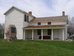 Chief Richardville House and Miami Treaty Groundslisted 1985
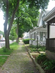 Drover Town Historic Districtlisted 2006
 German Reformed Churchlisted 1985
 Hawley Heights Historic Districtlisted 2003
 Hotel LaFontainelisted 1984
 Huntington Courthouse Square Historic Districtlisted 1992
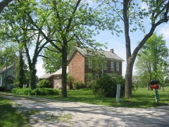 John and Minerva Kline Farmlisted 1988
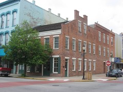 Moore/Carlew Buildinglisted 1983
 North Jefferson Street Historic Districtlisted 2010
 Old Plat Historic Districtlisted 2000
 David Alonzo and Elizabeth Purviance Houselisted 1994
 Samuel Purviance Houselisted 1986
Population over time
2 figuresHuntington fell from 17,391 to 17,022 between 2010 and 2020. These are the recorded population figures Wikidata holds for this place, reached through the Geographic Names Information System number this page is keyed on rather than by name, so they belong to this place and not to another of the same name. Most are census counts, but not all are: an early figure may be a founding or settlement estimate, and an estimate published within five years of a census is left out. The change column is computed, and is left blank where more than 20 years separate a figure from the one before it, because a gap that long is not a change between two counts.
| Year | People | Change |
|---|---|---|
| 2010 | 17,391 | |
| 2020 | 17,022 | -369 (-2%) |
Topographic sheets covering this place
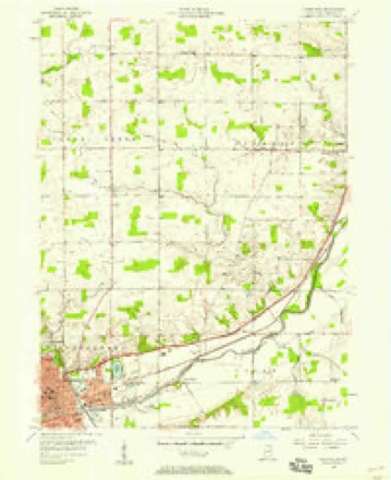
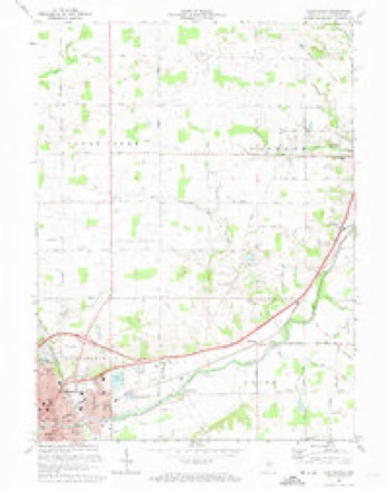
5 surveys from 12 printed sheetsMatched by testing this settlement's coordinate against the published boundary of every sheet in the United States Geological Survey's historical collection. Each opens the scanned sheet at the Survey.
- 1953 USGS Muncie quadrangle1:250000, 5 printings
- 1956 USGS Huntington quadrangle1:24000
- 1956 USGS Muncie quadrangle1:250000
- 1972 USGS Huntington quadrangle1:24000, 3 printings
- 1986 USGS Wabash quadrangle1:100000, 2 printings


What happened here
An account from the chapter on Huntington township. The inset identifies its exact source book and publication year.
Chapter Yii
City of Huntington - The Red Man's Resort - The Helvey Brothers - Other Early Comers - Gen. John Tipton - Securing the County Seat - Early Records - First Election - Early Trade and Commerce - Some of the Old Settlers - Wabash & Erie Canal - Indian Agency - Incorporation - List of Officers - Changes in the Business Center - Additions --The Cholera Scourge - Churches of the Town - Secret Societies - The Press - Banks - Manufacturing AND Other Industries - Fire Department - Gold and Natural Gas Excitements - Coming of the Railroad.
In the county-history sources
33,282 words on this townshipHistory of Huntington County, Indiana : from the Earliest Time to the Present with Biographical Sketches, Notes, Etc. : Together with a Short History of the Northwest, the Indiana Territory, and the State of Indiana, published 1887 names this settlement in its chapter on Huntington Township. These are the passages that mention it, exactly as the scans read.
THE present site of the city of Huntington was known among the Indians as Wa-pe-cha-an-gan-ge, mea,ning " Flint Place," ' owing to the abundance of flint at the mouth of Flint Creek; and among the Indian traders, white men and half breeds, who traded with the Indians long before any permanent settlements were made, as "Flint Springs," from the fine springs of pure water that flowed from the flinty ground at the foot of the little hill near the mouth of the creek. The ground was white with the hard flint for many rods around the springs, and was a noted camping ground with both Indians and traders, the flint being always dry and solid and nearly clear of underbrush. There is a tradition that Gen. William H. Harrison and his army encamped here on their march from Fort Recovery to Tippecar oe, in 1811; but the late Samuel Jones, of Warren, this county, who was a soldier in Gen. Harrison's army in the campaign, could not recollect the place as a camping ground of the army, although well remembering passing through the county with the army at or near this point.
Passage source: History of Huntington County, Indiana : from the Earliest Time to the Present with Biographical Sketches, Notes, Etc. : Together with a Short History of the Northwest, the Indiana Territory, and the State of Indiana, published 1887.
The land was a portion of the grant made by the United States Government, in 1837, to the State of Indiana, to aid in the construction of the canal, afterwards known as the Wabash & Erie Canal, connecting the navigable waters of the Wabash River at Terre Haute, Indiana, with Lake Erie, at or near Toledo, Ohio. The records do not show how the the interest of the Helveys in this tract of land was transferred to Gen. John Tipton, of Logansport, but the transfer was doubtless made in a manner satisfactory to both parties. Gen. Tipton obtained the patent for the land from the state, and by his agent, Capt. Elias Murray, platted and laid out the town, in the year 1833; Capt. Murray giving the new town the , name of "Huntington," in honor of Samuel Huntington, one of the signers of the Declar- ation of Independence, and Capt. Murray's uncle.
Passage source: History of Huntington County, Indiana : from the Earliest Time to the Present with Biographical Sketches, Notes, Etc. : Together with a Short History of the Northwest, the Indiana Territory, and the State of Indiana, published 1887.
Gen. Tipton, through Captain Murray, donated a large number of lots in the new town to the county to aid in the erection of county buildings, and Huntington became the county seat of the county upon its organization in May, 1834.
Passage source: History of Huntington County, Indiana : from the Earliest Time to the Present with Biographical Sketches, Notes, Etc. : Together with a Short History of the Northwest, the Indiana Territory, and the State of Indiana, published 1887.
Machine-read from a century-old scan, so expect the errors a machine makes: misspelled names, dropped words, stray characters.
Read the whole chapter on Huntington Township - it names this place 117 more 117 times.
Mines and quarries near this place
4 within 5 milesRegional context, not property-specific evidence. The federal mineral resources record lists 4 workings within 5 miles of Huntington: 4 producers. All of them still produce. What was taken out: Stone, Stone, Crushed/Broken, Sand and Gravel, Construction. Distance is straight-line from the map coordinates, so a quarry counted here may appear on a neighbouring settlement's page as well.
| Where | Site | Commodity | Status | Recorded |
|---|---|---|---|---|
| Hess Excavating | Sand and Gravel, Construction | Producer | ||
| Huntington Quarry | Stone, Crushed/Broken | Producer | ||
| Huntington City | Stone | Producer | ||
| Huntington Co. Hwy. Dept. | Stone | Producer |
Storms near this place
60 of 123 shownRegional context, not property-specific evidence. The National Weather Service names Huntington in 123 storm reports between 1994 and 2026: 70 thunderstorm wind, 45 hail, 4 tornado, 3 flash flood. No death or injury is recorded in these reports. Each account below is quoted exactly as the forecast office filed it, from the NOAA Storm Events Database, and each date opens the federal record of that event.
| When | Event | Place named | Harm | What the report says |
|---|---|---|---|---|
| July 1998 | Flash Flood | Huntington | $1,500,000 | TWO INCHES OF RAIN FELL IN LESS THEN 40 MINUTES IN HUNTINGTON WHICH FLOODED MANY BASEMENTS IN TOWN. A TREE FELL ONTO A VAN CRUSHING IT SEVERLY. MANY COUNTY ROADS WERE COMPLETELY WASHED OUT AS WELL INCLUDING US 24. |
| August 2007 | Thunderstorm Wind | Huntington | $200,000 | Several trees and power lines were blown down from just west of Huntington to 7 miles east of Huntington. A couple dozen houses as well as several vehicles were damaged by falling trees. A 4-H pavilion was heavily damaged. Damage is estimated at $200,000. |
| June 1994 | Hail | Huntington | $50,000 | Numerous reports of one to two inch diameter hail in the city caused damage to several cars and house rooftops. |
| June 2010 | Thunderstorm Wind | Huntington | $40,000 | The roof of a business at 239 Howenstein was partially blown off. Widespread trees down and power outages across town. |
| June 2008 | Thunderstorm Wind | Huntington | $25,000 | Emergency management officials reported two semi-trucks were blown off Interstate 69, one at mile marker 72 and the other mile marker 75. Damage is estimated at $25,000. |
| April 2004 | Tornado (F0) | Huntington | $25,000 | NWS storm survey team found F0 damage to five homes and in trees southwest of Huntington. The tornado was skipping along a three and one half mile path and was around 50 yards wide. |
| August 2005 | Thunderstorm Wind | Huntington | $20,000 | A 18 inch diameter tree was blown down onto a van. |
| July 1997 | Hail | Huntington | $20,000 | no account filed |
| July 2024 | Thunderstorm Wind | Huntington | $10,000 | Large tree fell onto a shed at a residence on north Goshen Road. |
| December 1998 | Thunderstorm Wind | Huntington | $10,000 | SEVERAL TREES WERE UPROOTED OR SNAPPED IN TOWN. |
| July 2024 | Thunderstorm Wind | Huntington | $5,000 | Multiple reports of trees down in and around Huntington. |
| June 2017 | Lightning | Huntington | $5,000 | Emergency management officials reported lightning appears to have struck a tree, causing the top half of the tree to fall onto a car. No injuries were reported. |
| July 1997 | Thunderstorm Wind | Huntington | $5,000 | no account filed |
| February 2024 | Thunderstorm Wind | Huntington | $4,000 | A 53 mph wind gust was recorded. Numerous healthy trees down in the area. |
| July 2024 | Thunderstorm Wind | Huntington | $1,000 | Tree down on Grayston Ave. |
| May 2024 | Hail | Huntington | $500 | no account filed |
| May 2024 | Hail | Huntington | $500 | no account filed |
| June 1995 | Thunderstorm Wind | Huntington | $0 | Numerous homes and automobiles were damaged in Huntington by blown over trees. Due to the damage and numbers of trees blocking the streets a state of emergency was declared in the town. |
| February 2026 | Hail | Huntington | - | Lots of smaller hail with a few hailstones to the size of quarters. |
| March 2022 | Thunderstorm Wind | Huntington | - | The public reported siding and insulation was removed from a home. |
| August 2022 | Thunderstorm Wind | Huntington | - | Multiple trees and limbs are down in the city. One stop light was also downed. |
| June 2022 | Thunderstorm Wind | Huntington | - | The public reported a shed was destroyed. |
| June 2020 | Thunderstorm Wind | Huntington | - | EM reported two trees blown over, one onto a vehicle. |
| June 2020 | Thunderstorm Wind | Huntington | - | EM reported tree snapped in two. |
| July 2020 | Thunderstorm Wind | Huntington | - | Sporadic reports of roughly six inch diameter tree limbs downed just north of Huntington, just north of Mt. Etna and at County Roads 300 N and 300 E. Time estimated from radar. |
| September 2020 | Hail | Huntington | - | Quarter size fell for 5 minutes at the Huntington North High School. |
| September 2020 | Thunderstorm Wind | Huntington | - | Emergency management officials reported a large tree limb down onto a house. |
| September 2020 | Thunderstorm Wind | Huntington | - | Emergency management officials reported a tree was blocking the roadway. |
| September 2020 | Thunderstorm Wind | Huntington | - | Emergency management officials reported a tree was blown down. |
| August 2020 | Thunderstorm Wind | Huntington | - | Emergency management officials reported a large portion of a tree was down per a shared picture. |
| May 2019 | Thunderstorm Wind | Huntington | - | Emergency management reported at least one tree was blown down in the area with winds estimated to 60 mph in Huntington. |
| May 2019 | Thunderstorm Wind | Huntington | - | Emergency management officials reported trees being blown down onto several roads. |
| June 2018 | Thunderstorm Wind | Huntington | - | Emergency management officials reported several trees down across the city of Huntington. At least three cars and a motorcycle suffered damage from falling trees or tree limbs. No injuries were reported. |
| April 2017 | Thunderstorm Wind | Huntington | - | A trained spotter reported a one foot diameter tree limb was blown down. |
| April 2017 | Thunderstorm Wind | Huntington | - | Trained spotters reported trees were blown down across the road. |
| June 2017 | Thunderstorm Wind | Huntington | - | Emergency management officials reported a 18 inch tree limb with signs of rot fell onto the edge of a house. |
| June 2016 | Thunderstorm Wind | Huntington | - | Emergency management officials reported multiple trees down across the northern part of the county. Two trees were blown down in the city limits, blocking roadways. |
| August 2016 | Thunderstorm Wind | Huntington | - | Emergency management officials reported 12 to 16 inch diameter tree limbs down near Wilkerson and First Streets. |
| May 2015 | Thunderstorm Wind | Huntington | - | Emergency management officials reported trees and power lines down on the east side of town. |
| June 2015 | Thunderstorm Wind | Huntington | - | Several trees and power lines down. Trees estimated 8 to 12 inches in diameter. |
| July 2015 | Flash Flood | Huntington | - | Street flooding in Huntington at Business U.S. 24 and Stults Road. |
| September 2015 | Thunderstorm Wind | Huntington | - | Emergency management officials reported several three to five inch diameter branches down. |
| September 2015 | Thunderstorm Wind | Huntington | - | The public measured 60 to 65 mph wind gusts with four trees downed, approximately six inches in diameter. Numerous smaller tree branches down as well. |
| September 2015 | Thunderstorm Wind | Huntington | - | Emergency management officials reported five power poles downed, snapped at the base, on West 600 North between North 200 West and North 300 West. |
| October 2014 | Hail | Huntington | - | Emergency management officials reported hail on State Route 9 between County Roads 600 and 700 North. The hail accumulated to around an inch on all surfaces. |
| October 2014 | Thunderstorm Wind | Huntington | - | A NWS survey of damage across the city of Huntington revealed a swath of damage consistent with sporadic wind damage along a three mile path from roughly 1.5 miles northwest of Huntington to 1.5 miles southeast of Huntington. Damage along the path was generally isolated in nature and mainly consisted of tree damage or structural damage resulting from fallen trees. Roof damage to a storage unit was also observed near the intersection of North State Road 9 and Commerce Road. No injuries were reported. |
| July 2013 | Thunderstorm Wind | Huntington | - | Emergency management officials reported a tree was blown down, blocking Rangeline Road, west southwest of Huntington. |
| June 2013 | Thunderstorm Wind | Huntington | - | Emergency management officials reported numerous trees down throughout Huntington. |
| June 2013 | Thunderstorm Wind | Huntington | - | Emergency management officials reported a large tree limb down at Gardendale and Engle Streets. The limb was too large to be removed by two officers. |
| June 2013 | Thunderstorm Wind | Huntington | - | Emergency management officials reported a large, healthy tree was blown down on Frederick Street, between Hannah and Herman Streets. |
| November 2013 | Thunderstorm Wind | Huntington | - | The public reported several tree limbs down down throughout the city. |
| July 2012 | Thunderstorm Wind | Huntington | - | Emergency management officials reported a tree was blown down on Grayston Avenue in Huntington. |
| August 2012 | Thunderstorm Wind | Huntington | - | Emergency management officials reported trees and power lines down near Rangeline Road and County Road 500 North. |
| July 2012 | Thunderstorm Wind | Huntington | - | Emergency management officials reported power lines were down on Tipton and Woodlawn Streets. |
| July 2012 | Thunderstorm Wind | Huntington | - | Local law enforcement officials reported a tree was blown down across County Road 200 West, just south of County Road 600 North. |
| July 2012 | Thunderstorm Wind | Huntington | - | Emergency management officials reported two three to five inch branches down on South Briant Street. |
| July 2012 | Thunderstorm Wind | Huntington | - | Emergency management officials reported power lines down on Tipton and Woodlawn Streets. |
| July 2012 | Thunderstorm Wind | Huntington | - | Emergency management officials reported a large tree fell into two homes on West Park Drive. Moderate damage was caused to one of the homes, with the other suffering minor damage. Observations indicated the tree broke in an area that appeared to have been damaged from the June 29th derecho event. |
| July 2012 | Thunderstorm Wind | Huntington | - | Emergency management officials reported corn was laying on its side at County Road 500 North and Clear Creek Road. |
| July 2011 | Thunderstorm Wind | Huntington | - | Emergency management officials reported a tree down onto power lines , as well onto the roof of a house at Fruit and Wesley Streets. |
Nearest settlements
The eight closest, with where each one stands in the county. Distances are straight-line, computed from the Geographic Names Information System coordinates.
| Map | Place | Distance | Sheets |
|---|---|---|---|
| Bowerstown | 2.9 miles | 12 | |
| Mardenis | 4.7 miles | 12 | |
| Simpson | 4.9 miles | 13 | |
| Andrews | 5.7 miles | 13 | |
| Harlansburg | 5.9 miles | 13 | |
| Browns Corner | 6.5 miles | 13 | |
| Mahon | 7.3 miles | 12 | |
| Makin | 7.4 miles | 10 |
Elsewhere
Matched on this settlement's Geographic Names Information System number rather than its name, so it cannot be a different place of the same name in another state.
| Wikipedia article on Huntington | An encyclopaedic summary. Its text is share-alike, so it is linked here rather than copied. |
| Wikidata item Q747545 | The structured record the population and elevation above come from. Public domain (CC0). |
Provenance
This settlement is recorded in the Geographic Names Information System as feature 436634. The sheet list is computed by point-in-boundary test against the United States Geological Survey's historical topographic inventory. Both are works of the United States government and carry no copyright under 17 U.S.C. 105.
Mines and quarries. USGS Mineral Resources Data System (MRDS) https://mrdata.usgs.gov/mrds/ A work of the United States government, no copyright under 17 U.S.C. 105.
Storms. NOAA National Centers for Environmental Information, Storm Events Database https://www.ncei.noaa.gov/stormevents/ A work of the United States government, no copyright under 17 U.S.C. 105. Narratives are quoted verbatim from the National Weather Service report and are not edited or summarised.