 Block
Irvington, Indiana
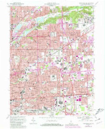
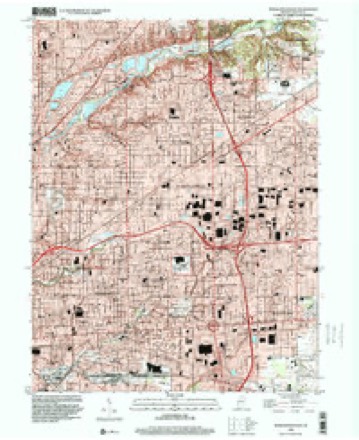
17 topographic sheets cover this place, the earliest surveyed in 1948 and the latest in 1998. It stands in Warren Township. It lies in ZIP code area 46219. It stands on Spring Brook. The Survey maps it on the Indianapolis East quadrangle. The federal gazetteer marks this settlement historical: it is no longer a populated place, though the surveys that recorded it still are.
On record in Irvington
Buildings and businesses the archive holds for this place. Each opens its own page, with the source record it came from.
On the National Register within a mile 6 records
The National Register names another town for these. They stand within one mile of this settlement's coordinate.
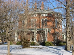 Julian-Clark Houselisted 1986 · 0.5 miles away
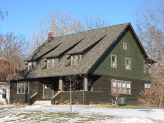 Carlos and Anne Recker Houselisted 1996 · 0.6 miles away
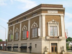 Irvington Historic Districtlisted 1987 · 0.7 miles away
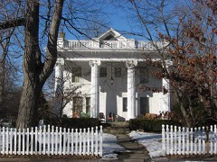 William H. H. Graham Houselisted 1982 · 0.8 miles away
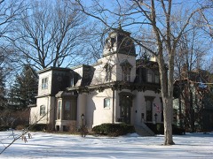 Benton Houselisted 1973 · 0.8 miles away
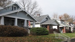 Irvington Terrace Historic Districtlisted 2011 · 0.9 miles away
Topographic sheets covering this place
9 surveys from 17 printed sheetsMatched by testing this settlement's coordinate against the published boundary of every sheet in the United States Geological Survey's historical collection. Each opens the scanned sheet at the Survey.
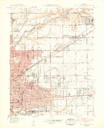
- 1948 USGS Indianapolis East quadrangle1:24000, 2 printings
- 1953 USGS Indianapolis quadrangle1:250000, 4 printings
- 1956 USGS Indianapolis quadrangle1:250000
- 1957 USGS Indianapolis quadrangle1:250000, 2 printings
- 1959 USGS Indianapolis East quadrangle1:24000
- 1962 USGS Indianapolis quadrangle1:250000
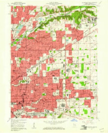
- 1967 USGS Indianapolis East quadrangle1:24000, 3 printings
- 1986 USGS Indianapolis quadrangle1:100000, 2 printings
- 1998 USGS Indianapolis East quadrangle1:24000





In the county-history sources
5,350 words on this townshipHistory of Indianapolis and Marion County, Indiana, published 1884 names this settlement in its chapter on Warren Township. These are the passages that mention it, exactly as the scans read.
German parentage, and was born near the Monongahela River, in Pennsylvania, Dec. 10, 1786. After staying a year in Pennsylvania, they emigrated to Butler County, Ohio, within a few miles of Hamilton, where he followed farming, and in the winter months worked at coopering. In the summer of 1812 he volunteered, and served in the war. His company went out in the early part of the summer, and, after a few months of active service, returned home in September, and remained long enough to put in their wheat. They returned to headquarters in October, where Mr. Brown served till the close of the war. His children still have the sword which he carried. In the fall of 1822 he and his family, in company with two of his brothers and a brother-inlaw, moved to Indianapolis, then but a small settlement of a few log huts. The evening before he reached Indianapolis he camped with a party of Indians on Lick Creek, just south of Irvington, the place where he lived so many years. Mr. Brown returned the next fall to Hamilton, Ohio, to enter his farm, south of Irvington, and on returning, in company with others, they were obliged to swim Blue iliver, which was very high at the time and the weather very cold. There were Indians camped near the river, and they wrung the water from their clothes and dried them by the Indian camp-fire. The only man they met between Blue River and Indianapolis was Henry Brady, who was hewing the logs for his cabin.
Passage source: History of Indianapolis and Marion County, Indiana, published 1884.
Reason Hawkins came from Hamilton County, Ohio, about 1826, and located on Pleasant Run, northeast of the present town of Irvington. In 1829 he was not assessed on any> lands in the township. He sold out his first location and afterwards bought land of Calvin Fletcher, situated a little west of
Passage source: History of Indianapolis and Marion County, Indiana, published 1884.
Villages. - There are three villages within the territory of the township of Warren, viz. : Irvington (the largest but youngest of the three), lying on the west line of the township, adjoining Centre, and about four miles east of the city of Indianapolis ; Julietta, in the southeast corner of the township ; and Cumberland, near the east line of Warren, and occupying a central position on that line, between the northeastern and southeastern corners of the township, eleven miles east of Indianapolis, on the old National or Cumberland road.
Passage source: History of Indianapolis and Marion County, Indiana, published 1884.
Machine-read from a century-old scan, so expect the errors a machine makes: misspelled names, dropped words, stray characters.
Read the whole chapter on Warren Township - it names this place 2 more 2 times.
Mines and quarries near this place
9 within 5 milesRegional context, not property-specific evidence. The federal mineral resources record lists 9 workings within 5 miles of Irvington (historical): 4 past producers, 2 occurrences, 2 producers, 1 unknown. 2 still produce. What was taken out: Sand and Gravel, Construction, Fluorine-Fluorite, Tungsten, Stone, Crushed/Broken. Distance is straight-line from the map coordinates, so a quarry counted here may appear on a neighbouring settlement's page as well.
| Where | Site | Commodity | Status | Recorded |
|---|---|---|---|---|
| Kentucky Ave Mine & Mill | Stone, Crushed/Broken | Producer | ||
| Mallory Metallurgical/ Indianapolis | Tungsten | Past Producer | ||
| N L Controls/ Beech Grove, Ind. | Lead | Past Producer | ||
| Fluorite Occurrence Number 1 | Fluorine-Fluorite | Occurrence | ||
| Fluorite Occurrence Number 1 | Fluorine-Fluorite | Occurrence | ||
| Ace Lake Pit | Sand and Gravel, Construction | Past Producer | ||
| Eagle Gravel Pit | Sand and Gravel, Construction | Unknown | ||
| Ok Sand & Gravel Co., Inc. | Sand and Gravel, Construction | Producer | ||
| Shannon Sand & Gravel Pit | Sand and Gravel, Construction | Past Producer |
Nearest settlements
The eight closest, with where each one stands in the county. Distances are straight-line, computed from the Geographic Names Information System coordinates.
| Map | Place | Distance | Sheets |
|---|---|---|---|
| Benton House | 0.8 miles | 17 | |
| Irvington | 0.8 miles | 17 | |
| Crossroad Temple | 0.9 miles | 17 | |
| Warren Park | 1.3 miles | 17 | |
| Sunnyview | 1.8 miles | 17 | |
| Clifford Park (historical) | 2.2 miles | 17 | |
| Willow Lakes | 2.2 miles | 17 | |
| East Brightwood (historical) | 2.3 miles | 17 |
Provenance
This settlement is recorded in the Geographic Names Information System as feature 452204. The sheet list is computed by point-in-boundary test against the United States Geological Survey's historical topographic inventory. Both are works of the United States government and carry no copyright under 17 U.S.C. 105.
Mines and quarries. USGS Mineral Resources Data System (MRDS) https://mrdata.usgs.gov/mrds/ A work of the United States government, no copyright under 17 U.S.C. 105.