 Block
Mier, Indiana
10 topographic sheets cover this place, the earliest surveyed in 1953 and the latest in 1992. It stands in Richland Township. It lies in ZIP code area 46919. It stands on Stoney Creek. The Survey maps it on the Sweetser quadrangle. 67 people lived here at the 2020 count. It stands 820 feet above sea level.
Population over time
2 figuresMier fell from 78 to 67 between 2010 and 2020. These are the recorded population figures Wikidata holds for this place, reached through the Geographic Names Information System number this page is keyed on rather than by name, so they belong to this place and not to another of the same name. Most are census counts, but not all are: an early figure may be a founding or settlement estimate, and an estimate published within five years of a census is left out. The change column is computed, and is left blank where more than 20 years separate a figure from the one before it, because a gap that long is not a change between two counts.
| Year | People | Change |
|---|---|---|
| 2010 | 78 | |
| 2020 | 67 | -11 (-14%) |
Topographic sheets covering this place
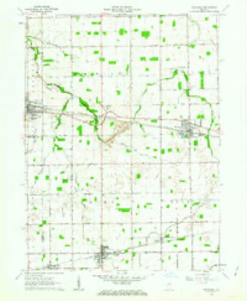
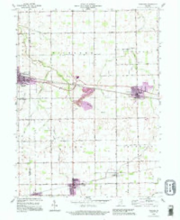
5 surveys from 10 printed sheetsMatched by testing this settlement's coordinate against the published boundary of every sheet in the United States Geological Survey's historical collection. Each opens the scanned sheet at the Survey.
- 1953 USGS Muncie quadrangle1:250000, 5 printings
- 1956 USGS Muncie quadrangle1:250000
- 1962 USGS Sweetser quadrangle1:24000
- 1986 USGS Wabash quadrangle1:100000, 2 printings
- 1992 USGS Sweetser quadrangle1:24000


In the county-history sources
3,297 words on this townshipThe county-history sources names this settlement in its chapter on Richland Township. These are the passages that mention it, exactly as the scans read.
Machine-read from a century-old scan, so expect the errors a machine makes: misspelled names, dropped words, stray characters.
Read the whole chapter on Richland Township - it names this place 3 more 3 times.
Mines and quarries near this place
1 within 5 milesRegional context, not property-specific evidence. The federal mineral resources record lists 1 working within 5 miles of Mier: 1 producer. All of them still produce. What was taken out: Stone, Crushed/Broken. Distance is straight-line from the map coordinates, so a quarry counted here may appear on a neighbouring settlement's page as well.
| Where | Site | Commodity | Status | Recorded |
|---|---|---|---|---|
| Pipe Creek Stone Co. Pit | Stone, Crushed/Broken | Producer |
Storms near this place
7 since 2001Regional context, not property-specific evidence. The National Weather Service names Mier in 7 storm reports between 2001 and 2019: 3 thunderstorm wind, 2 hail, 2 tornado. No death or injury is recorded in these reports. Each account below is quoted exactly as the forecast office filed it, from the NOAA Storm Events Database, and each date opens the federal record of that event.
| When | Event | Place named | Harm | What the report says |
|---|---|---|---|---|
| June 2008 | Thunderstorm Wind | Mier | $10,000 | Trained spotters reported trees and power lines down west of Sweetser. |
| June 2008 | Thunderstorm Wind | Mier | $5,000 | Emergency management officials reported power lines were down at county road 700 West and State Route 18. |
| May 2019 | Tornado (EF2) | Mier | - | This tornado started near the intersection of County Road 900 W and County Road 600 N where it destroyed a well built barn. The tornado destroyed a detached car garage, and lofted debris from a well built hay barn several hundred yards away. As it tracked to the southeast it destroyed a silo and a well built barn next to the silo. The tornado briefly lifted before touching down once again at the intersection of County Road 500 W and County Road 505 N where it snapped trees and caused shingle and siding damage to a home. The tornado then lifted for the final time. |
| November 2013 | Tornado (EF2) | Mier | - | A NWS survey of damage in Grant county indicated a tornado, reaching a maximum intensity of EF2, impacted a several mile long path. The tornado touched down on County Road 00 South, west of County Road 900 West where a hog barn suffered some roof damage. The tornado moved quickly northeast and intensified where it caused damage to two residences near the intersection of County Roads 300 North and 600 West. A large portion of the front wall of a one story home to collapse with subsequent removal of adjacent roof. A nearby home lost its entire roof (DI: MHSW DOD: 6). The tornado continued to intensify further approaching EF2 intensity as it cause extensive damage to a garage with the roof being removed and walls pushed down. Projectiles from the garage were found in the roof of the residence. EF2 intensity was reached around the intersection of County Road 325 West and Frances/Slocum Road where the top of a two story home was nearly removed (DI: FR12 DOD: 6). The tornado slowly weakened the remainder of its track impacting other residences with decreasing amounts and intensity of roof damage. Trees also suffered varying degrees of damage. The tornado cross briefly into Wabash county west of Grant County Road 00 West/Wabash County Road 600 East. The tornado was on the ground for over 11.5 miles with winds reaching a maximum intensity of around 125 mph. |
| October 2001 | Thunderstorm Wind | Mier | - | Trained spotter reported an estimated 60 MPH thunderstorm gust. |
| August 2007 | Hail | Mier | - | no account filed |
| August 2001 | Hail | Mier | - | no account filed |
Nearest settlements
The eight closest, with where each one stands in the county. Distances are straight-line, computed from the Geographic Names Information System coordinates.
Elsewhere
Matched on this settlement's Geographic Names Information System number rather than its name, so it cannot be a different place of the same name in another state.
| Wikipedia article on Mier | An encyclopaedic summary. Its text is share-alike, so it is linked here rather than copied. |
| Wikidata item Q6013694 | The structured record the population and elevation above come from. Public domain (CC0). |
Provenance
This settlement is recorded in the Geographic Names Information System as feature 439130. The sheet list is computed by point-in-boundary test against the United States Geological Survey's historical topographic inventory. Both are works of the United States government and carry no copyright under 17 U.S.C. 105.
Mines and quarries. USGS Mineral Resources Data System (MRDS) https://mrdata.usgs.gov/mrds/ A work of the United States government, no copyright under 17 U.S.C. 105.
Storms. NOAA National Centers for Environmental Information, Storm Events Database https://www.ncei.noaa.gov/stormevents/ A work of the United States government, no copyright under 17 U.S.C. 105. Narratives are quoted verbatim from the National Weather Service report and are not edited or summarised.