 Block
Millhousen, Indiana
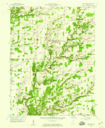
9 topographic sheets cover this place, the earliest surveyed in 1953 and the latest in 1986. It stands in Marion Township. It lies in ZIP code area 47240. The Survey maps it on the Millhousen quadrangle. 149 people lived here at the 2020 count. It stands 896 feet above sea level.
Population over time
2 figuresMillhousen grew from 127 to 149 between 2010 and 2020. These are the recorded population figures Wikidata holds for this place, reached through the Geographic Names Information System number this page is keyed on rather than by name, so they belong to this place and not to another of the same name. Most are census counts, but not all are: an early figure may be a founding or settlement estimate, and an estimate published within five years of a census is left out. The change column is computed, and is left blank where more than 20 years separate a figure from the one before it, because a gap that long is not a change between two counts.
| Year | People | Change |
|---|---|---|
| 2010 | 127 | |
| 2020 | 149 | +22 (+17%) |
Topographic sheets covering this place
4 surveys from 9 printed sheetsMatched by testing this settlement's coordinate against the published boundary of every sheet in the United States Geological Survey's historical collection. Each opens the scanned sheet at the Survey.
- 1953 USGS Cincinnati quadrangle1:250000, 3 printings
- 1957 USGS Cincinnati quadrangle1:250000
- 1958 USGS Millhousen quadrangle1:24000, 3 printings
- 1986 USGS Greensburg quadrangle1:100000, 2 printings



In the county-history sources
439 words on this townshipHistory of Decatur County, Indiana : Its People, Industries and Institutions, published 1915 names this settlement in its chapter on Marion Township. These are the passages that mention it, exactly as the scans read.
The population of Marion township is largely German. The northern half of the township is rolling and in some places the land is rough and broken. The eastern and southern portion is flat and was originally covered with oak, maple and gum. A good share of it is poor woods land. The first church in the township was that of the Immaculate Conception at Millhousen, which was erected in 1840, when Maximillian Schneider donated forty acres of land for this purpose. The first school house was also built by the Catholics and was placed close to the church. Maximillian Schneider, who was one of the leading spirits in the new community, kept the first store, which was located at Millhousen. Later he sold the store to Barney Hardbeck, who had built the first mill at Millhousen. The first mill in Marion township was erected by a man named Bush and was located on the banks of Sand creek.
Passage source: History of Decatur County, Indiana : Its People, Industries and Institutions, published 1915.
Machine-read from a century-old scan, so expect the errors a machine makes: misspelled names, dropped words, stray characters.
Mines and quarries near this place
1 within 5 milesRegional context, not property-specific evidence. The federal mineral resources record lists 1 working within 5 miles of Millhousen: 1 past producer. None of them still produces. What was taken out: Limestone, Dimension. Distance is straight-line from the map coordinates, so a quarry counted here may appear on a neighbouring settlement's page as well.
| Where | Site | Commodity | Status | Recorded |
|---|---|---|---|---|
| Sipes Stone Quarry | Limestone, Dimension | Past Producer |
Storms near this place
6 since 2017Regional context, not property-specific evidence. The National Weather Service names Millhousen in 6 storm reports between 2017 and 2025: 3 thunderstorm wind, 2 tornado, 1 hail. No death or injury is recorded in these reports. Each account below is quoted exactly as the forecast office filed it, from the NOAA Storm Events Database, and each date opens the federal record of that event.
| When | Event | Place named | Harm | What the report says |
|---|---|---|---|---|
| April 2017 | Tornado (EF1) | Millhousen | $35,000 | An EF-1 tornado touched down around 7:35 PM EDT approximately 2 miles northeast of Millhousen in southern Decatur County.||The tornado as on the ground intermittently along its path and caused damage to a few farm outbuildings, destroying one of them. Also, numerous trees were uprooted or snapped. |
| April 2022 | Tornado (EF0) | Millhousen | $15,000 | Broad rotation within the squall line's bookend vortex radar signature eventually led to a brief tornado in southeast Decatur County. The only damage was to a lean-to roof and wall on the east side of a farm outbuilding. This section was demolished with sheet metal roofing and wood debris thrown between 200 and 400 yards to the north and north-northwest. A small horse trailer was picked up and thrown to the north side of County Road 800 South. There were no scour or drag marks visible in the ground from where the trailer originally sat. A 2x4 was driven into the ground about 20 yards north of the damaged building. No other damage was found in the area. |
| April 2019 | Thunderstorm Wind | Millhousen | $5,000 | Several trees were downed near Millhousen due to damaging thunderstorm wind gusts. |
| May 2018 | Thunderstorm Wind | Millhousen | $5,000 | Utility lines, trees, and tree limbs were blown down due to damaging thunderstorm wind gusts in and near the Millhousen area. |
| April 2019 | Thunderstorm Wind | Millhousen | $800 | A small playset was blown over due to damaging thunderstorm wind gusts. |
| June 2025 | Hail | Millhousen | - | Report from mping. |
Nearest settlements
The eight closest, with where each one stands in the county. Distances are straight-line, computed from the Geographic Names Information System coordinates.
| Map | Place | Distance | Sheets |
|---|---|---|---|
| Tarkeo Corner | 4.5 miles | 10 | |
| Pinhook | 4.5 miles | 11 | |
| Smyrna | 4.7 miles | 10 | |
| Slabtown | 5.0 miles | 10 | |
| Gaynorsville | 5.1 miles | 11 | |
| Neff Corner | 6.1 miles | 11 | |
| Mapleton Corner | 6.2 miles | 11 | |
| Knarr Corner | 6.5 miles | 10 |
Elsewhere
Matched on this settlement's Geographic Names Information System number rather than its name, so it cannot be a different place of the same name in another state.
| Wikipedia article on Millhousen | An encyclopaedic summary. Its text is share-alike, so it is linked here rather than copied. |
| Wikidata item Q2746480 | The structured record the population and elevation above come from. Public domain (CC0). |
Provenance
This settlement is recorded in the Geographic Names Information System as feature 439237. The sheet list is computed by point-in-boundary test against the United States Geological Survey's historical topographic inventory. Both are works of the United States government and carry no copyright under 17 U.S.C. 105.
Mines and quarries. USGS Mineral Resources Data System (MRDS) https://mrdata.usgs.gov/mrds/ A work of the United States government, no copyright under 17 U.S.C. 105.
Storms. NOAA National Centers for Environmental Information, Storm Events Database https://www.ncei.noaa.gov/stormevents/ A work of the United States government, no copyright under 17 U.S.C. 105. Narratives are quoted verbatim from the National Weather Service report and are not edited or summarised.