 Block
New Augusta, Indiana
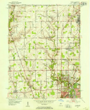
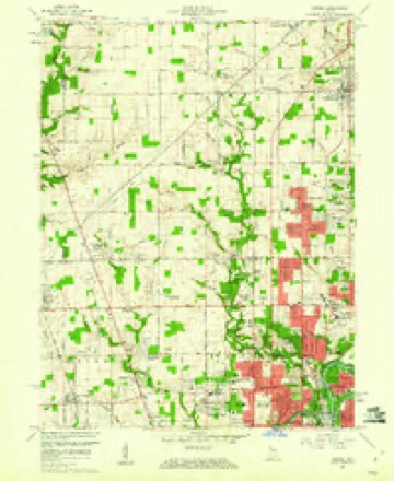
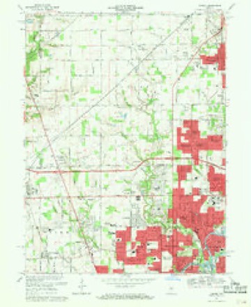
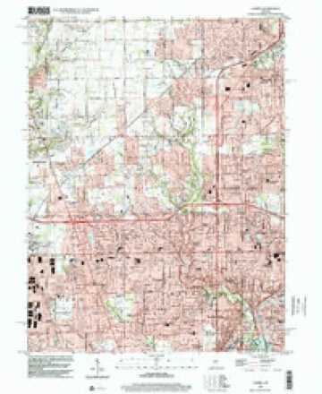
17 topographic sheets cover this place, the earliest surveyed in 1952 and the latest in 1998. It stands in Pike Township. It lies in ZIP code area 46268. It stands on Bird Branch. The Survey maps it on the Carmel quadrangle.
On record in New Augusta
Buildings and businesses the archive holds for this place. Each opens its own page, with the source record it came from.
On the National Register within a mile 1 record
The National Register names another town for these. They stand within one mile of this settlement's coordinate.
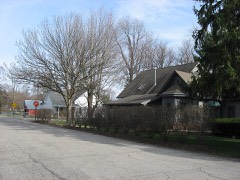 New Augusta Historic Districtlisted 1989 · 0.0 miles away
Topographic sheets covering this place
9 surveys from 17 printed sheetsMatched by testing this settlement's coordinate against the published boundary of every sheet in the United States Geological Survey's historical collection. Each opens the scanned sheet at the Survey.
- 1952 USGS Carmel quadrangle1:24000
- 1953 USGS Indianapolis quadrangle1:250000, 4 printings
- 1956 USGS Indianapolis quadrangle1:250000
- 1957 USGS Indianapolis quadrangle1:250000, 2 printings
- 1959 USGS Carmel quadrangle1:24000
- 1962 USGS Indianapolis quadrangle1:250000
- 1967 USGS Carmel quadrangle1:24000, 4 printings
- 1986 USGS Indianapolis quadrangle1:100000, 2 printings
- 1998 USGS Carmel quadrangle1:24000





In the county-history sources
10,135 words on this townshipHistory of Indianapolis and Marion County, Indiana, published 1884 names this settlement in its chapter on Pike Township. These are the passages that mention it, exactly as the scans read.
Pike township lies in the northwest corner of Marion County, and is bounded on the north by Hamilton and Boone Counties, on the east by Washington township, on the south by Wayne township, and on the west by Hendricks County. The township contains forty-four sections, or twenty-eight thousaDd one hundred and sixty acres of land. Its surface is in some parts rolling, in others nearly level, and in some parts rather swampy. The buttonwood ponds were formerly numerous in some localities, but these are unknown to-day, for the industrious farmers have cleared up these places and tile-drained them, so that excellent crops are raised on these lands. The soil of the township is generally of a good quality, and well adapted to farming and stock-raising. It is watered by Eagle Creek, which enters the township on the north line, about two and one-half miles east of the northwest corner, and runs in a southwesterly course until it reaches the Wayne township line, about one and one-quarter miles east of the west line of the township. Fishback Creek enters the township near the northwest corner, and empties into Eagle Creek one-half mile below Trader's Point. The country along this stream is the most broken part of the township, and is called the hilly country of Fishback. The creek derived its name from Freeman Fishback, who was an early settler on the farm now owned by P. Beck. Some of the finest springs of the county are along this stream. Bush's Run, a small stream, heads near the north centre of the township, and empties into Eagle Creek three-quarters of a mile below Trader's Point. Little Eagle Creek, which is somewhat of a noted stream, has its source near the south line of Boone County, and it enters this township about one mile east of the centre of the north line. It runs just east of New Augusta, and empties into Big Eagle near Mount Jackson, in Wayne township. This stream is the second in size in Pike. Crooked Creek enters the township near the northeast corner, and takes a southwesterly direction until just north of Old Augusta, where it bears to the southeast, and leaves the township about onethird of a mile southeast of Old Augusta. Staton's Creek heads a little south of Old Augusta, runs in a southwesterly course, and empties into Little Eagle on or near W. H. Guion's farm. It derived its name from Joseph Staton, who was the first settler in the southeastern part of the township.
Passage source: History of Indianapolis and Marion County, Indiana, published 1884.
Joseph Klingensmith, Samuel Rodebaugh, and Peter Anthony came to Pike township with their families (each having a wife and four children) in 1829. They were from Western Pennsylvania, and passed down the Ohio River with their families and household goods on a flat-boat to Cincinnati, where they disembarked, sold their boat, and finished their journey to this township by wagons, arriving in the early part of August in the year named. Joseph Klingensmith settled near where New Augusta Station now is, on the land now owned by Simon Klingensmith, his second son. Samuel Rodebaugh settled east and south of the centre of the township, on the land now owned by Joseph Rodebaugh. Peter Anthony settled near the centre of the township, on the farm known as the Daniel Meyers farm. Of this party of early settlers, but two who were then adults are now living, - Esther Klingensmith, who is eighty years old, and lives on the old farm, with her son Simon ; Sally, wife of Samuel Rodebaugh, is also one of the survivors, is eighty-one years old, and lives on the old farm with her youngest son, Joseph Rodebaugh.
Passage source: History of Indianapolis and Marion County, Indiana, published 1884.
The first post-ofiSce in this township was named Piketon, and located at Adam Wright's house, on the farm now owned and occupied by Zachariah Bush, on the Lafayette road. The mail was carried on horseback from Indianapolis to Lafayette. The mail contractor was a man named Bentley, and his son Joseph carried the mail for a number of years on this route. The second postmaster in this part of the township was Christopher Hines, under whom the office was removed to the farm now occupied by P. M. Hollingsworth. Piketon post-office was continued and kept at Mr. Hines' until 1853, when an office was established on the Indianapolis and Lafayette Railroad at Augusta Station (now New Augusta), and the Piketon office and also the office at Old Augusta were discontinued. Mr. Rudicil was the first postmaster at Augusta Station. The present postmaster there is Dr. E. Purdy.
Passage source: History of Indianapolis and Marion County, Indiana, published 1884.
Machine-read from a century-old scan, so expect the errors a machine makes: misspelled names, dropped words, stray characters.
Read the whole chapter on Pike Township - it names this place 9 more 9 times.
Mines and quarries near this place
1 within 5 milesRegional context, not property-specific evidence. The federal mineral resources record lists 1 working within 5 miles of New Augusta: 1 past producer. None of them still produces. What was taken out: Sand and Gravel, Construction. Distance is straight-line from the map coordinates, so a quarry counted here may appear on a neighbouring settlement's page as well.
| Where | Site | Commodity | Status | Recorded |
|---|---|---|---|---|
| Allied Aggregates Pit | Sand and Gravel, Construction | Past Producer |
Storms near this place
10 since 2006Regional context, not property-specific evidence. The National Weather Service names New Augusta in 10 storm reports between 2006 and 2025: 4 hail, 4 thunderstorm wind, 1 lightning, 1 heavy rain. The reports record 6 injuries. Each account below is quoted exactly as the forecast office filed it, from the NOAA Storm Events Database, and each date opens the federal record of that event.
| When | Event | Place named | Harm | What the report says |
|---|---|---|---|---|
| June 2006 | Lightning | New Augusta | 6 hurt | Six firefighters stowing equipment after a training exercise were indirectly struck by lightning. None of the injuries were life threatening. |
| August 2025 | Thunderstorm Wind | New Augusta | $5,000 | Thunderstorm winds downed several trees. |
| July 2015 | Thunderstorm Wind | New Augusta | $3,000 | A few trees were down at the intersection of 86th Street and Zionsville Road due to damaging thunderstorm wind gusts. |
| June 2016 | Thunderstorm Wind | New Augusta | $100 | Multiple small to medium tree limbs were down in a parking lot due to strong thunderstorm wind gusts. |
| December 2021 | Thunderstorm Wind | New Augusta | - | At West 79th Street and Georgetown Road. |
| June 2010 | Heavy Rain | New Augusta | - | Rainfall in the amount of 1.49 inches was measured in this location from 2:15 PM to 3:15 PM EDT. |
| September 2008 | Hail | New Augusta | - | Three quarter-inch hail was reported at both the intersection of 86th Street and Georgetown Road, as well as at 7500 North Michigan Road by amateur radio. |
| April 2006 | Hail | New Augusta | - | No damage estimates were available. |
| August 2017 | Hail | New Augusta | - | no account filed |
| April 2013 | Hail | New Augusta | - | no account filed |
Nearest settlements
The eight closest, with where each one stands in the county. Distances are straight-line, computed from the Geographic Names Information System coordinates.
| Map | Place | Distance | Sheets |
|---|---|---|---|
| Westover | 1.3 miles | 17 | |
| Legendary Hills | 1.3 miles | 18 | |
| Augusta | 1.5 miles | 17 | |
| Westchester Estates | 1.9 miles | 17 | |
| Grandview | 2.4 miles | 19 | |
| Holida | 2.6 miles | 17 | |
| Broadmoor | 2.7 miles | 19 | |
| Snacks | 2.8 miles | 16 |
Provenance
This settlement is recorded in the Geographic Names Information System as feature 440018. The sheet list is computed by point-in-boundary test against the United States Geological Survey's historical topographic inventory. Both are works of the United States government and carry no copyright under 17 U.S.C. 105.
Mines and quarries. USGS Mineral Resources Data System (MRDS) https://mrdata.usgs.gov/mrds/ A work of the United States government, no copyright under 17 U.S.C. 105.
Storms. NOAA National Centers for Environmental Information, Storm Events Database https://www.ncei.noaa.gov/stormevents/ A work of the United States government, no copyright under 17 U.S.C. 105. Narratives are quoted verbatim from the National Weather Service report and are not edited or summarised.