 Block
Rochester, Indiana
11 topographic sheets cover this place, the earliest surveyed in 1953 and the latest in 1992. It stands in Rochester Township. It lies in ZIP code area 46975. It lies near Coney Island. The Survey maps it on the Rochester quadrangle. 6,270 people lived here at the 2020 count. It stands 781 feet above sea level.
Research this city
On record in Rochester
Buildings and businesses the archive holds for this place. Each opens its own page, with the source record it came from.
On the National Register 6 records
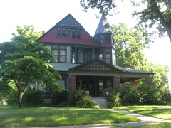 Lyman M. Brackett Houselisted 1984
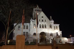 Fulton County Courthouselisted 2000
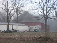 John Haimbaugh Round Barnlisted 1993
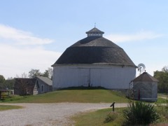 Bert Leedy Round Barnlisted 1993
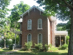 John W. Smith Houselisted 1979
- Rochester Downtown Historic Districtlisted 2008
Population over time
2 figuresRochester grew from 6,218 to 6,270 between 2010 and 2020. These are the recorded population figures Wikidata holds for this place, reached through the Geographic Names Information System number this page is keyed on rather than by name, so they belong to this place and not to another of the same name. Most are census counts, but not all are: an early figure may be a founding or settlement estimate, and an estimate published within five years of a census is left out. The change column is computed, and is left blank where more than 20 years separate a figure from the one before it, because a gap that long is not a change between two counts.
| Year | People | Change |
|---|---|---|
| 2010 | 6,218 | |
| 2020 | 6,270 | +52 (+1%) |
Topographic sheets covering this place
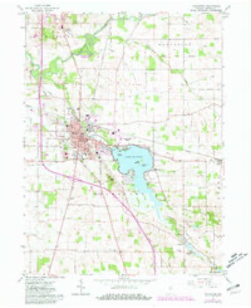
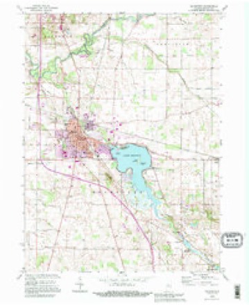
5 surveys from 11 printed sheetsMatched by testing this settlement's coordinate against the published boundary of every sheet in the United States Geological Survey's historical collection. Each opens the scanned sheet at the Survey.
- 1953 USGS Chicago quadrangle1:250000, 5 printings
- 1957 USGS Chicago quadrangle1:250000
- 1962 USGS Rochester quadrangle1:24000, 2 printings
- 1984 USGS Knox quadrangle1:100000, 2 printings
- 1992 USGS Rochester quadrangle1:24000


Mines and quarries near this place
3 within 5 milesRegional context, not property-specific evidence. The federal mineral resources record lists 3 workings within 5 miles of Rochester: 2 producers, 1 unknown. 2 still produce. What was taken out: Sand and Gravel, Construction, Stone. Distance is straight-line from the map coordinates, so a quarry counted here may appear on a neighbouring settlement's page as well.
| Where | Site | Commodity | Status | Recorded |
|---|---|---|---|---|
| Fulton County Hwy. Dept. | Stone | Producer | ||
| Janna Pit | Sand and Gravel, Construction | Unknown | ||
| Van Duyne Pit | Sand and Gravel, Construction | Producer |
Storms near this place
60 of 72 shownRegional context, not property-specific evidence. The National Weather Service names Rochester in 72 storm reports between 1995 and 2025: 44 thunderstorm wind, 22 hail, 3 lightning, 2 flood. The reports record 3 deaths and 13 injuries. Each account below is quoted exactly as the forecast office filed it, from the NOAA Storm Events Database, and each date opens the federal record of that event.
| When | Event | Place named | Harm | What the report says |
|---|---|---|---|---|
| January 2008 | Flood | Rochester | 2 killed, 1 hurt, $125,000 | Numerous roads across Fulton county were at least partially, if not fully impassable with flood waters from low areas, creeks, streams and rivers. County officials closed all roads to general travel from the evening of January 8th to the morning hours of the 9th. Reports of a Chevy Tahoe in deep water with children trapped was received by dispatch centers in Fulton and Kosciusko counties around 750 am Tuesday morning. The vehicle was located on County Road 600 North between 825 and 900 East near the Fulton/Kosciusko county line. The driver of the vehicle, a 29 year old female, reported coming over the top of a hill and unknowningly drove into flowing water over 600 North. By the time she realized what was going on the vehicle stalled and was subsequently carried by nearly seven feet of water into an adjacent field. The driver was able to rescue three of the five children, ages four, one and three months. However, flood waters overtook the vehicle and two children, a two year old girl and five year old boy drowned in the SUV. Due to the fast current, a boat and front end loader were used in the rescue. A Mentone firefighter suffered minor injuries during the rescue. |
| July 2003 | Thunderstorm Wind | Rochester | 1 killed, $15,000 | Emergency management reported a large tree fell on a mobile home crushing a 27 year old man. The man died of head injuries. |
| June 1995 | Tornado (F1) | Rochester | 10 hurt, $100,000 | A tornado flipped over four mobile office homes south of Rochester. Two men were injured when a tree fell on their car and another man was injured when a limb flew through the window of his home. Trees were blown down at Akron. Some trees were down on cars. |
| May 2008 | Lightning | Rochester | 1 hurt | An 18-year-old male was struck by lightning while traveling in his car near the intersection of South Park Road and West 13th Street. The bolt came through his windshield, and striking him on the shoulder. The vehicle stopped a few blocks away and he regained consciousness long enough to call his father before passing back out. He was treated and released from a local hospital with no serious injuries. |
| July 2001 | Lightning | Rochester | 1 hurt | One person hit by lightning. |
| April 2006 | Hail | Rochester | $75,000 | Hail ranging from penny to softball size was reported in and around the city of Rochester. While damage amounts are estimated, local newspaper articles reported damage to several vehicles as well as siding and roof damage. |
| March 2025 | Thunderstorm Wind | Rochester | $15,000 | Large portion of a metal outbuilding roof and wall toppled into the street. |
| August 2022 | Thunderstorm Wind | Rochester | $15,000 | A picture shows a football scoreboard was bent to the ground at Rochester High School. |
| August 2001 | Lightning | Rochester | $10,000 | Lightning struck a wood-frame barn west of Rochester. It burned it to the ground before firefighters could arrive on the scene. |
| May 2025 | Thunderstorm Wind | Rochester | $5,000 | Trained spotter reported a couple of trees down and several branches down. Estimated wind speeds of 50 to 60 mph. |
| August 2001 | Thunderstorm Wind | Rochester | $5,000 | A tree fell on a vehicle in the 1300 block of Madison Street in Rochester. Another tree fell on a vehicle in the 1300 block of Franklin Avenue. |
| June 2024 | Thunderstorm Wind | Rochester | $2,000 | Large tree down, and several large tree limbs down. |
| June 2000 | Thunderstorm Wind | Rochester | $2,000 | Tree down on car. |
| July 2025 | Thunderstorm Wind | Rochester | $1,000 | Photo on Facebook of a large tree down between two homes near the intersection of 12th and Elm Street in Rochester. |
| March 2022 | Thunderstorm Wind | Rochester | - | The public reported multiple large uprooted trees. |
| July 2019 | Thunderstorm Wind | Rochester | - | A mesonet station recorded a 59 mph wind gust. |
| May 2019 | Thunderstorm Wind | Rochester | - | A trained spotter reported trees were blown down onto power lines. |
| May 2019 | Thunderstorm Wind | Rochester | - | A trained spotter reported a large two to three foot diameter tree was downed near Duke Energy. |
| July 2016 | Thunderstorm Wind | Rochester | - | Large tree limbs were blown down. |
| August 2015 | Thunderstorm Wind | Rochester | - | Amateur radio operators reported trees and some large limbs down in the area. |
| August 2015 | Thunderstorm Wind | Rochester | - | Emergency management officials reported that a building, known as the Round Barn, sustained damage at the Fulton County museum. Review of the photos indicates that a microburst likely occurred in an open area with the wind traveling to a double barn door that was pushed in and the roof then compromised. Few if any other adjacent damage indicators were impacted. |
| November 2013 | Thunderstorm Wind | Rochester | - | Emergency management officials reported a 30 foot high pine tree snapped four feet above the base. |
| June 2012 | Thunderstorm Wind | Rochester | - | Emergency management officials reported trees down, blocking the roadway. |
| June 2012 | Thunderstorm Wind | Rochester | - | Emergency management officials reported a tree, as well as tree limbs down. |
| June 2012 | Thunderstorm Wind | Rochester | - | Emergency management officials reported trees and tree limbs down, blocking local roadways. |
| June 2012 | Thunderstorm Wind | Rochester | - | Emergency management officials reported trees and large limbs down onto a home. |
| July 2012 | Thunderstorm Wind | Rochester | - | An amateur radio operator estimated wind gusts to 60 mph. |
| July 2012 | Thunderstorm Wind | Rochester | - | Law enforcement officials reported a tree was blown down in the city of Rochester, as was several signs. Trees and power lines were also reported down across other portions of the county. |
| June 2012 | Thunderstorm Wind | Rochester | - | State police officials reported numerous trees down with widespread power outages in the Rochester area. |
| June 2012 | Thunderstorm Wind | Rochester | - | A trained spotter estimated wind gusts to 65 mph. Numerous trees and tree limbs were observed down across the county. |
| May 2007 | Thunderstorm Wind | Rochester | - | Two 12 inch diameter or larger trees were blown down. |
| August 2007 | Thunderstorm Wind | Rochester | - | Several trees and tree limbs were reported down in and around Rochester. |
| July 2005 | Thunderstorm Wind | Rochester | - | A large tree was blown down. |
| November 2005 | Thunderstorm Wind | Rochester | - | Several tree limbs were blown down northeast of Rochester. |
| August 2004 | Thunderstorm Wind | Rochester | - | Emergency management reported trees down in Rochester. |
| August 2004 | Thunderstorm Wind | Rochester | - | Law enforcement reported trees and a few power lines down north of Rochester. |
| July 2003 | Thunderstorm Wind | Rochester | - | HAM radio operator reported large trees down west of Rochester. |
| July 2003 | Thunderstorm Wind | Rochester | - | Law enforcement reported trees and power lines down in Rochester. |
| July 2003 | Thunderstorm Wind | Rochester | - | Law enforcement reported trees down south of Rochester. |
| July 2003 | Thunderstorm Wind | Rochester | - | Law enforcement reported trees and power lines down in the northwest part of the county. |
| May 2002 | Thunderstorm Wind | Rochester | - | Emergency manager reported a few trees down in Rochester. |
| July 2002 | Thunderstorm Wind | Rochester | - | Law enforcement reported trees down in Rochester. |
| August 2001 | Thunderstorm Wind | Rochester | - | Trees blown down. |
| May 2000 | Thunderstorm Wind | Rochester | - | Power lines down. |
| June 2000 | Thunderstorm Wind | Rochester | - | Trees down. |
| June 2000 | Thunderstorm Wind | Rochester | - | Trees down. |
| August 2000 | Thunderstorm Wind | Rochester | - | Trees down. |
| April 1999 | Flood | Rochester | - | Flooding reported along State Road 110 and Old 31 north of Rochester. |
| June 2023 | Thunderstorm Wind | Rochester | - | no account filed |
| October 2014 | Hail | Rochester | - | no account filed |
| June 2010 | Thunderstorm Wind | Rochester | - | no account filed |
| April 2006 | Hail | Rochester | - | no account filed |
| April 2006 | Hail | Rochester | - | no account filed |
| April 2006 | Hail | Rochester | - | no account filed |
| June 2006 | Hail | Rochester | - | no account filed |
| May 2004 | Hail | Rochester | - | no account filed |
| June 2002 | Hail | Rochester | - | no account filed |
| June 2002 | Hail | Rochester | - | no account filed |
| August 2001 | Hail | Rochester | - | no account filed |
| April 2000 | Hail | Rochester | - | no account filed |
Nearest settlements
The eight closest, with where each one stands in the county. Distances are straight-line, computed from the Geographic Names Information System coordinates.
| Map | Place | Distance | Sheets |
|---|---|---|---|
| Big Hill | 1.7 miles | 11 | |
| Athens | 4.9 miles | 11 | |
| Mount Zion | 5.0 miles | 11 | |
| Green Oak | 5.0 miles | 10 | |
| Pershing | 5.9 miles | 9 | |
| Tiosa | 6.1 miles | 11 | |
| Richland Center | 7.0 miles | 10 | |
| Nyona Lake | 7.3 miles | 10 |
Elsewhere
Matched on this settlement's Geographic Names Information System number rather than its name, so it cannot be a different place of the same name in another state.
| Wikipedia article on Rochester | An encyclopaedic summary. Its text is share-alike, so it is linked here rather than copied. |
| Wikidata item Q991186 | The structured record the population and elevation above come from. Public domain (CC0). |
Provenance
This settlement is recorded in the Geographic Names Information System as feature 442186. The sheet list is computed by point-in-boundary test against the United States Geological Survey's historical topographic inventory. Both are works of the United States government and carry no copyright under 17 U.S.C. 105.
Mines and quarries. USGS Mineral Resources Data System (MRDS) https://mrdata.usgs.gov/mrds/ A work of the United States government, no copyright under 17 U.S.C. 105.
Storms. NOAA National Centers for Environmental Information, Storm Events Database https://www.ncei.noaa.gov/stormevents/ A work of the United States government, no copyright under 17 U.S.C. 105. Narratives are quoted verbatim from the National Weather Service report and are not edited or summarised.