 Block
Southport, Indiana
17 topographic sheets cover this place, the earliest surveyed in 1948 and the latest in 1998. It stands in Perry Township. It lies in ZIP code area 46227. It stands on Derbyshire Creek. The Survey maps it on the Maywood quadrangle. 2,123 people lived here at the 2020 count. It stands 748 feet above sea level.
On record in Southport
Buildings and businesses the archive holds for this place. Each opens its own page, with the source record it came from.
On the National Register within a mile 2 records
The National Register names another town for these. They stand within one mile of this settlement's coordinate.
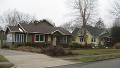 Homecroft Historic Districtlisted 1996 · 0.4 miles away
 Southport High School, Oldlisted 2003 · 0.6 miles away
Population over time
2 figuresSouthport grew from 1,712 to 2,123 between 2010 and 2020. These are the recorded population figures Wikidata holds for this place, reached through the Geographic Names Information System number this page is keyed on rather than by name, so they belong to this place and not to another of the same name. Most are census counts, but not all are: an early figure may be a founding or settlement estimate, and an estimate published within five years of a census is left out. The change column is computed, and is left blank where more than 20 years separate a figure from the one before it, because a gap that long is not a change between two counts.
| Year | People | Change |
|---|---|---|
| 2010 | 1,712 | |
| 2020 | 2,123 | +411 (+24%) |
Topographic sheets covering this place
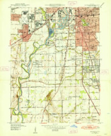
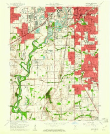
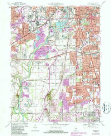
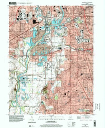
9 surveys from 17 printed sheetsMatched by testing this settlement's coordinate against the published boundary of every sheet in the United States Geological Survey's historical collection. Each opens the scanned sheet at the Survey.
- 1948 USGS Maywood quadrangle1:24000, 2 printings
- 1953 USGS Indianapolis quadrangle1:250000, 4 printings
- 1956 USGS Indianapolis quadrangle1:250000
- 1957 USGS Indianapolis quadrangle1:250000, 2 printings
- 1959 USGS Maywood quadrangle1:24000
- 1962 USGS Indianapolis quadrangle1:250000
- 1967 USGS Maywood quadrangle1:24000, 3 printings
- 1986 USGS Indianapolis quadrangle1:100000, 2 printings
- 1998 USGS Maywood quadrangle1:24000





In the county-history sources
9,757 words on this townshipHistory of Indianapolis and Marion County, Indiana, published 1884 names this settlement in its chapter on Perry Township. These are the passages that mention it, exactly as the scans read.
Church ; Archibald Bruce, immediately east of Henry Aleorn ; Charles and Elijah McBride, with their father, on the Bluff road, west side, three-quarters of a mile north of Glenn's Valley : Samuel Brewer, west side Madison road, north side of Buck Creek ; Purnell Coverdill, two or two and a half miles northeast of Southport ; Jeremiah Featherston and family, threequarters of a mile southeast of Southport ; Benjamin McFarland, the first man who practiced medicine that settled in the township, and his two sons, Samuel and William, and soon after him his son-in-law, John McCollum, near Lick Creek, east side of the township ; Moses Orme, on the Three-Notch line, next to Johnson County ; Lambert Saulter, with his two sons. Garret and Elijah, and Page Rawlings, about one mile and a half southeast of Southport ; Samuel Woodfield, five miles south of town, on the east of the Bluif road ; Charles Neighbors and Scipio Sedgwick, on adjoining land to Woodfield, Neighbors being just west of him, and Sedgwick south of Neighbors ; Thomas Richardson, one-half mile north of Southport, on the east side of the Madison ro»d ; Rev. John Ritchie, east side of the Bins' road, adjoining the Centre township line, ju.st west of George Marquis ; Noah Wright, on the east side of Madison road, south bank of Lick Creek ; William Evans, on the south side of Lick Creek, about three-quarters of a mile east of where the Madison road crosses ; James Hoagland, with his sons, Richard, John, and William, one and a half miles southeast of Southport.
Passage source: History of Indianapolis and Marion County, Indiana, published 1884.
About this time William Tracy, his son-in-law, Peggs, and his brother, John Tracy, settled one mile west of Southport, south side of the present gravel road. Jacob Peggs is still living at Franklin, Ind., about ninety years old. He served as recorder of Johnson County two terms, and as justice of the peace in the same county several terms, and was the first miller at Smock's mill, spoken of elsewhere. On the west side of the township was Silas Rhoads, who settled just across the road from Henry Alcorn, but he remained only a year or so, leaving in 1827, and moving to the Wabash ; and the same year Alexander Clark, after whom Clark township, Johnson County, is named, moved in, and after remaining about two years moved to the northeast corner of
Passage source: History of Indianapolis and Marion County, Indiana, published 1884.
About 1827, Isaac Kelly settled one half-mile north of Lick Creek, on the east side of the Three- Notch line ; William McCIain on the north side of the gravel road, one mile east of Southport ; Jesse Dunn on the north side of Buck Creek, one halfmile west of where the Three-Notch line crosses it; Benjamin Harris (a tenant only), about a mile and a half northwest of Southport; William Jones, who came in 1828, and was the first Welshman, two miles west of Southport, on the south side of the gravel road.
Passage source: History of Indianapolis and Marion County, Indiana, published 1884.
Machine-read from a century-old scan, so expect the errors a machine makes: misspelled names, dropped words, stray characters.
Read the whole chapter on Perry Township - it names this place 24 more 24 times.
Mines and quarries near this place
7 within 5 milesRegional context, not property-specific evidence. The federal mineral resources record lists 7 workings within 5 miles of Southport: 2 producers, 2 occurrences, 1 unknown, 1 plant. 3 still produce. What was taken out: Sand and Gravel, Construction, Fluorine-Fluorite, Stone, Crushed/Broken. Distance is straight-line from the map coordinates, so a quarry counted here may appear on a neighbouring settlement's page as well.
| Where | Site | Commodity | Status | Recorded |
|---|---|---|---|---|
| Indianapolis 522 Quarry | Stone, Crushed/Broken | Producer | ||
| Fluorite Occurrence Number 1 | Fluorine-Fluorite | Occurrence | ||
| Fluorite Occurrence Number 1 | Fluorine-Fluorite | Occurrence | ||
| Indianapolis Haveisen 510 Mill | Sand and Gravel, Construction | Plant | ||
| Indianapolis Haveisen 510 Pit | Sand and Gravel, Construction | Producer | ||
| Kelsay & York Gravel Pit | Sand and Gravel, Construction | Unknown | ||
| R.L. Schutt Borrow Pit | Sand and Gravel, Construction | Past Producer |
Storms near this place
29 since 1998Regional context, not property-specific evidence. The National Weather Service names Southport in 29 storm reports between 1998 and 2025: 16 hail, 9 thunderstorm wind, 3 lightning, 1 tornado. The reports record 97 injuries. Each account below is quoted exactly as the forecast office filed it, from the NOAA Storm Events Database, and each date opens the federal record of that event.
| When | Event | Place named | Harm | What the report says |
|---|---|---|---|---|
| September 2002 | Tornado (F2) | Southport | 97 hurt, $40,000,000 | no account filed |
| May 2008 | Lightning | Southport | $300,000 | One home was completely destroyed fire caused by a lightning strike, while another home received heavy fire damage. |
| July 2001 | Lightning | Southport | $7,500 | no account filed |
| May 2014 | Thunderstorm Wind | Southport | $7,000 | Trees were down in this location due to damaging thunderstorm wind gusts. |
| January 2013 | Thunderstorm Wind | Southport | $5,000 | Siding was taken off a house near the intersection of Sherman Drive and Stop 11 Road due to damaging thunderstorm wind gusts. |
| June 2007 | Lightning | Southport | $3,000 | Lightning struck a power line pole, which fell and subsequently hit and knocked over a tree. |
| June 2025 | Thunderstorm Wind | Southport | $1,000 | Large tree limb down by thunderstorm wind gusts. |
| August 2022 | Thunderstorm Wind | Southport | $1,000 | Large tree limbs downed by thunderstorm wind gusts at the intersection of Southport Road and Combs Road. |
| June 1998 | Thunderstorm Wind | Southport | $1,000 | no account filed |
| June 2023 | Hail | Southport | - | Thunderstorm hail as large as ping pongs in Southport. |
| October 2013 | Thunderstorm Wind | Southport | - | A thunderstorm wind gust, estimated at 70 mph, was observed on Highway 31 just north of County Line Road. |
| June 2010 | Thunderstorm Wind | Southport | - | Penny size hail accompanied these thunderstorm winds. |
| June 2008 | Thunderstorm Wind | Southport | - | Several trees were reported across roads due to damaging thunderstorm winds. |
| June 2007 | Hail | Southport | - | Hail upwards of dime size was reported by a trained spotter. |
| July 2003 | Thunderstorm Wind | Southport | - | Large trees and stoplights broken |
| May 2024 | Hail | Southport | - | no account filed |
| May 2014 | Hail | Southport | - | no account filed |
| May 2011 | Hail | Southport | - | no account filed |
| May 2011 | Hail | Southport | - | no account filed |
| August 2011 | Hail | Southport | - | no account filed |
| June 2008 | Hail | Southport | - | no account filed |
| April 2006 | Hail | Southport | - | no account filed |
| April 2006 | Hail | Southport | - | no account filed |
| June 2006 | Hail | Southport | - | no account filed |
| June 2006 | Hail | Southport | - | no account filed |
| September 2006 | Hail | Southport | - | no account filed |
| April 2005 | Hail | Southport | - | no account filed |
| March 2003 | Hail | Southport | - | no account filed |
| March 2003 | Hail | Southport | - | no account filed |
Nearest settlements
The eight closest, with where each one stands in the county. Distances are straight-line, computed from the Geographic Names Information System coordinates.
| Map | Place | Distance | Sheets |
|---|---|---|---|
| Homecroft | 0.4 miles | 17 | |
| Twin Brooks | 0.5 miles | 17 | |
| Perry Manor | 1.3 miles | 17 | |
| Edgewood | 1.4 miles | 17 | |
| Lindenwood | 1.5 miles | 17 | |
| Rosedale Hills | 2.0 miles | 17 | |
| University Heights | 2.8 miles | 17 | |
| Glenns Valley | 4.0 miles | 17 |
Elsewhere
Matched on this settlement's Geographic Names Information System number rather than its name, so it cannot be a different place of the same name in another state.
| Wikipedia article on Southport | An encyclopaedic summary. Its text is share-alike, so it is linked here rather than copied. |
| Wikidata item Q2517335 | The structured record the population and elevation above come from. Public domain (CC0). |
Provenance
This settlement is recorded in the Geographic Names Information System as feature 443880. The sheet list is computed by point-in-boundary test against the United States Geological Survey's historical topographic inventory. Both are works of the United States government and carry no copyright under 17 U.S.C. 105.
Mines and quarries. USGS Mineral Resources Data System (MRDS) https://mrdata.usgs.gov/mrds/ A work of the United States government, no copyright under 17 U.S.C. 105.
Storms. NOAA National Centers for Environmental Information, Storm Events Database https://www.ncei.noaa.gov/stormevents/ A work of the United States government, no copyright under 17 U.S.C. 105. Narratives are quoted verbatim from the National Weather Service report and are not edited or summarised.