 Block
Swanington, Indiana
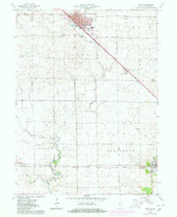
9 topographic sheets cover this place, the earliest surveyed in 1953 and the latest in 1990. It stands in Center Township. It lies in ZIP code area 47944. The Survey maps it on the Fowler quadrangle. It stands 801 feet above sea level.
Topographic sheets covering this place
6 surveys from 9 printed sheetsMatched by testing this settlement's coordinate against the published boundary of every sheet in the United States Geological Survey's historical collection. Each opens the scanned sheet at the Survey.
- 1953 USGS Danville quadrangle1:250000, 3 printings
- 1955 USGS Danville quadrangle1:250000
- 1956 USGS Danville quadrangle1:250000
- 1962 USGS Fowler quadrangle1:24000, 2 printings
- 1984 USGS Watseka quadrangle1:100000
- 1990 USGS Watseka quadrangle1:100000



In the county-history sources
1,723 words on this townshipProgress of Education in Benton County, Indiana : with an Explanation of the Indiana School System and the Duties of School Officers, Patrons and Pupils, published 1906 names this settlement in its chapter on Center Township. These are the passages that mention it, exactly as the scans read.
Warren B. Sheetz established a graded school at Swanington in 1894, employing Carl McCaslin and Lulu Johnson as the teachers in 1894-5. The people in the vicinity have always taken pride in this school and have done much to uphold it. They are now asking Trustee Hagenbuch to build them a new building and organize a high school. There are 1,210 books in the school libraries of the township. Many of Center's common school graduates have completed the course of the Fowler commissioned high school, and quite a number of them have taken a college course. Mr. Hagenbuch has been both a high school and college student, and is especially anxious that his teachers and schools should be of the best.
Passage source: Progress of Education in Benton County, Indiana : with an Explanation of the Indiana School System and the Duties of School Officers, Patrons and Pupils, published 1906.
Machine-read from a century-old scan, so expect the errors a machine makes: misspelled names, dropped words, stray characters.
Read the whole chapter on Center Township - it names this place 1 more 1 time.
Mines and quarries near this place
1 within 5 milesRegional context, not property-specific evidence. The federal mineral resources record lists 1 working within 5 miles of Swanington: 1 producer. All of them still produce. What was taken out: Stone. Distance is straight-line from the map coordinates, so a quarry counted here may appear on a neighbouring settlement's page as well.
| Where | Site | Commodity | Status | Recorded |
|---|---|---|---|---|
| Benton County Highway Dept. | Stone | Producer |
Storms near this place
4 since 2015Regional context, not property-specific evidence. The National Weather Service names Swanington in 4 storm reports between 2015 and 2024: 2 thunderstorm wind, 1 hail, 1 tornado. No death or injury is recorded in these reports. Each account below is quoted exactly as the forecast office filed it, from the NOAA Storm Events Database, and each date opens the federal record of that event.
| When | Event | Place named | Harm | What the report says |
|---|---|---|---|---|
| June 2024 | Thunderstorm Wind | Swanington | - | A tree snapped and fell onto a car near Fowler. |
| March 2023 | Tornado (EF2) | Swanington | - | This tornado touched down near the intersection of E County Road 200 S and S Adeway Rd south of Fowler. The tornado tracked to the northeast for nearly 12 miles. Along the way, it damaged a few homes and multiple wind turbines. The tornado reached its maximum intensity just east of Fowler where it snapped the base of a wind turbine about halfway up and threw the blades of wind turbines as far as 600 yards to the northeast. Wind speeds during this time are estimated to be around 120 mph. The storm also downed trees and power poles. It lifted near N County Road 800 E and E County Road 600 N in northeast Benton County. |
| May 2019 | Thunderstorm Wind | Swanington | - | Wind gusts were measured to 71 mph on a personal weather station. |
| September 2015 | Hail | Swanington | - | Large hail reported across southern parts of Benton County. |
Nearest settlements
The eight closest, with where each one stands in the county. Distances are straight-line, computed from the Geographic Names Information System coordinates.
Elsewhere
Matched on this settlement's Geographic Names Information System number rather than its name, so it cannot be a different place of the same name in another state.
| Wikipedia article on Swanington | An encyclopaedic summary. Its text is share-alike, so it is linked here rather than copied. |
| Wikidata item Q7653587 | The structured record the population and elevation above come from. Public domain (CC0). |
Provenance
This settlement is recorded in the Geographic Names Information System as feature 444465. The sheet list is computed by point-in-boundary test against the United States Geological Survey's historical topographic inventory. Both are works of the United States government and carry no copyright under 17 U.S.C. 105.
Mines and quarries. USGS Mineral Resources Data System (MRDS) https://mrdata.usgs.gov/mrds/ A work of the United States government, no copyright under 17 U.S.C. 105.
Storms. NOAA National Centers for Environmental Information, Storm Events Database https://www.ncei.noaa.gov/stormevents/ A work of the United States government, no copyright under 17 U.S.C. 105. Narratives are quoted verbatim from the National Weather Service report and are not edited or summarised.