 Block
Waynedale, Indiana
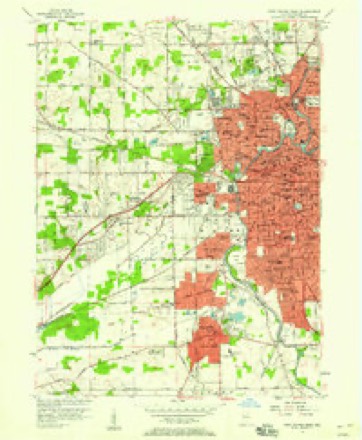
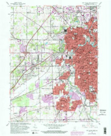
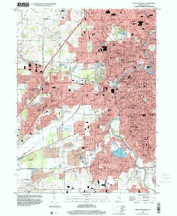
14 topographic sheets cover this place, the earliest surveyed in 1953 and the latest in 1998. It stands in Wayne Township. It lies in ZIP code area 46809. The Survey maps it on the Fort Wayne West quadrangle.
On record in Waynedale
Buildings and businesses the archive holds for this place. Each opens its own page, with the source record it came from.
On the National Register within a mile 1 record
The National Register names another town for these. They stand within one mile of this settlement's coordinate.
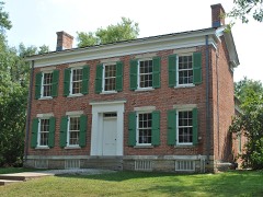 de Richardville, Chief Jean-Baptiste, HouseNational Historic Landmark · listed 1997 · 0.9 miles away
Topographic sheets covering this place
7 surveys from 14 printed sheetsMatched by testing this settlement's coordinate against the published boundary of every sheet in the United States Geological Survey's historical collection. Each opens the scanned sheet at the Survey.
- 1953 USGS Fort Wayne quadrangle1:250000, 4 printings
- 1956 USGS Fort Wayne quadrangle1:250000, 2 printings
- 1956 USGS Fort Wayne West quadrangle1:24000
- 1963 USGS Fort Wayne West quadrangle1:24000, 4 printings
- 1984 USGS Fort Wayne quadrangle1:100000
- 1994 USGS Fort Wayne quadrangle1:100000
- 1998 USGS Fort Wayne West quadrangle1:24000




In the county-history sources
40,276 words on this townshipHistory of Allen County, Indiana., published 1880 has no passage naming this settlement, which was common for smaller places. Its township is covered in full.
The chapter on Wayne Township covers the township.
Read the chapter on Wayne Township - 40,276 words.
Mines and quarries near this place
10 within 5 milesRegional context, not property-specific evidence. The federal mineral resources record lists 10 workings within 5 miles of Waynedale: 7 producers, 2 occurrences, 1 past producer. 7 still produce. What was taken out: Sand and Gravel, Construction, Stone, Crushed/Broken, Zinc, Fluorine-Fluorite, Sulfur. Distance is straight-line from the map coordinates, so a quarry counted here may appear on a neighbouring settlement's page as well.
| Where | Site | Commodity | Status | Recorded |
|---|---|---|---|---|
| Sphalerite and Fluorite Occurrence Z79 | Zinc, Fluorine-Fluorite, Sulfur | Occurrence | Fluorite, Sphalerite | |
| Unnamed Fluorite Occurrence | Fluorine-Fluorite | Occurrence | Fluorite | |
| Ardmore Stone Plant #2 | Stone, Crushed/Broken | Producer | ||
| Ft. Wayne Quarry & Mill | Stone, Crushed/Broken | Producer | ||
| Ardmore Sand Plant #1 | Sand and Gravel, Construction | Producer | ||
| Brudi #1 | Sand and Gravel, Construction | Producer | ||
| Brudi #4 | Sand and Gravel, Construction | Producer | ||
| Irving Gravel Co., Inc. | Sand and Gravel, Construction | Producer | ||
| Midwest Aggregates Pit 1 | Sand and Gravel, Construction | Producer | ||
| Midwest Aggregates Pit 2 | Sand and Gravel, Construction | Past Producer |
Storms near this place
20 since 2007Regional context, not property-specific evidence. The National Weather Service names Waynedale in 20 storm reports between 2007 and 2024: 17 thunderstorm wind, 2 heavy rain, 1 hail. No death or injury is recorded in these reports. Each account below is quoted exactly as the forecast office filed it, from the NOAA Storm Events Database, and each date opens the federal record of that event.
| When | Event | Place named | Harm | What the report says |
|---|---|---|---|---|
| July 2023 | Thunderstorm Wind | Waynedale | $10,000 | Many trees were uprooted or downed. |
| June 2007 | Thunderstorm Wind | Waynedale | $10,000 | A semi truck was blown over on Interstate 469, southwest of Fort Wayne. Several trees were blown down, as well as part of a barn roof being blown off. A 71 mph wind gust was recorded at the Fort Wayne International Airport. |
| July 2024 | Thunderstorm Wind | Waynedale | $1,000 | Tree down on S. Calhoun and Tillman Roads. Tree is 10-12 inches in diameter and healthy. |
| May 2022 | Thunderstorm Wind | Waynedale | - | The Fort Wayne ASOS recorded a 54 knot wind gust. |
| March 2022 | Thunderstorm Wind | Waynedale | - | The public reported a large tree was uprooted. |
| July 2022 | Thunderstorm Wind | Waynedale | - | A trained weather spotter estimated 70 mph wind gusts and stated that a wall cloud was forming. |
| May 2020 | Thunderstorm Wind | Waynedale | - | A 77 mph wind gust was recorded at the ASOS located at the Fort Wayne International Airport. |
| July 2020 | Thunderstorm Wind | Waynedale | - | Fire department responded to report of trees and wires down on Kinnerk Rd. near Winchester Rd. |
| June 2015 | Thunderstorm Wind | Waynedale | - | Eight inch healthy tree fell on power lines. |
| June 2015 | Thunderstorm Wind | Waynedale | - | Two foot diameter healthy tree down. |
| June 2015 | Heavy Rain | Waynedale | - | Flooding at the intersection of Calhoun St. and Tillman Rd. Storm drains discharging water. |
| June 2015 | Heavy Rain | Waynedale | - | Water flowing over the road up to half an inch deep. |
| June 2014 | Thunderstorm Wind | Waynedale | - | A trained spotter measured a 60 mph wind gust just east of the Fort Wayne International Airport. |
| November 2013 | Thunderstorm Wind | Waynedale | - | A trained spotter estimated wind gusts to 60 mph with tree limbs of unknown soze blown down in the area. |
| June 2012 | Thunderstorm Wind | Waynedale | - | A trained spotter reported 30 trees were blown down in a local part, with several close to two feet in diameter. Three of the trees were reported to have fallen on vehicles. |
| July 2011 | Thunderstorm Wind | Waynedale | - | Trained spotters reported minor structural damage, as well as several tree limbs and branches down in Waynedale. A wind gust to 67 mph was recorded in the city. |
| August 2011 | Thunderstorm Wind | Waynedale | - | The ASOS at the Fort Wayne International Airport recorded a 64 mph wind gust. |
| May 2011 | Thunderstorm Wind | Waynedale | - | A trained spotter reported a telephone pole was blown over near Ardmore Avenue, south of Engle Road. Several two to three inch diameter branches were broken from trees. |
| June 2008 | Thunderstorm Wind | Waynedale | - | The ASOS at the Fort Wayne International Airport recorded a 60 mph wind gust. |
| October 2014 | Hail | Waynedale | - | no account filed |
Nearest settlements
The eight closest, with where each one stands in the county. Distances are straight-line, computed from the Geographic Names Information System coordinates.
| Map | Place | Distance | Sheets |
|---|---|---|---|
| Avalon | 1.0 miles | 14 | |
| Lake Shores | 1.1 miles | 14 | |
| Indian Village | 1.8 miles | 14 | |
| Lincolnshire | 1.9 miles | 14 | |
| Hillcrest | 2.2 miles | 14 | |
| Westchester | 2.5 miles | 14 | |
| Country Club Gardens | 3.1 miles | 14 | |
| Times Corner | 3.6 miles | 14 |
Elsewhere
Matched on this settlement's Geographic Names Information System number rather than its name, so it cannot be a different place of the same name in another state.
| Wikidata item Q122539363 | The structured record the population and elevation above come from. Public domain (CC0). |
Provenance
This settlement is recorded in the Geographic Names Information System as feature 445580. The sheet list is computed by point-in-boundary test against the United States Geological Survey's historical topographic inventory. Both are works of the United States government and carry no copyright under 17 U.S.C. 105.
Mines and quarries. USGS Mineral Resources Data System (MRDS) https://mrdata.usgs.gov/mrds/ A work of the United States government, no copyright under 17 U.S.C. 105.
Storms. NOAA National Centers for Environmental Information, Storm Events Database https://www.ncei.noaa.gov/stormevents/ A work of the United States government, no copyright under 17 U.S.C. 105. Narratives are quoted verbatim from the National Weather Service report and are not edited or summarised.