 Block
West Lebanon, Indiana
9 topographic sheets cover this place, the earliest surveyed in 1953 and the latest in 1987. It stands in Pike Township. It lies in ZIP code area 47991. It stands on Johnson Branch. The Survey maps it on the West Lebanon quadrangle. 678 people lived here at the 2020 count. It stands 712 feet above sea level.
Population over time
2 figuresWest Lebanon fell from 723 to 678 between 2010 and 2020. These are the recorded population figures Wikidata holds for this place, reached through the Geographic Names Information System number this page is keyed on rather than by name, so they belong to this place and not to another of the same name. Most are census counts, but not all are: an early figure may be a founding or settlement estimate, and an estimate published within five years of a census is left out. The change column is computed, and is left blank where more than 20 years separate a figure from the one before it, because a gap that long is not a change between two counts.
| Year | People | Change |
|---|---|---|
| 2010 | 723 | |
| 2020 | 678 | -45 (-6%) |
Topographic sheets covering this place
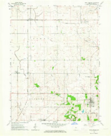
6 surveys from 9 printed sheetsMatched by testing this settlement's coordinate against the published boundary of every sheet in the United States Geological Survey's historical collection. Each opens the scanned sheet at the Survey.
- 1953 USGS Danville quadrangle1:250000, 3 printings
- 1955 USGS Danville quadrangle1:250000
- 1956 USGS Danville quadrangle1:250000
- 1961 USGS West Lebanon quadrangle1:24000, 2 printings
- 1984 USGS Danville quadrangle1:100000
- 1987 USGS Danville quadrangle1:100000



In the county-history sources
7,923 words on this townshipCounties of Warren, Benton, Jasper and Newton, Indiana : Historical and Biographical, published 1883 names this settlement in its chapter on Pike Township. These are the passages that mention it, exactly as the scans read.
BARTOX H. McI^fTOSH was born in this township and county September 17, 1848, and is the only son in a family of six children born to James H. and Elizabeth (Dunbar) Mcintosh, natives of Kentucky and Ohio respectively. Barton received his education from the common country school, and lived at home until his twentyfifth year, sharing in the products of the farm after his twenty-first year. On June 18, 1874, he was married to Miss Morcy Greene, a native of New York, daughter of M. S. and Sarah Greene, of West Lebanon. After his marriage, Mr. Mcintosh contracted to manage his father's farm until that parent's'dea.th. In October. 1876, he was elected Township Assessor, and re-elected in April, 1878. He was elected Township Trustee April 3, 1882. He is Past Master of Ancient Masons and a radical Republican. Mrs. Mcintosh is a member of the Christian Church.
Passage source: Counties of Warren, Benton, Jasper and Newton, Indiana : Historical and Biographical, published 1883.
To this union were born three cliildren - Ida V.. William E. and Rhoda A. Mr. Purviance is a Republican, and was formerly a Whig, having given his first vote for Gen. Harrison. He is a member of tlie Christian Church, and a respected citizen. W. L. RABOURN" was born in Vermillion County, Ind., July 26. 184S, and is the youngest of the four children born to Fielding and Rebecca (Shepherd) Rabourn. Fielding Rabourn was a native of Kentucky; he died March 13, 1831. The motlier of W. L. Rabourn diid when he was yet an infant, and he was taken by an aunt until his father's second marriage. His early life was passed in the service of his father on tlie farm during summer and attending school during winter. So he continued until he was nineteen, when he began teaching. In 1869, he commenced the study of law in the office of Davis & Mann, at Danville, 111., where he remained two j'cars, wlien, for want of means, he discontinued the law and resumed teaching. On April 16, 1871, he was married to Miss Dorothy Carithers, daughter of Jonathan and Elizabeth Carlthers. Si.x children liave blessed their union - Ldlie, Nellie, Ossian, Fannie, Stella and Charles O. In August, 1871, he was admitted to the bar of Vermillion County, Ind., and one year later to the bar of Vermillion County, 111., and also, in 1877, to the b,ir of Warren Countv, Ind. In 1879. he moved to West Lebanon, where he has been since located. Mr. Rabourn is a Republican, and in 1881 was elected Town Clerk and Treasurer. On May 1, 1883, he formed a law partnership with Hon. W. P. Rhodes, and is esteemed one of the tirst lawyers at the Warren Countv bar
Passage source: Counties of Warren, Benton, Jasper and Newton, Indiana : Historical and Biographical, published 1883.
Machine-read from a century-old scan, so expect the errors a machine makes: misspelled names, dropped words, stray characters.
Read the whole chapter on Pike Township - it names this place 23 more 23 times.
Mines and quarries near this place
4 within 5 milesRegional context, not property-specific evidence. The federal mineral resources record lists 4 workings within 5 miles of West Lebanon: 3 producers, 1 past producer. 3 still produce. What was taken out: Sand and Gravel, Construction. Distance is straight-line from the map coordinates, so a quarry counted here may appear on a neighbouring settlement's page as well.
| Where | Site | Commodity | Status | Recorded |
|---|---|---|---|---|
| Bell Gravel Pit | Sand and Gravel, Construction | Past Producer | ||
| Brown's Pit | Sand and Gravel, Construction | Producer | ||
| Hanging Rock Pit | Sand and Gravel, Construction | Producer | ||
| Wabash Gravel | Sand and Gravel, Construction | Producer |
Storms near this place
8 since 2004Regional context, not property-specific evidence. The National Weather Service names West Lebanon in 8 storm reports between 2004 and 2020: 6 thunderstorm wind, 2 hail. No death or injury is recorded in these reports. Each account below is quoted exactly as the forecast office filed it, from the NOAA Storm Events Database, and each date opens the federal record of that event.
| When | Event | Place named | Harm | What the report says |
|---|---|---|---|---|
| April 2006 | Thunderstorm Wind | West Lebanon | $100,000 | The roof and at least one wall was torn off a business by damaging winds. |
| October 2013 | Thunderstorm Wind | West Lebanon | $3,000 | One utility pole was snapped at the base, a couple trees were damaged, and a corn field was damaged due to damaging thunderstorm wind gusts. This report was received via Twitter. |
| August 2019 | Thunderstorm Wind | West Lebanon | $2,000 | Multiple trees knocked down due to thunderstorm wind gusts around the town of West Lebanon. |
| May 2017 | Thunderstorm Wind | West Lebanon | $1,000 | A 16-inch diameter tree was downed in this location due to damaging thunderstorm wind gusts. |
| April 2020 | Hail | West Lebanon | - | Relayed via Twitter. |
| April 2011 | Hail | West Lebanon | - | Pea to nickel-sized hail was reported in this location. |
| June 2010 | Thunderstorm Wind | West Lebanon | - | Trees were blown down by the thunderstorm winds. |
| July 2004 | Thunderstorm Wind | West Lebanon | - | no account filed |
Nearest settlements
The eight closest, with where each one stands in the county. Distances are straight-line, computed from the Geographic Names Information System coordinates.
| Map | Place | Distance | Sheets |
|---|---|---|---|
| Old Town | 0.8 miles | 9 | |
| Marshfield | 3.8 miles | 11 | |
| Five Points | 4.8 miles | 10 | |
| Williamsport | 5.1 miles | 10 | |
| Sloan | 5.2 miles | 9 | |
| Hedrick | 5.9 miles | 9 | |
| Johnsonville | 6.0 miles | 11 | |
| Judyville | 6.1 miles | 9 |
Elsewhere
Matched on this settlement's Geographic Names Information System number rather than its name, so it cannot be a different place of the same name in another state.
| Wikipedia article on West Lebanon | An encyclopaedic summary. Its text is share-alike, so it is linked here rather than copied. |
| Wikidata item Q2281736 | The structured record the population and elevation above come from. Public domain (CC0). |
Provenance
This settlement is recorded in the Geographic Names Information System as feature 445780. The sheet list is computed by point-in-boundary test against the United States Geological Survey's historical topographic inventory. Both are works of the United States government and carry no copyright under 17 U.S.C. 105.
Mines and quarries. USGS Mineral Resources Data System (MRDS) https://mrdata.usgs.gov/mrds/ A work of the United States government, no copyright under 17 U.S.C. 105.
Storms. NOAA National Centers for Environmental Information, Storm Events Database https://www.ncei.noaa.gov/stormevents/ A work of the United States government, no copyright under 17 U.S.C. 105. Narratives are quoted verbatim from the National Weather Service report and are not edited or summarised.