 Block
Woodruff Place, Indiana
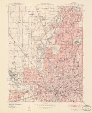
19 topographic sheets cover this place, the earliest surveyed in 1948 and the latest in 1998. It stands in Center Township. It lies in ZIP code area 46201. It stands on Pogues Run. The Survey maps it on the Indianapolis West quadrangle.
On record in Woodruff Place
Buildings and businesses the archive holds for this place. Each opens its own page, with the source record it came from.
On the National Register within a mile 12 of 19 shown
The National Register names another town for these. They stand within one mile of this settlement's coordinate.
 James Whitcomb Riley HouseNational Historic Landmark · listed 1966 · 0.5 miles away
 Woodruff Placelisted 1972 · 0.0 miles away
 U.S. Arsenal (Arsenal Technical High School)listed 1976 · 0.2 miles away
 Whittier, John Greenleaf, School, No. 33listed 1981 · 0.4 miles away
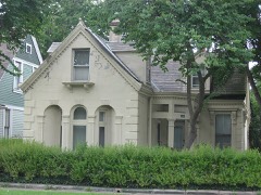 Prosser Houselisted 1975 · 0.4 miles away
 Indianapolis Public Library Branch No. 6listed 2016 · 0.5 miles away
 Cottage Home Historic Districtlisted 1990 · 0.5 miles away
 St. Philip Neri Parish Historic Districtlisted 1996 · 0.6 miles away
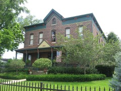 John Fitch Hill Houselisted 2004 · 0.8 miles away
 Gaseteria, Inc.listed 2013 · 0.9 miles away
 Indianapolis Public Library Branch No. 3listed 2016 · 0.9 miles away
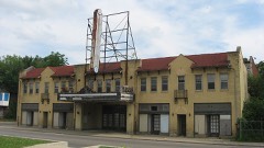 Rivoli Theaterlisted 2004 · 0.9 miles away
Topographic sheets covering this place
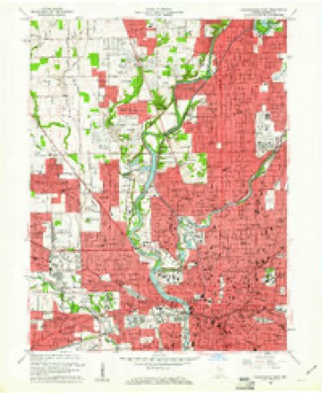
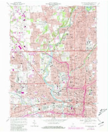
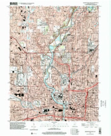
9 surveys from 19 printed sheetsMatched by testing this settlement's coordinate against the published boundary of every sheet in the United States Geological Survey's historical collection. Each opens the scanned sheet at the Survey.
- 1948 USGS Indianapolis West quadrangle1:24000, 2 printings
- 1953 USGS Indianapolis quadrangle1:250000, 4 printings
- 1956 USGS Indianapolis quadrangle1:250000
- 1957 USGS Indianapolis quadrangle1:250000, 2 printings
- 1959 USGS Indianapolis West quadrangle1:24000
- 1962 USGS Indianapolis quadrangle1:250000
- 1967 USGS Indianapolis West quadrangle1:24000, 5 printings
- 1986 USGS Indianapolis quadrangle1:100000, 2 printings
- 1998 USGS Indianapolis West quadrangle1:24000





Mines and quarries near this place
10 within 5 milesRegional context, not property-specific evidence. The federal mineral resources record lists 10 workings within 5 miles of Woodruff Place: 5 past producers, 2 occurrences, 2 producers, 1 unknown. 2 still produce. What was taken out: Sand and Gravel, Construction, Fluorine-Fluorite, Tungsten, Stone, Crushed/Broken. Distance is straight-line from the map coordinates, so a quarry counted here may appear on a neighbouring settlement's page as well.
| Where | Site | Commodity | Status | Recorded |
|---|---|---|---|---|
| Kentucky Ave Mine & Mill | Stone, Crushed/Broken | Producer | ||
| Mallory Metallurgical/ Indianapolis | Tungsten | Past Producer | ||
| Fluorite Occurrence Number 1 | Fluorine-Fluorite | Occurrence | ||
| Fluorite Occurrence Number 1 | Fluorine-Fluorite | Occurrence | ||
| Ace Lake Pit | Sand and Gravel, Construction | Past Producer | ||
| Eagle Gravel Pit | Sand and Gravel, Construction | Unknown | ||
| Ok Sand & Gravel Co., Inc. | Sand and Gravel, Construction | Producer | ||
| R.L. Schutt Borrow Pit | Sand and Gravel, Construction | Past Producer | ||
| Shannon Sand & Gravel Pit | Sand and Gravel, Construction | Past Producer | ||
| Standard Materials Corp S&G Pit | Sand and Gravel, Construction | Past Producer |
Storms near this place
12 since 2009Regional context, not property-specific evidence. The National Weather Service names Woodruff Place in 12 storm reports between 2009 and 2025: 7 thunderstorm wind, 2 lightning, 1 tornado, 1 hail. The reports record 1 injury. Each account below is quoted exactly as the forecast office filed it, from the NOAA Storm Events Database, and each date opens the federal record of that event.
| When | Event | Place named | Harm | What the report says |
|---|---|---|---|---|
| August 2009 | Lightning | Woodruff Place | 1 hurt, $1,000 | The NBC affiliate in Indianapolis reported that a man was struck by lightning as he and his son were walking from the car to the house, which was located in the 400 block of South Butler Avenue. A nearby tree was also struck and destroyed. The man was rushed to Wishard Hospital, where he was expected to recover. |
| June 2023 | Thunderstorm Wind | Woodruff Place | $2,500,000 | Extensive tree and powerline damage caused by thunderstorm wind gusts across the county. Over 57000 power outages caused by the storm within the county. |
| November 2013 | Thunderstorm Wind | Woodruff Place | $75,000 | A building at the corner of Washington Street and Ritter Avenue in the Irvington area was completely destroyed due to damaging thunderstorm wind gusts. |
| August 2021 | Thunderstorm Wind | Woodruff Place | $25,000 | Several reports of medium to large tree branches blown over by thunderstorm wind gusts across the eastern portions of Indianapolis. A large tree was also blown down near 10th street. |
| June 2025 | Thunderstorm Wind | Woodruff Place | $15,000 | Thunderstorm wind gusts downed power lines and a large tree. |
| August 2016 | Tornado (EF0) | Woodruff Place | $15,000 | This EF-0 tornado, with maximum wind speeds estimated at 80 mph, caused windows to be blown out of a home near the intersection of 25th and LaSalle Streets. A building on Stanton Street sustained roof damage. Some tree branches were downed as well. |
| June 2021 | Flash Flood | Woodruff Place | $2,000 | Video received via social media showing water flowing over a road in Irvington. |
| June 2021 | Thunderstorm Wind | Woodruff Place | $1,000 | One inch hail also reported at the same time as the estimated 60 mph thunderstorm wind gust. |
| August 2020 | Lightning | Woodruff Place | $1,000 | An 18 inch tree was downed due to a lightning strike. |
| January 2017 | Thunderstorm Wind | Woodruff Place | $500 | Several small branches were downed by thunderstorm winds estimated at 60 mph. |
| August 2018 | Thunderstorm Wind | Woodruff Place | $200 | Tree branches were reported down with power flickering off and on due to damaging thunderstorm wind gusts. The wind gusts in this area were estimated at 60 mph. |
| June 2021 | Hail | Woodruff Place | - | no account filed |
Nearest settlements
The eight closest, with where each one stands in the county. Distances are straight-line, computed from the Geographic Names Information System coordinates.
| Map | Place | Distance | Sheets |
|---|---|---|---|
| City of Indianapolis (balance) | 0.9 miles | 19 | |
| Indianapolis | 1.7 miles | 19 | |
| Brightwood (historical) | 2.1 miles | 17 | |
| Clifford Park (historical) | 2.3 miles | 17 | |
| Irvington | 2.9 miles | 17 | |
| Benton House | 2.9 miles | 17 | |
| Sunnyview | 3.3 miles | 17 | |
| North Indianapolis | 3.4 miles | 19 |
Provenance
This settlement is recorded in the Geographic Names Information System as feature 449542. The sheet list is computed by point-in-boundary test against the United States Geological Survey's historical topographic inventory. Both are works of the United States government and carry no copyright under 17 U.S.C. 105.
Mines and quarries. USGS Mineral Resources Data System (MRDS) https://mrdata.usgs.gov/mrds/ A work of the United States government, no copyright under 17 U.S.C. 105.
Storms. NOAA National Centers for Environmental Information, Storm Events Database https://www.ncei.noaa.gov/stormevents/ A work of the United States government, no copyright under 17 U.S.C. 105. Narratives are quoted verbatim from the National Weather Service report and are not edited or summarised.