BlockBefore
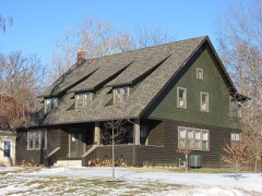
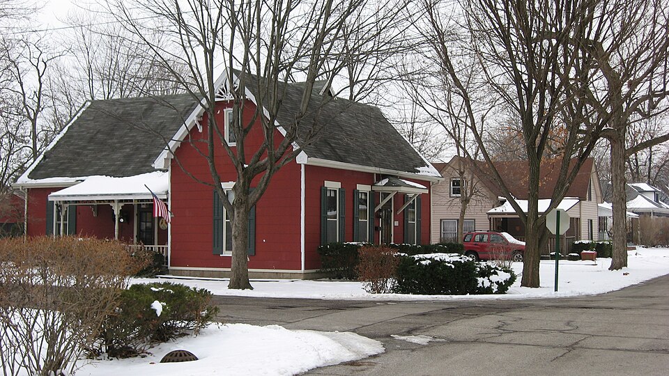
Photograph of Cumberland Historic District
Photograph by Nyttend, Public domain. Via Wikimedia Commons.

Cumberland Historic District

Listed on the National Register of Historic Places in 2001.

From the record

“Cumberland Historic District is a national historic district located at Cumberland, Indiana. It encompasses 91 contributing buildings in the Cumberland section of Indianapolis.”

Wikipedia article Cumberland Historic District, CC BY-SA 4.0.

One of 274 National Register listings published here for Marion County · listed in 2001 · category: District.

Sources: the Wikipedia article · the case file at the National Archives · the National Register database, National Park Service


The listing

The ground it stands on

5,350 words

The chapter on Warren Township in History of Indianapolis and Marion County, Indiana, published 1884 names Cumberland. This is what it says, exactly as the scans read.

Joseph S. Mix and wife came from Hamilton County, Ohio, in the year 1833, and settled in the east part of Warren township, in a perfect wilderness, where the only clearing was where the logs were cut for erecting his cabin, which was (as was usual in those days) of only one room, with puncheon floor, and quilts or blankets hung up at the door and windows. For three years he kept a store in Cumberland for Nicholas McCarty, and when he closed at night would take the money in a basket on his ^rm and go to his home, a mile distant through the woods. There he hung his basket (with the money in it) on a peg for the night, without the least doubt that it was perfectly safe, as it was. He was afterwards in the hemp business with Mr. McCarty. The farm on which he settled in 1833, and where he still lives, is situated one mile southeast of the village of Cumberland.

Passage source: History of Indianapolis and Marion County, Indiana, published 1884.

The first steam-mill was built on the National road, about two miles west of Cumberland. The exact date of the building of this mill is not known, but it sawed the lumber for planking the Cumberland plank road, now the National gravel road. At present there are three steam saw- mills in the township and one steam grist-mill. There are no waterpower mills.

Passage source: History of Indianapolis and Marion County, Indiana, published 1884.

Machine-read from a century-old scan, so expect the errors a machine makes: misspelled names, dropped words, stray characters.

Read the whole chapter on Warren Township - 5,350 words on its settlement, mills, schools and churches.

Mines and quarries near this property

1 within 5 miles

Regional context, not property-specific evidence. The federal mineral resources record lists 1 working within 5 miles of Cumberland Historic District: 1 producer. All of them still produce. What was taken out: Sand and Gravel, Construction. Distance is straight-line from the map coordinates, so a quarry counted here may appear on a neighbouring settlement's page as well.

Where SiteCommodity StatusRecorded
Indianapolis Aggregates DivisionSand and Gravel, ConstructionProducer

Every working recorded in Marion County

Storms near this property

9 since 1996

Regional context, not property-specific evidence. The National Weather Service names Cumberland, the town this property stands in, in 9 storm reports between 1996 and 2024: 5 hail, 2 tornado, 1 thunderstorm wind, 1 lightning. The reports record 3 injuries. Each account below is quoted exactly as the forecast office filed it, from the NOAA Storm Events Database, and each date opens the federal record of that event.

WhenEvent Place namedHarm What the report says
June 1998Tornado (F3)Cumberland3 hurt, $1,500,000no account filed
June 2006LightningCumberland$100,000A new house, which was unoccupied, was struck by lightning and heavily damaged by the ensuing fire. Firefighters escaped just minutes before the second floor, on which they were standing to fight the blaze, collapsed.
April 2012HailCumberland-Quarter-sized hail was covering the ground.
June 2002Tornado (F0)Cumberland-Trained spotter reported a brief F0 touchdown in a corn field. No damage.
May 2024HailCumberland-no account filed
April 2012HailCumberland-no account filed
September 2012HailCumberland-no account filed
May 1999Thunderstorm WindCumberland-no account filed
April 1996HailCumberland-no account filed

Every storm recorded in Marion County

Map coverage status

No historic map-sheet match is published for this property yet. That does not mean no map exists. This record needs a coordinate-quality review before it can be joined to a sheet boundary. Browse the county's mapped places while that work is pending.

Listed places nearby

6 within 8 miles

Other National Register properties close enough to walk or drive between, ordered by distance from this one. Both positions come from the same geocoding pass that matched these properties to their map sheets.

Photograph PropertyDistance Listed
Washington Park Cemetery2.5 miles2026
Thomas Askren House5.3 miles2006
Irvington Terrace Historic District5.4 miles2011
Carlos and Anne Recker House5.8 miles1996
Julian-Clark House6.0 miles1986
North Irvington Gardens Historic District6.1 miles2008

Sources for this property

National Archives recordThe nomination case file for reference 01001341 in Record Group 79.
Wikipedia articleCommunity-written account of this property, licensed CC BY-SA.
Marion CountyAll 274 listed properties in this county.

Provenance

  • Listing record. National Park Service National Register of Historic Places, listed-properties dataset, current to 2026-05-22.
  • Map join. Address geocoded through the United States Census geocoder, then tested against the published boundary of every sheet in the USGS Historical Topographic Map Collection.
  • How this page is made. Listing fields come from federal records; map-sheet coverage is a labelled coordinate-to-boundary calculation, not a source-field claim.
  • Mines and quarries. USGS Mineral Resources Data System (MRDS) https://mrdata.usgs.gov/mrds/ A work of the United States government, no copyright under 17 U.S.C. 105.
  • Storms. NOAA National Centers for Environmental Information, Storm Events Database https://www.ncei.noaa.gov/stormevents/ A work of the United States government, no copyright under 17 U.S.C. 105. Narratives are quoted verbatim from the National Weather Service report and are not edited or summarised.