 Block
From the record
One of 16 National Register listings published here for Howard County · listed in 2022 · category: Building.
Sources: the National Register database, National Park Service
Listed on the National Register of Historic Places in 2022.
One of 16 National Register listings published here for Howard County · listed in 2022 · category: Building.
Sources: the National Register database, National Park Service
The chapter on Honey Creek Township in Counties of Howard and Tipton, Indiana. Historical and Biographical.., published 1883 names Russiaville. This is what it says, exactly as the scans read.
It is said that Joseph C. Taylor and family were the first white inhabitants of Honey Creek Township. They came here during the year 1839. Mr. Taylor had left his home near Peru in the fall of 1838, and came here to build his little log cabin, into which he moved in March, 1839. It is also claimed for Mr. Taylor that he, in company with George Taylor, Isaac Price and Robert Walker, were the first white men who inhabited Howard County. The first year of Mr. Taylor's stay in this township, was very lonesome, as his was the only family in the present limits of the township. The first to come to share in the hardships of the dreary pioneer life was a man by the name of McCrery, who settled on a tract of land just w'est of the present site of Russiaville, which tract is at present owned by Jonathan Hodson.
Passage source: Counties of Howard and Tipton, Indiana. Historical and Biographical.., published 1883.
The first important dwelling house was erected on the north bank of Squirrel Creek, a little stream that crosses the present site of the town of Russiaville, as has been before mentioned. Joseph C. Taylor arrived here in the year 1838. His cabin home was the first white habitation in the township, but it was not long until several log cabins dotted the banks of Honey Creek. The structures were of a very primitive character, having only one room, the floors consisting of hewed puncheons, the door of a very rude pattern, with wooden hinge and latch. If a window graced one side of the building, it was usually very small. The roofs were of clapboards held on by long poles. The first improvement in the lands commenced around the cabins. The sturdy pioneers began to clear the soil of the timber in order to prepare it for cultivation, a few acres at a time, until they cleared enough to raise their vegetables, wheat and corn. Shortly there began to appear small patches of cleared land, and these gradually increased in size and shape until large and beautiful fields, covered with their wealth of grain, greeted the toil-worn farmer as a recompense for his early labors. That the soil of Honey Creek Township is rich and fertile is clearly evinced by the great increase in the agricultural interests, and what was once a howling wilderness is now one of the best and most beautiful farming communities in the State. Farms that once raised a few bushels of corn and wheat, now produce equal to the best farms. Farms that were once worthless on account of the superabundance of water, held in nature's reservoirs without an outlet, now have beautiful buildings on them, and where the ponds existed, fertile fields yield their abundant harvests. Not much attention was paid to improvement in the way of drainage until the rapidly increasing value of the land induced the owners of wet lands to fit them for cultivation.
Passage source: Counties of Howard and Tipton, Indiana. Historical and Biographical.., published 1883.
Machine-read from a century-old scan, so expect the errors a machine makes: misspelled names, dropped words, stray characters.
Read the whole chapter on Honey Creek Township - 15,037 words on its settlement, mills, schools and churches.
Regional context, not property-specific evidence. The National Weather Service names Russiaville, the town this property stands in, in 28 storm reports between 1996 and 2024: 15 thunderstorm wind, 7 hail, 3 tornado, 2 flood. No death or injury is recorded in these reports. Each account below is quoted exactly as the forecast office filed it, from the NOAA Storm Events Database, and each date opens the federal record of that event.
| When | Event | Place named | Harm | What the report says |
|---|---|---|---|---|
| November 2013 | Tornado (EF2) | Russiaville | $300,000 | At 1513EST, the EF-2 tornado touched down in Michigantown. This EF-2 tornado caused damage to a hog farm and several properties northeast of Michigantown, with additional damage found to the east of Rossville. At 1519EST, the tornado crossed into southwest Howard County. The tornado was at its strongest as it crossed through the southeast side of Kokomo, causing extensive property damage. A BMO Bank was destroyed with significant damage to several fast food restaurants along South Washington Street. The tornado lifted 2 miles north of Greentown at 1536EST. |
| March 2023 | Tornado (EF0) | Russiaville | $150,000 | This first of the three squall line tornadoes to impact Howard County touched down in a field with a few trees. The tornado impacted a home causing tree and barn damage, with maximum winds of 80 mph. One tree top was pulled back towards the home to the southwest. The tornado then quickly lifted in a farm field nearby. |
| July 2024 | Thunderstorm Wind | Russiaville | $60,000 | Thunderstorm winds uprooted or snapped numerous trees in Howard County, including several trees snapped in Russiaville, while powerlines were downed towards southwest portions of the county. Winds also broke smaller tree limbs and blew off shingles in Kokomo. |
| June 2016 | Thunderstorm Wind | Russiaville | $30,000 | Fifteen utility poles were downed across the road due to damaging thunderstorm wind gusts. |
| March 2023 | Thunderstorm Wind | Russiaville | $25,000 | Continuation from extreme northeastern Clinton County, thunderstorm straight line winds blew off the short end of a large metal barn, and downed large pine tree branches at County Road 600 South at 800 West. |
| August 2016 | Tornado (EF1) | Russiaville | $20,000 | This EF-1 tornado, with maximum wind speeds of 97 mph, largely tracked over open country. One garage was damaged. Trees and crops sustained damage throughout the path. |
| June 2022 | Thunderstorm Wind | Russiaville | $1,000 | Thunderstorm winds downed several tree limbs of unknown size. |
| June 2010 | Flood | Russiaville | $500 | Water was reported to be over parts of State Route 26 near Russiaville. |
| August 2020 | Thunderstorm Wind | Russiaville | - | A 70 mph thunderstorm wind gust was measured at SR 26 and 750 W. |
| June 2016 | Thunderstorm Wind | Russiaville | - | An 82 mph thunderstorm wind gust was measured in this location. |
| July 2011 | Thunderstorm Wind | Russiaville | - | An estimated thunderstorm wind gust of 60 mph was observed in this location. |
| June 2007 | Thunderstorm Wind | Russiaville | - | Law enforcement reported trees down due to damaging thunderstorm winds. |
| October 2007 | Hail | Russiaville | - | Hail was reported at 920 W and 500 S. |
| June 2006 | Thunderstorm Wind | Russiaville | - | A large tree was downed. |
| July 2005 | Thunderstorm Wind | Russiaville | - | A large tree was downed. |
| March 2019 | Hail | Russiaville | - | no account filed |
| May 2009 | Hail | Russiaville | - | no account filed |
| May 2007 | Hail | Russiaville | - | no account filed |
| May 2007 | Hail | Russiaville | - | no account filed |
| May 2004 | Hail | Russiaville | - | no account filed |
| July 2003 | Thunderstorm Wind | Russiaville | - | no account filed |
| June 2002 | Thunderstorm Wind | Russiaville | - | no account filed |
| May 2001 | Thunderstorm Wind | Russiaville | - | no account filed |
| May 2000 | Thunderstorm Wind | Russiaville | - | no account filed |
| June 2000 | Flood | Russiaville | - | no account filed |
| July 1998 | Hail | Russiaville | - | no account filed |
| July 1996 | Flash Flood | Russiaville | - | no account filed |
| October 1996 | Thunderstorm Wind | Russiaville | - | no account filed |
No historic map-sheet match is published for this property yet. That does not mean no map exists. This record needs a coordinate-quality review before it can be joined to a sheet boundary. Browse the county's mapped places while that work is pending.
Other National Register properties close enough to walk or drive between, ordered by distance from this one. Both positions come from the same geocoding pass that matched these properties to their map sheets.
| Photograph | Property | Distance | Listed |
|---|---|---|---|
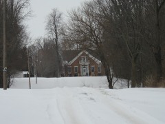 | Henry W. Smith House | 4.6 miles | 1979 |
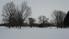 | Kokomo County Club Golf Course | 7.1 miles | 2006 |
 | Elwood Haynes House | 7.5 miles | 1984 |
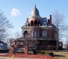 | Seiberling Mansion | 8.0 miles | 1971 |
| National Archives record | The nomination case file for reference 100007734 in Record Group 79. |
| Howard County | All 16 listed properties in this county. |