 Block
From the record
One of 9 National Register listings published here for Fulton County · listed in 2024 · category: District.
Sources: the National Register database, National Park Service
Listed on the National Register of Historic Places in 2024.
One of 9 National Register listings published here for Fulton County · listed in 2024 · category: District.
Sources: the National Register database, National Park Service
Regional context, not property-specific evidence. The federal mineral resources record lists 1 working within 5 miles of Akron Historic District: 1 producer. All of them still produce. What was taken out: Sand and Gravel, Construction. Distance is straight-line from the map coordinates, so a quarry counted here may appear on a neighbouring settlement's page as well.
| Where | Site | Commodity | Status | Recorded |
|---|---|---|---|---|
| Disko Sand and Gravel | Sand and Gravel, Construction | Producer |
Regional context, not property-specific evidence. The National Weather Service names Akron, the town this property stands in, in 17 storm reports between 1995 and 2023: 8 hail, 6 thunderstorm wind, 1 funnel cloud, 1 flood. No death or injury is recorded in these reports. Each account below is quoted exactly as the forecast office filed it, from the NOAA Storm Events Database, and each date opens the federal record of that event.
| When | Event | Place named | Harm | What the report says |
|---|---|---|---|---|
| June 1995 | Thunderstorm Wind | Akron | $10,000 | A tornado flipped over four mobile office homes south of Rochester. Two men were injured when a tree fell on their car and another man was injured when a limb flew through the window of his home. Trees were blown down at Akron. Some trees were down on cars. |
| July 2022 | Thunderstorm Wind | Akron | $1,000 | A tree down. Time estimated from radar. |
| June 2023 | Hail | Akron | $1,000 | no account filed |
| June 2023 | Hail | Akron | $1,000 | no account filed |
| May 2019 | Tornado (EF3) | Akron | - | This is a continuation of a tornado that crossed County Road 1600 N between County Roads 100 and 175 East in Miami county and into Fulton County. Tornado continued off to the ENE weakening as it crossed 1600 N and 100 E in Fulton county. Tornado then turned northeastward as it traveled just north of the Miami/Fulton county line causing sporadic damage to several farm buildings. Tornado continued to slowly |weaken in intensity as it crossed SR 114. As the tornado crossed CR 700 W it re-intensified for a time crossing SR 15 south of CR 1400 N with extensive damage to a hog confinement facility west of SR 15 and significant damage to a farm property |east of SR 15. From here the tornado rapidly weakened eastward and lifted near CR 400 W. The maximum intensity of the tornado in Fulton county was EF1. |
| June 2015 | Flood | Akron | - | Water was flowing over the road. |
| October 2014 | Hail | Akron | - | Hail to the size of pennies accumulated around an inch on local roads. |
| June 2013 | Thunderstorm Wind | Akron | - | County officials reported several trees down. |
| June 2009 | Hail | Akron | - | Law enforcement officials reported golf ball size hail. |
| June 2008 | Thunderstorm Wind | Akron | - | Trained spotters reported large limbs down in the Akron area. |
| April 2006 | Hail | Akron | - | Hail increased from the size of quarters up to golf ball size in the town of Akron. |
| July 2005 | Funnel Cloud | Akron | - | Numerous reports were received of well developed cold air funnel clouds in and around the Akron area as a result of interacting boundaries. |
| July 2002 | Thunderstorm Wind | Akron | - | Emergency management reported trees down in Akron. |
| October 2014 | Hail | Akron | - | no account filed |
| June 2008 | Hail | Akron | - | no account filed |
| July 2001 | Hail | Akron | - | no account filed |
| July 1998 | Thunderstorm Wind | Akron | - | no account filed |
No historic map-sheet match is published for this property yet. That does not mean no map exists. This record needs a coordinate-quality review before it can be joined to a sheet boundary. Browse the county's mapped places while that work is pending.
Other National Register properties close enough to walk or drive between, ordered by distance from this one. Both positions come from the same geocoding pass that matched these properties to their map sheets.
| Photograph | Property | Distance | Listed |
|---|---|---|---|
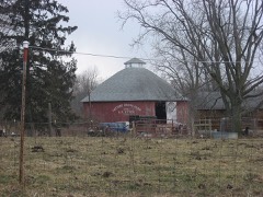 | Utter-Gerig Round Barn | 3.9 miles | 1990 |
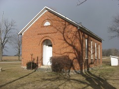 | Prill School | 5.3 miles | 1981 |
| National Archives record | The nomination case file for reference 100010028 in Record Group 79. |
| Fulton County | All 9 listed properties in this county. |