 Block
From the record
One of 19 National Register listings published here for Dubois County · listed in 2024 · category: District.
Sources: the National Register database, National Park Service
Listed on the National Register of Historic Places in 2024.
One of 19 National Register listings published here for Dubois County · listed in 2024 · category: District.
Sources: the National Register database, National Park Service
The chapter on Ferdinand Township in History of Dubois County from Its Primitive Days to 1910, published 1910 names Ferdinand. This is what it says, exactly as the scans read.
In 1868, paint was manufactured at Ferdinand from material found near the town. ' It was an excellent mineral paint, and its manufacture may some day be resumed. The paints and polishing powder of Ferdinand township have the highest endorsements of those who have used them, rivaling, and often surpassing, any others of this or foreign countries.
Passage source: History of Dubois County from Its Primitive Days to 1910, published 1910.
Machine-read from a century-old scan, so expect the errors a machine makes: misspelled names, dropped words, stray characters.
Read the whole chapter on Ferdinand Township - 272 words on its settlement, mills, schools and churches.
Regional context, not property-specific evidence. The federal wildfire occurrence database lists 1 fire within 5 miles of Ferdinand Historic District in 2001, burning under an acre in total. None started naturally. None was recorded as arson. Distance is straight-line from the map coordinates, so a fire counted here may appear on a neighbouring settlement's page as well.
| Reported cause | Fires |
|---|---|
| Smoking | 1 |
The most recent of them, most recent first, with the day each was reported and the service that recorded it.
| Date | Cause | Size | Reported by | Name on the report |
|---|---|---|---|---|
| 6 August 2001 | Smoking | under an acre | Hoosier National Forest | I-64 |
Regional context, not property-specific evidence. The National Weather Service names Ferdinand, the town this property stands in, in 31 storm reports between 2002 and 2025: 15 thunderstorm wind, 9 hail, 6 flash flood, 1 flood. No death or injury is recorded in these reports. Each account below is quoted exactly as the forecast office filed it, from the NOAA Storm Events Database, and each date opens the federal record of that event.
| When | Event | Place named | Harm | What the report says |
|---|---|---|---|---|
| April 2005 | Thunderstorm Wind | Ferdinand | $75,000 | Thunderstorm winds caused widespread damage in and east of Ferdinand. The roof was blown off a processing plant. Several homes in the town sustained roof damage. A horse barn was destroyed east of town. |
| May 2016 | Thunderstorm Wind | Ferdinand | $15,000 | The Dubois County emergency manager estimated winds near 80 mph which brought down a utility pole on east 13th street. |
| May 2014 | Thunderstorm Wind | Ferdinand | $15,000 | The Dubois County emergency manager reported that a pole barn with its doors open was blown down. |
| December 2015 | Thunderstorm Wind | Ferdinand | $10,000 | Local law enforcement reported to the NWS that severe thunderstorm winds brought down power lines on a car. |
| March 2025 | Thunderstorm Wind | Ferdinand | - | A light pole was down on Industrial Park Road. |
| June 2023 | Thunderstorm Wind | Ferdinand | - | A tree fell across East Holiday Lake Road. |
| March 2022 | Thunderstorm Wind | Ferdinand | - | There was a power line down on the 500 block of Maryland Street. |
| March 2022 | Thunderstorm Wind | Ferdinand | - | Several trees were snapped. Two pines were snapped including one at the trunk. One large Maple tree snapped near the ground, and another large Maple tree was uprooted. |
| March 2022 | Thunderstorm Wind | Ferdinand | - | A power line was down on the 2400 block of Willow Lane. |
| August 2020 | Flash Flood | Ferdinand | - | State Road 264, north of Ferdinand, was impassable due to flooding. |
| October 2019 | Thunderstorm Wind | Ferdinand | - | A tree was reported down on the roadway at 23rd Street and Main Street in Ferdinand. |
| June 2019 | Thunderstorm Wind | Ferdinand | - | There was a report of a large tree down adjacent to a house near East Mariah Hill Road near Ferdinand. |
| July 2017 | Flash Flood | Ferdinand | - | Trained spotters reported flash flooding in the area. |
| March 2016 | Hail | Ferdinand | - | A trained spotter reported hail 1.25 inches in diameter. |
| April 2015 | Flood | Ferdinand | - | The public reported high water on Interstate 64 that forced semi trailers off the road. |
| August 2015 | Thunderstorm Wind | Ferdinand | - | An amateur radio operator reported that severe thunderstorm winds brought down a few trees and power poles in the area. |
| July 2015 | Flash Flood | Ferdinand | - | The Dubois County emergency manager reported flooded roads in the area from excessive rainfall. Between 1 and 2 inches of rain fell from slow moving thunderstorms. |
| December 2015 | Thunderstorm Wind | Ferdinand | - | A trained spotter reported to the NWS a measured 50 knot wind gust. |
| July 2009 | Flash Flood | Ferdinand | - | Interstate 64 was down to one lane at the Ferdinand Exit due to high water on the road. |
| August 2008 | Hail | Ferdinand | - | Quarter size hail was reported on the north side of Ferdinand. |
| March 2008 | Flash Flood | Ferdinand | - | Numerous road in the county were closed due to high water. Old Huntinburg Road was closed in Bainbridge. Ferdinand Road was closed east of County Road 200W. Old Petersburg Road was closed north of State Road 56. Kellersville Road was closed. |
| May 2004 | Thunderstorm Wind | Ferdinand | - | Power lines and trees were downed along Interstate 64. |
| March 2012 | Hail | Ferdinand | - | no account filed |
| May 2011 | Hail | Ferdinand | - | no account filed |
| June 2008 | Thunderstorm Wind | Ferdinand | - | no account filed |
| March 2006 | Hail | Ferdinand | - | no account filed |
| April 2006 | Hail | Ferdinand | - | no account filed |
| May 2004 | Flash Flood | Ferdinand | - | no account filed |
| April 2003 | Hail | Ferdinand | - | no account filed |
| April 2002 | Hail | Ferdinand | - | no account filed |
| March 2002 | Hail | Ferdinand | - | no account filed |
No historic map-sheet match is published for this property yet. That does not mean no map exists. This record needs a coordinate-quality review before it can be joined to a sheet boundary. Browse the county's mapped places while that work is pending.
Other National Register properties close enough to walk or drive between, ordered by distance from this one. Both positions come from the same geocoding pass that matched these properties to their map sheets.
| Photograph | Property | Distance | Listed |
|---|---|---|---|
| St. Ferdinand Parish Historic District | 0.2 miles | 2020 | |
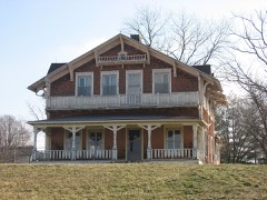 | Dr. Alois Wollenmann House | 0.3 miles | 2013 |
 | Convent Immaculate Conception Historic District | 0.6 miles | 1983 |
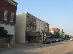 | Huntingburg Commercial Historic District | 7.1 miles | 2006 |
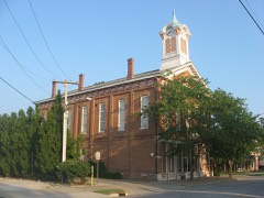 | Huntingburg Town Hall and Fire Engine House | 7.2 miles | 1975 |
| National Archives record | The nomination case file for reference 100011043 in Record Group 79. |
| Dubois County | All 19 listed properties in this county. |