 Block
From the record
One of 81 National Register listings published here for Allen County · listed in 2025 · category: District.
Sources: the National Register database, National Park Service
Listed on the National Register of Historic Places in 2025.
One of 81 National Register listings published here for Allen County · listed in 2025 · category: District.
Sources: the National Register database, National Park Service
The chapter on St. Joseph Township in History of Allen County, Indiana., published 1880 names Fort Wayne. This is what it says, exactly as the scans read.
Charles II. De Rome, a native of Canada, came to the township in 1829. At \ iocennes, he married an Indian maiden of the Miami tribe, and lived on the reserve bearing his name, until death. Several of bis descendants still reside in this county. Dc Rome was well educated, and for many years was connected with the business houses of Fort Wayne in a clerical capacity. His knowledge of three languages made him a valuable assistant to his employers.
Passage source: History of Allen County, Indiana., published 1880.
The First Road. - In 1834, Christian Parker presented a petition to the Board of County Commissioners for the construction of a county road along the St. Joseph River, from Fort Wayne to Jacob Notcstine's farm. The petition was granted and the road surveyed. In the following year, he presented a petition to the Legislature praying that the same be made a State road. This, too, met With au affirmative response, and the road was constiuetcd to the north line of Allen County, in a direction nearly parallel with the course of the river.
Passage source: History of Allen County, Indiana., published 1880.
Machine-read from a century-old scan, so expect the errors a machine makes: misspelled names, dropped words, stray characters.
Read the whole chapter on St. Joseph Township - 5,065 words on its settlement, mills, schools and churches.
Regional context, not property-specific evidence. The federal mineral resources record lists 4 workings within 5 miles of Kirkwood Park Historic District: 3 producers, 1 past producer. 3 still produce. What was taken out: Sand and Gravel, Construction. Distance is straight-line from the map coordinates, so a quarry counted here may appear on a neighbouring settlement's page as well.
| Where | Site | Commodity | Status | Recorded |
|---|---|---|---|---|
| Brudi Pit #3 | Sand and Gravel, Construction | Producer | ||
| Irving Gravel Co., Inc. | Sand and Gravel, Construction | Producer | ||
| Midwest Aggregates Pit 1 | Sand and Gravel, Construction | Producer | ||
| Nail Road Pit | Sand and Gravel, Construction | Past Producer |
Regional context, not property-specific evidence. The National Weather Service names Fort Wayne, the town this property stands in, in 5 storm reports between 1994 and 1997: 2 thunderstorm wind, 2 flash flood, 1 hail. No death or injury is recorded in these reports. Each account below is quoted exactly as the forecast office filed it, from the NOAA Storm Events Database, and each date opens the federal record of that event.
| When | Event | Place named | Harm | What the report says |
|---|---|---|---|---|
| June 1995 | Thunderstorm Wind | Fort Wayne | $8,000 | Several automobiles were damaged by trees blown over in Fort Wayne. |
| July 1994 | Thunderstorm Wind | Fort Wayne | $5,000 | Trees and power lines were downed on the north and east sides of Fort Wayne. |
| September 1997 | Flash Flood | Fort Wayne | $1,000 | no account filed |
| April 1994 | Hail | Fort Wayne | $500 | One-inch diameter hail fell on the north side of Fort Wayne at Point Inverness at 2044EST; also one inch hail near United States 33 and Cook Road on the north side of Fort Wayne at 2050 EST. |
| July 1997 | Flash Flood | Fort Wayne | - | no account filed |
No historic map-sheet match is published for this property yet. That does not mean no map exists. This record needs a coordinate-quality review before it can be joined to a sheet boundary. Browse the county's mapped places while that work is pending.
Other National Register properties close enough to walk or drive between, ordered by distance from this one. Both positions come from the same geocoding pass that matched these properties to their map sheets.
| Photograph | Property | Distance | Listed |
|---|---|---|---|
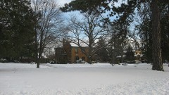 | Forest Park Boulevard Historic District | 0.7 miles | 2007 |
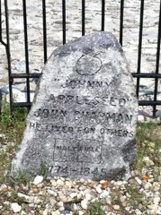 | Johnny Appleseed Memorial Park | 0.8 miles | 1973 |
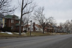 | North Anthony Boulevard Historic District | 0.9 miles | 2014 |
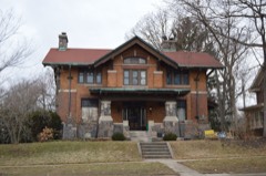 | William C. and Clara Hagerman House | 1.1 miles | 2015 |
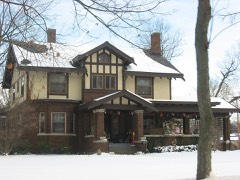 | John H. and Mary Abercrombie House | 1.1 miles | 2013 |
| Driving Park-Seven States Historic District | 1.1 miles | 2021 |
| National Archives record | The nomination case file for reference 100011866 in Record Group 79. |
| Allen County | All 81 listed properties in this county. |