BlockBefore
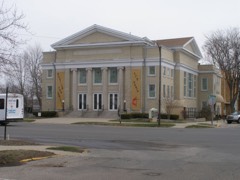
Photograph of Ramsay-Fox Round Barn and Farm
Photograph by Nyttend, Public domain. Via Wikimedia Commons.

Ramsay-Fox Round Barn and Farm

Listed on the National Register of Historic Places in 2012.

From the record

“Ramsay-Fox Round Barn and Farm is a historic round barn and farm in West Township, Marshall County, Indiana. The round barn was built about 1911 and is a true-circular barn, with a 60-foot (18 m) diameter.”

Wikipedia article Ramsay-Fox Round Barn and Farm, CC BY-SA 4.0.

One of 34 National Register listings published here for Marshall County · listed in 2012 · category: Building.

Sources: the Wikipedia article · the case file at the National Archives · the National Register database, National Park Service

The listing

  • What is counted as historic. The nomination lists 4 buildingss, 1 structure, 1 object as contributing to the listing.
  • Listed as. Ramsay--Fox Round Barn and Farm - the National Register files a house under its owner's surname.
  • Address. 18889 9th Rd., Plymouth, 46563
  • When was it listed? April 2012
  • Category. building
  • Also known as. Round and Polygonal Barns of Indiana MPS
  • Township. West township
  • National Register reference number. 12000187 - the number the National Park Service assigned this property when it was listed, and the key its nomination file is catalogued under at the National Archives.

The ground it stands on

5,967 words

The chapter on West Township in History of Indiana : Containing a History of Indiana and Biographical Sketches of Governors and Other Leading Men. Also a Statement of the Growth and Prosperity of Marshall County, Together with a Personal and Family Histry of Many of Its Citizens, published 1890 names Plymouth. This is what it says, exactly as the scans read.

Prominent among the representative citizens of Marshall county is John W. Baugher, who, as the name indicates, is of German ancestry. The name originally was Von Bacher, and in the annals of the old country, it appears in connection with the history of the Napoleonic wars, and it is a family tradition that some of the ancestors of the subject fought under the great emperor. Mr. Baugher was born in Prussia in 1845, and when two years of age was brought by his parents, John and Magdalene Baugher, to the United States. The family first settled in Tuscarawas county, Ohio, and after a residence there of twelve years, moved to Kosciusko county, Ind., where the parents were living at the breaking out of the late war. Whether the subject had inherited a taste for military life from his Prussian forefathers or not, the writer can not say, but certain it is, that his inclinations led him to enter the service of his adopted country, and he served as a gallant soldier throughout the war. He was connected, at various times, with the One Hundred and Eighteenth, One Hundred and Thirty-eighth and One Hundred and Fifty-fifth Indiana volunteers, and his military career was similar to that of the thousands of brave and patriotic men who risked their lives in defense of the National Union. At the close of the war Mr. Baugher went to northern Michigan, where for four years he was engaged in the manufacture of lumber. While there he attained proficiency as a sawyer, for which business he appears by nature to have been adapted. He returned to Indiana in 1869, and settled in Marshall county, where he has since resided, and of which he is in every respect a worth}' and popular citizen. He began the lumber business for himself about the year 1870, and the mill which he operated was located a few miles northwest of Plymouth. This mill, in 1879, was completely destroyed by fire, but Mr. Baugher, with that energy which has characterized his life, at once began to rebuild, and soon had a larger and much more complete mill in successful operation. This mill requires the labor of about twelve men, most of whom have been with Mr. Baugher for a term of years, and has a caoacity of 12,000 feet of lumber per day. It is supplied with the latest improved machinery, much of which is of Mr. Baugher's own invention. As a machinist, he is quite skilful, and has no superior in Marshall county, and but few anywhere. He has made the subject of mechanical appliances a specialty, and his judgment upon machinery is sound and founded upon scientific knowledge, instead of mere conjecture. Mr. Baugher has been a great reader, both of English and German authors, and though of limited early education, has managed to acquire a practical knowledge of affairs at large, and is well versed in general literature. Socially, "he is a hale fellow well met," and he numbers his friends by the score in all parts of the county. He is fond of traveling, and, including his army experience, he has visited nearly every state in the Union. He is a member of the K. of P., Odd Fellows, and stands high in the Masonic fraternity, having taken the degree of Sir Knight. Politically he is a democrat, and is looked upon as one of his party's leaders in this county. Mr. Baugher and Sarah Conklin, a native of Marshall county, were united in marriage in 1873, and to their union have been born two children, Frank and Norah.

Passage source: History of Indiana : Containing a History of Indiana and Biographical Sketches of Governors and Other Leading Men. Also a Statement of the Growth and Prosperity of Marshall County, Together with a Personal and Family Histry of Many of Its Citizens, published 1890.

Robert J. Evans claims to be the oldest settler of West township, and has literally seen the county grow out of the woods. He was born in Kentucky, April 24, 1825. His father, Joseph, was a native of Butler county, Penn., and his mother, Bidiah (Turner) Evans, was born in North Carolina. Grandparents were born in America, the father being of Irish, and the mother of Scotch, origin. At the early age of three years, the subject of this sketch was brought to Indiana by his parents, who settled in Franklin county in 1826, and remained there until 1835, when they removed to Marshall county, settling in West township, on what is known as the Sherland place. The countr}' was then entirely new, the nearest neighbor of the Evans family' beingThomas Singleton, who lived up on the La Porte road, that and the Michigan pike being the only roads in the county at that time. Plymouth then contained from four to six houses. Between the Evanses and the alleged town, a man named Murphy lived on what is known as the Wallace farm. The newly arrived family began farming at once, getting in five acres the first year (1836) . Mr. Evans says there were plenty of Indians (Pottawatamies) when his family came there. They were hunters by profession, lived in villages, the women doing what little work there was done. They were a lazy lot, true to their friends and never molested any one. Their relations with the settlers were of the friendliest character. Mr. Evans had little chance to get an education. There were no schools to attend until he was able to work, and when that time arrived he had to put in all his time helping to dig a living out of the wilderness. Hard work was of more importance in those days than education. At the age of twenty, Robert J. Evans was married to Lydia Thomas, whose parents lived near what is now Tyner City. They went to work on their own account at farming and kept it up until 1850, when Mr. Evans started to California, leaving his wife and family on the farm. When he arrived in northwest Missouri he was taken with fever and lay there fifty days. Owing to this sickness was obliged to return home. After farming there a few years more, he removed to the Wallace farm. Mr. Evans has occupied his present residence for fifteen years Of the thirteen children born to this devoted couple, eight are living, viz.: Larkin L., who married Frances Rogers, Marshall county; Josephine, wife of Wallace Pitcher, Missouri; Martha Alice, wife of Walter Rogers, St. Joe county; Mary E., wife of John F. Tindall, Hancock county; Viola, wife of Harry B. Joseph, Albuquerque, New Mexico; Robert L., who is unmarried, lives at home, also Albertus and Littie. In religious belief Mr. Evans is a spiritualist. He never had many educational advantages, but keeps posted by reading the papers. In politics he is independent, believing very earnestly that every man should hold himself in position to vote for the best interests of the community, which he certainly cannot always do if he keeps tied, without chance of change, to one particular party. He has never held any office except that of assessor, which has been conferred on him for eleven successive years. But this is his last year in that capacity. Mr. Evans has seen many of the ups and downs of life, many of its hardships and sorrows, he has also enjoyed many of its blessings and innocent pleasures. Mr. Evans was present at the organization of the county, and remembers that the meeting was held one and a half miles south of Plymouth, at Austehout's house. There were not over six people present.

Passage source: History of Indiana : Containing a History of Indiana and Biographical Sketches of Governors and Other Leading Men. Also a Statement of the Growth and Prosperity of Marshall County, Together with a Personal and Family Histry of Many of Its Citizens, published 1890.

Machine-read from a century-old scan, so expect the errors a machine makes: misspelled names, dropped words, stray characters.

Read the whole chapter on West Township - 5,967 words on its settlement, mills, schools and churches.

Fires near this property

5 since 2002

Regional context, not property-specific evidence. The federal wildfire occurrence database lists 5 fires within 5 miles of Ramsay-Fox Round Barn and Farm between 2002 and 2007, burning about 24 acres in total. None started naturally. None was recorded as arson. Distance is straight-line from the map coordinates, so a fire counted here may appear on a neighbouring settlement's page as well.

Reported cause Fires
Equipment and vehicle use2
Missing data/not specified/undetermined2
Debris and open burning1

The most recent of them, most recent first, with the day each was reported and the service that recorded it.

DateCause SizeReported by Name on the report
25 July 2002Missing data/not specified/undetermined15 acresIndiana State Fire Marshal's Officenot named
17 June 2007Equipment and vehicle use1.0 acresIndiana State Fire Marshal's Officenot named
20 April 2005Missing data/not specified/undetermined3.0 acresIndiana State Fire Marshal's Officenot named
29 March 2007Debris and open burning4.0 acresIndiana State Fire Marshal's Officenot named
6 November 2004Equipment and vehicle use1.0 acresIndiana State Fire Marshal's Officenot named

Every fire recorded in Marshall County

Storms near this property

60 of 70 shown

Regional context, not property-specific evidence. The National Weather Service names Plymouth, the town this property stands in, in 70 storm reports between 1995 and 2026: 55 thunderstorm wind, 8 hail, 3 flash flood, 2 lightning. The reports record 2 injuries. Each account below is quoted exactly as the forecast office filed it, from the NOAA Storm Events Database, and each date opens the federal record of that event.

WhenEvent Place namedHarm What the report says
August 2003LightningPlymouth2 hurt2 Plymouth residents were struck by lightning near Dixon Lake. 2 men, one 19 years and the other 43 years old were waiting for a ride home after a day of fishing on the lake when they were struck by lightning. Both gentlemen suffered burns on their arms, shoulders and portions of their back and were likely knocked unconscious briefly. Both were treated at a nearby hospital and released.
May 2006Thunderstorm WindPlymouth$100,000Numerous trees, tree limbs, power lines and poles were blown down in Plymouth. Several pine trees fell onto a residence. A few fires resulted form trees falling onto power lines as well.
January 2008LightningPlymouth$90,000Lightning struck a three car garage attached to a house in the 11000 block of south Michigan Road. When firefighters arrived, the garage was engulfed in flames. Severe damage occurred to the garage and 3 vehicles in it, as well as smoke and water damage to portions of the house. Damage was estimated $90,000.
August 2007Thunderstorm WindPlymouth$80,000A local newspaper reported significant damage to a residence in the 1000 block of W Lake Ave in Plymouth. 3 sheds around the residence were also damaged. Damage is estimated at $80,000.
August 2022Thunderstorm WindPlymouth$30,000A tree is down on a house at Ewin and Balis Street.
August 2008Thunderstorm WindPlymouth$25,000Law enforcement officials reported several trees and tree limbs down across the county. A tree fell down onto a car, totaling the vehicle, as well as causing damage to the front of a house adjacent to the parked car. Damage is estimated at $10,000 for the car, $5,000 for the front of the house, and $10,000 for power lines down and other minor structure damage in the area.
June 1998Thunderstorm WindPlymouth$25,000NUMEROUS TREES DOWN IN TOWN AND ACROSS THE COUNTY. SEVERAL ROADS WERE BLOCKED DUE TO FALLEN TREES AND DOWNED POWER LINES.
July 2024Thunderstorm WindPlymouth$20,000Emergency Manager reports four trees down with powerlines down on Nutmeg, south of Menominee Elementary School.
July 2007Flash FloodPlymouth$15,000Several roads were closed in the southern part of the county by flowing water around 1 foot deep.
March 2025Thunderstorm WindPlymouth$10,000Numerous reports of tree damage around the county. Tree was reported down on a home at Pretty View Condos.
July 2005Thunderstorm WindPlymouth$10,000Trees were reported down northwest of Plymouth. The Lapaz Town Marshall was driving on North Michigan Street in Plymouth when high winds blew a large tree down onto his patrol car. The officer saw the tree falling but was unable to react fast enough to avoid it.
July 2005Thunderstorm WindPlymouth$10,000Several large trees were blown down. One of these large trees fell onto a car.
June 2023HailPlymouth$5,000Twitter photos show baseball size hail in Plymouth.
March 2023Thunderstorm WindPlymouth$5,000An amateur radio operator reports a tree down across the road.
August 2022Thunderstorm WindPlymouth$5,000A large tree is down over the road.
May 2001Thunderstorm WindPlymouth$4,000Large tree down on roof of house.
June 2001Thunderstorm WindPlymouth$3,000Large tree fell near home,knocked down two NIPSCO power poles.
March 2023HailPlymouth$2,000Ping pong ball sized hail reported.
July 2022Thunderstorm WindPlymouth$2,000Trees down on 13th Road west of Queen Road.
July 2003Thunderstorm WindPlymouth$2,000Law enforcement reported a tractor trailer flipped by winds on SR 31.
June 2002Thunderstorm WindPlymouth$2,000Newspaper report of large tree limbs down on a home and a car. Slight damage to roof and gutter of home with roof and windshield damage to car.
June 1999Thunderstorm WindPlymouth$2,000Trees down reported by Indiana state police.
June 2025Flash FloodPlymouth$1,000Emergency manager reports flooding of intersections and viaducts near downtown Plymouth, IN in Marshall County. A nearby CoCoRaHS observer recorded 2.43 inches of rain.
July 2023Thunderstorm WindPlymouth$1,000Tree down along North Michigan Street in Plymouth. Time estimated from radar.
April 1998Thunderstorm WindPlymouth$1,000Semi trailer blown over on US-30. Semi trailer also blown over south of Plymouth on US-31.
June 1995Thunderstorm WindPlymouth$1,000Trees were blown down at U.S. 30 and Lylac Road near Plymouth. A funnel cloud was spotted by a pilot north of Plymouth.
April 2026FloodPlymouth-A majority appears to be in normally flood-prone areas, but it has also started to hit other areas too. Up to 3 vehicle rescues.
May 2020Thunderstorm WindPlymouth-The local dispatch center reported two trees were blown down just south of Plymouth.
August 2020Thunderstorm WindPlymouth-The public reported numerous trees and power lines down across Plymouth.
June 2018Thunderstorm WindPlymouth-Local media reported a partially rotten tree was blown down onto residence.
February 2017Thunderstorm WindPlymouth-Local media reported swing sets, a few trees and trampolines blown over.
June 2017Thunderstorm WindPlymouth-The public reported a large tree was blown down.
July 2015Flash FloodPlymouth-Extensive road flooding in Plymouth. 2.47 inches of rain in the past one and a half hours.
May 2014Thunderstorm WindPlymouth-Local media reported a tree was blown down onto a residence on Baker Street.
September 2014Thunderstorm WindPlymouth-Emergency management officials reported a tree was blown down on the 300 block of South Michigan.
September 2014Thunderstorm WindPlymouth-Emergency management officials reported a tree was blown down onto a vehicle at the intersection of US-31 and County Road 9A. There were reports of injuries with the initial call, but no further details could be found.
July 2013Thunderstorm WindPlymouth-The public reported a tree was partially blown down onto a garage in Plymouth.
June 2013Thunderstorm WindPlymouth-Emergency management officials reported utility lines down on Michigan Street.
August 2012Thunderstorm WindPlymouth-Emergency management officials reported trees down throughout the county, including across US 31, south of US 30.
April 2011Thunderstorm WindPlymouth-Law enforcement officials reported a tree down in the 1600 block of 9th Street.
May 2011Thunderstorm WindPlymouth-Local media reported a large tree was blown down onto a car on Michigan Street. No one was injured.
June 2010Thunderstorm WindPlymouth-Law enforcement officials reported large trees down on the west side of Plymouth.
June 2010Thunderstorm WindPlymouth-Emergency manager reports trees and power lines down across the entire county.
June 2009HailPlymouth-A trained spotter reported nickel size hail.
June 2009Thunderstorm WindPlymouth-Law enforcement officials reported a large tree, as well as power lines down near the intersection of 18th Street and Apple Street in Plymouth.
July 2004Thunderstorm WindPlymouth-Trees and power lines down.
August 2004Thunderstorm WindPlymouth-Law enforcement reported trees down in Plymouth.
July 2003Thunderstorm WindPlymouth-Law enforcement reported trees and power lines down west of Plymouth.
August 2001Thunderstorm WindPlymouth-Trees blown down.
May 2000Thunderstorm WindPlymouth-Trees down just west of Plymouth.
June 2000Thunderstorm WindPlymouth-Minor damage to siding of building.
June 2000Thunderstorm WindPlymouth-Several trees down. Camper trailers blown over.
June 2000Thunderstorm WindPlymouth-Tree down.
June 2000Thunderstorm WindPlymouth-Trees and power lines down countywide.
September 2000Thunderstorm WindPlymouth-Several trees down.
June 1998Thunderstorm WindPlymouth-NUMEROUS TREE LIMBS DOWN
July 1998Thunderstorm WindPlymouth-TREES AND POWER LINES DOWN THROUGHOUT THE COUNTY.
July 1998Thunderstorm WindPlymouth-SEVERAL TREES DOWN IN COUNTY WITH SOME MINOR ROOF DAMAGE MAINLY NORTHEAST THROUGH SOUTHEAST OF PLYMOUTH.
June 1997Thunderstorm WindPlymouth-A line of severe thunderstorms moved into western Marshall county. Winds reaching near 60 mph and heavy rain, resulted in a few small trees blown down.
July 1995Thunderstorm WindPlymouth-Trees were blown down.

Every storm recorded in Marshall County

Map coverage status

No historic map-sheet match is published for this property yet. That does not mean no map exists. This record needs a coordinate-quality review before it can be joined to a sheet boundary. Browse the county's mapped places while that work is pending.

Listed places nearby

6 within 8 miles

Other National Register properties close enough to walk or drive between, ordered by distance from this one. Both positions come from the same geocoding pass that matched these properties to their map sheets.

Sources for this property

National Archives recordThe nomination case file for reference 12000187 in Record Group 79.
Wikipedia articleCommunity-written account of this property, licensed CC BY-SA.
Marshall CountyAll 34 listed properties in this county.

Provenance

  • Listing record. National Park Service National Register of Historic Places, listed-properties dataset, current to 2026-05-22.
  • Map join. Address geocoded through the United States Census geocoder, then tested against the published boundary of every sheet in the USGS Historical Topographic Map Collection.
  • How this page is made. Listing fields come from federal records; map-sheet coverage is a labelled coordinate-to-boundary calculation, not a source-field claim.
  • Wildfire. Short, Karen C. 2022. Spatial wildfire occurrence data for the United States, 1992-2020 [FPA_FOD_20221014]. 6th Edition. Fort Collins, CO: Forest Service Research Data Archive. https://doi.org/10.2737/RDS-2013-0009.6 Collected with United States Government funding and usable without additional permissions or fees.
  • Storms. NOAA National Centers for Environmental Information, Storm Events Database https://www.ncei.noaa.gov/stormevents/ A work of the United States government, no copyright under 17 U.S.C. 105. Narratives are quoted verbatim from the National Weather Service report and are not edited or summarised.