BlockBefore
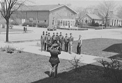
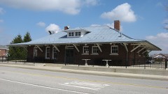
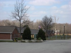
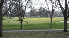
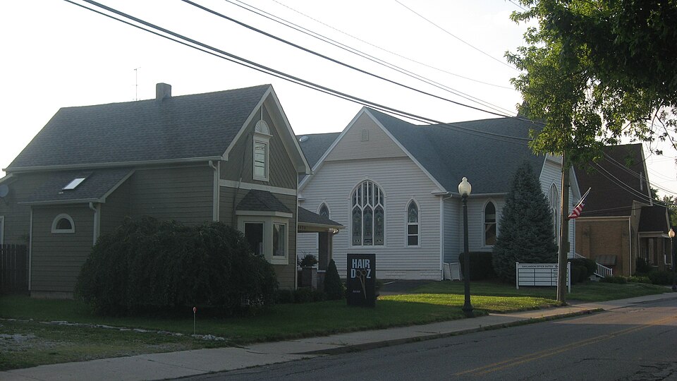
Photograph of Oaklandon Historic District
Photograph by Nyttend, Public domain. Via Wikimedia Commons.

Oaklandon Historic District

Listed on the National Register of Historic Places in 2013.

From the record

“Oaklandon Historic District is a national historic district located at Indianapolis, Indiana. It encompasses 38 contributing buildings in the mid-19th century settlement of Oaklandon.”

Wikipedia article Oaklandon Historic District, CC BY-SA 4.0.

One of 274 National Register listings published here for Marion County · listed in 2013 · category: District.

Sources: the Wikipedia article · the National Register database, National Park Service
The listing

The ground it stands on

25,786 words

The chapter on Lawrence Township in History of Indianapolis and Marion County, Indiana, published 1884 names Lawrence. This is what it says, exactly as the scans read.

This township is situated in the extreme northeastern portion of the county, and is seven miles square, containing forty-nine square miles, or thirty thousand eight hundred and nineteen acres of land. It is bounded on the north by Hamilton County, on the east by Hancock County, on the south by Warren township, and on the west by Washington township. The surface of the country is generally level, except along the streams, where it is somewhat broken, and in some localities hilly. The soil is well adapted to the culture of wheat, corn, rye, barley, and most vegetables, but the culture of fruit has proved to be unprofitable during the past few years, though in a few localities this branch of agriculture has yielded a good revenue. About thirty-five years ago immense crops of peaches were raised, but the peach crop has been almost an entire failure during the last twenty years. The soil is principally clay, but consists of four grades, viz. : white clay, or beech flats ; black loam of the flats ; limestone or clay hills ; and bottomland, or dark chocolate loam intermixed with sand. Originally the township was covered with a heavy growth of timber, consisting principally of walnut, sugar, poplar, ash, beech, hickory, sycamore, lime, buckeye, oak, and hackberry. In the lowlands, the primitive forest abounded with grape-vines, frequently growing to an enormous height. Beneath the forest and the net-work of vines grew pawpaws, leatherwood, prickly-ash, black haw, and other underbrush. At the Lawrence district fair, September, 1883, John Johnson exhibited fifty-four natural varieties of timber of the township. Nearly all the valuable timber was recklessly destroyed in the clearing of the land, or has since been sold in the market. In an early day the level lands were covered with immense sheets of water, quagmires, and ponds.

Passage source: History of Indianapolis and Marion County, Indiana, published 1884.

Lawrence township was erected April 16, 1822, by order of the board of county commissioners, and on the same day and by the same authority it was joined to Washington for purposes of township organization (neither township being sufficiently populous to be organized separatelyj. This union of the two townships as one continued until Sept. 4, 1826, when the board of justices ordered that Lawrence be taken from Washington and separately organized, and that an election be held on the first Saturday in the following October at the house of John Johnson for choice of a justice of the peace for Lawrence, Alexander Wilson to be inspector of said election. The election was held as ordered, and resulted in the choice of Peter Casteller as justice of the peace. The following is a list of officers of the township from its erection to the present time, viz. :

Passage source: History of Indianapolis and Marion County, Indiana, published 1884.

Machine-read from a century-old scan, so expect the errors a machine makes: misspelled names, dropped words, stray characters.

Read the whole chapter on Lawrence Township - 25,786 words on its settlement, mills, schools and churches.

Mines and quarries near this property

2 within 5 miles

Regional context, not property-specific evidence. The federal mineral resources record lists 2 workings within 5 miles of Oaklandon Historic District: 2 producers. All of them still produce. What was taken out: Stone, Sand and Gravel, Construction. Distance is straight-line from the map coordinates, so a quarry counted here may appear on a neighbouring settlement's page as well.

Where SiteCommodity StatusRecorded
Fishers Sand PlantSand and Gravel, ConstructionProducer
Lawrence City-Own CrewsStoneProducer

Every working recorded in Marion County

Storms near this property

26 since 1998

Regional context, not property-specific evidence. The National Weather Service names Lawrence, the town this property stands in, in 26 storm reports between 1998 and 2025: 12 hail, 11 thunderstorm wind, 1 lightning, 1 tornado. The reports record 1 death and 19 injuries. Each account below is quoted exactly as the forecast office filed it, from the NOAA Storm Events Database, and each date opens the federal record of that event.

WhenEvent Place namedHarm What the report says
July 2006LightningLawrence1 killed, 1 hurtTwo boys, aged 9 and 11, were struck by lightning while standing under a tree and playing in the rain. The 9-year-old died a short time later at Wishard Hospital. The 11-year-old was injured, but survived.
May 2008Tornado (EF2)Lawrence18 hurt, $29,000,000Numerous structures were damaged in Marion County with the hardest hit area being an apartment complex near 38th Street and Mitthoefer Road. The tornado was associated with an embedded supercell that was overtaken by a line. Based on damage indicators, wind speeds were estimated around 125 mph. This tornado formed near 42nd Street and Post Road and tracked southeastward for 3.1 miles before exiting Marion County on North County Line Road 500 meters south of East 38th Street. The tornado continued in Hancock County. While in Marion County the tornado was rated EF-2 and while in Hancock County the tornado was rated EF-1. The tornado continued to the southeast in Hancock County for 4.0 miles. This made the entire path length 7.1 miles. The width of the tornado while in Hancock County was 100 yards and lasted from 2132 until 2136. Overall, the tornado was on the ground from 2127 until 2136. The tornado lifted in Hancock County 500 feet south of West 200 North on North 400 West. While in Hancock County the tornado damaged barns, houses, billboards, trees, and powerlines.
August 2004Thunderstorm WindLawrence$25,000A large tree fell along with several power lines and a power pole. Three mobile homes were damaged by the falling tree and pole. Damage amounts were estimated.
April 2024Thunderstorm WindLawrence$10,000Roof damage caused by thunderstorm wind gusts reported across Lawrence.
May 2018Thunderstorm WindLawrence$8,000A large tree limb broke off due damaging thunderstorm wind gusts and damaged a parked car. Power lines were always reported down.
January 2012Thunderstorm WindLawrence$3,000Trees were reported downed on Boy Scout Road due to damaging thunderstorm wind gusts.
April 2011Thunderstorm WindLawrence$2,000Tree limbs, six to eight inches in diameter, were blown down due to damaging thunderstorm wind gusts.
June 1998Thunderstorm WindLawrence$1,000Power lines downed.
August 2010FloodLawrence$500High water was reported on roadways in and around the city of Lawrence due to thunderstorm heavy rainfall.
February 2024Thunderstorm WindLawrence-A 60 mph thunderstorm wind gust was estimated at this location.
August 2016Thunderstorm WindLawrence-An estimated 60 mph thunderstorm wind gust was observed near 32nd Street and Shadeland Avenue. Small hail was also reported.
June 2013HailLawrence-This report was received via Twitter.
September 2008HailLawrence-Three-quarter inch hail fell at 38th Street and Shadeland Avenue.
July 2005Thunderstorm WindLawrence-Several large trees were downed.
March 2025HailLawrence-no account filed
April 2012HailLawrence-no account filed
May 2011HailLawrence-no account filed
May 2009HailLawrence-no account filed
April 2007Thunderstorm WindLawrence-no account filed
April 2006HailLawrence-no account filed
May 2006HailLawrence-no account filed
May 2005HailLawrence-no account filed
June 2002Thunderstorm WindLawrence-no account filed
March 1998HailLawrence-no account filed

Every storm recorded in Marion County

Map coverage status

No historic map-sheet match is published for this property yet. That does not mean no map exists. This record needs a coordinate-quality review before it can be joined to a sheet boundary. Browse the county's mapped places while that work is pending.

Listed places nearby

6 within 8 miles

Other National Register properties close enough to walk or drive between, ordered by distance from this one. Both positions come from the same geocoding pass that matched these properties to their map sheets.

Sources for this property

National Archives recordThe nomination case file for reference 13000724 in Record Group 79.
Wikipedia articleCommunity-written account of this property, licensed CC BY-SA.
Marion CountyAll 274 listed properties in this county.

Provenance

  • Listing record. National Park Service National Register of Historic Places, listed-properties dataset, current to 2026-05-22.
  • Map join. Address geocoded through the United States Census geocoder, then tested against the published boundary of every sheet in the USGS Historical Topographic Map Collection.
  • How this page is made. Listing fields come from federal records; map-sheet coverage is a labelled coordinate-to-boundary calculation, not a source-field claim.
  • Mines and quarries. USGS Mineral Resources Data System (MRDS) https://mrdata.usgs.gov/mrds/ A work of the United States government, no copyright under 17 U.S.C. 105.
  • Storms. NOAA National Centers for Environmental Information, Storm Events Database https://www.ncei.noaa.gov/stormevents/ A work of the United States government, no copyright under 17 U.S.C. 105. Narratives are quoted verbatim from the National Weather Service report and are not edited or summarised.