BlockBefore
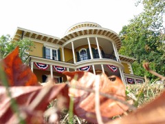
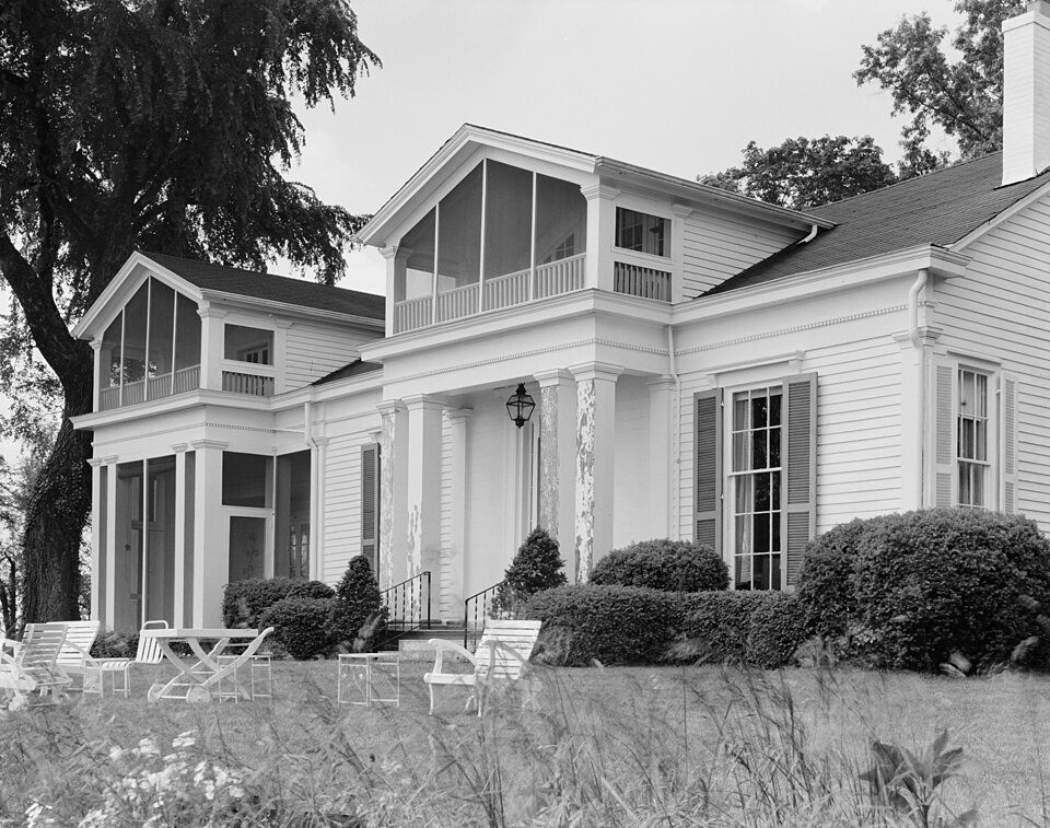
Photograph of Veraestau
Photograph by J. Marshall Davis, Public domain. Via Wikimedia Commons.

Veraestau

Listed on the National Register of Historic Places in 1973.

From the record

“Veraestau is a historic home located in Center Township, Dearborn County, Indiana. It was built in 1838, and is a two-story, Greek Revival style brick and frame dwelling.”

Wikipedia article Veraestau, CC BY-SA 4.0.

One of 26 National Register listings published here for Dearborn County · listed in 1973 · category: Building.

Sources: the Wikipedia article · the case file at the National Archives · the National Register database, National Park Service
The listing

  • Address. 1.mi. S of Aurora on IN 56, Aurora, 47001
  • When was it listed? April 1973
  • Category. building
  • Township. Center township
  • Architectural style. Greek Revival architecture
  • National Register reference number. 73000013 - the number the National Park Service assigned this property when it was listed, and the key its nomination file is catalogued under at the National Archives.

The ground it stands on

2,243 words

The chapter on Center Township in History of Dearborn County Indiana, published 1915 names Aurora. This is what it says, exactly as the scans read.

The earliest land entered from the government was made by Daniel Con¬ ner, April 22, 1801. and it was resold to Oliver Ormsby, December 9, 1806. Ormsby must have purchased it for speculation, for the records fail to show that he ever lived upon it. Ormsby also bought a large tract of land at an early period in Mexico bottoms, in Switzerland county. The next tract of land entered was by Charles Wilkins, April 27. 1801. On December 19, of the same year, James Conn purchased fractional sections 27, 28 and 29 in township 5, range 1 west. Daniel Conner also entered fractional section 4. September 18, 1804, and resold it December 18, 1810, to G. R. Terrence. Charles Vattier entered sections 32 and 33, in town 5, range 1, September 18, 1804. This is the land on which the city of Aurora is situated. In 1806 David Rees and Nathan C. Findlay entered land in sections 19 and 20.

Passage source: History of Dearborn County Indiana, published 1915.

The town of Cochran, now incorporated with Aurora, on the right bank of South Hogan creek, joins the city of Aurora. The Baltimore & Ohio Southwestern railway passes through it and the main street is the Aurora and Laughery turnpike. On account of the car shops of the railway company being erected here when the road was first constructed the town owes its origin. The town was laid out in section 31, township 5, range 1 west, and was platted and filed in the recorder's office of the county on August 25, i860. The postoffice was established in 1878, on July 4, with A. P. Shutts postmaster. The village suffered the loss of many of its inhabitants by the removal of the railway shops to Washington, Indiana, but has recovered from it now and is becoming both a residence and business part of the city of Aurora.

Passage source: History of Dearborn County Indiana, published 1915.

Machine-read from a century-old scan, so expect the errors a machine makes: misspelled names, dropped words, stray characters.

Read the whole chapter on Center Township - 2,243 words on its settlement, mills, schools and churches.

Mines and quarries near this property

4 within 5 miles

Regional context, not property-specific evidence. The federal mineral resources record lists 4 workings within 5 miles of Veraestau: 3 producers, 1 past producer. 3 still produce. What was taken out: Sand and Gravel, Construction. Distance is straight-line from the map coordinates, so a quarry counted here may appear on a neighbouring settlement's page as well.

Where SiteCommodity StatusRecorded
Burlington SandSand and Gravel, ConstructionProducer
D & M MineSand and Gravel, ConstructionPast Producer
Laughery PlantSand and Gravel, ConstructionProducer
Petersburg MineSand and Gravel, ConstructionProducer

Every working recorded in Dearborn County

Storms near this property

32 since 1996

Regional context, not property-specific evidence. The National Weather Service names Aurora, the town this property stands in, in 32 storm reports between 1996 and 2022: 12 thunderstorm wind, 9 flash flood, 6 flood, 4 hail. No death or injury is recorded in these reports. Each account below is quoted exactly as the forecast office filed it, from the NOAA Storm Events Database, and each date opens the federal record of that event.

WhenEvent Place namedHarm What the report says
April 1999Tornado (F0)Aurora$250,000A small barn was totally destroyed, a 40 foot silo was damaged and several trees were downed. Four homes were heavily damaged in rural Dillsboro.
June 2021Flash FloodAurora$100,000Numerous reports of high water and flash flooding were received from the Aurora and Guilford areas. Several people and pets were stranded in Guilford due to rising water. Two vehicles were also swept away in the Guilford area after their occupants escaped.
March 1997Thunderstorm WindAurora$30,000no account filed
June 2008Thunderstorm WindAurora$20,000A neighborhood near Aurora sustained structural damage to some homes and automobiles, as well as numerous trees being blown down, uprooted, or split. All of the damage was caused by straight-line winds estimated near 80 mph.
June 2017Flash FloodAurora$15,000A portion of Market Street in Aurora was ripped up due to flood waters.
March 2008FloodAurora$5,000Numerous roads were flooded across the county.
March 2008FloodAurora$5,000Numerous roads were flooded and closed.
June 2022Thunderstorm WindAurora$4,000Several trees were downed.
July 2022Thunderstorm WindAurora$3,000A few trees were downed.
May 2018Thunderstorm WindAurora$3,000A few trees were downed onto State Route 148.
April 2011Thunderstorm WindAurora$2,000Trees were reported down due to damaging thunderstorm winds.
February 2006Thunderstorm WindAurora$2,000Two trees were knocked down.
April 2006Thunderstorm WindAurora$2,000Power lines were downed.
July 2014Thunderstorm WindAurora$1,000A tree was downed due to thunderstorm winds.
June 2013Flash FloodAurora$1,000Multiple roads were closed due to high water caused by heavy rainfall.
April 2011Thunderstorm WindAurora$1,000Large branches were broken due to damaging thunderstorm winds.
July 2019Thunderstorm WindAurora$250A few small trees were downed on Wilson Creek Road.
May 2022FloodAurora-High water was reported on the roadway near the intersection of State Route 148 and U.S. 50.
February 2019FloodAurora-U.S. 50 westbound in Aurora was blocked due to high water.
February 2019FloodAurora-One road was closed near the Ohio County line due to flooding.
June 2019FloodAurora-High water was reported over 1 1/2 lanes of Wilson Creek Road.
February 2018Flash FloodAurora-Multiple roads were closed throughout the county due to high water.
March 2006Flash FloodAurora-High water caused several road closures.
May 2002Flash FloodAurora-An automobile was trapped when high water surged over a bridge.
May 2002Flash FloodAurora-Laughery Creek Road was closed by high water.
August 2001Flash FloodAurora-Heavy rainfall caused roads to be closed across the southern part of the county.
May 2022HailAurora-no account filed
April 2017Flash FloodAurora-no account filed
July 2014Thunderstorm WindAurora-no account filed
May 2011HailAurora-no account filed
June 1998HailAurora-no account filed
August 1996HailAurora-no account filed

Every storm recorded in Dearborn County

Map coverage status

No historic map-sheet match is published for this property yet. That does not mean no map exists. This record needs a coordinate-quality review before it can be joined to a sheet boundary. Browse the county's mapped places while that work is pending.

Listed places nearby

6 within 8 miles

Other National Register properties close enough to walk or drive between, ordered by distance from this one. Both positions come from the same geocoding pass that matched these properties to their map sheets.

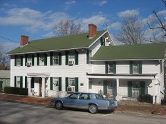
Photograph PropertyDistance Listed
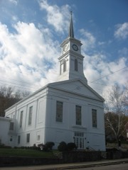
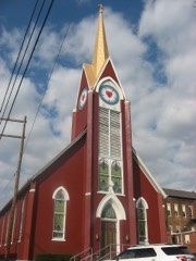
First Evangelical United Church of Christ0.8 miles1994
Levi Stevens House0.9 miles1996
Hillforest (Forest Hill)0.9 miles1971
First Presbyterian Church0.9 miles1994
Downtown Aurora Historic District0.9 miles1994
Lewis Hurlbert Sr. House1.0 miles1994

Sources for this property

National Archives recordThe nomination case file for reference 73000013 in Record Group 79.
Wikipedia articleCommunity-written account of this property, licensed CC BY-SA.
Dearborn CountyAll 26 listed properties in this county.

Provenance

  • Listing record. National Park Service National Register of Historic Places, listed-properties dataset, current to 2026-05-22.
  • Map join. Address geocoded through the United States Census geocoder, then tested against the published boundary of every sheet in the USGS Historical Topographic Map Collection.
  • How this page is made. Listing fields come from federal records; map-sheet coverage is a labelled coordinate-to-boundary calculation, not a source-field claim.
  • Mines and quarries. USGS Mineral Resources Data System (MRDS) https://mrdata.usgs.gov/mrds/ A work of the United States government, no copyright under 17 U.S.C. 105.
  • Storms. NOAA National Centers for Environmental Information, Storm Events Database https://www.ncei.noaa.gov/stormevents/ A work of the United States government, no copyright under 17 U.S.C. 105. Narratives are quoted verbatim from the National Weather Service report and are not edited or summarised.