BlockBefore
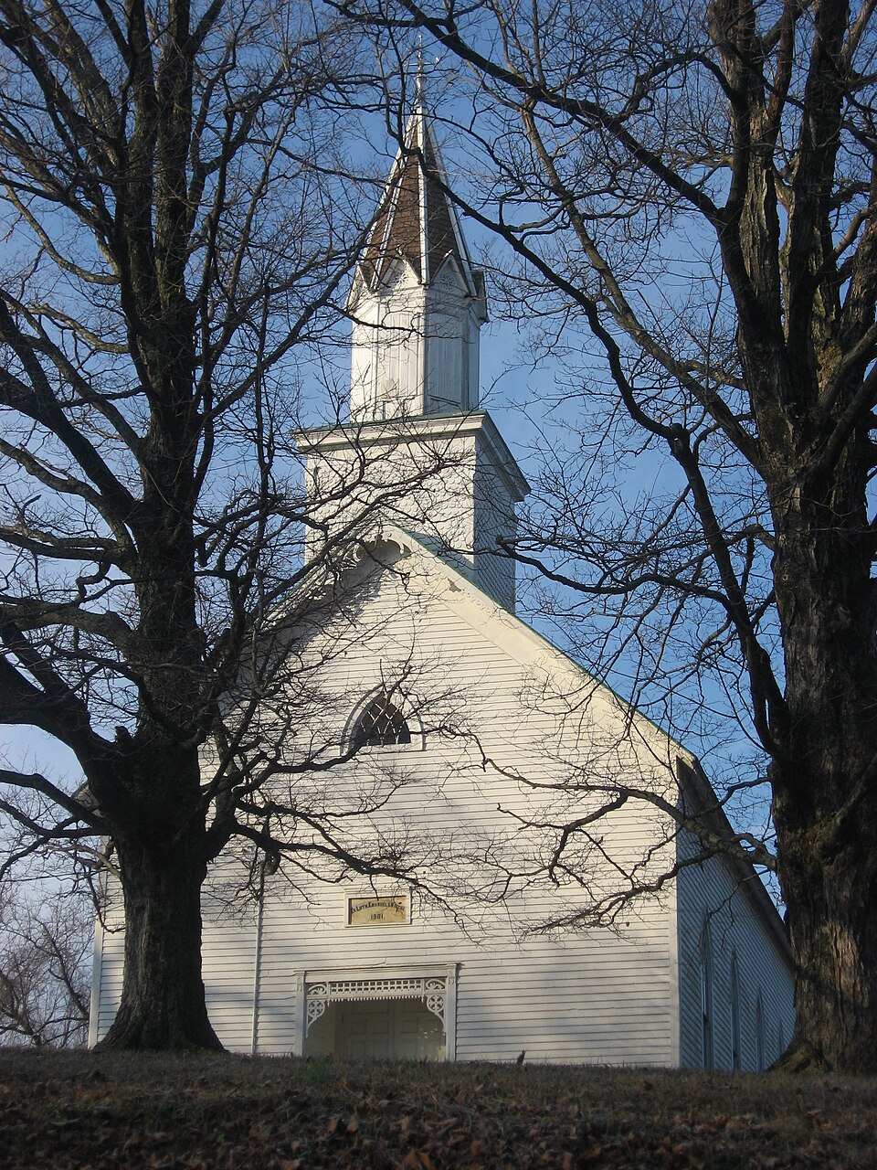
Photograph of Evangelische Lutherische Emanuels Kirche
Photograph by Nyttend, Public domain. Via Wikimedia Commons.

Evangelische Lutherische Emanuels Kirche

Listed on the National Register of Historic Places in 1990.

From the record

One of 19 National Register listings published here for Dubois County · listed in 1990 · category: District.

Sources: the case file at the National Archives · the National Register database, National Park Service · the Wikipedia article

The listing

  • What is counted as historic. The nomination lists 7 buildingss, 1 site as contributing to the listing.
  • Address. Co. Rd. 445 E., 1 mi. S of IN 56, Dubois, 47527
  • When was it listed? February 1990
  • Category. district
  • Township. Harbison township
  • Architectural style. Renaissance Revival architecture
  • National Register reference number. 90000329 - the number the National Park Service assigned this property when it was listed, and the key its nomination file is catalogued under at the National Archives.

The ground it stands on

1,134 words

The chapter on Harbison Township in History of Dubois County from Its Primitive Days to 1910, published 1910 names Dubois. This is what it says, exactly as the scans read.

This township honors the name of a pioneer family of Dubois county. The first land entered in the township was the southwest quarter of section thirty-six, township one, north, range five west, under date of May 29, 1807. It is on the "Buffalo Trace," and the entry was made by Samuel McConnell.

Passage source: History of Dubois County from Its Primitive Days to 1910, published 1910.

In Harbison township lived General John Abel, a surveyor, assessor, and a member of the thirty-seventh session of the Indiana legislature. It is said Andrew F. Kelso, who came to Dubois county, in 1817, erected one of the first grist mills in the county. His mill was at Dubois. Later in life he had a mill at Ireland. Andrew F. Kelso was born in 1807, and is the father of Lemuel L. Kelso, formerly of Boone township.

Passage source: History of Dubois County from Its Primitive Days to 1910, published 1910.

Machine-read from a century-old scan, so expect the errors a machine makes: misspelled names, dropped words, stray characters.

Read the whole chapter on Harbison Township - 1,134 words on its settlement, mills, schools and churches.

Storms near this property

20 since 1999

Regional context, not property-specific evidence. The National Weather Service names Dubois, the town this property stands in, in 20 storm reports between 1999 and 2023: 7 thunderstorm wind, 5 hail, 5 flash flood, 3 flood. No death or injury is recorded in these reports. Each account below is quoted exactly as the forecast office filed it, from the NOAA Storm Events Database, and each date opens the federal record of that event.

WhenEvent Place namedHarm What the report says
June 2019Thunderstorm WindDubois$20,000Power lines were reported down along Jasper Dubois Road.
March 2020Flash FloodDubois$15,000There was a car stuck in high water.
March 2023Flash FloodDubois-Flash Flooding was observed along Jasper Dubois Road south of Indiana Route 545.
September 2022Flash FloodDubois-A school basement in the town of Dubois flooded, and local emergency services were requested to help remove water from the school. Rainfall totals of between 3 and 4 inches were observed in the vicinity of the flooding reports.
August 2021Flash FloodDubois-There was significant street flooding in the town of Dubois. The gymnasium was flooded at the intermediate school.
March 2020Thunderstorm WindDubois-Trees and branches were reported down in the area.
June 2018FloodDubois-The emergency manager reported that State Road 545 has flowing water over it that has pushed large rocks onto the roadway.
April 2015FloodDubois-State officials reported that numerous roads were closed due to high water. Between 1 and 3 inches of rain fell across the county on top of saturated ground.
April 2015FloodDubois-State officials reported numerous road closures due to high water. Between 1 and 3 inches of rain fell on top of saturated ground.
August 2012Thunderstorm WindDubois-Several trees were downed in the town of Dubois. The local fire department estimated 60 mph winds.
February 2008Flash FloodDubois-Parts of Dubois Road Norteast were closed due to high water.
April 2006HailDubois-Quarter size hail was hitting the roof at the 911 center.
May 2004Thunderstorm WindDubois-Large limbs were blown down. A funnel cloud was also spotted.
July 2004Thunderstorm WindDubois-Numerous large trees were blown down.
July 2004Thunderstorm WindDubois-A 60 mph wind gust was measured at Patoka Lake.
February 1999HailDubois-Quarter size hail fell in northeast part of county
March 2012HailDubois-no account filed
May 2006HailDubois-no account filed
June 2006HailDubois-no account filed
May 2004Thunderstorm WindDubois-no account filed

Every storm recorded in Dubois County

Map coverage status

No historic map-sheet match is published for this property yet. That does not mean no map exists. This record needs a coordinate-quality review before it can be joined to a sheet boundary. Browse the county's mapped places while that work is pending.

Listed places nearby

6 within 8 miles

Other National Register properties close enough to walk or drive between, ordered by distance from this one. Both positions come from the same geocoding pass that matched these properties to their map sheets.

Photograph PropertyDistance Listed
Indiana Desk Company7.5 miles2025
Gramelspacher-Gutzweiler House7.7 miles1983
St. Joseph Catholic Church7.7 miles1980
Jasper Downtown Historic District7.8 miles2017
Dubois County Courthouse7.8 miles1996
Louis H. Sturm Hardware Store7.8 miles2003

Sources for this property

National Archives recordThe nomination case file for reference 90000329 in Record Group 79.
Wikipedia articleCommunity-written account of this property, licensed CC BY-SA.
Dubois CountyAll 19 listed properties in this county.

Provenance

  • Listing record. National Park Service National Register of Historic Places, listed-properties dataset, current to 2026-05-22.
  • Map join. Address geocoded through the United States Census geocoder, then tested against the published boundary of every sheet in the USGS Historical Topographic Map Collection.
  • How this page is made. Listing fields come from federal records; map-sheet coverage is a labelled coordinate-to-boundary calculation, not a source-field claim.
  • Storms. NOAA National Centers for Environmental Information, Storm Events Database https://www.ncei.noaa.gov/stormevents/ A work of the United States government, no copyright under 17 U.S.C. 105. Narratives are quoted verbatim from the National Weather Service report and are not edited or summarised.