BlockBefore
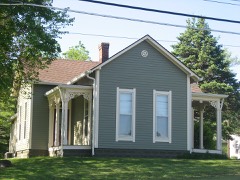
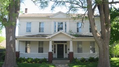
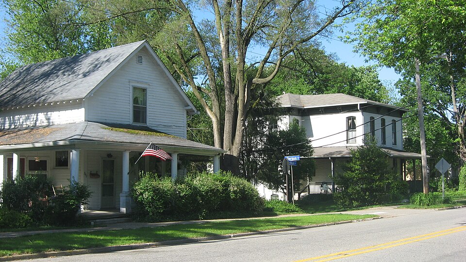
Photograph of Danville Main Street Historic District
Photograph by Nyttend, Public domain. Via Wikimedia Commons.

Danville Main Street Historic District

Listed on the National Register of Historic Places in 1994.

From the record

“Danville Main Street Historic District is a national historic district located at Danville, Indiana. The district encompasses 37 contributing buildings in a residential section of Danville.”

Wikipedia article Danville Main Street Historic District, CC BY-SA 4.0.

One of 22 National Register listings published here for Hendricks County · listed in 1994 · category: District.

Sources: the Wikipedia article · the case file at the National Archives · the National Register database, National Park Service

The listing

  • Address. Bounded by East, Main, Cross, and Marion Sts., Danville, 46122
  • When was it listed? September 1994
  • Category. district
  • Township. Center township
  • National Register reference number. 94001109 - the number the National Park Service assigned this property when it was listed, and the key its nomination file is catalogued under at the National Archives.

What happened here

An account from the chapter on Center township. The inset identifies its exact source book and publication year.

From History of Hendricks County, Indiana, Together with Sketches of Its Cities, Villages and Towns, Educational, Religious, Civil, Military, and Political History, Portraits of Prominent Persons, and Biographies of Representative Citizens, published 1885 - Center Township

History Of Hendriok8 County

1 1 He was found dead in bis stable and was supposed to have been i murdered by his servant for his money. He was a man of note and ] influence. The Hadleys have been noted for their thrift, both in this and the old country. The most of them have been farmers i and all have owned the land they worked. Until the last genera- ; tion or two all have been Friends, and none were military men 1 until the late civil war, when several bore arms in defense of the !

Read the rest of this passage

The ground it stands on

36,715 words

The chapter on Center Township in History of Hendricks County, Indiana, Together with Sketches of Its Cities, Villages and Towns, Educational, Religious, Civil, Military, and Political History, Portraits of Prominent Persons, and Biographies of Representative Citizens, published 1885 names Danville. This is what it says, exactly as the scans read.

During tlie late war the people of DanriUe and vicinity were very strong in tlieir Union sentiments, and so wrought up were they in 1864 that luetliods were pursued in the political campaign that would tind few defenders now, and which were palliated, not excused, by the peculiar conditions of tlie times. Returned soldiers and otlier Unionists held the polls, and by one means and anotRer kept the Democratic vote down to three, while 457 votes were given for the Union ticket. Tliis and other incidents caused many of the Democratic citizens of the county to conceive a dislike for Danville which has lasted to this day, and which has had a permanently injurious effect upon the business of what ought to be a more thriving town. The ill-fetling was such during the later years of the war that some Democrats threatened to come and burn the court-house, and for a time this structure was carefully guarded and the streets regularly patrolled by the patriotic Danvilleites.

Passage source: History of Hendricks County, Indiana, Together with Sketches of Its Cities, Villages and Towns, Educational, Religious, Civil, Military, and Political History, Portraits of Prominent Persons, and Biographies of Representative Citizens, published 1885.

In the winter of 18S2-'3 there was the first Methodist preaching in this region at the house of Kobert "Wilson, near present Shiloh church, and a class was organized with Robert Wilson as Leader. This was the first class establisjied in the county. Soon after prosperous classes were organized at Xorth Salem, Danville, Stilesville, "Wesley Chapel and at or near Lizton. At the first quarterly meeting for White Lick Circuit, held at Robert Wilson's on Oct. 25, 182S, there were present John Strange, P. E.; Joseph Tarkington, A. P.; Peter Monicle, L. P., and Robert "Wilson and "Wesley Monicle, Leaders. At that meeting Aaron Homan, Gideon "Wilson and Elisha Kise were appointed a committee to make an estimate of the^amoimt necessary to build a meeting-house near Eobert Wilson 8. Early the next season tbe arrangements were perfected and ^le house built-the first Methodist meeting-house !n Hendricks County. At that same meeting the receipts from the different classes were shown to be as follows: Martinsville, $4 3U- White possessed they gave more than we do from our abundance, and more than that it is by the work so well done by those that have passed away that the possibility is given us to enlarge the offerings they laid upon the altars of the church.

Passage source: History of Hendricks County, Indiana, Together with Sketches of Its Cities, Villages and Towns, Educational, Religious, Civil, Military, and Political History, Portraits of Prominent Persons, and Biographies of Representative Citizens, published 1885.

Machine-read from a century-old scan, so expect the errors a machine makes: misspelled names, dropped words, stray characters.

Read the whole chapter on Center Township - 36,715 words on its settlement, mills, schools and churches.

Mines and quarries near this property

1 within 5 miles

Regional context, not property-specific evidence. The federal mineral resources record lists 1 working within 5 miles of Danville Main Street Historic District: 1 producer. All of them still produce. What was taken out: Stone. Distance is straight-line from the map coordinates, so a quarry counted here may appear on a neighbouring settlement's page as well.

Where SiteCommodity StatusRecorded
Hendricks Co. Hwy. Dept.StoneProducer

Every working recorded in Hendricks County

Storms near this property

47 since 1994

Regional context, not property-specific evidence. The National Weather Service names Danville, the town this property stands in, in 47 storm reports between 1994 and 2025: 21 hail, 21 thunderstorm wind, 3 flood, 1 lightning. No death or injury is recorded in these reports. Each account below is quoted exactly as the forecast office filed it, from the NOAA Storm Events Database, and each date opens the federal record of that event.

WhenEvent Place namedHarm What the report says
April 2020Thunderstorm WindDanville$50,000Numerous trees and power poles snapped across the county due to thunderstorm wind gusts. Damage was locally concentrated in Danville.
July 2015Flash FloodDanville$50,000Four to five roads were washed out with numerous roads flooded county-wide due to heavy thunderstorm rainfall.
April 2011Thunderstorm WindDanville$50,000Approximately 10 homes were damaged, due to damaging thunderstorm wind gusts, in the Clear Creek housing edition. One home had major roof damage. The others had mainly vinyl siding and garage door damage. No injuries were reported.
January 2008Thunderstorm WindDanville$30,000A house was heavily damaged on the southwest side of Danville due to damaging thunderstorm winds.
September 2012Thunderstorm WindDanville$15,000The roof was blown off a barn, east of Danville, due to damaging thunderstorm wind gusts.
August 2002LightningDanville$15,000Lightning struck an office building.
August 2019Thunderstorm WindDanville$10,000Several large tree limbs downed due to thunderstorm wind gusts. A roof was blown off along with several trees uprooted or snapped near the location.
June 2006Thunderstorm WindDanville$10,000A garage was destroyed by a falling tree.
October 2010Thunderstorm WindDanville$2,000An 18 inch diameter tree and power lines were downed due to damaging thunderstorm wind gusts on Cook Avenue in Danville. Power outages in Danville, Pittsboro, and Brownsburg were reported as well.
June 2018Thunderstorm WindDanville$1,000A large tree was downed on State Road 39 in Danville due to damaging thunderstorm wind gusts.
June 2017FloodDanville$500Portions of Cartersburg Road was closed due to flooding from heavy rainfall.
June 2013FloodDanville$500Water was reported over the roadway near the intersection of Main Street and County Road 200 East due to thunderstorm heavy rainfall.
August 2009Thunderstorm WindDanville$300A decayed 12 inch diameter limb was blown down due to thunderstorm wind gusts. This limb blocked Highway 39 south of Danville.
April 2025Thunderstorm WindDanville-Two 70 mph thunderstorm wind gusts were measured at or near this location.
July 2023HailDanville-Hail near Danville as large as 1.55 inches. CoCoRaHS observer (Danville 1.6 NE) reported 1.00 inch hail that shredded leaves. Widespread crop damage to Beasley Orchard (2.6 miles east of Danville), with the entire apple and sunflower crop destroyed and additional damage noted to tomato, pumpkin, and sweet corn crops. Several additional reports of 0.75-0.88 inch hail between Danville and Avon.
July 2015HailDanville-The hail was accompanied by 45 mph wind gusts.
July 2015Thunderstorm WindDanville-An estimated 60 mph thunderstorm wind gust was observed in this location.
December 2015Thunderstorm WindDanville-A 61 mph thunderstorm wind gust was measured on the west side of Danville.
July 2014Thunderstorm WindDanville-An estimated 60 to 70 mph thunderstorm wind gust was observed just south of Danville High School.
March 2012Thunderstorm WindDanville-A thunderstorm wind gust estimated at 60 mph was observed in this location.
September 2012HailDanville-An estimated 30 mph thunderstorm wind gust was also observed.
June 2010Thunderstorm WindDanville-A wind gust, measured at 60 mph, was observed in north Danville.
February 2009FloodDanville-A flooded roadway was reported at State Route 39 North and United States 36.
January 2008HailDanville-There were also winds estimated at 55 mph.
February 2006Thunderstorm WindDanville-A large tree was downed in an intersection.
April 2006HailDanville-No property damage estimates were available.
May 2005Thunderstorm WindDanville-Large tree branches broken.
August 2005Thunderstorm WindDanville-Trees were blown down.
April 2017HailDanville-no account filed
July 2015HailDanville-no account filed
March 2012HailDanville-no account filed
September 2012HailDanville-no account filed
April 2010HailDanville-no account filed
April 2006HailDanville-no account filed
May 2006HailDanville-no account filed
May 2005HailDanville-no account filed
April 2005HailDanville-no account filed
May 2003Thunderstorm WindDanville-no account filed
July 2003Thunderstorm WindDanville-no account filed
August 2000HailDanville-no account filed
June 1998Thunderstorm WindDanville-no account filed
April 1996HailDanville-no account filed
June 1994HailDanville-no account filed

Every storm recorded in Hendricks County

Map coverage status

No historic map-sheet match is published for this property yet. That does not mean no map exists. This record needs a coordinate-quality review before it can be joined to a sheet boundary. Browse the county's mapped places while that work is pending.

Listed places nearby

6 within 8 miles

Other National Register properties close enough to walk or drive between, ordered by distance from this one. Both positions come from the same geocoding pass that matched these properties to their map sheets.

Sources for this property

National Archives recordThe nomination case file for reference 94001109 in Record Group 79.
Wikipedia articleCommunity-written account of this property, licensed CC BY-SA.
Hendricks CountyAll 22 listed properties in this county.

Provenance

  • Listing record. National Park Service National Register of Historic Places, listed-properties dataset, current to 2026-05-22.
  • Map join. Address geocoded through the United States Census geocoder, then tested against the published boundary of every sheet in the USGS Historical Topographic Map Collection.
  • How this page is made. Listing fields come from federal records; map-sheet coverage is a labelled coordinate-to-boundary calculation, not a source-field claim.
  • Mines and quarries. USGS Mineral Resources Data System (MRDS) https://mrdata.usgs.gov/mrds/ A work of the United States government, no copyright under 17 U.S.C. 105.
  • Storms. NOAA National Centers for Environmental Information, Storm Events Database https://www.ncei.noaa.gov/stormevents/ A work of the United States government, no copyright under 17 U.S.C. 105. Narratives are quoted verbatim from the National Weather Service report and are not edited or summarised.