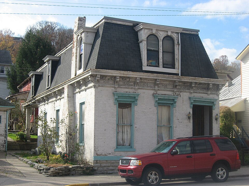
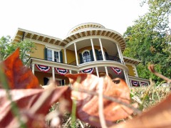
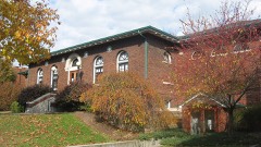
Listed on the National Register of Historic Places in 1994.
From the record
“George Sutton Medical Office Building is a historic medical office building located at Aurora, Indiana. It was built about 1870, and is a small two-story, Second Empire style brick building.”
Wikipedia article George Sutton Medical Office, CC BY-SA 4.0.
One of 26 National Register listings published here for Dearborn County · listed in 1994 · category: Building.
Architectural style. Second Empire architecture in the United States and Canada
National Register reference number.94001118- the number the National Park Service assigned this property when it was listed, and the key its nomination file is catalogued under at the National Archives.
The ground it stands on
2,243 words
The chapter on Center Township in History of Dearborn County Indiana, published 1915 names Aurora. This is what it says, exactly as the scans read.
The earliest land entered from the government was made by Daniel Con¬ ner, April 22, 1801. and it was resold to Oliver Ormsby, December 9, 1806. Ormsby must have purchased it for speculation, for the records fail to show that he ever lived upon it. Ormsby also bought a large tract of land at an early period in Mexico bottoms, in Switzerland county. The next tract of land entered was by Charles Wilkins, April 27. 1801. On December 19, of the same year, James Conn purchased fractional sections 27, 28 and 29 in township 5, range 1 west. Daniel Conner also entered fractional section 4. September 18, 1804, and resold it December 18, 1810, to G. R. Terrence. Charles Vattier entered sections 32 and 33, in town 5, range 1, September 18, 1804. This is the land on which the city of Aurora is situated. In 1806 David Rees and Nathan C. Findlay entered land in sections 19 and 20.
The town of Cochran, now incorporated with Aurora, on the right bank of South Hogan creek, joins the city of Aurora. The Baltimore & Ohio Southwestern railway passes through it and the main street is the Aurora and Laughery turnpike. On account of the car shops of the railway company being erected here when the road was first constructed the town owes its origin. The town was laid out in section 31, township 5, range 1 west, and was platted and filed in the recorder's office of the county on August 25, i860. The postoffice was established in 1878, on July 4, with A. P. Shutts postmaster. The village suffered the loss of many of its inhabitants by the removal of the railway shops to Washington, Indiana, but has recovered from it now and is becoming both a residence and business part of the city of Aurora.
Regional context, not property-specific
evidence. The federal mineral resources record lists
3 workings within 5 miles of Dr. George Sutton Medical Office Building: 2 producers, 1 past producer.
2 still produce. What was taken out: Sand and Gravel, Construction. Distance is straight-line from the
map coordinates, so a quarry counted here may appear on a neighbouring
settlement's page as well.
Regional context, not property-specific
evidence. The National Weather Service names
Aurora, the town this property stands in, in 32 storm reports between 1996 and 2022: 12 thunderstorm wind, 9 flash flood, 6 flood, 4 hail.
No death or injury is recorded in these reports. Each account below is quoted exactly as the forecast office
filed it, from the NOAA Storm Events Database, and each date
opens the federal record of that event.
Numerous reports of high water and flash flooding were received from the Aurora and Guilford areas. Several people and pets were stranded in Guilford due to rising water. Two vehicles were also swept away in the Guilford area after their occupants escaped.
A neighborhood near Aurora sustained structural damage to some homes and automobiles, as well as numerous trees being blown down, uprooted, or split. All of the damage was caused by straight-line winds estimated near 80 mph.
No historic map-sheet match is published
for this property yet. That does not mean no map exists. This record needs
a coordinate-quality review before it can be joined to a sheet boundary.
Browse the county's mapped places while that work is
pending.
Listed places nearby
6 within 8 miles
Other National Register properties close
enough to walk or drive between, ordered by distance from this one. Both
positions come from the same geocoding pass that matched these properties
to their map sheets.
Listing record. National Park Service National Register of Historic Places, listed-properties dataset, current to 2026-05-22.
Map join. Address geocoded through the United States Census geocoder, then tested against the published boundary of every sheet in the USGS Historical Topographic Map Collection.
How this page is made. Listing fields come from federal records; map-sheet coverage is a labelled coordinate-to-boundary calculation, not a source-field claim.
Mines and quarries. USGS Mineral Resources Data System (MRDS) https://mrdata.usgs.gov/mrds/ A work of the United States government, no copyright under 17 U.S.C. 105.
Storms. NOAA National Centers for Environmental Information, Storm Events Database https://www.ncei.noaa.gov/stormevents/ A work of the United States government, no copyright under 17 U.S.C. 105. Narratives are quoted verbatim from the National Weather Service report and are not edited or summarised.
 Block