 Block
From the record
5 National Register listings published here.
Sources: the National Register database, National Park Service
30 topographic sheets cover 5 settlements here, and 5 properties are on the National Register of Historic Places.
5 National Register listings published here.
Sources: the National Register database, National Park Service
Every property in this county listed on the National Register of Historic Places, with the year it was listed and the federal nomination document.
| Photograph | Property | Type | Listed | Reference |
|---|---|---|---|---|
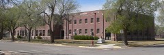 | Ashland Grade School | building | 2005 | 05001245 |
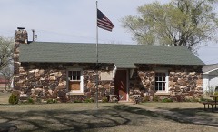 | Girl Scout Little House | building | 2015 | 15000142 |
| Hodson Hotel | building | 2019 | 100004456 | |
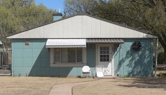 | Stein House | building | 2001 | 01000182 |
 | Stockgrowers State Bank | building | 1972 | 72000490 |
Every wildfire the federal occurrence database records inside this county: 42 of them, burning about 31,585 acres. 6 started naturally and none was recorded as arson. Each settlement page carries the fires within five miles of it.
| Reported cause | Fires |
|---|---|
| Missing data/not specified/undetermined | 23 |
| Equipment and vehicle use | 8 |
| Natural | 6 |
| Debris and open burning | 5 |
The five largest, by the area the report gives. None of them was recorded as arson.
| Date | Cause | Size | Reported by | Name on the report |
|---|---|---|---|---|
| 28 January 2008 | Missing data/not specified/undetermined | 6,000 acres | Kansas Counties | LEXINGTON |
| 14 August 2010 | Natural | 4,190 acres | Kansas Counties | MILLER FIRE |
| 24 February 2002 | Missing data/not specified/undetermined | 4,000 acres | Clark County | not named |
| 4 September 2000 | Missing data/not specified/undetermined | 2,500 acres | Clark County | not named |
| 17 September 2000 | Missing data/not specified/undetermined | 1,700 acres | Clark County | not named |
| 5 March 2018 | Equipment and vehicle use | 1,600 acres | Kansas Forest Service | 3 |
| 13 December 2004 | Missing data/not specified/undetermined | 1,500 acres | Kansas Forest Service | DUNNE RANCH |
| 24 July 2005 | Missing data/not specified/undetermined | 1,500 acres | Kansas Forest Service | KRIER RANCH |
Every settlement page carries the fires within five miles of it - see the settlement index below.
The NOAA Storm Events Database holds 691 reports for this county, causing no deaths, no injuries and about $2,399,830 in recorded property damage. Each settlement page carries the reports that name it.
| Kind of event | Reports |
|---|---|
| Hail | 471 |
| Thunderstorm Wind | 145 |
| Tornado | 41 |
| Heavy Rain | 22 |
| Flash Flood | 5 |
| Flood | 3 |
| Lightning | 2 |
| Funnel Cloud | 2 |
The most serious of them, by death, then injury, then recorded damage. The accounts are quoted exactly as the forecast office filed them.
| When | Event | Place named | Harm | What the report says |
|---|---|---|---|---|
| August 1997 | Hail | Minneola | $2,000,000 | Nearly every window in the small community were broken with siding destroyed on many homes. Cars received considerable damage too. Shingles were also torn off. Skylights broken at the school. |
| May 1998 | Hail | Minneola | $160,000 | A USDA report indicated tennis ball size hail across parts of the county but no specific information was given to the location or time. There was damage to crops...almost county wide. |
| April 1994 | Tornado (F2) | Ashland | $50,000 | Tornado touched down briefly and passed through the Roger Giles Farmstead. House windows were broken out, farm machinery was wrecked, and the house was moved on its foundation. All but two outbuildings on the farmstead were damaged. |
| August 1996 | Lightning | Ashland | $50,000 | no account filed |
| June 2009 | Hail | Minneola | $30,000 | Golf ball sized hail covered the ground and combined with high wind caused extensive damage to vehicles and farm equipment. |
| July 1972 | Tornado (F2) | not stated | $25,000 | no account filed |
| September 1994 | Hail | Ashland | $20,000 | A severe thunderstorm with one-inch diameter hail and winds greater than 52 knots (60 mph) knocked down large tree branches and produced some roof damage seven miles southwest of Ashland at 1615 CST. |
| May 1998 | Hail | Minneola | $20,000 | no account filed |
| March 2021 | Thunderstorm Wind | Minneola | $15,000 | A mobile home was blown over by high wind. |
| June 1997 | Thunderstorm Wind | Ashland | $10,000 | 12 power poles blown down. |
| July 2006 | Thunderstorm Wind | Ashland | $5,000 | Power poles blown down on highway 34. |
| July 2000 | Thunderstorm Wind | Ashland | $4,500 | Roof torn of a 15 x 30 shed and a tree was uprooted. |
| June 1996 | Hail | Ashland | $3,800 | no account filed |
| May 1999 | Thunderstorm Wind | Sitka | $3,000 | Ten power poles taken down by the RearFlank Downdraft. |
| August 1996 | Thunderstorm Wind | Minneola | $3,000 | no account filed |
| March 2001 | Thunderstorm Wind | Minneola | $500 | Road sign blown down on the east side of town. |
| August 1973 | Tornado (F0) | not stated | $30 | no account filed |
| April 2025 | Hail | Sitka | - | Public report of 1.5 inch hail. |
| April 2025 | Hail | Englewood | - | Public report of 1.75 inch hail. |
| August 2025 | Thunderstorm Wind | Ashland Krier Arpt | - | A mesonet from the Kansas State Mesonet recorded a 58 mph wind gust. |
| July 2025 | Thunderstorm Wind | Ashland Krier Arpt | - | Personal Weather Station. |
| September 2025 | Hail | Ashland | - | A public report of 3 inch hail. 2.75 inch hail was reported at the same time and place. |
| September 2025 | Hail | Ashland | - | A public report of about 3.5 inch hail. |
| September 2025 | Hail | Ashland Krier Arpt | - | A social media post of measured 3.5 inch hail. |
| September 2025 | Hail | Minneola | - | A public report of 1 inch hail. |
| September 2025 | Hail | Minneola | - | A public report of 3 inch hail. Another 1 inch hail report in the same place a couple minutes later. |
| September 2025 | Hail | Minneola | - | A public report of 4 inch hail from social media with pictures. |
| September 2025 | Hail | Minneola | - | A public report of 2 inch hail. |
| August 2024 | Thunderstorm Wind | Ashland | - | Emergency Manager reported multiple trees down and building damage in Ashland. Time estimated from radar. |
| May 2024 | Heavy Rain | Acres | - | A rainfall report of 3.04 inches. |
| June 2024 | Flash Flood | Clark State Lake | - | Social media report with pictures showing water over a county road at this location. |
| July 2024 | Thunderstorm Wind | Ashland Krier Arpt | - | Strong thunderstorms wind gusts were measured by area mesonet. |
| June 2023 | Thunderstorm Wind | Minneola | - | The observer reported roof damage. |
| June 2023 | Thunderstorm Wind | Sitka | - | Minor damage and tree limbs down due to high thunderstorms winds. |
| June 2023 | Thunderstorm Wind | Sitka | - | Report multiple power lines down along SR34 Road. |
| June 2023 | Thunderstorm Wind | Sitka | - | Report of semi blown over on Highway 34 near mm 28. |
| July 2023 | Thunderstorm Wind | Clark State Lake | - | Tree damage. |
| July 2023 | Thunderstorm Wind | Sitka | - | Six power poles snapped just east of highway 160 and highway 34 intersection. |
| July 2023 | Thunderstorm Wind | Sitka | - | Reports of 3 inch tree limbs broken. |
| May 2022 | Thunderstorm Wind | Minneola | - | Winds were estimated to be 60 MPH. |
| May 2022 | Thunderstorm Wind | Ashland Krier Arpt | - | Mesonet station 8S of Ashland. |
| April 2022 | Thunderstorm Wind | Minneola | - | Winds were estimated to be at least 60 MPH. |
| July 2022 | Heavy Rain | Clark State Lake | - | Rainfall of 3.50 inches was observed. |
| August 2021 | Hail | Minneola | - | There was severe roof and siding damage. |
| May 2019 | Tornado (EF0) | Minneola | - | Brief tornado on the foward flank videotaped by a storm chaser. |
| May 2019 | Thunderstorm Wind | Minneola | - | There was also very heavy rain with the wind. |
| May 2019 | Tornado (EF1) | Minneola | - | The tornado moved out of Meade County at 1943 LST and moved into Ford County at 1952 LST. As it crossed Highway 54 it overturned a semi truck but fortunately the driver was not hurt. |
| August 2019 | Thunderstorm Wind | Sitka | - | Winds were estimated at 70 MPH. |
| June 2018 | Thunderstorm Wind | Minneola | - | Winds were estimated at 70 MPH. |
| May 2017 | Tornado (EF1) | Minneola | - | The tornado did damage to vehicles, power lines and a small outbuildings. |
| May 2017 | Flash Flood | Minneola | - | Water over the roads in and around Minneola. |
| May 2017 | Hail | Sitka | - | The hail was mostly pea sized. |
| May 2017 | Flash Flood | Minneola | - | Rain water was curb-to-curb. |
| May 2017 | Funnel Cloud | Minneola | - | There was a brief cone funnel. |
| August 2017 | Heavy Rain | Ashland Krier Arpt | - | Rainfall was 4.89 inches. |
| September 2016 | Hail | Ashland | - | Hail covered the ground. |
| June 2015 | Thunderstorm Wind | Sitka | - | Winds were estimated to be 60 MPH. |
| June 2014 | Thunderstorm Wind | Minneola | - | There was also ping pong ball sized hail with the high wind. |
| June 2014 | Hail | Minneola | - | Winds also gusted to 60 MPH with the hail. |
| June 2014 | Thunderstorm Wind | Acres | - | Winds were estimated to be 65 MPH. |
Named settlements recorded in the Geographic Names Information System, each with the topographic sheets covering it. Villages, hamlets and abandoned places alike. Each is shown with the nearest named watercourse or landform and the survey quadrangle it falls on.
Center township · 67831 · On West Branch Bear Creek · Ashland quadrangle
11 sheets, 1896 to 1985
Englewood township · 67840 · On Fivemile Creek · Englewood quadrangle
11 sheets, 1896 to 1985
Lexington township · 67831 · On Lone Tree Creek · Lexington quadrangle
12 sheets, 1896 to 1985