 Block
From the record
10 National Register listings published here.
Sources: the National Register database, National Park Service
41 topographic sheets cover 15 settlements here, and 10 properties are on the National Register of Historic Places.
10 National Register listings published here.
Sources: the National Register database, National Park Service
Every property in this county listed on the National Register of Historic Places, with the year it was listed and the federal nomination document.
| Photograph | Property | Type | Listed | Reference |
|---|---|---|---|---|
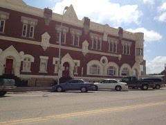 | Bankers Loan and Trust Company Building | building | 1977 | 77000576 |
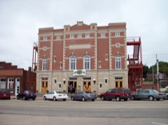 | Brown Grand Opera House | building | 1973 | 73000747 |
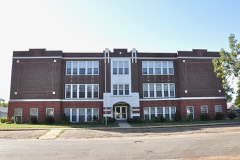 | Clyde School | building | 2009 | 08001348 |
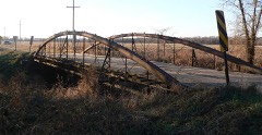 | County Line Bowstring | structure | 1990 | 89002192 |
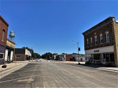 | Glasco Downtown Historic District | district | 2002 | 02001307 |
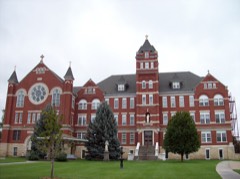 | Nazareth Convent and Academy | building | 1973 | 73000748 |
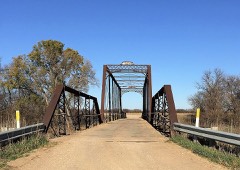 | Pott's Ford Bridge | structure | 1990 | 89002173 |
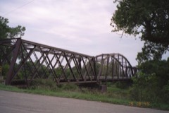 | Republican River Pegram Truss | structure | 1990 | 89002190 |
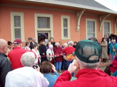 | Union Pacific Railroad Depot | building | 2004 | 03001465 |
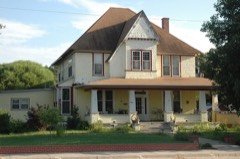 | Charles W. Van De Mark House | building | 1985 | 85001492 |
Every wildfire the federal occurrence database records inside this county: 35 of them, burning about 2,038 acres. None started naturally and none was recorded as arson. Each settlement page carries the fires within five miles of it.
| Reported cause | Fires |
|---|---|
| Missing data/not specified/undetermined | 19 |
| Debris and open burning | 7 |
| Equipment and vehicle use | 5 |
| Smoking | 3 |
| Fireworks | 1 |
The five largest, by the area the report gives. None of them was recorded as arson.
| Date | Cause | Size | Reported by | Name on the report |
|---|---|---|---|---|
| 20 March 2015 | Debris and open burning | 1,500 acres | Kansas Forest Service | 6 |
| 18 February 2017 | Debris and open burning | 130 acres | Republic County | 1700003 |
| 5 April 2018 | Debris and open burning | 60 acres | Kansas Forest Service | 3 |
| 20 February 2016 | Smoking | 52 acres | Kansas Forest Service | 2 |
| 3 October 2015 | Missing data/not specified/undetermined | 30 acres | Kansas Forest Service | 113 |
| 21 February 2015 | Missing data/not specified/undetermined | 30 acres | Kansas Forest Service | 1 |
| 3 April 2015 | Missing data/not specified/undetermined | 30 acres | Kansas Forest Service | 108 |
| 6 March 2017 | Debris and open burning | 30 acres | Cloud County | 4 |
Every settlement page carries the fires within five miles of it - see the settlement index below.
The NOAA Storm Events Database holds 756 reports for this county, causing 1 death, 14 injuries and about $34,492,780 in recorded property damage. Each settlement page carries the reports that name it.
| Kind of event | Reports |
|---|---|
| Hail | 401 |
| Thunderstorm Wind | 279 |
| Tornado | 52 |
| Flash Flood | 16 |
| Funnel Cloud | 3 |
| Flood | 3 |
| Lightning | 2 |
The most serious of them, by death, then injury, then recorded damage. The accounts are quoted exactly as the forecast office filed them.
| When | Event | Place named | Harm | What the report says |
|---|---|---|---|---|
| June 1967 | Tornado (F2) | not stated | 1 killed, 5 hurt, $2,500,000 | no account filed |
| July 1992 | Thunderstorm Wind | not stated | 6 hurt | no account filed |
| November 1960 | Tornado (F3) | not stated | 2 hurt, $250,000 | no account filed |
| May 1950 | Tornado (F1) | not stated | 1 hurt, $25,000 | no account filed |
| September 1973 | Tornado (F3) | not stated | $25,000,000 | no account filed |
| June 1967 | Tornado (F2) | not stated | $2,500,000 | no account filed |
| May 2004 | Tornado (F2) | Jamestown | $2,100,000 | A tornado touched down 4 miles westnorthwest of Jamestown and moved eastnorteast before dissipating 3 miles northnorthwest of Jamestown. Large trees and power poles were downed. A number of farms along the route had significant damage. |
| June 1992 | Tornado (F1) | not stated | $250,000 | no account filed |
| June 1992 | Tornado (F1) | not stated | $250,000 | no account filed |
| June 1992 | Tornado (F1) | not stated | $250,000 | no account filed |
| March 1990 | Tornado (F1) | not stated | $250,000 | no account filed |
| September 1973 | Tornado (F2) | not stated | $250,000 | no account filed |
| May 1957 | Tornado (F4) | not stated | $250,000 | no account filed |
| May 2004 | Tornado (F1) | Jamestown | $175,000 | A tornado touched down in rural areas near Jamestown. The tornado destroyed one house and heavily damaged three others along its 4 mile path. Two sheds were flattened, one of which fell onto two pickup trucks destroying both vehicles. Many power lines were downed. Some irrigation units were toppled. |
| July 2007 | Flash Flood | Clyde | $50,000 | Water six inches deep reported to be flowing across 260th road. Several other rural roads in the Clyde area water covered or barricaded. Coop observer reported nearly 6 inches of rain. |
| April 1994 | Thunderstorm Wind | not stated | $50,000 | Sixty mph winds blew an empty tractor semi-trailer off the road causing it to overturn. |
| August 1993 | Hail | Concordia | $50,000 | no account filed |
| August 1993 | Hail | Aurora | $50,000 | no account filed |
| May 2004 | Thunderstorm Wind | Jamestown | $30,000 | Strong thunderstorm winds damaged a 40 foot by 80 foot shop building in Jamestown. |
| July 1996 | Thunderstorm Wind | Concordia | $30,000 | no account filed |
| February 2004 | Thunderstorm Wind | Glasco | $28,000 | strong winds destroyed several outbuildings and a shed at a farmstead. A shed and pickup camper in it were also destroyed. |
| June 1990 | Tornado (F1) | not stated | $25,000 | no account filed |
| June 2004 | Hail | Clyde | $23,000 | Large hail damed power transformers doing extensive damage. |
| May 2004 | Thunderstorm Wind | Concordia | $15,000 | Strong thunderstorm winds ripped shingles off houses and downed trees in a 4 mile path near Concordia. |
| July 2011 | Thunderstorm Wind | Concordia | $10,000 | Near Clyde, a front porch was ripped off of a new construction home. Also half of a tin roof was ripped off, brick and mortar cracked on all four corners of house, and some rafters cracked and split. A 53 foot trailer was blown onto its side with all the contents spilled-out. Windows were blown out of an old house with steel rod posts and pipes sheered off. The barn roof was lifted up and rafters were broken in the metal shed. The ASOS station at Concordia measured a 67 mph wind gust prior to most of the damage occurring. |
| June 2010 | Thunderstorm Wind | Jamestown | $10,000 | Concordia ASOS reported a 75 mph wind gust. Also multiple large trees uprooted onto streets making them impassible. One tree fell on a house causing damage. Power lines also fell and pulled meters out from houses. In Jamestown a 3 foot diameter hackberry tree blew onto a house. |
| May 1996 | Hail | Concordia | $10,000 | no account filed |
| April 2001 | Thunderstorm Wind | Concordia | $6,000 | Thunderstorm winds damaged outbuildings on a farm. |
| May 1995 | Hail | Concordia | $5,000 | no account filed |
| July 1994 | Thunderstorm Wind | not stated | $5,000 | no account filed |
| July 2002 | Thunderstorm Wind | Jamestown | $4,000 | Strong winds knocked street lights off poles. |
| July 2011 | Thunderstorm Wind | Macyville | $3,000 | Three 12 inch diameter tree limbs were broken from outflow winds. Tin from a shed was also blown into a field. |
| May 2010 | Thunderstorm Wind | Clyde | $3,000 | A total of 3 power poles were snapped off. |
| July 1992 | Tornado (F0) | not stated | $2,500 | no account filed |
| April 1991 | Tornado (F0) | not stated | $2,500 | no account filed |
| July 1988 | Tornado (F0) | not stated | $2,500 | no account filed |
| June 1987 | Tornado (F0) | not stated | $2,500 | no account filed |
| June 1987 | Tornado (F0) | not stated | $2,500 | no account filed |
| April 1974 | Tornado (F1) | not stated | $2,500 | no account filed |
| June 1972 | Tornado (F0) | not stated | $2,500 | no account filed |
| August 1966 | Tornado (F0) | not stated | $2,500 | no account filed |
| July 1953 | Tornado (F0) | not stated | $2,500 | no account filed |
| May 1951 | Tornado (F1) | not stated | $2,500 | no account filed |
| July 1951 | Tornado | not stated | $2,500 | no account filed |
| October 2002 | Thunderstorm Wind | Jamestown | $2,000 | Strong winds blew off shed doors and damaged them. |
| April 2001 | Thunderstorm Wind | Miltonvale | $2,000 | Strong thunderstorm winds damaged several farm houses and took down trees. |
| August 1999 | Lightning | Concordia | $1,000 | Lightning struck the city library in Concordia and ignited a fire which did minor damage. |
| June 1994 | Hail | Jamestown | $500 | no account filed |
| June 1994 | Hail | Concordia | $500 | no account filed |
| June 1994 | Hail | Jamestown | $500 | no account filed |
| June 1994 | Hail | Agenda | $500 | no account filed |
| June 1994 | Hail | Concordia | $500 | no account filed |
| September 1993 | Hail | Clyde | $500 | no account filed |
| May 1972 | Tornado (F0) | not stated | $250 | no account filed |
| June 1983 | Tornado (F0) | not stated | $30 | no account filed |
| April 2026 | Thunderstorm Wind | Macyville | - | Hail to nickel size was also covering the ground. |
| April 2026 | Hail | Miltonvale | - | Hail was covering the ground. |
| March 2025 | Hail | Catlin | - | Ping pong ball size hail. |
| May 2025 | Thunderstorm Wind | (Cnk)Blosser Apt Con | - | Concordia asos station KCNK measured gust. |
| June 2025 | Thunderstorm Wind | Macyville | - | Personal weather station. |
Named settlements recorded in the Geographic Names Information System, each with the topographic sheets covering it. Villages, hamlets and abandoned places alike. Each is shown with the nearest named watercourse or landform and the survey quadrangle it falls on.
Nelson township · 66901 · On East Branch Oak Creek · Rice quadrangle
13 sheets, 1892 to 1985
Grant township · 66948 · On Little Cheyenne Creek · Jamestown quadrangle
13 sheets, 1892 to 1985
Grant township · 66948 · On Skunk Creek · Jamestown NW quadrangle
13 sheets, 1892 to 1985
No longer a settlement
The vanished settlements of Cloud County: the places named above that are no longer on the map.