Block
From the record
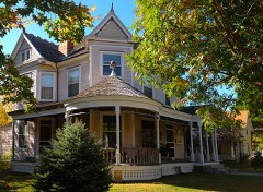
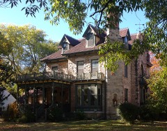
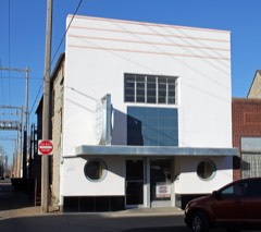
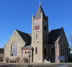
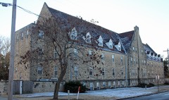
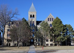
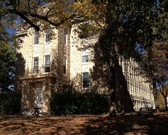
26 National Register listings published here.
Sources: the National Register database, National Park Service
51 topographic sheets cover 32 settlements here, and 26 properties are on the National Register of Historic Places.
26 National Register listings published here.
Sources: the National Register database, National Park Service
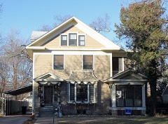
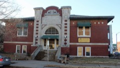
Every property in this county listed on the National Register of Historic Places, with the year it was listed and the federal nomination document.
Every wildfire the federal occurrence database records inside this county: 634 of them, burning about 44,039 acres. 6 started naturally and 25 were recorded as arson. Each settlement page carries the fires within five miles of it.
| Reported cause | Fires |
|---|---|
| Debris and open burning | 272 |
| Missing data/not specified/undetermined | 195 |
| Equipment and vehicle use | 66 |
| Arson/incendiarism | 25 |
| Other causes | 18 |
| Recreation and ceremony | 17 |
| Power generation/transmission/distribution | 15 |
| Smoking | 15 |
| Natural | 6 |
| Fireworks | 5 |
The five largest, by the area the report gives. None of them was recorded as arson.
| Date | Cause | Size | Reported by | Name on the report |
|---|---|---|---|---|
| 4 March 2016 | Missing data/not specified/undetermined | 25,650 acres | Cowley County | FERGUSON RANCH |
| 11 November 2015 | Power generation/transmission/distribution | 6,400 acres | Kansas Forest Service | 63 |
| 1 March 2006 | Missing data/not specified/undetermined | 3,000 acres | Kansas Counties | MAPLE CITY |
| 8 April 2009 | Missing data/not specified/undetermined | 1,000 acres | Kansas Counties | 141ST ROAD |
| 12 March 2006 | Missing data/not specified/undetermined | 700 acres | Kansas Counties | KAUFMAN RANCH |
| 6 February 2009 | Missing data/not specified/undetermined | 640 acres | Kansas Counties | FERGUSON RANCH |
| 12 April 2006 | Missing data/not specified/undetermined | 450 acres | Kansas Counties | 52ND STREET |
| 9 April 2009 | Missing data/not specified/undetermined | 320 acres | Kansas Counties | 111TH ROAD |
Every settlement page carries the fires within five miles of it - see the settlement index below.
The NOAA Storm Events Database holds 1,414 reports for this county, causing 77 deaths, 300 injuries and about $59,175,480 in recorded property damage. Each settlement page carries the reports that name it.
| Kind of event | Reports |
|---|---|
| Hail | 718 |
| Thunderstorm Wind | 504 |
| Tornado | 89 |
| Flash Flood | 44 |
| Heavy Rain | 29 |
| Flood | 18 |
| Lightning | 12 |
The most serious of them, by death, then injury, then recorded damage. The accounts are quoted exactly as the forecast office filed them.
| When | Event | Place named | Harm | What the report says |
|---|---|---|---|---|
| May 1955 | Tornado (F5) | not stated | 75 killed, 270 hurt, $250,000 | no account filed |
| April 1956 | Tornado (F4) | not stated | 1 killed, 6 hurt, $2,500,000 | no account filed |
| April 1991 | Tornado (F4) | not stated | 1 killed, $25,000,000 | no account filed |
| March 1991 | Tornado (F3) | not stated | 6 hurt, $2,500,000 | no account filed |
| October 1980 | Tornado (F3) | not stated | 4 hurt, $2,500,000 | no account filed |
| May 1993 | Thunderstorm Wind | Arkansasa City | 3 hurt, $5,000,000 | Arkansas City was hit with winds greater than 80 miles an hour. Four mobile homes were destroyed, four had major damage and another six received minor damage. A mobile home was also destroyed five miles east of town. Three people suffered minor injuries. One site-built home was also destroyed and 30 others had damage. Major damage was centered in the 700 and 800 blocks of 6th, 7th and 8th Streets. Estimated damage in Arkansas City totalled nearly $1 million. |
| March 1965 | Tornado (F4) | not stated | 3 hurt, $250,000 | no account filed |
| April 1999 | Thunderstorm Wind | Winfield | 2 hurt, $250,000 | In southeast Winfield, one barn was blown off it's foundation, slamming into the west wall of a home. One couple sustained minor injuries due to broken glass. Three other barns also sustained damage. A second house, 9 miles southeast of Winfield, sustained damage to siding. In addition, seven mobile homes sustained damage including one that was destroyed. |
| June 1996 | Thunderstorm Wind | Winfield | 2 hurt, $5,000 | no account filed |
| July 2011 | Thunderstorm Wind | Arkansas City | 2 hurt, $3,000 | A fireworks tent was blown over on the state line south of Arkansas City, injuring two tent workers (direct). |
| July 1994 | Thunderstorm Wind | Rock | 1 hurt, $5,000,000 | Ninety to 115 mph winds hit the Burden area. Big trees were uprooted, a horse barn collapsed and grain bins were destroyed. In Atlanta, a mobile home was blown over and demolished. A man inside at the time sustained a punctured lung and concussion and was hospitalized in fair condition. The winds, estimated at 85 mph, collapsed two brick walls and caused considerable tree damage. Sixty mph winds occurred in Cambridge and were estimated up to 80 mph in Rock where golf ball-size hail fell. The Winfield cooling tower sustained $103 thousand damage from 70 mph winds and there was heavy damage to the roof of Dexter High School. |
| April 1984 | Tornado (F1) | not stated | 1 hurt, $25,000 | no account filed |
| May 1981 | Tornado (F2) | not stated | $2,500,000 | no account filed |
| March 1973 | Tornado (F2) | not stated | $2,500,000 | no account filed |
| June 2007 | Thunderstorm Wind | Arkansas City | $1,500,000 | Straight line winds produced widespread damage across the Arkansas City area. The strong winds downed numerous trees and power lines/poles, inflicted roof damage to several homes and businesses, and blew over a few semi trailers. Several grave stones at the local cemetary were damaged, and 69 power poles and 24 transformers were damaged or destroyed across the Arkansas City area.| |
| April 1996 | Thunderstorm Wind | Arkansas City | $1,500,000 | no account filed |
| July 2009 | Thunderstorm Wind | Rock | $1,000,000 | Large grain bins along Highway 77 about 5 miles south of Rock were heavily damaged. One grain bin collapsed completely, and the top half of another bin caved in substantially. Additionally, numerous trees were downed across mainly western portions of the county. |
| June 1998 | Tornado (F0) | Udall | $500,000 | One barn and a few houses damaged. |
| June 1998 | Tornado (F0) | Burden | $500,000 | Minor damage inflicted to a few homes on south side of Burden. |
| April 1996 | Thunderstorm Wind | Arkansas City | $500,000 | no account filed |
| July 2007 | Flash Flood | Winfield | $320,000 | Extremely heavy rainfall from the end of June into early July caused flash flooding throughout Cowley County. The flash flooding and the ensuing river flooding resulted in roughly 320 thousand dollars in damage. Major flooding was observed on the Walnut River at Winfield with a crest of 35.79 feet recorded the evening of July 1st. This was 17.79 feet above flood stage. The Walnut River at Winfield remained above flood stage until July 3rd. Moderate flooding was also observed on the Walnut River and the Arkansas River at Arkansas City. |
| April 1999 | Thunderstorm Wind | Winfield | $300,000 | Rubbermaid plant lost 100 feet of roofing. |
| September 2008 | Flood | Winfield | $255,000 | Rapidly rising water along the Walnut River caused the Winfield Fairgrounds to flood. This flood caused the rapid evacuation of thousands of campers who had come to claim thier spot for the annual Walnut Valley Festival. Muddy conditions caused by up to 3.50 inches of rainfall lead to many of the campers to be pulled or towed out of the effected area. The water inundated the main grandstand and most of the stages, causing superfical damage but mainly caused some minor road damage. |
| September 2008 | Flash Flood | Udall | $250,000 | Cowley Highway 3 had water over the road 4 miles south of Udall. |
| March 1991 | Tornado (F3) | not stated | $250,000 | no account filed |
| May 2010 | Tornado (EF1) | Arkansas City | $200,000 | The tornado caused damage to a storage shed and peeled back several roofs. One roof that was peeled back was to a bait shop, one wall was also partially collapsed. |
| April 2009 | Flood | Udall | $200,000 | Continued runoff from very heavy rainfall during the afternoon, evening and overnight hours on the 26th produced river flooding from the early afternoon hours on the 27th into the morning hours on the 29th along the Arkansas and Walnut Rivers, and their associated tributaries. Several rural and some city roads were closed due to high water. The Cowley county fairgrounds in Winfield were inundated by portions of the swollen Walnut River, including some buildings on the grounds. Property damage amounts are rough estimates, and crop damage estimates are unknown. The Winfield Courier contributed to this report. |
| June 1998 | Hail | Udall | $200,000 | Softball to grapefruit-sized hail smashed windows and inflicted roof and siding damage to at least 20 homes. Also, at least 20 cars sustained broken windows. |
| August 2006 | Thunderstorm Wind | Arkansas City | $175,000 | A short duration Microburst produced the following damage. A roof was blown off of the teen center. Numerous power lines were downed. About 500 customers without power. |
| June 2009 | Tornado (EF0) | Silverdale | $150,000 | Tornado moving east near Maple City caused damage to a homestead. The house and barn sustained damage to the roof. All the windows were blown out of the cars, and a horse trailer was overturned. |
| March 2008 | Thunderstorm Wind | Udall | $135,000 | Thunderstorm wind gusts caused extensive damage to several locations along the path of the channeled microburst. Damage included but was not limited to, blowing the second story of a barn off, tearing the front portion of a homes roof off, caving in part of a silo, flipping a plane over at the air strip, and completely destroying a metal pole barn. |
| September 2010 | Thunderstorm Wind | Winfield | $132,000 | Damaging winds from the rear flank downdraft of a supercell thunderstorm tore across portions of Winfield, laying out a path of destruction from north of Winfield, Kansas, to the east side of downtown. A trailer was destroyed northwest of Winfiled. A church on the east side of town lost a portion of its roof, which flew off the building and pierced the side of a sport utility vehicle that was parked nearby. A stout awning was also blown off a building on the east side of town, and numerous tree branches were knocked down as well. A good portion of the town was left without power. |
| June 2009 | Thunderstorm Wind | Maple City | $130,000 | Twenty-one power poles were downed along 282nd Road near K-15. |
| August 2017 | Thunderstorm Wind | Arkansas City | $125,000 | Twenty five power poles were snapped. |
| June 2008 | Tornado (EF1) | Winfield | $125,000 | The tornado moved southeast and caused damage to three homesteads. One of the homes along 151st Road had the most extensive damage, including a 5th wheel camper thrown 75 feet and destroyed, a 500 gallon propane tank overturned. The tornado also caused damage to the home and garage, and damage to two outbuildings and several vehicles. |
| June 2009 | Thunderstorm Wind | Winfield | $120,000 | Tree limbs and power poles were bent over or downed across southern portions of Winfield. Roof damage occurred to a business in downtown Winfield, resulting in the eventual demolition of the structure by city crews. Additionally, an 18 x 20 foot metal garage was destroyed. The Arkansas City Traveler contributed to this report. |
| February 2012 | Thunderstorm Wind | Winfield Arpt | $100,000 | Measured at Winfield Strother Field Airport. Extensive damage occurred to the terminal building, peeling off large sections of the roof. Additionally, a large 100-foot tall sign received some damaged. Information courtesy of the Arkansas City Traveler. |
| August 2009 | Lightning | Silverdale | $100,000 | A rural home a few miles east of Arkansas City was destroyed by fire after being hit by lightning during the early morning hours. No one was injured. The Winfield Daily Courier contributed to this report. |
| June 2008 | Thunderstorm Wind | Winfield | $100,000 | Two 80,000 bushel grain bins were blown over. |
| May 1998 | Thunderstorm Wind | Winfield | $100,000 | Substantial damage to homes, a hospital, temporary storage structures, campers and vehicles. Widespread tree damage and downed power lines. Damage also occurred at nearby Strother Field and at Rock where nine steel bins were damaged with one blown over. |
| June 2008 | Thunderstorm Wind | Winfield Arpt | $75,000 | The roof to the Workforce Development Building at Strother Field Airport was blown off. An unofficial wind gust of 112 mph was recorded from a General Electric weather station. The official NWS observation at the airport measured 71 mph. |
| July 2005 | Thunderstorm Wind | Winfield | $75,000 | Parked semi-truck blown on top of parked Honda Odyssey mini-van. (Narrative courtesy of Winfield Daily Courier.) |
| July 1997 | Thunderstorm Wind | Rock | $75,000 | BARN BLOWN DOWN, MOBILE HOME ROLLED OVER, NUMEROUS TREES BLOWN DOWN. |
| April 2016 | Thunderstorm Wind | Maple City | $50,000 | Microburst winds removed a large portion of the roof and porch of a modular home. Eight trees were also blown down or severely damaged. |
| February 2012 | Thunderstorm Wind | Winfield Arpt | $50,000 | A farmstead was badly damaged southwest of Strother Field. Winds estimated around 85 mph destroyed a wood-frame garage, raised the home's roof six inches, and damaged the kitchen cabinets. The winds also tore off the roof of a metal hay barn and a horse pen. Information courtesy of the Arkansas City Traveler. |
| August 2011 | Lightning | Arkansas City | $50,000 | Lightning struck a shed in northwest Arkansas City during the predawn hours on the 10th. Fire from the burning shed spread to an adjacent home, catching that residence on fire. In addition to the shed, the east side of the house was a total loss, including a back room and the kitchen. While the rest of the house was saved, including the living room, dining room and bedrooms, there was extensive damage throughout the building. Most of the belongings were salvageable. No one was injured in this incident. Property damage amounts are rough estimates. The Arkansas City Traveler was the sole contributor to this report. |
| August 2010 | Lightning | Dexter | $50,000 | Fire from a lightning strike destroyed a barn during the evening hours on the 31st. The contents of the barn were also destroyed, including saddles, a four-wheeler and a quantity of hay. The Winfield Daily Courier contributed to this report. |
| June 2008 | Thunderstorm Wind | Arkansas City | $50,000 | Numerous trees and several power poles were downed due to the high winds. |
| June 2005 | Tornado (F1) | Arkansas City | $50,000 | One farmstead hit. The home was partially unroofed with unspecified damage to a barn. |
| October 2001 | Thunderstorm Wind | Winfield | $50,000 | Trailer home flipped over and destroyed. Time estimated based on timing of 0.88 inch hail at Burden. |
| May 1993 | Thunderstorm Wind | New Salem | $50,000 | Event began on 5/8/93 and ended on 5/15/93. Heavy rains faling over already saturated ground caused maily low land and agricultural flooking along the Smoky Hill River and Chapman Creek. These conditions persisted for several days which kept water levels kept water levels above flood stage. Most of the damage was agricultural but persons living along the Smoky Hill River and Chapman Creek had to be evacuated and damage was done to their homes. Many county roads were underwater and had to be closed. |
| October 1993 | Hail | Rock | $50,000 | no account filed |
| March 1993 | Hail | Winfield | $50,000 | no account filed |
| July 2009 | Thunderstorm Wind | Udall | $40,000 | Three barns were destroyed near the intersection of 102nd and 51st road. |
| June 2008 | Thunderstorm Wind | Burden | $35,000 | A tree was blown onto a house causing damage to the house. Also several power poles were blown down. |
| June 2007 | Flash Flood | Arkansas City | $35,000 | Cowley County Emergency Management reported a water rescue near Cowley County State Lake along Highway 166. Emergency crews rescued two individuals who became trapped in a camper on the east side of the lake. The rising water went into the windows of the camper. |
| June 2019 | Flash Flood | Winfield Arpt | $30,000 | Emergency management reported flash flooding occurring at Strother Field. Estimates from photos showed cars sitting submerged in about one foot of water in the parking lot. |
| July 2009 | Thunderstorm Wind | Udall | $30,000 | A barn was destroyed near the intersection of 51st and 52nd Road. |
| April 1999 | Lightning | Arkansas City | $30,000 | Lightning struck a home, setting it ablaze. |
| June 2008 | Thunderstorm Wind | Winfield | $27,000 | Thunderstorm winds knocked down several power poles northeast of Winfield as well as west of Burden. |
The Survey's mineral resources record lists 6 workings inside this county. 5 still produce and 1 is closed or unrecorded. Each settlement page carries the workings within five miles of it.
| Commodity | Workings |
|---|---|
| Sand and Gravel, Construction | 3 |
| Stone, Dimension | 2 |
| Stone, Crushed/Broken | 1 |
The least common of them first, because a county's hundredth gravel pit says nothing its first ten did not.
| Where | Site | Commodity | Status | Recorded |
|---|---|---|---|---|
| Daniels Rock Quarry & Mill | Stone, Crushed/Broken | Unknown | ||
| Dowler Quarry & Mill | Stone, Dimension | Producer | ||
| Elam Quarry | Stone, Dimension | Producer | ||
| Haynes Sand & Gravel Pit & Plant | Sand and Gravel, Construction | Producer | ||
| Mcfarland Sand & Gravel Pit & Plant | Sand and Gravel, Construction | Producer | ||
| Oxford Sand & Gravel Pit | Sand and Gravel, Construction | Producer |
Named settlements recorded in the Geographic Names Information System, each with the topographic sheets covering it. Villages, hamlets and abandoned places alike. Each is shown with the nearest named watercourse or landform and the survey quadrangle it falls on.
Arkansas City city · 67005 · On Spring Creek · Arkansas City quadrangle
15 sheets, 1890 to 1985
Silverdale township · 67005 · On Silver Creek · Maple City quadrangle
13 sheets, 1889 to 1985
Liberty township · 67038 · On Crabb Creek · Eaton quadrangle
14 sheets, 1889 to 1985
No longer a settlement
Harvey township · 67023 · On Ferguson Creek · Cambridge NE quadrangle
13 sheets, 1889 to 1985
No longer a settlement
Pleasant Valley township · 67005 · Silverdale quadrangle
13 sheets, 1889 to 1985
No longer a settlement
Silverdale township · 67005 · On Otter Creek · Silverdale quadrangle
13 sheets, 1889 to 1985
Otter township · 67024 · On South Cedar Creek · Cedar Vale West quadrangle
14 sheets, 1889 to 1985
The vanished settlements of Cowley County: the places named above that are no longer on the map.