 Block
From the record
3 National Register listings published here, 1 of them a National Historic Landmark.
Sources: the National Register database, National Park Service
22 topographic sheets cover 4 settlements here, and 3 properties are on the National Register of Historic Places.
3 National Register listings published here, 1 of them a National Historic Landmark.
Sources: the National Register database, National Park Service
Every property in this county listed on the National Register of Historic Places, with the year it was listed and the federal nomination document.
| Photograph | Property | Type | Listed | Reference |
|---|---|---|---|---|
 | Grant County Courthouse District | district | 2002 | 02000396 |
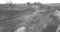 | Lower Cimarron Spring | site | 1966 | 66000344 |
| Lower Cimarron Spring (Boundary Increase) | site | 2013 | 13000728 |
Every wildfire the federal occurrence database records inside this county: 22 of them, burning about 64 acres. None started naturally and none was recorded as arson. Each settlement page carries the fires within five miles of it.
| Reported cause | Fires |
|---|---|
| Missing data/not specified/undetermined | 12 |
| Fireworks | 4 |
| Debris and open burning | 3 |
| Equipment and vehicle use | 2 |
| Smoking | 1 |
The five largest, by the area the report gives. None of them was recorded as arson.
| Date | Cause | Size | Reported by | Name on the report |
|---|---|---|---|---|
| 6 December 2015 | Missing data/not specified/undetermined | 50 acres | Kansas Forest Service | 91 |
| 30 January 2016 | Missing data/not specified/undetermined | 10 acres | Kansas Forest Service | 11 |
| 5 July 2015 | Fireworks | 2.0 acres | Kansas Forest Service | 57 |
| 3 May 2015 | Missing data/not specified/undetermined | 1.0 acres | Kansas Forest Service | 32 |
| 30 January 2017 | Debris and open burning | under an acre | Grant County | 8 |
| 15 October 2016 | Debris and open burning | under an acre | Kansas Forest Service | 97 |
| 15 October 2016 | Debris and open burning | under an acre | Kansas Forest Service | 96 |
| 6 April 2015 | Missing data/not specified/undetermined | under an acre | Kansas Forest Service | 26 |
Every settlement page carries the fires within five miles of it - see the settlement index below.
The NOAA Storm Events Database holds 553 reports for this county, causing no deaths, 10 injuries and about $6,958,780 in recorded property damage. Each settlement page carries the reports that name it.
| Kind of event | Reports |
|---|---|
| Hail | 332 |
| Thunderstorm Wind | 166 |
| Tornado | 28 |
| Heavy Rain | 12 |
| Flash Flood | 6 |
| Flood | 5 |
| Funnel Cloud | 2 |
| Lightning | 1 |
| Dust Devil | 1 |
The most serious of them, by death, then injury, then recorded damage. The accounts are quoted exactly as the forecast office filed them.
| When | Event | Place named | Harm | What the report says |
|---|---|---|---|---|
| June 1951 | Tornado (F3) | not stated | 3 hurt, $25,000 | no account filed |
| June 1951 | Tornado (F2) | not stated | 3 hurt, $2,500 | no account filed |
| June 1990 | Tornado (F2) | not stated | 2 hurt, $2,500,000 | no account filed |
| June 1996 | Thunderstorm Wind | Ulysses | 2 hurt, $1,000,000 | no account filed |
| May 1977 | Tornado (F2) | not stated | $2,500,000 | no account filed |
| May 2005 | Tornado (F2) | Ulysses | $350,000 | This tornado traveled into Kearny county before roping out. At 2ne of Ulysses part of a barn roof was blown off and a large tree was uprooted. Several horses were slightly injured. Then at 5ne of Ulysses an abandoned mobile home was destroyed. At six miles northeast of Ulysses, two pivot sprinklers were mangled, large trees were snapped at the base and several power poles were destroyed. Several grain bins (full of wheat) were completely swept away and the grain was scattered for some distance. Remnants of the grain bins were not found in the local vicinity. Farther northeast along the track several more pivot sprinklers were destroyed. It is estimated that if this tornado had made a direct hit, it would have likely caused at least high-end F3 damage. |
| April 2001 | Tornado (F2) | Ulysses | $235,000 | Tornado crossed into Grant county from Stevens county at 1647. Three pivot sprinklers were destroyed, 2 grain bins, a silo, machine shed and horse trailer were also damaged or destroyed. A roof was taken off a building and an empty rail car was overturned. |
| September 1996 | Thunderstorm Wind | Ulysses | $100,000 | no account filed |
| June 2005 | Tornado (F1) | Ulysses | $50,000 | This tornado kicked up a lot of dirt and debris (tumble weeds). One pivot sprinkler was damaged. This tornado moved into Kearny county. |
| October 2006 | Tornado (F1) | Ulysses | $40,000 | This tornado moved west towards and into the city of Ulysses damaging the roof of the hospital and causing some tree damage. |
| June 1996 | Thunderstorm Wind | Ulysses | $25,000 | no account filed |
| May 1991 | Tornado (F1) | not stated | $25,000 | no account filed |
| May 1981 | Tornado (F1) | not stated | $25,000 | no account filed |
| May 2001 | Thunderstorm Wind | Ulysses | $20,000 | Roof blown off a house and a semi truck was blown over. No injuries. |
| June 2000 | Thunderstorm Wind | Ulysses | $15,000 | Roof blown off a house and also off a trailer house. Powe poles blown down. |
| June 1998 | Thunderstorm Wind | Ulysses | $15,000 | Dry microburst produced high wind that took the roof off of one house and damaged numerous trees and power lines. Wind was probably over 100 knots. |
| June 2009 | Thunderstorm Wind | Columbian Carbon | $8,000 | The high wind took the roof off a hay barn and several pole barn roofs were destroyed. |
| September 2001 | Thunderstorm Wind | Ulysses | $5,000 | The wind damaged irrigation pipes and took down power poles. |
| May 1998 | Thunderstorm Wind | Hickok | $5,000 | Several power poles taken down by the wind. |
| May 1993 | Tornado (F1) | Hugoton | $5,000 | Tornado that was in Stevens County moved into southern Grant County. Tornado roped out two miles north of the Stevens/Grant County line. A well pumping house 16 miles northeast of Hugoton was destroyed. |
| April 1951 | Tornado (F0) | not stated | $2,500 | no account filed |
| July 2011 | Thunderstorm Wind | Stano Station | $2,000 | Two power poles were blown down near mile marker 56 on highway 160. |
| June 2009 | Thunderstorm Wind | Columbian Carbon | $1,200 | Real Flank downdraft winds blew two power poles down. |
| April 2008 | Thunderstorm Wind | Ulysses | $1,000 | Two power poles were blown down. |
| July 2008 | Thunderstorm Wind | Ulysses Arpt | $1,000 | A power pole was blown down. |
| June 2003 | Thunderstorm Wind | Ulysses | $500 | Large grain car was blown over. |
| June 1994 | Hail | Ulysses | $50 | no account filed |
| May 1977 | Tornado (F0) | not stated | $30 | no account filed |
| May 2025 | Hail | Stano Station | - | A storm chaser reported 2 inch hail. |
| May 2025 | Hail | Ulysses Arpt | - | A public report of 1.25 inch hail. |
| August 2025 | Thunderstorm Wind | Ulysses | - | A mesonet site recorded a 81 mph wind gust. |
| August 2025 | Thunderstorm Wind | Ulysses | - | A public report of a 63 mph wind gust. |
| July 2025 | Thunderstorm Wind | Ulysses | - | Measured at the Ambient Weather Network site Videra. |
| July 2025 | Hail | Ulysses | - | One inch diameter hail was reported by the public. |
| July 2025 | Thunderstorm Wind | Ulysses Arpt | - | Measured by the AWOS station at Ulysses. |
| July 2025 | Thunderstorm Wind | Ulysses | - | Public report of a 80 mph wind gust. |
| July 2025 | Thunderstorm Wind | Ulysses | - | Emergency manager reported downed 4 to 6 inch tree limbs. |
| July 2025 | Thunderstorm Wind | Ulysses | - | Public report of a bunch of big branches snapped blocking the road city had to come out with equipment and remove them. |
| August 2025 | Thunderstorm Wind | Ulysses | - | Personal weather station Ambient Weather Network site: Videra Weather recorded a 75 mph gust. |
| May 2024 | Hail | Hickok | - | Dimes to Nickels mostly , with a few Quarter size hailstones were reported. |
| May 2024 | Hail | Hickok | - | Quarter to half dollar size hail was reported. |
| July 2024 | Thunderstorm Wind | Ulysses Arpt | - | Strong thunderstorm wind gusts were measured at the Ulysses Airport. |
| July 2024 | Thunderstorm Wind | Ulysses Arpt | - | Measured at the Ulysses Airport. |
| April 2024 | Thunderstorm Wind | Ulysses | - | Video of gustnado. |
| February 2023 | Hail | Ulysses | - | Report received through social media with photos. |
| May 2023 | Tornado (EF0) | Columbian Carbon | - | Land spouts reported 5 miles west of Sublette. |
| June 2023 | Flash Flood | Hickok | - | Report of a road flooding and vehicle stranded along county road 5. |
| June 2023 | Tornado (EF0) | Stano Station | - | Public report confirmed tornado north of Big Bow. |
| May 2021 | Thunderstorm Wind | Ulysses Arpt | - | Reported at the Ulysses airport. |
| May 2021 | Thunderstorm Wind | Ulysses Arpt | - | Observed at the Ulysses airport. |
| July 2021 | Heavy Rain | Ulysses Arpt | - | Rainfall of over 2 inches was observed. |
| May 2020 | Thunderstorm Wind | Ulysses Arpt | - | There was considerable (but not specified) damage to a structure at the feedlot. |
| July 2020 | Heavy Rain | Ulysses | - | Rainfall of 3.50 inches was observed. |
| June 2019 | Tornado (EF0) | Ulysses Arpt | - | Numerous persons videotaped this landspout tornado. |
| May 2019 | Flash Flood | Ulysses | - | Flooding across many streets of Ulysses. |
| May 2019 | Flash Flood | Ulysses | - | Water on some streets was 3 feet deep stranding some motorists. |
| May 2019 | Funnel Cloud | Ulysses | - | A small funnel cloud was visible underneath a shower. |
| May 2019 | Flash Flood | Stano Station | - | Widespread field flooding with water across several county roads. |
| August 2019 | Thunderstorm Wind | Hickok | - | Two to three inch diameter tree branches were broken by the high wind. |
| June 2018 | Thunderstorm Wind | Hickok | - | Large tree limbs were broken and blown down. |
Named settlements recorded in the Geographic Names Information System, each with the topographic sheets covering it. Villages, hamlets and abandoned places alike. Each is shown with the nearest named watercourse or landform and the survey quadrangle it falls on.