 Block
From the record
12 National Register listings published here.
Sources: the National Register database, National Park Service
77 topographic sheets cover 27 settlements here, and 12 properties are on the National Register of Historic Places.
12 National Register listings published here.
Sources: the National Register database, National Park Service
Every property in this county listed on the National Register of Historic Places, with the year it was listed and the federal nomination document.
| Photograph | Property | Type | Listed | Reference |
|---|---|---|---|---|
 | Eureka Atchison, Topeka and Santa Fe Railroad Depot | building | 2013 | 12001119 |
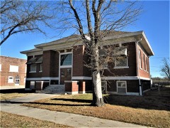 | Eureka Carnegie Library | building | 1988 | 88001170 |
| Eureka Downtown Historic District | district | 2019 | 100004458 | |
| Greenwood Cemetery and Mausoleum | site | 2020 | 100004925 | |
 | Greenwood Hotel | building | 2006 | 06000769 |
 | Paul Jones Building | building | 2012 | 12000247 |
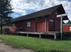 | Madison Atchison, Topeka and Santa Fe Railroad Depot | building | 1991 | 91001774 |
| North Branch Otter Creek Bridge | structure | 1985 | 85001426 | |
 | Robertson House | building | 2011 | 10001207 |
 | US Post Office-Eureka | building | 1989 | 89001637 |
| Verdigris River Bridge | structure | 1985 | 85001444 | |
 | Westside Service Station and Riverside Motel | building | 2012 | 12000248 |
Every wildfire the federal occurrence database records inside this county: 148 of them, burning about 80,732 acres. 1 started naturally and 6 were recorded as arson. Each settlement page carries the fires within five miles of it.
| Reported cause | Fires |
|---|---|
| Missing data/not specified/undetermined | 93 |
| Debris and open burning | 25 |
| Equipment and vehicle use | 19 |
| Arson/incendiarism | 6 |
| Power generation/transmission/distribution | 3 |
| Natural | 1 |
| Fireworks | 1 |
The five largest, by the area the report gives. None of them was recorded as arson.
| Date | Cause | Size | Reported by | Name on the report |
|---|---|---|---|---|
| 18 April 1996 | Missing data/not specified/undetermined | 23,000 acres | Greenwood County | not named |
| 1 April 2002 | Missing data/not specified/undetermined | 12,000 acres | Greenwood County | not named |
| 2 April 1996 | Missing data/not specified/undetermined | 10,000 acres | Greenwood County | not named |
| 5 March 2020 | Missing data/not specified/undetermined | 5,500 acres | Greenwood County | HAMLITON |
| 21 March 2015 | Missing data/not specified/undetermined | 3,500 acres | Greenwood County | 50TH ST |
| 23 March 2015 | Missing data/not specified/undetermined | 3,200 acres | Kansas Forest Service | 53 |
| 31 March 2002 | Missing data/not specified/undetermined | 3,000 acres | Greenwood County | not named |
| 8 January 2020 | Missing data/not specified/undetermined | 2,700 acres | Greenwood County | D165 |
Every settlement page carries the fires within five miles of it - see the settlement index below.
The NOAA Storm Events Database holds 553 reports for this county, causing 1 death, 18 injuries and about $29,188,200 in recorded property damage. Each settlement page carries the reports that name it.
| Kind of event | Reports |
|---|---|
| Hail | 226 |
| Thunderstorm Wind | 206 |
| Tornado | 46 |
| Flash Flood | 26 |
| Flood | 25 |
| Heavy Rain | 19 |
| Funnel Cloud | 4 |
| Lightning | 1 |
The most serious of them, by death, then injury, then recorded damage. The accounts are quoted exactly as the forecast office filed them.
| When | Event | Place named | Harm | What the report says |
|---|---|---|---|---|
| April 2009 | Flood | Hilltop | 1 killed | Heavy rainfall from numerous thunderstorms during the afternoon, evening and overnight hours on the 26th produced widespread flooding across much of Greenwood county. Numerous roads remained submerged and consequently closed through early on the 28th from the high water. Sadly, a 20 year old Yates Center man died around 11 pm on the 27th when the vehicle he was riding in drove into a flooded section of road caused by the swollen Verdigris River near DD and 200th Road west of Quincy. Unfortunately, property and crop damage estimates are unavailable. The Yates Center News contributed to this report. |
| June 2018 | Tornado (EF3) | Eureka | 8 hurt, $13,690,000 | A large circulation around tree top level moved into the southwest side of town causing minimal damage initially to trees and one business, before descending fully to the ground, as it moved northeast across town. The tornado fully came down to the ground, on the northeast side of town, intensifying, and causing significant damage to homes and businesses. The worst damage, rated EF-3, occurred just south of the high school, with one home having only interior walls remaining standing. Eight injuries were reported due to the tornado, with three of the injuries occurring in one house. |
| April 1956 | Tornado (F4) | not stated | 5 hurt, $250,000 | no account filed |
| June 1968 | Tornado (F2) | not stated | 3 hurt, $250,000 | no account filed |
| March 1961 | Tornado (F2) | not stated | 1 hurt, $250,000 | no account filed |
| May 1974 | Tornado (F2) | not stated | 1 hurt | no account filed |
| July 2016 | Tornado (EF2) | Eureka Arpt | $3,800,000 | A tornado touched down just northwest of the Eureka Country Club and moved southeast across the town. As the tornado moved through town, it destroyed 31 homes, 23 homes had major damage, and another 32 had minor damage. A total of 152 structures were damaged in some way. The tornado was rated an EF2, due the damage caused across town, with the hardest hit areas, just to the west of the Eureka nursing home. NO serious injuries or deaths occurred with the tornado. Eyewitness accounts suggest that residents received ample warning lead time, due to the information being received through the alert function of their mobile devices. |
| April 1991 | Tornado (F3) | not stated | $2,500,000 | no account filed |
| April 1991 | Tornado (F3) | not stated | $2,500,000 | no account filed |
| March 1982 | Tornado (F2) | not stated | $2,500,000 | no account filed |
| March 2012 | Hail | Madison | $1,000,000 | Hail stone diameters ranged from golfball size to just over three-inches in Madison. Widespread roof and car damage likely occurred. This was the first (and largest) round of large hail to hit Madison within a two-hour period. Property damage amounts are rough estimates. |
| April 1994 | Thunderstorm Wind | Eureka | $500,000 | Strong thunderstorm winds caused damage in excess of $300,000. The damage was from Eureka to Quirva. At least 40 electric poles were blown down and numerous trees and outbuildings sustained damage. |
| April 1986 | Tornado (F1) | not stated | $250,000 | no account filed |
| April 1986 | Tornado (F2) | not stated | $250,000 | no account filed |
| June 1973 | Tornado (F2) | not stated | $250,000 | no account filed |
| July 2016 | Tornado (EF3) | Teterville | $100,000 | The tornado touched down in open country and then moved southeast. Towards the end of the tornadoes life, a home was hit and completely destroyed with all walls being compromised. The walls were not adequately secured to the foundation, therefore, a lower rating was provided. Otherwise, significant tree damage including snapped trunks were widespread along the river valley. A corn crop was also completely decimated. The odd track is due to this mesocyclone dissipating and a new one developing to the southeast and it became influenced by the airflow around the new circulation. This carousal affect also led to such a wide damage path near the end of its life. |
| July 2003 | Thunderstorm Wind | Eureka | $100,000 | Hangar blown down at airport. |
| May 2014 | Hail | Severy | $75,000 | The large hail ranged in size from quarters to golf ball sized. |
| April 2009 | Thunderstorm Wind | Climax | $75,000 | One cattle barn was destroyed from which 1 wall was left standing. A machine shed was also totally destroyed. |
| May 2003 | Tornado (F1) | Hamilton | $75,000 | Tornado moved north of Hamilton causing roof damage to one home and a few other farm buildings. |
| July 2007 | Flood | Eureka | $51,000 | Heavy rainfall from the end of June into early July caused flash flooding throughout Greenwood County. This resulted in roughly 59 thousand dollars in damage. |
| September 2001 | Thunderstorm Wind | Eureka | $50,000 | Large tree uprooted and landed on trailer home. An unspecified number of sheds and outbuildings were damaged as well. Area newspapers contributed to this report. |
| May 2016 | Thunderstorm Wind | Neal | $44,000 | Twenty two power poles were snapped. Time is estimated from radar. |
| June 2017 | Lightning | Severy | $30,000 | Lightning struck a home and caused a structural fire. All occupants are okay except for a bit of smoke inhalation. |
| June 2008 | Thunderstorm Wind | Eureka | $27,000 | High winds downed power lines in Eureka. |
| May 2008 | Thunderstorm Wind | Thrall | $25,000 | Wind gusts estimated at nearly 100 mph caused damage to area trees and barns. |
| May 2008 | Thunderstorm Wind | Madison Godfrey Arpt | $25,000 | Wind gusts estimated at nearly 100 mph caused damage to a barn and home. |
| June 2002 | Thunderstorm Wind | Severy | $25,000 | Roof blown off a store. |
| April 1984 | Tornado (F1) | not stated | $25,000 | no account filed |
| May 1983 | Tornado (F0) | not stated | $25,000 | no account filed |
| September 1978 | Tornado (F0) | not stated | $25,000 | no account filed |
| May 1978 | Tornado (F0) | not stated | $25,000 | no account filed |
| April 1972 | Tornado (F2) | not stated | $25,000 | no account filed |
| November 1964 | Tornado (F2) | not stated | $25,000 | no account filed |
| June 1958 | Tornado (F0) | not stated | $25,000 | no account filed |
| May 2020 | Thunderstorm Wind | Hamilton | $20,000 | Emergency manager reported multiple trees down and wind damage to outbuildings 5 to 6 miles south of Hamilton. Sheriffs deputy estimated winds of 75 mph. |
| May 2016 | Thunderstorm Wind | Neal | $20,000 | Several power lines were blown down. |
| May 2009 | Flash Flood | Eureka | $20,000 | Three to four inches of rainfall produced widespread flooding of county roads and street flooding in the towns of Madison and Eureka. Most of the rain feel within a two hour period in the morning. The rainfall fell so hard and so fast that schools in Madison were cancelled. |
| May 2003 | Tornado (F0) | Piedmont | $20,000 | Semi blown off highway. |
| April 2010 | Thunderstorm Wind | Fall River | $17,500 | A barn was destroyed and a house was damaged. |
| April 2019 | Thunderstorm Wind | Eureka Arpt | $15,000 | The roof was blown off a hangar at Eureka Airport per social media photo. At the time of the incident, the Eureka (K13K) AWOS measured a 46-knot gust, but it is unknown whether or not this was the peak gust. Considering the magnitude of the damage, it's doubtful that it was. The time of the event was estimated from the METAR observation. An event that occurred 3 miles NNE Eureka measured a 60-knot gust. Therefore, the gust for this event is estimated at 61 knots (70 mph). |
| May 2014 | Flood | Eureka | $15,000 | Flooding was in progress on the west side of town at the 7th Street and State Street Bridges. |
| May 2011 | Thunderstorm Wind | Hamilton | $15,000 | A small barn was destroyed by winds estimated around 70 mph. |
| May 1996 | Thunderstorm Wind | Eureka | $15,000 | no account filed |
| May 1996 | Thunderstorm Wind | Eureka | $12,000 | no account filed |
| May 2011 | Thunderstorm Wind | Madison | $10,000 | A large tree fell on a house in Madison, partially damaging one side of the home. |
| April 2008 | Thunderstorm Wind | Thrall | $10,000 | Several power poles were tilted over by severe thunderstorm winds. |
| May 2008 | Thunderstorm Wind | Seely Corner | $10,000 | Several power poles were downed. |
| June 2008 | Flash Flood | Teterville | $10,000 | Widespread 3 to 6 inch rains across the northern half of Greenwood County during the early morning hours of the 27th produced widespread flooding of mainly rural and low-lying areas. Numerous roads were covered with water and barricaded near the Hamilton area. |
| April 1999 | Thunderstorm Wind | Climax | $10,000 | Roof blown off house. Numerous tree limbs blown down. |
| May 2011 | Thunderstorm Wind | Piedmont | $8,000 | The roof of a barn was blown off, and trees of undetermined size were damaged. |
| August 2013 | Thunderstorm Wind | Eureka | $7,000 | A tree fell on a house and a car. |
| August 2013 | Thunderstorm Wind | Eureka | $6,000 | An eight to ten inch diameter tree was knocked down, with several small trees blocking roadways across town. |
| May 2020 | Thunderstorm Wind | Hamilton | $5,000 | Power poles and several trees were knocked down along 230th street south of Hamilton. |
| May 2008 | Thunderstorm Wind | Madison Godfrey Arpt | $5,000 | There was damage reported to trees and a barn. |
| June 2008 | Flash Flood | Severy | $5,000 | KDOT barricaded a portion of highway 77 north of Severly due to water over the road. Also, flooding was reported in the town of Fall river. Several other county roads were underwater. |
| April 2006 | Thunderstorm Wind | Eureka | $5,000 | A barn was damaged by severe straight line winds. |
| April 2003 | Thunderstorm Wind | Eureka | $5,000 | Roof blown off a porch. |
| June 1999 | Thunderstorm Wind | Eureka | $5,000 | Numerous tree limbs blown down and dumpsters overturned in Southwest Eureka. |
| July 1994 | Thunderstorm Wind | Madison | $5,000 | The winds knocked down limbs and whole trees in Madison, where one tree fell on a house. Lesser winds of 60 mph passed over Eureka. |
The Survey's mineral resources record lists 4 workings inside this county. All of them still produce. Each settlement page carries the workings within five miles of it.
| Commodity | Workings |
|---|---|
| Stone, Crushed/Broken | 4 |
The least common of them first, because a county's hundredth gravel pit says nothing its first ten did not.
| Where | Site | Commodity | Status | Recorded |
|---|---|---|---|---|
| Eureka Quarry & Mill | Stone, Crushed/Broken | Producer | ||
| Piedmont Quarry | Stone, Crushed/Broken | Producer | ||
| Severy Quarry | Stone, Crushed/Broken | Producer | ||
| Wall Street Quarry | Stone, Crushed/Broken | Producer |
Named settlements recorded in the Geographic Names Information System, each with the topographic sheets covering it. Villages, hamlets and abandoned places alike. Each is shown with the nearest named watercourse or landform and the survey quadrangle it falls on.
Spring Creek township · 67045 · Reece quadrangle
14 sheets, 1885 to 1990
No longer a settlement
Fall River township · 67137 · On Snake Creek · Severy North quadrangle
19 sheets, 1885 to 1990
Salt Springs township · 67047 · On Salt Creek · Fall River quadrangle
19 sheets, 1885 to 1990
Eureka township · 67045 · On Kitty Creek · Eureka quadrangle
14 sheets, 1885 to 1990
No longer a settlement
Madison township · 66860 · On Tate Branch Creek · Madison quadrangle
16 sheets, 1888 to 1985
The vanished settlements of Greenwood County: the places named above that are no longer on the map.