 Block
From the record
6 National Register listings published here.
Sources: the National Register database, National Park Service
36 topographic sheets cover 14 settlements here, and 6 properties are on the National Register of Historic Places.
6 National Register listings published here.
Sources: the National Register database, National Park Service
Every property in this county listed on the National Register of Historic Places, with the year it was listed and the federal nomination document.
| Photograph | Property | Type | Listed | Reference |
|---|---|---|---|---|
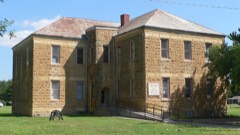 | Burr Oak School | building | 2005 | 05001201 |
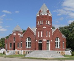 | Burr Oak United Methodist Church | building | 2007 | 07001225 |
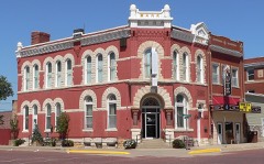 | First National Bank | building | 1976 | 76000823 |
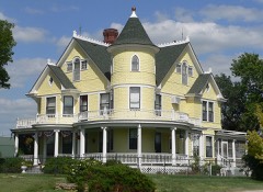 | O.W. Francis House | building | 2000 | 00000036 |
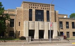 | Jewell County Courthouse | building | 2002 | 02000397 |
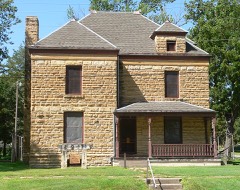 | Jewell County Jail | building | 1995 | 95000511 |
Every wildfire the federal occurrence database records inside this county: 31 of them, burning about 584 acres. 4 started naturally and none was recorded as arson. Each settlement page carries the fires within five miles of it.
| Reported cause | Fires |
|---|---|
| Debris and open burning | 10 |
| Equipment and vehicle use | 8 |
| Natural | 4 |
| Recreation and ceremony | 4 |
| Missing data/not specified/undetermined | 4 |
| Smoking | 1 |
The five largest, by the area the report gives. None of them was recorded as arson.
| Date | Cause | Size | Reported by | Name on the report |
|---|---|---|---|---|
| 7 March 2020 | Missing data/not specified/undetermined | 250 acres | Kansas Forest Service | not named |
| 22 September 2017 | Equipment and vehicle use | 70 acres | Jewell County | 12 |
| 4 May 2018 | Natural | 45 acres | Kansas Forest Service | 19 |
| 27 April 2018 | Equipment and vehicle use | 40 acres | Kansas Forest Service | 42718 |
| 24 February 2015 | Debris and open burning | 40 acres | Kansas Forest Service | 201503 |
| 30 April 2018 | Missing data/not specified/undetermined | 30 acres | Kansas Forest Service | 18 |
| 15 June 2018 | Natural | 20 acres | Kansas Forest Service | 17 |
| 3 March 2020 | Recreation and ceremony | 15 acres | Kansas Forest Service | not named |
Every settlement page carries the fires within five miles of it - see the settlement index below.
The NOAA Storm Events Database holds 566 reports for this county, causing no deaths, 4 injuries and about $21,847,580 in recorded property damage. Each settlement page carries the reports that name it.
| Kind of event | Reports |
|---|---|
| Hail | 332 |
| Thunderstorm Wind | 162 |
| Tornado | 43 |
| Heavy Rain | 14 |
| Flash Flood | 9 |
| Funnel Cloud | 3 |
| Flood | 3 |
The most serious of them, by death, then injury, then recorded damage. The accounts are quoted exactly as the forecast office filed them.
| When | Event | Place named | Harm | What the report says |
|---|---|---|---|---|
| May 2015 | Tornado (EF2) | Esbon | 1 hurt, $1,500,000 | This tornado started west of Mankato, traveling north and passing approximately 1 mile to the west of Burr Oak before turning more to the northeast and lifting. One woman was injured at her home approximately 4 miles south-southwest of Burr Oak. This tornado was rated an EF2, with an estimated peak wind speed of 130 MPH.||Along the path of this tornado, at least 4 homes sustained damage, including roof, window and siding damage. One home lost a large section of its roof. A garage was destroyed, with the vehicles inside moved 30-50 feet from their original location. Other outbuildings, grain bins, power poles and trees were damaged or destroyed. |
| May 2013 | Tornado (EF3) | Salem | 1 hurt, $400,000 | This tornado affected two counties in north central Kansas, touching down north of Lebanon in Smith County and lifting north of Esbon in Jewell County. The maximum wind speed was estimated to be near 140 MPH, with a maximum path width of 1580 yards. Along its path, this tornado caused minor to major tree damage, overturned irrigation pivots, snapped power poles and damaged or destroyed grain bins and outbuildings. Four homesteads suffered damage, with the hardest hit locations approximately 3 miles northeast of Lebanon in Smith County. Two homes in this area were heavily damaged or destroyed, with one losing its entire second level. This location also completely lost grain bins, a large outbuilding and newly constructed garage. One person suffered minor injuries and was treated and released from an area hospital. |
| July 1995 | Thunderstorm Wind | Burr Oak | 1 hurt, $50,000 | no account filed |
| May 1950 | Tornado (F2) | not stated | 1 hurt, $25,000 | no account filed |
| May 2008 | Tornado (EF3) | Jewell | $5,000,000 | This tornado moved out of Mitchell County and into Jewell County about 4 miles west of Highway 14. As the tornado moved northeast and was southwest of the town of Jewell, it hit three farmsteads and severely damaged the homes and outbuildings at these locations. One of the homes was completely destroyed and other had a machine shed also destroyed. Trees and power poles and lines were also damaged along its path. The tornado entered the southwest side of community of Jewell and moved across the west side of town. Several homes and businesses were damaged or destroyed. The Jewell Caf and the Bourbon Trucking Company were destroyed. The towns water tower was also blown down by the tornado. The tornado lifted about two miles northeast of town. Luckily no injuries were reported. |
| September 1986 | Tornado (F3) | not stated | $2,500,000 | no account filed |
| June 2003 | Flash Flood | Countywide | $1,500,000 | no account filed |
| May 2015 | Tornado (EF2) | Webber | $1,250,000 | This tornado touched down west-northwest of Webber in Jewell County, KS, traveling northeast through the very northwest corner of Republic County, KS, before entering Nebraska near the town of Hardy in Nuckolls County. It continued traveling northeast into Thayer County, lifting northwest of Deshler. This tornado was rated an EF2, with an estimated peak wind speed of 122 MPH. EF2 damage was noted in both Jewell County, KS and Nuckolls County, NE.||Damage along this tornado path included numerous pivots overturned and snapped power poles. There was a large amount of tree damage noted. In addition, in Jewell County, grain bins and outbuildings were destroyed, and a home lost a portion of its roof. |
| May 2023 | Hail | Mankato | $1,000,000 | Hail up to the size of tennis balls was reported in Mankato. |
| August 2020 | Hail | Mankato | $1,000,000 | A long-lived supercell produced a substantial swath of very large hail in the Mankato and Jewell areas, with large hail produced for a significant amount of time. A public report of golf ball size hail was received at 7:45 p.m. CDT in Mankato. By 7:50 p.m. CDT, the hail size in Mankato reached a measured diameter of 4 inches, with tennis ball size hail still falling in town at 8:10 p.m. CDT. At 8:13 p.m. CDT, golf ball size hail was reported about 3 miles northwest of Randall. At 8:15 p.m. CDT, 4 inch diameter hail was reported 2 miles north of Jewell, with baseball size hail in Jewell. Significant hail damage to homes, vehicles and crops occurred in the area. As just one example, local media reported that the Jewell County EMS Director's vehicle incurred major hail damage, including a shattered windshield. |
| July 1994 | Thunderstorm Wind | Jewell | $500,000 | Extremely strong thunderstorm winds caused major tree and structural damage across the area. |
| July 1994 | Thunderstorm Wind | Mankato | $500,000 | Extremely strong thunderstorm winds caused extensive tree and structural damage across the area. |
| May 2015 | Tornado (EF1) | Formoso | $250,000 | This tornado touched down southeast of Formoso, traveling about 4 miles before lifting northeast of Formoso. This tornado was rated an EF1, with an estimated peak wind speed of 110 MPH. Tree and power pole damage was noted along its path, and one home sustained roof, window and siding damage. An outbuilding was also destroyed. |
| May 2015 | Flash Flood | Burr Oak | $250,000 | A swath of 5 to 9 inches of rain, with locally higher amounts, was reported across an area stretching from west-central to north-northeastern portions of the county. The Republican River along the northern edge of the county flooded, and numerous county roads were under water. |
| May 2013 | Hail | Montrose | $250,000 | Numerous tennis ball to softball size hail stones reported, with the largest measuring 5.25 inches. |
| March 1990 | Tornado (F1) | not stated | $250,000 | no account filed |
| March 1990 | Tornado (F1) | not stated | $250,000 | no account filed |
| April 1976 | Tornado (F2) | not stated | $250,000 | no account filed |
| May 1974 | Tornado (F1) | not stated | $250,000 | no account filed |
| September 2001 | Hail | Burr Oak | $200,000 | no account filed |
| September 2015 | Thunderstorm Wind | Burr Oak | $150,000 | Wind gust was measured with a Davis instrument. |
| September 2015 | Hail | Burr Oak | $150,000 | Hail up to the size of golf balls was accompanied by the 80 MPH winds. Hail was approximately 4 inches deep and broke the vehicle's windshield. Numerous home windows were broken in Burr Oak. |
| May 2013 | Hail | Burr Oak | $150,000 | Ping pong ball to hen egg size hail was reported. |
| May 2013 | Hail | Mankato | $150,000 | Hail up to the size of tennis balls was reported. |
| May 2010 | Thunderstorm Wind | Mankato Arpt | $120,000 | Approximately 20 power poles were reported to have been damaged across the area, along with an empty grain bin. |
| May 2025 | Flash Flood | Salem | $100,000 | Strong thunderstorms dropped as much as 4 to 6 inches of heavy rain across the area. Rural roads in the area were affected by running water, as were a portion of Highway 78/128 near the border of Webster County, NE and Jewell County, KS and a portion of Highway 281 in Smith County, KS. Some of the highest measured rain totals included: 5.62 inches from nine miles north-northwest of Burr Oak, KS; 5.61 inches from three miles east of Guide Rock, NE; 5.60 inches from six miles north of Esbon; 4.84 inches from four miles north-northwest of Bostwick. |
| May 2023 | Hail | Jewell | $100,000 | Hail up to the size of golf balls was reported along this path. |
| June 2012 | Hail | Lovewell Res | $100,000 | Dime to golf ball size hail fell over Lovewell Park. |
| June 2011 | Flood | Ionia | $100,000 | Heavy rainfall in excess of four inches resulted in widespread flooding along the Little Oak, Granite and Limestone Creeks. |
| July 1997 | Hail | Esbon | $100,000 | Several power poles were damaged or downed by high winds. |
| August 2014 | Thunderstorm Wind | Jewell | $100,000 | no account filed |
| June 2005 | Hail | Jewell | $100,000 | no account filed |
| July 2004 | Hail | Burr Oak | $100,000 | no account filed |
| September 2015 | Hail | Jewell | $75,000 | Home windows were broken on the north side of Jewell. |
| August 2014 | Thunderstorm Wind | Burr Oak | $75,000 | Wind gusts were estimated to be near 60 MPH, with tree limbs up to 4 inches in diameter downed. |
| June 2014 | Thunderstorm Wind | Burr Oak | $75,000 | A line of thunderstorms producing damaging winds moved through Jewell County. The cooperative observer in Burr Oak estimated wind gusts near 70 MPH and a home weather station near Webber measured a 77 MPH wind gust at 1146 pm CDT. An outbuilding was destroyed a few miles south of the Kansas state line on Highway 128. |
| July 2012 | Hail | Jewell | $75,000 | Hail was accompanied by wind gusts estimated at 60 mph. |
| May 2008 | Flash Flood | North Branch | $75,000 | Thunderstorms rumbled across northern Kansas and dumped several inches of rain across Jewell County. This caused several rural roads and area creeks and streams to flood. |
| May 2012 | Hail | Jewell | $75,000 | no account filed |
| July 2002 | Thunderstorm Wind | Esbon | $75,000 | no account filed |
| July 2002 | Hail | Esbon | $75,000 | no account filed |
| April 2001 | Tornado (F0) | Formoso | $70,000 | Exited Jewell county and entered Republic county |
| July 2020 | Flash Flood | Salem | $50,000 | Storm total rainfall amounts ranged from 4 to 7 inches across the area. Law enforcement reported that multiple roads were closed to running water. Just north of Randall, a car left the road and ended up in the ditch, with the driver needing rescued. |
| September 2018 | Thunderstorm Wind | Mankato | $50,000 | Wind gusts estimated to be near 70 MPH resulted in tree limbs being downed in Mankato and a power pole being snapped near Montrose. In the Lovewell State Park area, a roof of an old radio communications building was torn off and nearby crops were damaged. |
| May 2015 | Thunderstorm Wind | Webber | $50,000 | Irrigation pipes were moved and a irrigation pivot was tipped over. |
| August 2014 | Thunderstorm Wind | Mankato | $50,000 | Wind gusts were estimated to be near 70 MPH. |
| June 2014 | Thunderstorm Wind | Formoso | $50,000 | CoCoRaHS observer reported that gusts estimated at 70 MPH caused lots of tree damage. Time estimated from radar data. |
| March 2012 | Tornado (EF0) | Montrose | $50,000 | A 30 by 40 foot machine shed was destroyed by a brief EF0 tornado, which touched down between Montrose and Formoso. The maximum wind speed was estimated at 80 mph. |
| April 2001 | Tornado (F0) | Ionia | $50,000 | Entered from Smith county |
| August 1993 | Thunderstorm Wind | Burr Oak | $50,000 | A few large trees were blown over by the strong winds. |
| July 2023 | Hail | Burr Oak | $50,000 | no account filed |
| July 2006 | Thunderstorm Wind | Webber | $50,000 | no account filed |
| July 2006 | Thunderstorm Wind | Jewell | $50,000 | no account filed |
| May 2002 | Hail | Esbon | $50,000 | no account filed |
| October 2002 | Thunderstorm Wind | Jewell | $50,000 | no account filed |
| April 2001 | Thunderstorm Wind | Jewell | $50,000 | no account filed |
| June 1999 | Thunderstorm Wind | Burr Oak | $50,000 | no account filed |
| July 1994 | Thunderstorm Wind | Jewell | $50,000 | no account filed |
| July 2011 | Thunderstorm Wind | Webber | $45,000 | A modular home located on 240 Road and Diamond Avenue just inside Jewell County south of Superior had most of its roof torn off, with a portion of one wall blown approximately 30 yards away. A couple of power poles were snapped in this area. |
| April 2006 | Hail | Burr Oak | $40,000 | no account filed |
The Survey's mineral resources record lists 1 working inside this county. It still produces. Each settlement page carries the workings within five miles of it.
| Commodity | Workings |
|---|---|
| Stone, Crushed/Broken | 1 |
The least common of them first, because a county's hundredth gravel pit says nothing its first ten did not.
| Where | Site | Commodity | Status | Recorded |
|---|---|---|---|---|
| Ideal Limestone Quarry | Stone, Crushed/Broken | Producer |
Named settlements recorded in the Geographic Names Information System, each with the topographic sheets covering it. Villages, hamlets and abandoned places alike. Each is shown with the nearest named watercourse or landform and the survey quadrangle it falls on.