 Block
From the record
2 National Register listings published here.
Sources: the National Register database, National Park Service
14 topographic sheets cover 5 settlements here, and 2 properties are on the National Register of Historic Places.
2 National Register listings published here.
Sources: the National Register database, National Park Service
Every property in this county listed on the National Register of Historic Places, with the year it was listed and the federal nomination document.
| Photograph | Property | Type | Listed | Reference |
|---|---|---|---|---|
 | Lane County Community High School | building | 2005 | 05000978 |
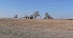 | Alexander & Anna Schwartz Farm | building | 2014 | 14000829 |
Every wildfire the federal occurrence database records inside this county: 27 of them, burning about 21,028 acres. 6 started naturally and none was recorded as arson. Each settlement page carries the fires within five miles of it.
| Reported cause | Fires |
|---|---|
| Missing data/not specified/undetermined | 8 |
| Natural | 6 |
| Debris and open burning | 5 |
| Power generation/transmission/distribution | 4 |
| Equipment and vehicle use | 3 |
| Smoking | 1 |
The five largest, by the area the report gives. None of them was recorded as arson.
| Date | Cause | Size | Reported by | Name on the report |
|---|---|---|---|---|
| 6 March 2017 | Power generation/transmission/distribution | 18,000 acres | Lane County | 358 |
| 15 February 2017 | Debris and open burning | 1,200 acres | Lane County | 255 |
| 15 June 2006 | Missing data/not specified/undetermined | 1,200 acres | Kansas Counties | ATTWELL (FORMERLY LANE COUNTY) |
| 3 August 2005 | Equipment and vehicle use | 450 acres | Finney County | not named |
| 22 June 2017 | Natural | 120 acres | Lane County | 967 |
| 10 August 2017 | Natural | 19 acres | Lane County | 1341 |
| 17 October 2016 | Debris and open burning | 15 acres | Kansas Forest Service | 2148 |
| 30 March 2020 | Natural | 10 acres | Kansas Forest Service | not named |
Every settlement page carries the fires within five miles of it - see the settlement index below.
The NOAA Storm Events Database holds 483 reports for this county, causing no deaths, 3 injuries and about $2,396,750 in recorded property damage. Each settlement page carries the reports that name it.
| Kind of event | Reports |
|---|---|
| Hail | 299 |
| Thunderstorm Wind | 120 |
| Tornado | 45 |
| Heavy Rain | 12 |
| Flood | 5 |
| Flash Flood | 1 |
| Funnel Cloud | 1 |
The most serious of them, by death, then injury, then recorded damage. The accounts are quoted exactly as the forecast office filed them.
| When | Event | Place named | Harm | What the report says |
|---|---|---|---|---|
| April 1972 | Tornado (F3) | not stated | 2 hurt, $2,500 | no account filed |
| August 2020 | Thunderstorm Wind | Dighton Arpt | 1 hurt | A building was heavily damaged from an apparent microburst. Blowing gravel broke out the windows of a vehicle and injured the occupant of the vehicle. There were also power poles blown down in this location. |
| May 1996 | Hail | Dighton | $1,840,000 | no account filed |
| July 1996 | Thunderstorm Wind | Healy | $300,000 | no account filed |
| October 2008 | Thunderstorm Wind | Dighton | $85,000 | Extensive damage was done to major transmission lines and power poles. As many as 30,000 meters were without power and some were out for over 2 days. Numerous trees were uprooted and the Lane county road and bridge building lost it's roof. Other buildings sustained some structural damage. |
| May 2008 | Tornado (EF1) | Dighton Arpt | $65,000 | This was a satellite tornado that moved northwest along the eastern edge of the larger parent tornado. It produced EF1 damage to a pivot irrigation sprinkler. |
| May 1991 | Tornado (F1) | not stated | $25,000 | no account filed |
| July 1987 | Tornado (F0) | not stated | $25,000 | no account filed |
| April 1972 | Tornado (F3) | not stated | $25,000 | no account filed |
| May 2004 | Tornado (F1) | Shields | $10,000 | This tornado completely destroyed a mobile home at the Cat House Recreation area northeast of Shields. Trees in the area were also heavily damaged. |
| June 2004 | Thunderstorm Wind | Pendennis | $6,000 | The wind blew down 18 inch diameter tree limbs and took the roof of a shed. Metal corral gates along with fencing were also blown down |
| June 2002 | Thunderstorm Wind | Alamota | $5,000 | The wind caused some roof damage and took down numerous two inch diameter tree limbs. |
| June 1998 | Thunderstorm Wind | Amy | $3,000 | Five to 10 inch tree limbs down. Several power poles destroyed. |
| August 1986 | Tornado (F0) | not stated | $2,500 | no account filed |
| April 1976 | Tornado (F1) | not stated | $2,500 | no account filed |
| May 1971 | Tornado (F1) | not stated | $250 | no account filed |
| April 2025 | Hail | Shields | - | A public report of 1.25 inch hail. |
| April 2025 | Hail | Shields | - | An emergency manager reported hail just slightly larger than golf ball sized hail. |
| April 2025 | Hail | Shields | - | A public report of multiple two inch hail stones. |
| May 2025 | Thunderstorm Wind | Dighton | - | A measured wind gust of 72 mph at the mesonet station KKSDIGHT22. |
| April 2025 | Hail | Healy | - | Law enforcement reported 1.5 inch hail. |
| August 2025 | Thunderstorm Wind | Amy | - | Report was from the Kansas State Mesonet of 66 mph. |
| August 2025 | Thunderstorm Wind | Dighton | - | The report was received from AWN weather station. |
| August 2025 | Thunderstorm Wind | Dighton | - | The report of a 77 mph wind gust was from KKSDIGHT22 weather station. |
| August 2025 | Thunderstorm Wind | Dighton | - | A personal weather station Hineman Farms - KKSDIGHT22 recorded a 59 mph wind gust. |
| August 2025 | Thunderstorm Wind | Shields | - | Public report of a 70 mph wind gust. |
| August 2025 | Thunderstorm Wind | Dighton | - | Two public reports came in at the same time reporting multiple large tree limbs downed. One of the report included pictures. |
| August 2024 | Hail | Amy | - | Golf ball sized hail was reported by the public. |
| June 2024 | Thunderstorm Wind | Healy | - | Powerlines down in this location. |
| June 2024 | Thunderstorm Wind | Alamota | - | Report of 93 mph wind gust. |
| May 2024 | Tornado (EFU) | Pendennis | - | At roughly this point the tornado may have moved south into Lane County. |
| May 2023 | Tornado (EF0) | Alamota | - | Reported by Off duty NWS Employee. |
| May 2023 | Thunderstorm Wind | Amy | - | Numerous four inch tree limbs downed. |
| March 2021 | Heavy Rain | Dighton | - | Rainfall of 2.60 inches was observed. |
| July 2020 | Heavy Rain | Dighton | - | Rainfall of 5.00 inches was observed. |
| July 2020 | Heavy Rain | Healy | - | Rainfall of 4.70 inches was observed. |
| August 2020 | Thunderstorm Wind | Dighton | - | Power poles were blown down along highway 23 near county Road 160. |
| August 2020 | Thunderstorm Wind | Amy | - | Siding damage was done to a barn. |
| July 2019 | Tornado (EF0) | Amy | - | This was a landspout tornado. |
| April 2019 | Thunderstorm Wind | Pendennis | - | There were also quite a few gustnadoes reported along with a lot of blowing dirt. |
| August 2019 | Thunderstorm Wind | Dighton | - | Winds were estimated to be 60 MPH. |
| July 2018 | Hail | Healy | - | There were only a few the size of a golf ball. Most stones were quarter sized. |
| July 2018 | Thunderstorm Wind | Amy | - | Small hail of an undisclosed size also occurred with the high wind. |
| May 2018 | Hail | Dighton | - | Windows were broken and there was also roof and siding damage from the hail. Wheat fields were also decimated in the area. |
| May 2018 | Thunderstorm Wind | Dighton Arpt | - | Grain bins were destroyed by the high wind. |
| October 2017 | Hail | Alamota | - | There was virtually no wind as the hail fell. |
| May 2016 | Tornado (EF0) | Healy | - | This tornado appeared to be stronger than the rating but since it did not encounter anything, it was given a rating of EF0. |
| May 2016 | Tornado (EF0) | Healy | - | This tornado moved almost due north. |
| May 2016 | Tornado (EF0) | Pendennis | - | There was brief circulation at the surface for a little less than a minute. |
| May 2016 | Tornado (EF0) | Alamota | - | This was a brief tornado. |
| May 2016 | Tornado (EF0) | Alamota | - | Another tornado observed from the cyclic supercell. |
| May 2016 | Tornado (EF0) | Alamota | - | This tornado was weak. |
| May 2016 | Tornado (EF0) | Dighton | - | This was a weak tornado that moved west of due north. |
| May 2016 | Tornado (EF0) | Healy | - | There was brief circulation at the surface from this apparent weak tornado. |
| August 2016 | Thunderstorm Wind | Shields | - | Winds were estimated to be gusting to 60 MPH. |
| May 2015 | Flood | Healy | - | Many county roads were flooded. |
| May 2015 | Heavy Rain | Healy | - | Rainfall of 3.80 was measured. |
| May 2015 | Heavy Rain | Dighton Arpt | - | There was 5.6 inches recorded. Unofficial reports of 8 inches were reported across southeast Lane County. |
| April 2015 | Hail | Alamota | - | The hail was nickel to quarter sized. |
| April 2015 | Hail | Alamota | - | The hail covered the ground. |
Named settlements recorded in the Geographic Names Information System, each with the topographic sheets covering it. Villages, hamlets and abandoned places alike. Each is shown with the nearest named watercourse or landform and the survey quadrangle it falls on.