 Block
From the record
19 National Register listings published here.
Sources: the National Register database, National Park Service
48 topographic sheets cover 21 settlements here, and 19 properties are on the National Register of Historic Places.
19 National Register listings published here.
Sources: the National Register database, National Park Service
Every property in this county listed on the National Register of Historic Places, with the year it was listed and the federal nomination document.
| Photograph | Property | Type | Listed | Reference |
|---|---|---|---|---|
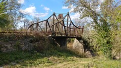 | Asylum Bridge | structure | 1990 | 89002187 |
 | John Brown Cabin | building | 1971 | 71000319 |
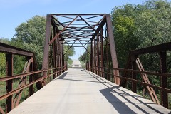 | Carey's Ford Bridge | structure | 1990 | 89002179 |
 | Congregational Church | building | 2013 | 12001239 |
 | Creamery Bridge | site | 1983 | 83000434 |
| First Presbyterian Church of Paola | building | 2025 | 100012121 | |
| Fowler and Baehr Buildings | building | 2025 | 100011631 | |
 | Jackson Hotel | building | 2008 | 08000646 |
| Jake's Branch of Middle Creek Bridge | structure | 1985 | 85001432 | |
| Martin Farm | district | 2019 | 100003428 | |
 | Miami County Courthouse | building | 1973 | 73000768 |
| Miami County Mercantile Company | building | 2021 | 100006325 | |
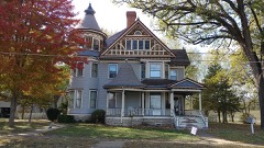 | William Mills House | building | 1986 | 86003291 |
 | New Lancaster General Store | building | 2013 | 13000817 |
| New Lancaster Grange Hall, No. 223 | building | 2013 | 13000818 | |
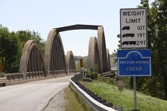 | Pottawatomie Creek Bridge | site | 1983 | 83000433 |
| Soldiers' Monument | object | 2012 | 12000386 | |
| Ursuline Academy - Auditorium | building | 2025 | 100011629 | |
| West Elementary School | building | 2024 | 100011117 |
Every wildfire the federal occurrence database records inside this county: 368 of them, burning about 2,245 acres. 2 started naturally and 19 were recorded as arson. Each settlement page carries the fires within five miles of it.
| Reported cause | Fires |
|---|---|
| Missing data/not specified/undetermined | 169 |
| Debris and open burning | 125 |
| Equipment and vehicle use | 24 |
| Arson/incendiarism | 19 |
| Smoking | 14 |
| Recreation and ceremony | 7 |
| Fireworks | 6 |
| Natural | 2 |
| Power generation/transmission/distribution | 1 |
| Other causes | 1 |
The five largest, by the area the report gives. None of them was recorded as arson.
| Date | Cause | Size | Reported by | Name on the report |
|---|---|---|---|---|
| 15 March 2015 | Debris and open burning | 80 acres | Kansas Forest Service | 81 |
| 13 July 2018 | Debris and open burning | 80 acres | Kansas Forest Service | 200 |
| 18 March 2017 | Debris and open burning | 80 acres | Johnson County | 770106 |
| 11 March 2015 | Debris and open burning | 65 acres | Kansas Forest Service | 70 |
| 30 January 2017 | Debris and open burning | 61 acres | Franklin County | 36 |
| 8 March 2015 | Debris and open burning | 60 acres | Kansas Forest Service | 63 |
| 8 March 2017 | Missing data/not specified/undetermined | 60 acres | Miami County | 66 |
| 4 February 2017 | Missing data/not specified/undetermined | 60 acres | Johnson County | 350082 |
Every settlement page carries the fires within five miles of it - see the settlement index below.
The NOAA Storm Events Database holds 412 reports for this county, causing 6 deaths, 31 injuries and about $23,775,660 in recorded property damage. Each settlement page carries the reports that name it.
| Kind of event | Reports |
|---|---|
| Hail | 187 |
| Thunderstorm Wind | 162 |
| Flash Flood | 27 |
| Tornado | 22 |
| Flood | 9 |
| Lightning | 5 |
The most serious of them, by death, then injury, then recorded damage. The accounts are quoted exactly as the forecast office filed them.
| When | Event | Place named | Harm | What the report says |
|---|---|---|---|---|
| May 1957 | Tornado (F5) | not stated | 4 killed, 20 hurt, $2,500,000 | no account filed |
| October 2018 | Flood | Paola | 1 killed | From FOX 4 Kansas City: Miami County Sheriffs Office confirmed to FOX4 that a missing 78-year-old woman has been found dead. Authorities found Hazel Phillips inside her vehicle near Hospital Drive south of 327th Street Friday morning. According to deputies, someone noticed the roof of a silver car showing after flood waters in the area receded and alerted authorities. Osawatomie Fire Department pulled the car from the water and determined it belonged to Phillips. Phillips was still inside. Phillips family reported her missing Wednesday. They said they last spoke to her Tuesday night when she told them she was going to Drexel, Missouri, on Wednesday morning. ||https://fox4kc.com/2018/10/12/missing-78-year-old-miami-county-woman-found-dead-in-vehicle-pulled-from-flood-waters/ . |
| August 2017 | Flash Flood | New Lancaster | 1 killed | A vehicle hydroplaned off the road on HWY 69 near 363rd Street. The vehicle left the roadway, then sank into the flooded ditch alongside the road. An occupant in the vehicle perished. |
| May 1995 | Tornado (F1) | Beagle to | 5 hurt, $500,000 | An F1 tornado touched down just west of U.S. Route 169 about 1/10 mile south of the junction with state Route 7. Damage was intermittent along the path as the tornado skipped east for about 8 miles, finally lifting 2 miles north of Fontana. The most significant damage was along Route 7 where a mobile home was overturned, and its 5 occupants received minor injuries. Several trees were also downed in this same general area, and siding and roofing was ripped from a home on the east side of the road. A horse barn on the west side of the road also sustained damage. Another mobile home was destroyed about 2 miles east of Route 7. Mainly tree damage occurred from here to the lift point. |
| April 1960 | Tornado (F3) | not stated | 2 hurt, $250,000 | no account filed |
| May 1978 | Tornado (F2) | not stated | 1 hurt, $2,500,000 | no account filed |
| February 1984 | Tornado (F1) | not stated | 1 hurt, $25,000 | no account filed |
| September 2015 | Tornado (EF1) | Paola Majeski Arpt | 1 hurt | A NWS survey team concluded that the tornado developed near the southeast side of Hillsdale Lake, traveling a few degrees north of east, before dissipating in rural Miami county between Spring Hill and Louisburg. The tornado caused one non-critical injury at a trailer park at Hillsdale Lake. A single wide manufactured home was rolled but remained essentially intact. Three unsecured RVs were also rolled and destroyed. |
| July 1996 | Lightning | Paola | 1 hurt | no account filed |
| July 2007 | Flood | Stanton | $16,000,000 | The Marais Des Cygnes River at Osawatomie experienced the second highest|flood crest on record. The crest was at 49.19 feet on July 1st at 20:27|CST, or 21.19 feet above flood stage. Numerous homes and businesses suffered total loss, or severe damage. |
| April 1995 | Hail | Louisburg | $750,000 | Severe thunderstorms dropped dime-size hail and knocked down large tree limbs in the Hillsdale area. The storm continued east to Louisburg where it dropped hail up to golf ball size. The hail punched fist-sized holes in vinyl siding and smashed windows on a few homes. Just north of town, the hail covered the ground several inches deep. A car dealership had damage to nearly every car on the lot, and five sheriff's department vehicles were damaged. Winds knocked down tree limbs and power lines, and nearly 1200 customers were without power. |
| August 2004 | Lightning | Paola | $300,000 | House struck by lightning and totally destroyed by fire. |
| May 1977 | Tornado (F2) | not stated | $250,000 | no account filed |
| April 1969 | Tornado (F2) | not stated | $250,000 | no account filed |
| May 1995 | Thunderstorm Wind | Fontana to | $70,000 | A 7 mile path of wind damage associated with strong straight line winds, or a downburst moved across the southeast portion of the county. Damage was associated with a storm that had previously produced a tornado (see above entry), and reached from northeast of Fontana all the way to the Bates county (MO) line near and south of Drexel, MO. Damage along the path consisted mainly of tree damage, but some of those trees fell on cars and utility lines. Several trees also fell on homes in the area, and the winds also knocked down some utility poles. |
| April 2026 | Hail | Osawatomie | $50,000 | Several social media photos and videos of hail up to tennis ball size in Osawatomie. Multiple homes and vehicles were damaged, with many windows and windshields cracked or broken from the hail. |
| April 2026 | Hail | Paola | $50,000 | Softball sized hail (4 inch) reported on north side of Paola. |
| April 2019 | Tornado (EF0) | Henson | $50,000 | During an overnight complex of thunderstorms a QLCS tornado formed just south of Paola. The tornado impacted a church and did room damage. Several grave markers were also damaged in a nearby cemetery, and the flag pole in front of the church was bent completely over. |
| August 2010 | Thunderstorm Wind | Paola Majeski Arpt | $50,000 | Thunderstorm wind gusts were estimated up to 80 mph. Several homes had their roofs blown off. |
| July 1997 | Lightning | Paola | $50,000 | Lightning struck a house causing a fire during a thunderstorm. Several rooms of the house were damaged. |
| May 1999 | Thunderstorm Wind | Bucyrus | $25,000 | A house was damaged by thunderstorm winds in Bucyrus. |
| May 1968 | Tornado (F3) | not stated | $25,000 | no account filed |
| July 2012 | Thunderstorm Wind | O Brien | $10,000 | Thunderstorm wind gusts were estimated up to 70 mph. Trees up to three feet in diameter, were uprooted or snapped off, at the Osawatomie golf course. There was also some shingle and roof damage reported with area residences. |
| September 2000 | Lightning | Paola | $7,000 | Lightning downed half of a tree, which fell on a 1994 Honda, rendering the vehicle a total loss. |
| July 1996 | Thunderstorm Wind | Paola | $7,000 | no account filed |
| May 1995 | Thunderstorm Wind | Antioch to | $6,000 | Wind damage associated with strong straight line winds moved across the far northern portion of the county, from the Franklin county line west of Antioch, all the way to the Cass county (MO) line southeast of Stillwell. |
| May 1995 | Thunderstorm Wind | Paola | $6,000 | Severe thunderstorms produced up to Golfball size hail in the Hillsdale lake area, with damaging winds striking Paola. Several tree limbs fell onto a car in Paola, causing substantial damage. |
| May 2011 | Tornado (EF0) | Louisburg | $5,000 | At 0945CST a brief EF0 tornado touchdown was observed about a half mile west southwest of Louisburg. The tornado lifted at 0947CST. A truck was overturned and heavily damaged. Minor building damage also observed. |
| September 2000 | Thunderstorm Wind | Bucyrus | $5,000 | Trees were downed, and a shed was damaged. |
| August 1999 | Thunderstorm Wind | Louisburg | $5,000 | A tree was blown down onto a car. |
| April 1995 | Hail | Bucyrus | $5,000 | Hail up to dime-size occurred in many areas across the entire county between 2330 and 2400 CST. Accumlated several inches deep. |
| May 1996 | Thunderstorm Wind | Louisburg | $5,000 | no account filed |
| April 1964 | Tornado | not stated | $2,500 | no account filed |
| April 1964 | Tornado (F2) | not stated | $2,500 | no account filed |
| July 2005 | Thunderstorm Wind | Beagle | $2,000 | Numerous trees and power lines blown down. |
| June 2001 | Thunderstorm Wind | Osawatomie | $2,000 | Law enforcement reported wind damage with several large trees down. |
| June 1995 | Thunderstorm Wind | Osawatomie | $2,000 | Several large tree limbs were downed across Osawatomie, causing power outages. |
| June 1995 | Thunderstorm Wind | Louisburg | $2,000 | Winds up to 65 mph occurred at Louisburg, and tree limbs were downed. |
| July 2018 | Thunderstorm Wind | Osawatomie | $1,000 | Power lines down on 6th Street due to strong winds. |
| June 2016 | Thunderstorm Wind | Paola Majeski Arpt | $1,000 | A healthy 8 inch tree was blown down a the intersection of W 287th Street and Lonestar Road near Paola, Kansas. |
| July 2011 | Lightning | Paola | $1,000 | A transformer was hit by lightning and set on fire, at 247th and Metcalf. |
| July 2008 | Thunderstorm Wind | New Lancaster | $1,000 | Trees and power lines were reported down with winds estimated to 60 mph. |
| June 2008 | Thunderstorm Wind | Osawatomie | $1,000 | Miami county sheriff reported power lines were downed in Osawatomie. |
| July 2008 | Thunderstorm Wind | Bucyrus | $1,000 | Gutter and siding was lost on a house due to high winds. |
| July 2011 | Thunderstorm Wind | Bucyrus | $500 | A power line was reported down in Bucyrus. Thunderstorm wind gusts were estimated up to 60 mph. |
| June 2013 | Thunderstorm Wind | Henson | $100 | Thunderstorm wind gusts were estimated up to 60 mph, with a small shed reported blown over. |
| May 1982 | Tornado (F0) | not stated | $30 | no account filed |
| May 1982 | Tornado (F0) | not stated | $30 | no account filed |
| March 2026 | Thunderstorm Wind | Somerset | - | Social media report of tree damage near 323rd Street south of Louisburg. |
| April 2026 | Hail | Osawatomie | - | Ping pong ball sized hail. |
| April 2026 | Hail | Osawatomie Paola Arp | - | Two inch hail reported north of Osawatomie. Damaged a roof. |
| April 2026 | Hail | Osawatomie Paola Arp | - | Baseball sized hail reported northeast of Osawatomie toward Paola. |
| April 2026 | Hail | Osawatomie Paola Arp | - | Baseball sized hail reported northeast of Osawatomie. |
| April 2026 | Hail | Paola | - | Two inch hail reported south of Paola. |
| April 2026 | Hail | Paola Majeski Arpt | - | Tennis ball sized hail reported west of Paola. |
| April 2026 | Hail | Paola | - | Hail larger than baseballs on the east side of Paola. |
| April 2026 | Hail | Paola | - | Tennis ball sized hail measured in downtown Paola. |
| April 2026 | Thunderstorm Wind | Osawatomie Paola Arp | - | Measured wind gust of 69 mph southwest of Paola. |
| April 2026 | Thunderstorm Wind | Paola | - | Downed wires in Paola. |
| April 2026 | Hail | Paola | - | Golf ball sized hail reported at Paola Golf Club north of town. |
Named settlements recorded in the Geographic Names Information System, each with the topographic sheets covering it. Villages, hamlets and abandoned places alike. Each is shown with the nearest named watercourse or landform and the survey quadrangle it falls on.