 Block
From the record
17 National Register listings published here.
Sources: the National Register database, National Park Service
50 topographic sheets cover 12 settlements here, and 17 properties are on the National Register of Historic Places.
17 National Register listings published here.
Sources: the National Register database, National Park Service
Every property in this county listed on the National Register of Historic Places, with the year it was listed and the federal nomination document.
| Photograph | Property | Type | Listed | Reference |
|---|---|---|---|---|
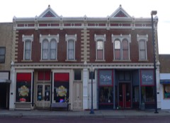 | Banks-Waudby Building | building | 2006 | 06001172 |
| Deeble Rock Garden | site | 2017 | 100001705 | |
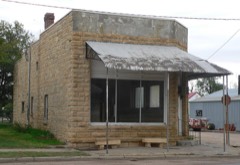 | Dorrance State Bank | building | 2011 | 11000507 |
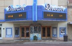 | Dream Theater | building | 2006 | 06000112 |
| First National Bank-Waudby Building | building | 2006 | 06001174 | |
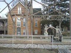 | Garden of Eden | site | 1977 | 77000595 |
| Nicholas Gernon House | building | 2022 | 100008291 | |
| House at 202 West 3rd Street | building | 2023 | 100008786 | |
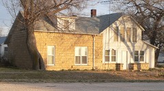 | Kennedy Hotel | building | 2007 | 06001244 |
| Lucas School Gymnasium | building | 2022 | 100008290 | |
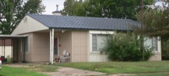 | Mann House | building | 2001 | 01000190 |
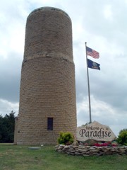 | Paradise Water Tower | structure | 2007 | 06001242 |
| Pospishil Building | building | 2025 | 100011683 | |
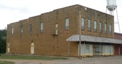 | Reiff Building | building | 2007 | 07000140 |
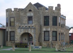 | Russell County Jail and Sheriff's Residence | building | 2012 | 11001080 |
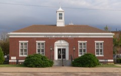 | US Post Office-Russell | building | 1989 | 89001649 |
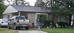 | Woelk House | building | 2001 | 01000191 |
Every wildfire the federal occurrence database records inside this county: 82 of them, burning about 40,605 acres. 2 started naturally and 2 were recorded as arson. Each settlement page carries the fires within five miles of it.
| Reported cause | Fires |
|---|---|
| Missing data/not specified/undetermined | 44 |
| Equipment and vehicle use | 18 |
| Debris and open burning | 6 |
| Power generation/transmission/distribution | 5 |
| Smoking | 4 |
| Arson/incendiarism | 2 |
| Natural | 2 |
| Misuse of fire by a minor | 1 |
The five largest, by the area the report gives. None of them was recorded as arson.
| Date | Cause | Size | Reported by | Name on the report |
|---|---|---|---|---|
| 6 March 2017 | Missing data/not specified/undetermined | 28,000 acres | Russell County | 17010 |
| 24 November 2017 | Missing data/not specified/undetermined | 4,500 acres | Russell County | GORHAM |
| 4 April 2009 | Missing data/not specified/undetermined | 3,000 acres | Kansas Counties | CRAIG NALER |
| 27 June 2012 | Missing data/not specified/undetermined | 1,920 acres | Kansas Counties | DORRANCE |
| 7 March 2017 | Debris and open burning | 1,200 acres | Russell County | 170014 |
| 23 March 2010 | Missing data/not specified/undetermined | 550 acres | Kansas Counties | LUCAS PARK FIRE |
| 7 March 2017 | Smoking | 400 acres | Russell County | 11 |
| 7 March 2017 | Missing data/not specified/undetermined | 350 acres | Russell County | 17014 |
Every settlement page carries the fires within five miles of it - see the settlement index below.
The NOAA Storm Events Database holds 1,079 reports for this county, causing 2 deaths, 28 injuries and about $8,213,600 in recorded property damage. Each settlement page carries the reports that name it.
| Kind of event | Reports |
|---|---|
| Hail | 485 |
| Thunderstorm Wind | 471 |
| Tornado | 79 |
| Flood | 16 |
| Flash Flood | 14 |
| Heavy Rain | 10 |
| Lightning | 3 |
| Funnel Cloud | 1 |
The most serious of them, by death, then injury, then recorded damage. The accounts are quoted exactly as the forecast office filed them.
| When | Event | Place named | Harm | What the report says |
|---|---|---|---|---|
| May 1993 | Tornado (F4) | Dorrance | 1 killed, 6 hurt, $5,000,000 | At approximately 1705 CST a half mile wide tornado touched down 1.5 miles southwest of the MINOOKA PARK area on the south shore of Wilson Lake. The tornado ravaged Ken's Marina and the MINOOKA PARK area around 1710 CST by destroying the marina building, numerous boats, motors, and trailers plus campers, motor homes, vehicles, and buildings at MINOOKA PARK. As the tornado passed through, flying debris killed a 79 year old female and injured two other people. By 1720 CST the tornado crossed Highway 223, one mile east and 3 miles south of Lucas where four homes and a power sub- station were severely damaged. The other four injuries were sustained by the occupants of these homes. By 1725 CST the tornado passed 1.5 miles east of Lucas where three more homes received moderate damage. About 1745 CST the tornado crossed into southeast Osborne County destroying one farmstead before dissipating about 1755 CST. (F79O) |
| July 2024 | Thunderstorm Wind | Wilson Lake | 1 killed, 3 hurt | Multiple campers were blown over throughout the state park at Wilson Lake with debris spreading all over. Three people were transported to the hospital with injuries, and one person was found deceased. |
| May 1991 | Thunderstorm Wind | not stated | 12 hurt | no account filed |
| July 2004 | Thunderstorm Wind | Gorham | 2 hurt, $25,000 | Five semi-trailers overturned on I-70, with two of the drivers taken to a hospital. (Narrative courtesy of Great Bend Tribune.) |
| May 1985 | Thunderstorm Wind | not stated | 2 hurt | no account filed |
| August 2006 | Thunderstorm Wind | Dorrance | 1 hurt, $40,000 | Tractor trailer was blown off of the highway. |
| April 1986 | Thunderstorm Wind | not stated | 1 hurt | no account filed |
| August 1964 | Tornado (F1) | not stated | 1 hurt | no account filed |
| July 1994 | Thunderstorm Wind | Russell | $500,000 | Winds of 85 to 95 an hour accompanied a line of thunderstorms that moved across the county. In the Russell area, four tractor-semitrailers were overturned on Interstate 70. A 50- by 100-foot boat and RV storage shed was destroyed near Dorrance with some of its debris scattered hundreds of yards. Damage to the shed was calculated at $30 thousand. Total county damage was about $40 thousand. |
| June 2011 | Hail | Paradise | $300,000 | Several home roofs and vehicles were damaged countywide by golfball to baseball size hail. The exact number of roofs and vehicles damaged in unknown, so property damage amounts are rough estimates. |
| October 1956 | Tornado (F3) | not stated | $250,000 | no account filed |
| May 2002 | Tornado (F1) | Paradise | $170,000 | Damaged outbuildings and power lines. |
| June 2014 | Thunderstorm Wind | Waldo | $144,000 | Twenty five to thirty power poles were knocked from the high winds. The poles were located along Highway 281. |
| September 2018 | Flood | Russell | $100,000 | A number of rural roads and low water crossings were flooded. Some roads reported washed out culverts. |
| September 2006 | Tornado (F1) | Russell | $100,000 | The tornado moved NNE along the west side of Russell and damaged two sheds, blew the roof from an oil field pipeline building, and blew the windows out of a home. |
| July 2004 | Tornado (F1) | Russell | $100,000 | Two homes damaged, one of which was unroofed, numerous outbuildings, as well as damage to several trees. (Lucas-Sylvan News contributed greatly to this narrative.) |
| May 1999 | Thunderstorm Wind | Lucas | $100,000 | Home and building damage, large grain bins and an elevator leg destroyed as well as head stone damage and grave markers blown over. |
| June 1996 | Thunderstorm Wind | Russell | $100,000 | no account filed |
| August 2010 | Thunderstorm Wind | Luray | $80,000 | Estimated 70 to 80 mph winds produced widespread damage in and around the Luray area. A church limestone steeple was badly damaged, a fertilizer conveyer at the COOP was blown over, an awning was blown off a business, several trees and tree limbs of various sizes were downed, and some power lines were downed, one of which fell on a house. |
| April 2005 | Tornado (F1) | Milberger | $75,000 | Farmstead hit sustaining the following damage: Two sheds and one garage destroyed. House sustained broken windows on it's south side. Several trees uprooted. |
| July 2004 | Tornado (F0) | Bunker Hill | $75,000 | This was a second tornado that hit the same farmstead. The first one hit the barn across the road, and this one did some damage to trees and tore a few shingles off the roof of the home. Some small barns were also damaged. |
| May 2010 | Lightning | Russell | $60,000 | Sometime on the 19th, lightning from a relatively weak area of showers and thunderstorms struck a tank battery near the intersection of 184th Street and Plymouth road southwest of Russell. The battery was set ablaze. No injuries were incurred, but the tank battery was badly damaged. The time of the event was roughly estimated based off of archived radar data. The Russell County News contributed to this article. |
| May 2021 | Thunderstorm Wind | Russell | $50,000 | Widespread large tree limbs of 4 to 5 inches in diameter were knocked in east Russell. |
| April 2015 | Hail | Lucas | $50,000 | The emergency manager reported that virtually every car and roof sustained significant damage in Lucas. All of the skylights at the middle school were broken. |
| July 2004 | Tornado (F0) | Bunker Hill | $50,000 | Damage caused to barn. |
| April 2001 | Thunderstorm Wind | Russell | $50,000 | Semi-truck blown over on I-70. |
| August 1997 | Hail | Waldo | $50,000 | THOUGH NOT HAIL-RELATED, TORRENTIAL RAINS OCCURRING AT THE TIME ERODED A ONE FOOT THICK LIMESTONE WALL BENEATH A SIDEWALK AND FOOTBRIDGE, CAUSING BOTH TO CRUMBLE. |
| June 1997 | Thunderstorm Wind | Russell | $50,000 | TWO TRAILERS FLIPPED OVER, TREES & POWER LINES DOWNED. |
| May 2011 | Thunderstorm Wind | Lucas | $35,000 | Winds estimated around 70 mph produced damage in Lucas. Main street received damage to several buildings, including a bowed out wall, broken windows, roof damage, and some car window damage. |
| March 2004 | Thunderstorm Wind | Luray | $35,000 | Midway Co-op lost five 9,500 bushel grain bins due to microburst winds. The grain bins were blown into adjacent power lines as well as one power pole possessing a transformer, severing power to Luray for approximately 4 hours. Two light towers at Luray-Lucas High School were toppled as was one utility pole adjacent to Luray-Lucas Elementary. The microburst winds caused damage to many roofs and broke windows. Many vehicles sustained damage from blowing sand, gravel, and debris. (Report courtesy of Russell County News and Lucas-Sylvan News.) |
| June 2011 | Hail | Paradise | $30,000 | The hail damaged some cars. Damage amounts are rough estimates. |
| June 2011 | Hail | Wilson Lake | $30,000 | Many campers and car wind shields were damaged. |
| August 2008 | Flood | Russell | $25,000 | Law enforcement reported a county road had been washed out about 7 miles north of Russell. |
| August 2006 | Thunderstorm Wind | Russell | $25,000 | A pickup pulling a camper was blown over near mile marker 206 on interstate 70. |
| June 2000 | Thunderstorm Wind | Russell | $25,000 | Trees and power lines downed severing power to Russell for about an hour. |
| June 1997 | Thunderstorm Wind | Russell | $25,000 | MOBILE HOME DEMOLISHED. PICKUP TRUCK & STORAGE SHED DAMAGED. |
| April 1984 | Tornado (F0) | not stated | $25,000 | no account filed |
| August 1974 | Tornado (F2) | not stated | $25,000 | no account filed |
| June 1964 | Tornado (F2) | not stated | $25,000 | no account filed |
| July 2023 | Thunderstorm Wind | Homer | $20,000 | There were five power poles knocked down on Homer Road in between Bunker Hill and Russell. |
| May 1998 | Thunderstorm Wind | Lucas | $20,000 | Two 1,000 bushel grain bins destroyed with small sheds and stock tanks damaged. Widespread tree damage, including a large tree falling onto a mobile home as well as numerous power poles and power lines blown down. |
| May 1997 | Tornado (F0) | Milberger | $20,000 | no account filed |
| June 2013 | Thunderstorm Wind | Russell | $15,000 | Numerous trees were reported down across the city. A few power lines were also knocked down, which led to portions of town to be without power for a short time. |
| August 2011 | Thunderstorm Wind | (Rsl)Russell Muni Ar | $15,000 | Measured at the Russell Airport. Several power poles and tree limbs were downed in Russell. |
| May 2010 | Thunderstorm Wind | (Rsl)Russell Muni Ar | $15,000 | A semi truck was blown over on Highway 281. |
| August 2006 | Thunderstorm Wind | Gorham | $15,000 | Two out buildings roofs were blown off. Hay bails were also rolled into the fields. |
| April 2001 | Thunderstorm Wind | Luray | $15,000 | Shed destroyed. |
| June 1998 | Thunderstorm Wind | Russell | $12,500 | Empty semi tractor-trailer rig over turned on I-70. |
| August 2010 | Thunderstorm Wind | Russell | $12,000 | A trained spotter estimated the winds, causing trees and power poles to be blown down. |
| July 2023 | Thunderstorm Wind | (Rsl)Russell Muni Ar | $10,000 | A semi was overturned at mile marker 189 on Interstate 70. |
| September 2014 | Thunderstorm Wind | (Rsl)Russell Muni Ar | $10,000 | Empty tanks were blown around and a hanger door was blown off its track. |
| July 2011 | Thunderstorm Wind | Milberger | $10,000 | Winds estimated around 70 mph produced some damage near the Russell/Barton county line 6 miles north of Susank, including a blown over stock trailer and downed tree limbs and power lines. |
| April 2010 | Thunderstorm Wind | Dorrance | $10,000 | A metal shed roof was blown off, and a garage was destroyed. |
| April 2010 | Thunderstorm Wind | Bunker Hill | $10,000 | Wind damage was reported at the Bear House Truckstop. Nine vehicles lost side windows due to wind-blown gravel. The estimated 70 mph winds also moved a breezeway wall at the truckstop, and moved an empty ice machine 20 yards into a trailer. Fuel pumps were twisted as well. |
| August 2009 | Thunderstorm Wind | Russell | $10,000 | At least 5 power poles were downed. The Salina Journal also contributed to this report. |
| June 2008 | Lightning | Gorham | $10,000 | A ligthning strike set two field crude oil tanks on fire. |
| September 2008 | Flash Flood | Waldo | $10,000 | A local observer reported 5.25 inches of rain along Paradise Creek. This caused roads to flood along the creek and washed out some small bridges. |
| July 2002 | Thunderstorm Wind | Fairport | $10,000 | Power poles snapped with associated power lines obviously downed. |
| April 2001 | Thunderstorm Wind | Lucas | $10,000 | Power lines blown down. (Reported by KRSL Radio). |
| April 2001 | Thunderstorm Wind | Luray | $10,000 | Power lines blown down. |
Named settlements recorded in the Geographic Names Information System, each with the topographic sheets covering it. Villages, hamlets and abandoned places alike. Each is shown with the nearest named watercourse or landform and the survey quadrangle it falls on.
Fairview township · 67648 · On East Fork Wolf Creek · Lucas quadrangle
13 sheets, 1896 to 1985