 Block
From the record
4 National Register listings published here.
Sources: the National Register database, National Park Service
44 topographic sheets cover 12 settlements here, and 4 properties are on the National Register of Historic Places.
4 National Register listings published here.
Sources: the National Register database, National Park Service
Every property in this county listed on the National Register of Historic Places, with the year it was listed and the federal nomination document.
| Photograph | Property | Type | Listed | Reference |
|---|---|---|---|---|
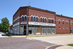 | Stockbrands and Kemmerer Department Store | building | 1985 | 85003146 |
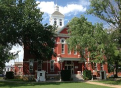 | Woodson County Courthouse | building | 1985 | 85002951 |
 | Yates Center Carnegie Library | building | 1987 | 87000974 |
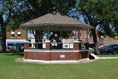 | Yates Center Courthouse Square Historic District | district | 1986 | 86001120 |
Every wildfire the federal occurrence database records inside this county: 29 of them, burning about 2,985 acres. 2 started naturally and 2 were recorded as arson. Each settlement page carries the fires within five miles of it.
| Reported cause | Fires |
|---|---|
| Recreation and ceremony | 10 |
| Missing data/not specified/undetermined | 7 |
| Debris and open burning | 6 |
| Equipment and vehicle use | 2 |
| Natural | 2 |
| Arson/incendiarism | 2 |
The five largest, by the area the report gives. None of them was recorded as arson.
| Date | Cause | Size | Reported by | Name on the report |
|---|---|---|---|---|
| 4 April 2009 | Missing data/not specified/undetermined | 2,000 acres | Kansas Counties | BROWNING |
| 14 April 2003 | Recreation and ceremony | 320 acres | Woodson County | not named |
| 12 March 2005 | Recreation and ceremony | 160 acres | Woodson County | not named |
| 13 April 2003 | Recreation and ceremony | 130 acres | Woodson County | not named |
| 16 March 2006 | Missing data/not specified/undetermined | 80 acres | Woodson County | not named |
| 13 April 2003 | Recreation and ceremony | 72 acres | Woodson County | not named |
| 30 March 2003 | Recreation and ceremony | 50 acres | Woodson County | not named |
| 7 April 2005 | Debris and open burning | 40 acres | Woodson County | not named |
Every settlement page carries the fires within five miles of it - see the settlement index below.
The NOAA Storm Events Database holds 271 reports for this county, causing no deaths, 12 injuries and about $6,701,950 in recorded property damage. Each settlement page carries the reports that name it.
| Kind of event | Reports |
|---|---|
| Hail | 130 |
| Thunderstorm Wind | 91 |
| Flash Flood | 23 |
| Tornado | 14 |
| Heavy Rain | 8 |
| Flood | 5 |
The most serious of them, by death, then injury, then recorded damage. The accounts are quoted exactly as the forecast office filed them.
| When | Event | Place named | Harm | What the report says |
|---|---|---|---|---|
| April 1956 | Tornado (F4) | not stated | 5 hurt, $25,000 | no account filed |
| May 2003 | Tornado (F3) | Toronto | 3 hurt, $2,500,000 | Damage summary: Toronto: Outbuildings destroyed. 1N Toronto: Trees & limbs downed. 1W Batesville: Large trees uprooted and sheared off, sheet metal in trees, old wood shed destroyed. 1N Batesville: Oil tank 12-15 feet high toppled (leaked profusely), power pole blown over. 2NE Batesville: House destroyed, 2 vehicles heavily damaged, pair of 2-3 foot diameter trees stripped 4 feet off ground. 3-4NE Batesville: Cattle barn & garage destroyed, windows blown out of house, large pick-up truck rolled onto side. 1N Yates Center: House & barn destroyed on Highway 75, horse trailer flipped over, large trees uprooted or snapped off at bases, broke or toppled 70 grave markers at the cemetery. 1NW Yates Center: Two-story house and 3 barns destroyed, trees completely shreaded. Yates Center: Five homes destroyed and 30 damaged. Two of the three injuries occurred at one residence with both requiring transport to a hospital. Forty-five miles of fence damaged. Stored hay contaminated by embedding of wiring and nails. Estimated crop losses: Corn: 300 acres. Wheat: 100 acres. Pasture: 1312 acres. Hay: 655 acres. Of the estimated $2.5 million damage, $1.506 million inflicted upon farming facilities. Farming facility damage breakdown: Dwellings and Service Buildings: $900,000; Structures: $6,000; Machinery & equipment: $600,000. USDA Flash Situation Report contributed greatly to this narrative. This tornado would cross just barely into extreme Northwest Allen County. |
| April 1994 | Thunderstorm Wind | Yates Center | 2 hurt, $500,000 | Severe thunderstorm winds overturned a mobile home and rolled it five times, resulting in the injury of its two occupants-a man and his teenage son. They sustained bruises and cuts. Another mobile home was destroyed. Twelve barns were destroyed, along with some outbuildings and sheds. Total damage exceeded $100,000. |
| June 2001 | Thunderstorm Wind | Yates Center | 2 hurt, $100,000 | Flat bed-trailer overturned, barn destroyed, livestock trailer picked up and thrown, barrel rolled 1 1/2 blocks and destroyed and 2-story house displaced from foundation with most of top floor removed. In addition, a couple, both around 50 years of age, were lifted by the wind with one knocked unconscious by blown debris. Both were taken to a hospital, treated, and released. Based on description of this damage, winds are being estimated at 70-78kts. |
| March 1982 | Tornado (F2) | not stated | $2,500,000 | no account filed |
| April 1991 | Tornado (F3) | not stated | $250,000 | no account filed |
| April 1986 | Tornado (F2) | not stated | $250,000 | no account filed |
| June 2004 | Hail | Yates Center | $97,200 | The following sustained damage: 16 farm dwellings & service buildings ($96,000), 3 pieces of equipment/ machinery ($1,200), and an estimated 4,800 acres of land ($21,600) due primarily to gullying and erosion. Acreage breakdown of 3rd category follows: Corn: 800, Wheat: 1,400; Soybeans: 1,200; Grain sorghum: 1,200; Hay: 200. (This portion of narrative courtesy of USDA Flash Situation Report, Woodson County.) Property damage extensive, involving the following: Broken windows in numerous buildings, business and residential, including the courthouse, a hardware store, and a restaurant, roofs and siding on numerous homes and, obviously, trees and other foliage. (Latter narrative courtesy of Iola Register.) |
| June 2001 | Thunderstorm Wind | Yates Center | $75,000 | Barn destroyed and blown across highway, cars blown off road and power lines downed. |
| July 2007 | Flash Flood | Yates Center | $71,000 | Extremely heavy rainfall from the end of June into early July caused flash flooding throughout Woodson County. This resulted in roughly 71 thousand dollars in damage. |
| May 2020 | Thunderstorm Wind | Batesville | $50,000 | Numerous trees were down west of Yates Center. The Emergency manager also reported damage to several outbuildings and metal structures between 70th and 100th streets, including along highway 54. |
| August 2003 | Thunderstorm Wind | Yates Center | $50,000 | Part of roof of west wing of the historic Woodson Hotel torn from it's rafters. Trailer overturned at community building. Widespread tree damage. Yates Center News contributed greatly to this narrative. |
| April 1996 | Thunderstorm Wind | Yates Center | $50,000 | no account filed |
| June 2001 | Thunderstorm Wind | Yates Center | $35,000 | Power lines and power poles blown down. In one instance, a large tree fell onto primary power lines that were carrying 12,000 volts resulting in power outages to part of southeast Yates Center. Another tree fell onto a vehicle causing roof damage. A health and fitness center had four of 10 plate glass windows blown out, had one of the double doors in front broken and a lock twisted. Yates Center News contributed to this report. |
| June 2001 | Thunderstorm Wind | Yates Center | $25,000 | Barn blown down. |
| June 1998 | Thunderstorm Wind | Yates Center | $25,000 | Widespread tree damage. |
| April 2014 | Thunderstorm Wind | Yates Center | $15,000 | A barn was blown over. |
| June 2005 | Thunderstorm Wind | Yates Center | $15,000 | Two homes sustained roof damage. |
| July 2015 | Thunderstorm Wind | Yates Center | $10,000 | Reports of trees and power lines down near Yates Center and the western portions of the county. |
| June 2001 | Thunderstorm Wind | Yates Center | $10,000 | Windows blown out off several houses and widespread tree damage. |
| June 1996 | Thunderstorm Wind | Yates Center | $10,000 | no account filed |
| September 2012 | Thunderstorm Wind | Yates Center | $7,500 | A roof was blown off an old armory building in Yates Center. |
| April 2019 | Thunderstorm Wind | Yates Center | $5,000 | Power lines were blown down at this location. |
| May 2016 | Thunderstorm Wind | Toronto | $5,000 | Report of 4 to 6 inch tree limbs blown down. Time is estimated by radar. |
| May 2010 | Thunderstorm Wind | Yates Center | $5,000 | Some minor property damage was reported with the strong winds. |
| April 2007 | Heavy Rain | Yates Center | $5,000 | A fatal car accident happend at 10:45 pm when a pickup truck hydroplaned and crashed into a car. A 51 year old passanger of the car was killed. The Coffeyville Journal contributed to this report. |
| June 2001 | Thunderstorm Wind | Yates Center | $5,000 | Windows broken out of one home and trees with 12 inch diameter trunks uprooted. |
| June 2009 | Thunderstorm Wind | Yates Center | $3,000 | Trained spotter reported small trees downed with power outages in Yates Center. |
| June 2014 | Thunderstorm Wind | Yates Center | $1,000 | Tree limbs up to 10 inches in diameter were blown down. |
| August 2011 | Thunderstorm Wind | Yates Center | $500 | A 6-inch diameter tree limb was downed, and a stop sign was blown over. Pea size hail occurred with the wind. |
| July 1994 | Thunderstorm Wind | Yates Center | $500 | Tree limbs, power lines and a small shed were blown over. |
| June 2014 | Thunderstorm Wind | Yates Center | $250 | Two inch diameter tree limbs were blown down. |
| September 2016 | Flash Flood | Yates Center | $100 | High water led to the temporary closure of Highway 54 east of Yates Center. |
| September 2016 | Flash Flood | Yates Center | $100 | Numerous rural roads were flooded across the county, especially just to the east of Yates Center. Rainfall amounts of 3 to 4 inches were reported. |
| August 2013 | Flash Flood | Yates Center | $100 | Law enforcement reported several rural roads across the county were impassable due to high water. |
| August 2013 | Flood | Yates Center | $100 | Several rural roads had water over them. |
| June 2010 | Flash Flood | Yates Center | $100 | Widespread street flooding was reported across Yates Center. The heavy rainfall also closed Highway 54 for a short time. |
| July 2010 | Flash Flood | Yates Center | $100 | Numerous low water crossings were closed across the county from Buffalo to Neosho Falls. |
| July 2010 | Flash Flood | Neosho Falls | $100 | A few low water crossings around Neosho Falls were covered in water. |
| May 2009 | Flash Flood | Yates Center | $100 | Several county roads were under water during the morning hours due to 2 to 4 inches of rainfall falling in a very short period of time. |
| September 2009 | Flash Flood | Toronto | $100 | Highway 105 was closed in and around Toronto due to water over the road. |
| June 2008 | Flood | Batesville | $100 | Low water crossings across the southern half of the county were impassible due to high water. |
| April 2026 | Thunderstorm Wind | Yates Center | - | The wind gust was estimated. |
| April 2026 | Thunderstorm Wind | Yates Center | - | Wind gusts were estimated near 65 mph with pea size hail. |
| April 2026 | Thunderstorm Wind | Neosho Falls | - | Wind gusts were estimated near 80 mph. |
| June 2025 | Flash Flood | Yates Center | - | The westbound lane of Highway 54 was flooded at Jay Road. |
| May 2024 | Thunderstorm Wind | Yates Center | - | Wind gusts estimated to be around 60 mph. |
| June 2024 | Thunderstorm Wind | Yates Center | - | Power poles were down and tree limbs broken in Yates Center. |
| June 2024 | Tornado (EFU) | Yates Center | - | A brief landspout was reported by the fire department; there were public reports on social media with pictures and videos. |
| April 2024 | Tornado (EF2) | Batesville | - | Rural fire department surveyed the damage to a farmstead which had four outbuildings destroyed. A trailer, which was attached to a pickup, was tossed a quarter of a mile. There was some damage to the windows on the house and hardwood trees on the property had broken limbs. The rest of the damage in the county was to trees with branches broken. |
| October 2024 | Thunderstorm Wind | Toronto Lake | - | A trained spotter relayed to emergency management that they had 60 mph winds on the south side of Toronto Lake. |
| October 2024 | Thunderstorm Wind | Piqua | - | A trained spotter estimated 70 mph winds along with pea to marble sized hail. |
| February 2023 | Thunderstorm Wind | Yates Center | - | Kansas Mesonet measured 63 mph winds. |
| July 2023 | Flash Flood | Yates Center | - | There was street flooding reported. |
| July 2023 | Thunderstorm Wind | Yates Center | - | There was a report of a semi trailer blown over on Highway 54. There were also multiple power lines down across the county. |
| July 2023 | Thunderstorm Wind | Yates Center | - | The Kansas Mesonet site near Yates Center reported an 85 mph wind gust. |
| March 2021 | Heavy Rain | Toronto | - | This is a 72 hour rainfall total. |
| July 2021 | Flood | Batesville | - | Numerous roads across the county were reported as flooded. |
| July 2021 | Heavy Rain | Yates Center | - | This was a 24 hour rain total of 4.9 inches. |
| July 2021 | Heavy Rain | Toronto | - | This was a 24 hour rain total of 4.82 inches. |
Named settlements recorded in the Geographic Names Information System, each with the topographic sheets covering it. Villages, hamlets and abandoned places alike. Each is shown with the nearest named watercourse or landform and the survey quadrangle it falls on.
Neosho Falls township · 66758 · On Spring Creek · Neosho Falls quadrangle
16 sheets, 1885 to 1990
Perry township · 66783 · Vilas quadrangle
21 sheets, 1886 to 1990
No longer a settlement
The vanished settlements of Woodson County: the places named above that are no longer on the map.