 Block
Buttermilk, Kansas
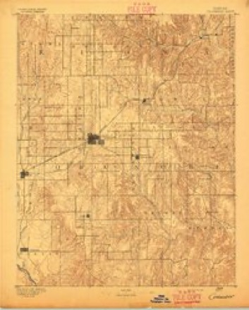
13 topographic sheets cover this place, the earliest surveyed in 1892 and the latest in 1985. It stands in Avilla Township. It lies in ZIP code area 67029. The Survey maps it on the Buttermilk quadrangle.
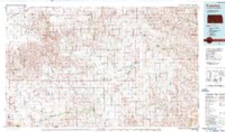
Topographic sheets covering this place
5 surveys from 13 printed sheetsMatched by testing this settlement's coordinate against the published boundary of every sheet in the United States Geological Survey's historical collection. Each opens the scanned sheet at the Survey.
- 1892 USGS Coldwater quadrangle1:125000, 5 printings
- 1955 USGS Pratt quadrangle1:250000, 3 printings
- 1959 USGS Pratt quadrangle1:250000, 2 printings
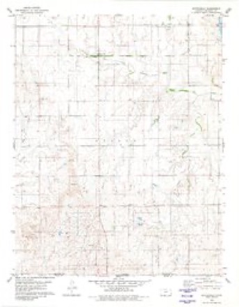
- 1980 USGS Buttermilk quadrangle1:24000
- 1985 USGS Protection quadrangle1:100000, 2 printings
Fires near this place
1 since 2015Regional context, not property-specific evidence. The federal wildfire occurrence database lists 1 fire within 5 miles of Buttermilk in 2015, burning about 9 acres in total. None started naturally. None was recorded as arson. Distance is straight-line from the map coordinates, so a fire counted here may appear on a neighbouring settlement's page as well.
| Reported cause | Fires |
|---|---|
| Debris and open burning | 1 |
The most recent of them, most recent first, with the day each was reported and the service that recorded it.
| Date | Cause | Size | Reported by | Name on the report |
|---|---|---|---|---|
| 2 April 2015 | Debris and open burning | 9.0 acres | Kansas Forest Service | 2015018 |
Storms near this place
60 of 103 shownRegional context, not property-specific evidence. The National Weather Service names Buttermilk in 103 storm reports between 1993 and 2025: 74 hail, 14 thunderstorm wind, 8 tornado, 4 heavy rain. The reports record 2 injuries. Each account below is quoted exactly as the forecast office filed it, from the NOAA Storm Events Database, and each date opens the federal record of that event.
| When | Event | Place named | Harm | What the report says |
|---|---|---|---|---|
| March 2000 | Thunderstorm Wind | Buttermilk | 1 hurt, $50,000 | Downburst destroyed a shed and toppled a 75 foot radio tower. An empty fuel tank was carried 400 yards. A camper trailer parked at an oil rig was heavily damaged and the male occupant received a minor injury. |
| March 2000 | Tornado (F1) | Buttermilk | 1 hurt | Barn completely destroyed and several dog houses were destroyed but no injuries to the animals resulted. Debris was carried 2 miles. |
| July 2013 | Thunderstorm Wind | Buttermilk | $5,000 | Up to 10 power poles were broken from the high wind. |
| September 2025 | Hail | Buttermilk | - | The emergency manager reported 1.75 inch hail. |
| April 2025 | Hail | Buttermilk | - | Comanche County emergency manager sent a picture of golf ball size hail via Slack. |
| August 2025 | Flood | Buttermilk | - | The emergency manager reported water over roadways at the intersection of Avenue V and Road 17. They also reported flooding ongoing along Avenue Y between Road 14 and 16. |
| June 2025 | Thunderstorm Wind | Buttermilk | - | Reported outbuilding damage in this approximate location. Time was estimated from radar and the report came from Emergency Management. |
| May 2024 | Hail | Buttermilk | - | Mostly pea size hail or smaller. Hail was covering the ground. Did have a few stones as large as a half dollar. |
| September 2024 | Thunderstorm Wind | Buttermilk | - | A public report estimated winds of 60 MPH associated with the storm 2 miles NW of Buttermilk. |
| May 2022 | Tornado (EF0) | Buttermilk | - | Brief ground circulation from this landspout. Observed by law enforcement and storm spotters. |
| July 2021 | Thunderstorm Wind | Buttermilk | - | Tree limbs of at least 1 inch in diameter were broken by the high wind. |
| October 2018 | Heavy Rain | Buttermilk | - | Rainfall for the period was 6.92 inches. |
| June 2017 | Heavy Rain | Buttermilk | - | The home station observed rates of 9 inches per hour. The total was 3.36 inches. |
| June 2017 | Thunderstorm Wind | Buttermilk | - | Four inch diameter tree limbs were broken by the high wind. |
| June 2017 | Thunderstorm Wind | Buttermilk | - | Tree limbs of 4 inches in diameter were blown down by the high wind. |
| April 2015 | Hail | Buttermilk | - | The ground was nearly covered by the hail. |
| April 2015 | Tornado (EF0) | Buttermilk | - | This was a weak tornado with intermittent contact with the ground. |
| November 2015 | Tornado (EF1) | Buttermilk | - | This tornado moved out of Oklahoma and into Comanche County. It struck a farmstead damaging an older home, outbuildings and farm implements. |
| May 2013 | Thunderstorm Wind | Buttermilk | - | There was unspecified wind damage done by the high wind. |
| April 2013 | Hail | Buttermilk | - | Pea to penny sized hail covered the ground. |
| July 2013 | Thunderstorm Wind | Buttermilk | - | Overhead bins were blown over by the high wind. |
| July 2013 | Thunderstorm Wind | Buttermilk | - | A mobile home was destroyed by the high wind and the occupant of the mobile home survived without a scratch. |
| June 2013 | Thunderstorm Wind | Buttermilk | - | Winds were estimated to be 70 MPH breaking 3 inch diameter tree branches. |
| April 2012 | Tornado (EF2) | Buttermilk | - | This tornado was observed and photographed as it traveled across mainly open range area. However, it did reach the edge of a farm and did considerable damage to trees, implements, power poles and fence. Some machinery was carried 1/2 of a mile. |
| June 2011 | Thunderstorm Wind | Buttermilk | - | Winds were estimated to be 70 MPH. |
| May 2011 | Hail | Buttermilk | - | There were numerous reports of hail received from the Buttermilk area. The size of the hail ranged from dime to golf ball and reports indicated the hail occurred from 403 to 420 PM CDT. |
| September 2010 | Tornado (EF0) | Buttermilk | - | This brief landspout tornado formed under a rapidly developing thunderstorm but did not encounter anything to damage. |
| May 2010 | Hail | Buttermilk | - | Most of hail was pea sized. |
| April 2009 | Hail | Buttermilk | - | There was a lot of pea to penny sized hail. |
| May 2008 | Tornado (EF3) | Buttermilk | - | This 1/2 mile wide tornado moved out of Oklahoma. EF3+ damaged was based on trees that appeared to be sand blasted. Also, there were trees uprooted, several antique cars that have yet to be found as of late July, 2008 (probably dropped in ravines in the area). An oil tank was carried 2 miles. Several head of cattle were killed. The tornado turned west (left) as it began to dissipate. |
| June 2007 | Flood | Buttermilk | - | A road was washed out near a bridge. Nearly all county roads in southeast Comanche county had water on them. Estimated 3 to 5 inches of rain fell. |
| June 2007 | Flood | Buttermilk | - | Numerous roads washed out from 5.80 inches of rain that fell. |
| June 2007 | Heavy Rain | Buttermilk | - | Rainfall of 2.60 inches fell in about 1 1/2 hours. |
| May 2002 | Tornado (F0) | Buttermilk | - | This tornado did not hit anything to give it a rating other than zero. |
| June 2024 | Thunderstorm Wind | Buttermilk | - | no account filed |
| May 2024 | Hail | Buttermilk | - | no account filed |
| May 2024 | Hail | Buttermilk | - | no account filed |
| September 2021 | Hail | Buttermilk | - | no account filed |
| July 2019 | Hail | Buttermilk | - | no account filed |
| May 2019 | Hail | Buttermilk | - | no account filed |
| May 2018 | Hail | Buttermilk | - | no account filed |
| May 2018 | Hail | Buttermilk | - | no account filed |
| May 2018 | Hail | Buttermilk | - | no account filed |
| May 2018 | Hail | Buttermilk | - | no account filed |
| May 2018 | Hail | Buttermilk | - | no account filed |
| June 2017 | Hail | Buttermilk | - | no account filed |
| June 2017 | Hail | Buttermilk | - | no account filed |
| April 2017 | Hail | Buttermilk | - | no account filed |
| April 2017 | Hail | Buttermilk | - | no account filed |
| September 2016 | Hail | Buttermilk | - | no account filed |
| April 2015 | Hail | Buttermilk | - | no account filed |
| April 2015 | Hail | Buttermilk | - | no account filed |
| April 2015 | Hail | Buttermilk | - | no account filed |
| June 2015 | Hail | Buttermilk | - | no account filed |
| June 2014 | Hail | Buttermilk | - | no account filed |
| May 2013 | Hail | Buttermilk | - | no account filed |
| May 2013 | Hail | Buttermilk | - | no account filed |
| May 2013 | Hail | Buttermilk | - | no account filed |
| May 2013 | Hail | Buttermilk | - | no account filed |
| April 2013 | Hail | Buttermilk | - | no account filed |
Nearest settlements
The eight closest, with where each one stands in the county. Distances are straight-line, computed from the Geographic Names Information System coordinates.
| Map | Place | Distance | Sheets |
|---|---|---|---|
| Protection | 10.8 miles | 13 | |
| Coldwater | 11.5 miles | 13 | |
| Wilmore | 17.2 miles | 13 |
Elsewhere
Matched on this settlement's Geographic Names Information System number rather than its name, so it cannot be a different place of the same name in another state.
| Wikipedia article on Buttermilk | An encyclopaedic summary. Its text is share-alike, so it is linked here rather than copied. |
| Wikidata item Q5003004 | The structured record the population and elevation above come from. Public domain (CC0). |
Provenance
This settlement is recorded in the Geographic Names Information System as feature 484539. The sheet list is computed by point-in-boundary test against the United States Geological Survey's historical topographic inventory. Both are works of the United States government and carry no copyright under 17 U.S.C. 105.
Wildfire. Short, Karen C. 2022. Spatial wildfire occurrence data for the United States, 1992-2020 [FPA_FOD_20221014]. 6th Edition. Fort Collins, CO: Forest Service Research Data Archive. https://doi.org/10.2737/RDS-2013-0009.6 Collected with United States Government funding and usable without additional permissions or fees.
Storms. NOAA National Centers for Environmental Information, Storm Events Database https://www.ncei.noaa.gov/stormevents/ A work of the United States government, no copyright under 17 U.S.C. 105. Narratives are quoted verbatim from the National Weather Service report and are not edited or summarised.