 Block
Cedar Vale, Kansas
14 topographic sheets cover this place, the earliest surveyed in 1889 and the latest in 1985. It stands in Jefferson Township. It lies in ZIP code area 67024. The Survey maps it on the Cedar Vale West quadrangle. 476 people lived here at the 2020 count. It stands 948 feet above sea level.
On record in Cedar Vale
Buildings and businesses the archive holds for this place. Each opens its own page, with the source record it came from.
On the National Register 3 records
- L.C. Adam Mercantile Buildinglisted 2007
- Hewins Park Pavilionlisted 2007
- Otter Creek Bridgelisted 1990
Population over time
2 figuresCedar Vale fell from 579 to 476 between 2010 and 2020. These are the recorded population figures Wikidata holds for this place, reached through the Geographic Names Information System number this page is keyed on rather than by name, so they belong to this place and not to another of the same name. Most are census counts, but not all are: an early figure may be a founding or settlement estimate, and an estimate published within five years of a census is left out. The change column is computed, and is left blank where more than 20 years separate a figure from the one before it, because a gap that long is not a change between two counts.
| Year | People | Change |
|---|---|---|
| 2010 | 579 | |
| 2020 | 476 | -103 (-18%) |
Topographic sheets covering this place
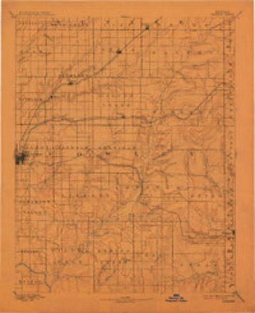
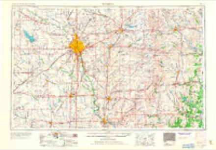
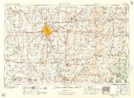
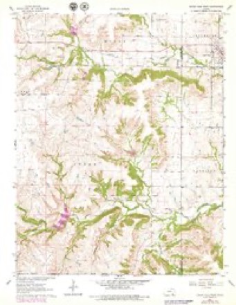
5 surveys from 14 printed sheetsMatched by testing this settlement's coordinate against the published boundary of every sheet in the United States Geological Survey's historical collection. Each opens the scanned sheet at the Survey.
- 1889 USGS Burden quadrangle1:125000, 6 printings
- 1955 USGS Wichita quadrangle1:250000, 3 printings
- 1958 USGS Wichita quadrangle1:250000
- 1962 USGS Cedar Vale West quadrangle1:24000, 2 printings
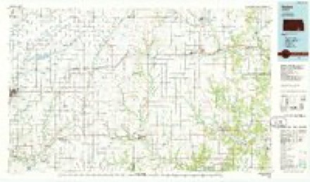
- 1985 USGS Sedan quadrangle1:100000, 2 printings
Fires near this place
6 since 2017Regional context, not property-specific evidence. The federal wildfire occurrence database lists 6 fires within 5 miles of Cedar Vale between 2017 and 2020, burning about 148 acres in total. None started naturally. None was recorded as arson. Distance is straight-line from the map coordinates, so a fire counted here may appear on a neighbouring settlement's page as well.
| Reported cause | Fires |
|---|---|
| Missing data/not specified/undetermined | 3 |
| Equipment and vehicle use | 2 |
| Misuse of fire by a minor | 1 |
The most recent of them, most recent first, with the day each was reported and the service that recorded it.
| Date | Cause | Size | Reported by | Name on the report |
|---|---|---|---|---|
| 6 March 2020 | Missing data/not specified/undetermined | 100 acres | Kansas Forest Service | not named |
| 3 March 2020 | Misuse of fire by a minor | 40 acres | Kansas Forest Service | not named |
| 16 March 2017 | Missing data/not specified/undetermined | under an acre | Chautauqua County | 3162017 |
| 21 February 2017 | Missing data/not specified/undetermined | 5.0 acres | Chautauqua County | 22117 |
| 31 December 2019 | Equipment and vehicle use | under an acre | Kansas Forest Service | 254 |
| 28 January 2018 | Equipment and vehicle use | 2.0 acres | Kansas Forest Service | 2 |
Settlements close enough to share some of these fires:
Storms near this place
60 of 142 shownRegional context, not property-specific evidence. The National Weather Service names Cedar Vale in 142 storm reports between 1993 and 2026: 66 hail, 58 thunderstorm wind, 7 flash flood, 6 tornado. No death or injury is recorded in these reports. Each account below is quoted exactly as the forecast office filed it, from the NOAA Storm Events Database, and each date opens the federal record of that event.
| When | Event | Place named | Harm | What the report says |
|---|---|---|---|---|
| May 2013 | Thunderstorm Wind | Cedar Vale | $100,000 | Estimated winds up to 85 mph caused a swath of damage from Cedar Vale to 9 miles northwest of Sedan. Numerous trees, power lines, and limbs were reported down. The swath was estimated to be 2 to 3 miles wide. An estimated 9 power poles were laying across highway 99. |
| June 2007 | Flash Flood | Cedar Vale | $100,000 | The CO-OP observer in Cedar Vale measured 7.2 inches of rain which lead to flooding of his residence. 6 inches of rain was also measured in the town of Chautauqua. Flash flooding was also reported in Sedan where numerous city streets were inundated. |
| June 2011 | Thunderstorm Wind | Cedar Vale | $20,000 | The estimated winds of 80 mph blew about 50 percent of a roof off of a home. |
| April 2012 | Thunderstorm Wind | Cedar Vale | $15,000 | A couple of power poles were downed with power outages reported. |
| February 2012 | Thunderstorm Wind | Cedar Vale | $15,000 | Winds estimated around 80 mph produced some damage across Cedar Vale. Power lines were downed, tree limbs 10 inches in diameter were downed, and the announcer's box roof at the ball field blew off. Additionally, ping pong ball size hail accompanied these severe winds. |
| July 2006 | Thunderstorm Wind | Cedar Vale | $15,000 | Severe winds tore the roof off of a gas station. |
| August 2011 | Thunderstorm Wind | Cedar Vale | $10,000 | A tree was downed onto a building. The extent of damage is unknown, therefore property damage amounts are rough estimates. |
| May 2010 | Thunderstorm Wind | Cedar Vale | $10,000 | Some power flashes were noted with a few powerlines knocked down. |
| September 2001 | Thunderstorm Wind | Cedar Vale | $5,000 | Tree fell onto a house. |
| July 2000 | Thunderstorm Wind | Cedar Vale | $5,000 | Several pieces of tin torn off a barn. |
| August 2006 | Thunderstorm Wind | Cedar Vale | $3,000 | The strong winds stripped siding from a house. |
| June 2011 | Thunderstorm Wind | Cedar Vale | $2,000 | Several street signs and tree limbs of 5 to 6 inches in diameter were snapped off of trees. |
| July 2009 | Thunderstorm Wind | Cedar Vale | $500 | Tree limbs were downed. |
| April 1994 | Hail | Cedar Vale | $500 | no account filed |
| February 1993 | Hail | Cedar Vale | $500 | no account filed |
| February 1993 | Hail | Cedar Vale | $500 | no account filed |
| April 2026 | Hail | Cedar Vale | - | The ground was covered with pea to quarter size hail. |
| April 2026 | Thunderstorm Wind | Cedar Vale | - | Wind gusts were estimated between 60 and 70 mph. |
| August 2025 | Flash Flood | Cedar Vale | - | There was a report of water over the bridge just southwest of the cemetery and much of the road leading up to the bridge was under water as well. |
| June 2025 | Thunderstorm Wind | Cedar Vale | - | Wind gusts up to 60 mph were estimated. |
| April 2024 | Thunderstorm Wind | Cedar Vale | - | Emergency manager had an estimated 60 mph wind that lasted for 10 to 15 minutes. |
| April 2024 | Flash Flood | Cedar Vale | - | Emergency manager relayed quite a bit of road damage with roads washed out completely north of Cedar Vale due to rapid rises on the Caney River and its associated creeks. At Road 6 and Quivira, a rainfall gauge had 6.4 inches of rain through the following morning, but it overfilled before getting the complete total. |
| April 2024 | Heavy Rain | Cedar Vale | - | A public report relayed via emergency management of an estimated 6.4 inches of rain at Road 6 and Quivira Road. The gage overflowed thus the full measurement is unknown. Additional rainfall reports were received in the county ranging from 4.02 inches in Sedan to 3.77 inches near Hale by cooperative observers. There was quite a bit of flooding and associated road damage in the western portion of the county due to rises on rivers, creeks and streams. |
| September 2024 | Thunderstorm Wind | Cedar Vale | - | A camper trailer was blown over and off of Highway 166 near the Cowley-Chautauqua county line. Nearby, a video showed a barn was severely damaged along with several power lines and trees snapped or down. |
| June 2022 | Heavy Rain | Cedar Vale | - | A mesonet station near Cedarvale reported 1.22 inches of rainfall in 24 hours. |
| May 2020 | Hail | Cedar Vale | - | The dime to nickel size hail covered the ground. |
| September 2019 | Tornado (EFU) | Cedar Vale | - | This was a brief event that caused no damage. |
| May 2018 | Thunderstorm Wind | Cedar Vale | - | Tree damage was reported across town along with the awning at the city pool being blown off. |
| May 2018 | Tornado (EF0) | Cedar Vale | - | Brief touchdown in open country outside of town. |
| June 2018 | Thunderstorm Wind | Cedar Vale | - | The winds were estimated up to 60 mph. Numerous limbs were downed along with some blowing debris. |
| June 2018 | Thunderstorm Wind | Cedar Vale | - | The caller estimated 60 to 70 mph winds. The time of the event was estimated from radar. |
| April 2016 | Thunderstorm Wind | Cedar Vale | - | A trained spotter measured the 77-mph gust on a home weather station. The time is estimated from radar. No damage was reported. |
| April 2015 | Thunderstorm Wind | Cedar Vale | - | A law enforcement officer estimated the gust. |
| April 2015 | Thunderstorm Wind | Cedar Vale | - | A trained spotter reported the gust. |
| April 2015 | Hail | Cedar Vale | - | Winds of 70 to 75 mph were also reported. |
| April 2015 | Thunderstorm Wind | Cedar Vale | - | Quarter sized hail was also reported. |
| May 2015 | Flood | Cedar Vale | - | Reports of minor street flooding was noted at many low water crossings across the county. |
| July 2014 | Thunderstorm Wind | Cedar Vale | - | Damage to several trees were noted across the area along with several downed power lines. Wind speed up to 70 mph were reported. |
| September 2014 | Tornado (EF1) | Cedar Vale | - | Nice cone tornado move across open country across the county causing damage to a couple of barns and several trees. One barn was completely collapsed and another lost some of the metal roofing. |
| September 2014 | Thunderstorm Wind | Cedar Vale | - | The winds were estimated at between 70 and 80 mph. |
| May 2013 | Thunderstorm Wind | Cedar Vale | - | No damage was reported. |
| May 2013 | Thunderstorm Wind | Cedar Vale | - | Some minor damage was reported to a few structures. |
| May 2013 | Hail | Cedar Vale | - | Fifty five mile per hour winds were also reported. |
| April 2012 | Hail | Cedar Vale | - | The hail covered the ground. |
| February 2012 | Hail | Cedar Vale | - | Winds estimated around 80 mph accompanied the large hail. |
| November 2011 | Hail | Cedar Vale | - | The hail was mostly dime to quarter size, but a few were up to golfball size. The hail occurred with 50 mph winds. |
| February 2011 | Tornado (EF0) | Cedar Vale | - | The tornado touched down briefly over open country. No damage was noted with this tornado. |
| June 2011 | Thunderstorm Wind | Cedar Vale | - | A trained spotter reported an estimated wind gust of 60 mph. |
| June 2011 | Heavy Rain | Cedar Vale | - | Heavy rains caused minor flooding of rural land across the county. |
| May 2010 | Thunderstorm Wind | Cedar Vale | - | Wind gusts were estimated at around 60 mph. |
| April 2010 | Thunderstorm Wind | Cedar Vale | - | The strong winds were accompanied by pea sized hail. |
| October 2010 | Hail | Cedar Vale | - | Winds estimated at 50 mph occurred with the hail. |
| March 2010 | Hail | Cedar Vale | - | Pea to penny sized hail covered the ground. |
| May 2009 | Hail | Cedar Vale | - | Winds also gusted to 45 mph. |
| June 2009 | Thunderstorm Wind | Cedar Vale | - | Cedar Vale experienced a power outage due to the wind. |
| May 2009 | Hail | Cedar Vale | - | The hail was accompanied with 50 mph winds. |
| June 2008 | Flood | Cedar Vale | - | Very heavy rainfall in a short period of time caused some flooding across Chautauqua County from the early morning to early afternoon hours on the 28th. Water covered parts of Highway 99 just west of Sedan, and typical low water crossings flooded in and around Cedar Vale. Any potential damage estimates are unknown. |
| June 2005 | Flash Flood | Cedar Vale | - | Water flowed over Gallup Road Bridge. |
| April 2004 | Hail | Cedar Vale | - | Hail covered ground, making roads slick. |
| April 2003 | Tornado (F0) | Cedar Vale | - | Remained in the country. |
Nearest settlements
The eight closest, with where each one stands in the county. Distances are straight-line, computed from the Geographic Names Information System coordinates.
Elsewhere
Matched on this settlement's Geographic Names Information System number rather than its name, so it cannot be a different place of the same name in another state.
| Wikipedia article on Cedar Vale | An encyclopaedic summary. Its text is share-alike, so it is linked here rather than copied. |
| Wikidata item Q2231565 | The structured record the population and elevation above come from. Public domain (CC0). |
Provenance
This settlement is recorded in the Geographic Names Information System as feature 469099. The sheet list is computed by point-in-boundary test against the United States Geological Survey's historical topographic inventory. Both are works of the United States government and carry no copyright under 17 U.S.C. 105.
Wildfire. Short, Karen C. 2022. Spatial wildfire occurrence data for the United States, 1992-2020 [FPA_FOD_20221014]. 6th Edition. Fort Collins, CO: Forest Service Research Data Archive. https://doi.org/10.2737/RDS-2013-0009.6 Collected with United States Government funding and usable without additional permissions or fees.
Storms. NOAA National Centers for Environmental Information, Storm Events Database https://www.ncei.noaa.gov/stormevents/ A work of the United States government, no copyright under 17 U.S.C. 105. Narratives are quoted verbatim from the National Weather Service report and are not edited or summarised.