 Block
Clay Center, Kansas
14 topographic sheets cover this place, the earliest surveyed in 1891 and the latest in 1985. It stands in Clay Center City. It lies in ZIP code area 67432. It stands on Spring Creek. The Survey maps it on the Clay Center NE quadrangle. 4,199 people lived here at the 2020 count. It stands 1,201 feet above sea level.
On record in Clay Center
Buildings and businesses the archive holds for this place. Each opens its own page, with the source record it came from.
On the National Register 3 records
- Clay Center Carnegie Librarylisted 1987
- Clay Center Downtown Historic District (Additional Documentation)listed 2020
- Clay County Courthouselisted 1973
Population over time
2 figuresClay Center fell from 4,334 to 4,199 between 2010 and 2020. These are the recorded population figures Wikidata holds for this place, reached through the Geographic Names Information System number this page is keyed on rather than by name, so they belong to this place and not to another of the same name. Most are census counts, but not all are: an early figure may be a founding or settlement estimate, and an estimate published within five years of a census is left out. The change column is computed, and is left blank where more than 20 years separate a figure from the one before it, because a gap that long is not a change between two counts.
| Year | People | Change |
|---|---|---|
| 2010 | 4,334 | |
| 2020 | 4,199 | -135 (-3%) |
Topographic sheets covering this place
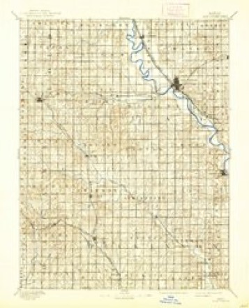
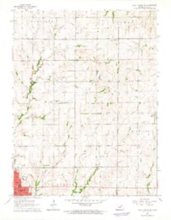
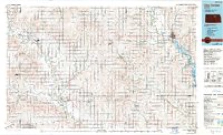
6 surveys from 14 printed sheetsMatched by testing this settlement's coordinate against the published boundary of every sheet in the United States Geological Survey's historical collection. Each opens the scanned sheet at the Survey.
- 1891 USGS Clay Center quadrangle1:125000, 5 printings
- 1955 USGS Manhattan quadrangle1:250000, 4 printings
- 1956 USGS Manhattan quadrangle1:250000
- 1957 USGS Manhattan quadrangle1:250000
- 1964 USGS Clay Center NE quadrangle1:24000
- 1985 USGS Clay Center quadrangle1:100000, 2 printings
Fires near this place
25 since 2015Regional context, not property-specific evidence. The federal wildfire occurrence database lists 25 fires within 5 miles of Clay Center between 2015 and 2020, burning about 173 acres in total. 1 started naturally. 2 were recorded as arson. Distance is straight-line from the map coordinates, so a fire counted here may appear on a neighbouring settlement's page as well.
| Reported cause | Fires |
|---|---|
| Debris and open burning | 10 |
| Missing data/not specified/undetermined | 7 |
| Equipment and vehicle use | 4 |
| Arson/incendiarism | 2 |
| Smoking | 1 |
| Natural | 1 |
The most recent of them, most recent first, with the day each was reported and the service that recorded it.
| Date | Cause | Size | Reported by | Name on the report |
|---|---|---|---|---|
| 5 September 2018 | Arson/incendiarism | under an acre | Kansas Forest Service | 2018111 |
| 17 September 2017 | Natural | under an acre | Clay County | 2017081 |
| 5 July 2018 | Debris and open burning | 1.0 acres | Kansas Forest Service | 15 |
| 25 June 2015 | Debris and open burning | 1.0 acres | Kansas Forest Service | 1500011 |
| 1 June 2020 | Missing data/not specified/undetermined | 1.0 acres | Kansas Forest Service | not named |
| 28 April 2018 | Arson/incendiarism | under an acre | Kansas Forest Service | 2018064 |
| 8 March 2015 | Debris and open burning | 30 acres | Kansas Forest Service | 1438 |
| 7 March 2015 | Debris and open burning | 20 acres | Kansas Forest Service | 150004 |
Settlements close enough to share some of these fires:
Mines and quarries near this place
1 within 5 milesRegional context, not property-specific evidence. The federal mineral resources record lists 1 working within 5 miles of Clay Center: 1 past producer. None of them still produces. What was taken out: Clay. Distance is straight-line from the map coordinates, so a quarry counted here may appear on a neighbouring settlement's page as well.
| Where | Site | Commodity | Status | Recorded |
|---|---|---|---|---|
| Alsop Sand Pit & Plant | Clay | Past Producer |
Storms near this place
60 of 131 shownRegional context, not property-specific evidence. The National Weather Service names Clay Center in 131 storm reports between 1993 and 2024: 67 hail, 51 thunderstorm wind, 7 flash flood, 3 tornado. No death or injury is recorded in these reports. Each account below is quoted exactly as the forecast office filed it, from the NOAA Storm Events Database, and each date opens the federal record of that event.
| When | Event | Place named | Harm | What the report says |
|---|---|---|---|---|
| May 2007 | Flash Flood | Clay Center | $600,000 | Water reported over 9th road and Kiowa south of Clay Center. Road is closed. |
| July 1994 | Thunderstorm Wind | Clay Center | $500,000 | Strong thunderstorm winds caused major tree damage in the area. |
| May 2007 | Flash Flood | Clay Center | $200,000 | One foot of water flowing over Crawford street in town. |
| April 2006 | Tornado (F1) | Clay Center | $100,000 | This tornado formed from a supercell thunderstorm 2 miles west of Clay Center at 3:40pm cst and travelled 9 miles before lifting 2 miles south-southwest of Garfield Center at 3:52pm cst. The tornado was up to 1/2 mile wide at times and damaged numerous outbuildings, trees, roofs, and irrigation pivots along its path. It was rated as a strong F1 tornado. |
| June 1994 | Hail | Clay Center | $50,000 | no account filed |
| June 1994 | Hail | Clay Center | $50,000 | no account filed |
| August 1997 | Lightning | Clay Center | $15,000 | no account filed |
| May 1996 | Flash Flood | Clay Center | $10,000 | no account filed |
| September 2004 | Thunderstorm Wind | Clay Center | $9,000 | Strong winds blew down power lines. Also a tree was blow down onto a parked car doing minor damage. Asecond tree was blown down onto the roof of a house causing some roof damage. |
| August 2003 | Thunderstorm Wind | Clay Center | $5,000 | Strong winds destroyed some outbuildings. |
| August 2003 | Thunderstorm Wind | Clay Center | $5,000 | Strong winds damaged power poles. |
| October 1997 | Thunderstorm Wind | Clay Center | $1,000 | no account filed |
| October 1997 | Thunderstorm Wind | Clay Center | $1,000 | no account filed |
| May 1993 | Thunderstorm Wind | Clay Center | $500 | no account filed |
| August 2024 | Thunderstorm Wind | Clay Center | - | Picture from social media of a large part of a healthy tree down across road. |
| July 2024 | Thunderstorm Wind | Clay Center | - | Tree down on Third Street in Clay Center. |
| June 2024 | Thunderstorm Wind | Clay Center | - | Estimated wind gusts. |
| April 2023 | Thunderstorm Wind | Clay Center | - | NWS storm survey found extensive tree damage in Clay Center from a microburst with 80 to 90 mph winds. |
| July 2023 | Thunderstorm Wind | Clay Center | - | Kansas state mesonet site reported a wind gust of 61 mph. |
| April 2022 | Hail | Clay Center | - | Quarter sized hail reported. |
| April 2022 | Thunderstorm Wind | Clay Center | - | Measured at mesonet station ew5822 clay center. |
| December 2021 | Thunderstorm Wind | Clay Center | - | Measured at mesonet station ew5822 clay center. |
| December 2021 | Thunderstorm Wind | Clay Center | - | Damage to metal grain bins. |
| July 2019 | Thunderstorm Wind | Clay Center | - | Measured wind gust. |
| July 2019 | Thunderstorm Wind | Clay Center | - | Measured by a automated station. |
| August 2019 | Thunderstorm Wind | Clay Center | - | Rotten tree uprooted. |
| May 2018 | Thunderstorm Wind | Clay Center | - | Measured by a mesonet site. |
| May 2018 | Thunderstorm Wind | Clay Center | - | Strong winds were reported on the gust front. Power was also out in Clay Center. |
| July 2018 | Thunderstorm Wind | Clay Center | - | A tree trunk in 1-2 feet in diameter was snapped at the base of the trunk. The report was received via a social media photo. |
| May 2018 | Hail | Clay Center | - | Dime to nickel size hail was reported. |
| August 2016 | Hail | Clay Center | - | Winds were estimated up to 50 mph. No damage was reported. |
| August 2016 | Thunderstorm Wind | Clay Center | - | Delayed report. |
| October 2016 | Tornado (EF1) | Clay Center | - | This tornado was documented by storm chasers with video and photos which showed a well developed cone shaped tornado that at times appears to have done damage along a nearly 300 yard swath at least briefly after it crossed highway 15 in an open field. The main structures impacted included a farmstead with grain bins and other outbuildings exhibiting high end EF1 damage. Winds to around 110 mph were estimated at the farmstead. Given the lack of damage indicators along the path it is possible that this tornado was stronger at some point in its life as it moved through open fields. |
| October 2016 | Hail | Clay Center | - | Largest hailstone in the photo was approximately 2 inches in diameter. |
| July 2015 | Thunderstorm Wind | Clay Center | - | Minor tree damage in Clay Center. |
| August 2014 | Thunderstorm Wind | Clay Center | - | Large tree limbs down. |
| July 2014 | Thunderstorm Wind | Clay Center | - | Medium sized tree limbs down. |
| June 2014 | Thunderstorm Wind | Clay Center | - | A tree limb fell on power line. |
| August 2013 | Flash Flood | Clay Center | - | Several streets in Clay center have water running over them. |
| October 2013 | Thunderstorm Wind | Clay Center | - | Large tree limb blocking the road on the outskirts of city. No diameter given. |
| October 2013 | Thunderstorm Wind | Clay Center | - | Wind gust estimated. |
| May 2013 | Thunderstorm Wind | Clay Center | - | Large tree down in town square. Time estimated from radar. |
| June 2011 | Flood | Clay Center | - | Widespread flooding continues in Clay County along large stem rivers and smaller streams. Highway 15 was down to one lane near the Republican River. |
| August 2011 | Thunderstorm Wind | Clay Center | - | In Clay Center 7 to 9 inch diameter tree limbs were snapped at 9th Street and Dexter as a result of strong thunderstorm winds. |
| August 2009 | Thunderstorm Wind | Clay Center | - | Numerous power lines were blown down in the town of Clay Center. |
| June 2008 | Tornado (EF1) | Clay Center | - | A third tornado touched down in Clay County the night of the 5th. The weak tornado caused window, roof, and siding damage to several homes along it's path. Storm surveyors also noted that several trees and outbuildings had also been damaged or destroyed. |
| June 2008 | Hail | Clay Center | - | Trained spotters and law enforcement officials across Clay Center called as hail quickly grew from one and a half inches in diameter the size of golfballs, to tennis balls, and finally to three and a half inches in diameter. The city of Clay Center, and local newspapers relayed numerous reports of damage. The large hail backed up storm sewers, which lead to flash flooding in the city. Homes and farm buildings were damaged. Vehicles, especially windshields also suffered fairly extensive damage. |
| June 2008 | Hail | Clay Center | - | Law enforcement and trained spotters reported hail from the size of walnuts to the size of golfballs. |
| September 2007 | Thunderstorm Wind | Clay Center | - | Estimated 60mph winds at the intersection of 14th and Frontier. |
| April 2006 | Thunderstorm Wind | Clay Center | - | Debris reported on the west side of town. |
| August 2006 | Thunderstorm Wind | Clay Center | - | Report of trees and tree limbs down. High winds and heavy rain forced two cars down an embankment off the Wakefield Causeway. Two individuals needed to be transported to area hospitals with indirect injuries following the accidents. |
| July 2001 | Flash Flood | Clay Center | - | Heavy rains caused flash flooding in Clay Center and rural areas of Clay county. |
| September 1998 | Heavy Rain | Clay Center | - | Heavy rains fell across Clay county during the evening hours. Clay Center received 4.97 inches of rain but there were public reports of as much as 6 to 7 inches south and east of Clay Center. A road east of Clay Center was flooded for a time. |
| June 2024 | Thunderstorm Wind | Clay Center | - | no account filed |
| June 2024 | Thunderstorm Wind | Clay Center | - | no account filed |
| June 2024 | Hail | Clay Center | - | no account filed |
| June 2024 | Thunderstorm Wind | Clay Center | - | no account filed |
| June 2017 | Thunderstorm Wind | Clay Center | - | no account filed |
| June 2015 | Hail | Clay Center | - | no account filed |
| July 2014 | Hail | Clay Center | - | no account filed |
Nearest settlements
The eight closest, with where each one stands in the county. Distances are straight-line, computed from the Geographic Names Information System coordinates.
| Map | Place | Distance | Sheets |
|---|---|---|---|
| Broughton (historical) | 5.4 miles | 14 | |
| Green | 7.4 miles | 14 | |
| Morganville | 7.4 miles | 14 | |
| Idana | 7.5 miles | 14 | |
| Ladysmith | 7.9 miles | 14 | |
| Oscar (historical) | 9.7 miles | 13 | |
| Garfield Center | 10.1 miles | 13 | |
| Browndale | 12.0 miles | 14 |
Elsewhere
Matched on this settlement's Geographic Names Information System number rather than its name, so it cannot be a different place of the same name in another state.
| Wikipedia article on Clay Center | An encyclopaedic summary. Its text is share-alike, so it is linked here rather than copied. |
| Wikidata item Q1914606 | The structured record the population and elevation above come from. Public domain (CC0). |
Provenance
This settlement is recorded in the Geographic Names Information System as feature 476034. The sheet list is computed by point-in-boundary test against the United States Geological Survey's historical topographic inventory. Both are works of the United States government and carry no copyright under 17 U.S.C. 105.
Wildfire. Short, Karen C. 2022. Spatial wildfire occurrence data for the United States, 1992-2020 [FPA_FOD_20221014]. 6th Edition. Fort Collins, CO: Forest Service Research Data Archive. https://doi.org/10.2737/RDS-2013-0009.6 Collected with United States Government funding and usable without additional permissions or fees.
Mines and quarries. USGS Mineral Resources Data System (MRDS) https://mrdata.usgs.gov/mrds/ A work of the United States government, no copyright under 17 U.S.C. 105.
Storms. NOAA National Centers for Environmental Information, Storm Events Database https://www.ncei.noaa.gov/stormevents/ A work of the United States government, no copyright under 17 U.S.C. 105. Narratives are quoted verbatim from the National Weather Service report and are not edited or summarised.