 Block
Colby, Kansas
9 topographic sheets cover this place, the earliest surveyed in 1943 and the latest in 1985. It stands in Morgan Township. It lies in ZIP code area 67701. The Survey maps it on the Colby quadrangle. 5,570 people lived here at the 2020 count. It stands 3,159 feet above sea level.
On record in Colby
Buildings and businesses the archive holds for this place. Each opens its own page, with the source record it came from.
On the National Register 4 records
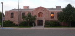 Colby City Halllisted 2003
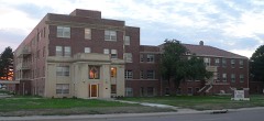 St. Thomas Hospitallisted 2013
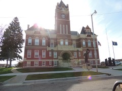 Thomas County Courthouselisted 1976
- Colby Community High Schoollisted 2003
Population over time
2 figuresColby grew from 5,387 to 5,570 between 2010 and 2020. These are the recorded population figures Wikidata holds for this place, reached through the Geographic Names Information System number this page is keyed on rather than by name, so they belong to this place and not to another of the same name. Most are census counts, but not all are: an early figure may be a founding or settlement estimate, and an estimate published within five years of a census is left out. The change column is computed, and is left blank where more than 20 years separate a figure from the one before it, because a gap that long is not a change between two counts.
| Year | People | Change |
|---|---|---|
| 2010 | 5,387 | |
| 2020 | 5,570 | +183 (+3%) |
Topographic sheets covering this place
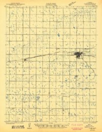
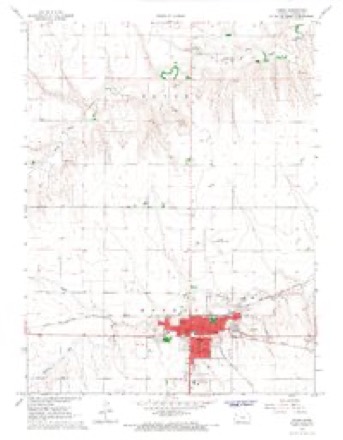
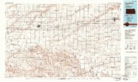
6 surveys from 9 printed sheetsMatched by testing this settlement's coordinate against the published boundary of every sheet in the United States Geological Survey's historical collection. Each opens the scanned sheet at the Survey.
- 1943 USGS Colby quadrangle1:62500, 2 printings
- 1954 USGS Goodland quadrangle1:250000
- 1956 USGS Goodland quadrangle1:250000
- 1957 USGS Goodland quadrangle1:250000, 2 printings
- 1967 USGS Colby quadrangle1:24000
- 1985 USGS Goodland quadrangle1:100000, 2 printings



Fires near this place
15 since 2015Regional context, not property-specific evidence. The federal wildfire occurrence database lists 15 fires within 5 miles of Colby between 2015 and 2018, burning about 50 acres in total. None started naturally. 1 was recorded as arson. Distance is straight-line from the map coordinates, so a fire counted here may appear on a neighbouring settlement's page as well.
| Reported cause | Fires |
|---|---|
| Equipment and vehicle use | 6 |
| Missing data/not specified/undetermined | 4 |
| Debris and open burning | 2 |
| Fireworks | 2 |
| Arson/incendiarism | 1 |
The most recent of them, most recent first, with the day each was reported and the service that recorded it.
| Date | Cause | Size | Reported by | Name on the report |
|---|---|---|---|---|
| 16 September 2018 | Arson/incendiarism | 2.0 acres | Kansas Forest Service | 100 |
| 5 July 2015 | Fireworks | under an acre | Kansas Forest Service | 49 |
| 5 July 2015 | Fireworks | under an acre | Kansas Forest Service | 50 |
| 2 July 2015 | Missing data/not specified/undetermined | under an acre | Kansas Forest Service | 46 |
| 2 July 2015 | Missing data/not specified/undetermined | under an acre | Kansas Forest Service | 45 |
| 16 July 2015 | Equipment and vehicle use | 15 acres | Kansas Forest Service | 54 |
| 15 May 2018 | Equipment and vehicle use | 1.0 acres | Kansas Forest Service | 53 |
| 6 April 2017 | Debris and open burning | under an acre | Thomas County | 38 |
Settlements close enough to share some of these fires:
Storms near this place
60 of 308 shownRegional context, not property-specific evidence. The National Weather Service names Colby in 308 storm reports between 1993 and 2025: 150 hail, 119 thunderstorm wind, 16 flash flood, 11 tornado. The reports record 6 injuries. Each account below is quoted exactly as the forecast office filed it, from the NOAA Storm Events Database, and each date opens the federal record of that event.
| When | Event | Place named | Harm | What the report says |
|---|---|---|---|---|
| August 2006 | Tornado (F1) | Colby | 4 hurt, $125,000 | A tornado developed approximately 2 miles south of Colby at Interstate 70 and highway 25 and traveled 5 miles to the northwest before dissipating. The tornado developed near the Oasis Travel Plaza at 649 pm CDT and dissipated at 659 pm CDT over open fields west of town. The tornado moved northwest at approximately 30 mph. A damage survey team rated the tornado an F1 on the Fujita Scale.The tornado injured 4 people as a result of flying glass and debris at the nearby Comfort Inn, which sustained damage with debris piercing the outside walls, while awnings and tables were also damaged. A 45 foot sign supported by three "I" beams was bent over to the ground. A car dealership reported damage to about 15-20 vehicles with one vehicle a total loss. Most of the damage was due to debris breaking windows and denting the vehicles. A semi truck and trailer parked at the gas station and was lifted and pushed into another truck. |
| May 1995 | Tornado (F2) | Colby | 1 hurt, $700,000 | Intermittent tornado damage included farm residence and storage buildings roofs torn off, high voltage electricty towers destroyed,irrigation rigs over-turned, trees snapped. Extensive crop damage from tornado, highs winds, and large hail. Tornado moved nearly due east at 25 mph and entered Sheridan County. One woman was slightly injured while in her home during the tornado. A mobile home was completely destroyed. |
| August 2002 | Lightning | Colby | 1 hurt | Truck driver stopped to assist at an accident site. When climbing back into his truck, lightning apparently struck near the vehicle, affecting the driver's left arm and chest. Police described the man as being in a state of shock, hyperventilating, having slurred speech, and complaining of tightness in his chest. |
| July 2024 | Thunderstorm Wind | Colby | $100,000 | A tin shed that was unanchored was blown apart with one tree uprooted, several tree limbs down, and a portion of a rear windshield blown out of a truck. |
| March 1998 | Thunderstorm Wind | Colby | $100,000 | Power poles snapped. Two center pivot irrigation rigs destroyed. |
| August 2011 | Thunderstorm Wind | Colby | $75,000 | Wind gust measured at Colby airport. Several hangars suffered damage to doors, and roofing. Minor damage to aircraft and vehicles stored in the hangars also occurred. |
| August 2011 | Thunderstorm Wind | Colby | $50,000 | Numerous power poles and power lines were blown down around town. Several trees were uprooted with numerous limbs down. A glass window was blown in at a car dealership and minor sign damage occurred at other businesses. A few shingles were removed from the courthouse roof. |
| April 2007 | Lightning | Colby | $50,000 | Time estimated based on newspaper report of other power outages in town. Owner not home at the time, but returned to find the electric meter on the home destroyed. A circuit breaker box was burned and hanging from the wall. The strike damaged the underground sprinkler system and destroyed a tree in the yard, which was estimated to have taken the direct lightning strike. The home's entire electrical system was damaged and a television damaged. |
| June 2001 | Thunderstorm Wind | Colby | $50,000 | Straight line winds directly impacted the Colby area. These winds damaged trusses from a manufacturing plant north of Colby. A storage building and log cabin were completely destroyed at the plant by the high winds. Also, numerous homes and business sustained wind damage, such as shingles blown off roofs, windows knocked out, and siding torn off houses. The strong winds blew large tree limbs onto power lines, causing power outages throughout the area. |
| June 1994 | Hail | Colby | $50,000 | Hail accompanied by winds 50 to 70 mph destroyed crops and caused extensive damage to several farmsteads and vehicles. Damage was one to four miles wide and seven miles long. |
| June 1994 | Tornado (F1) | Colby | $50,000 | Tornado observed by spotters knocked down power poles and moved south into Logan County. |
| August 1993 | Thunderstorm Wind | Colby | $50,000 | At least 60 mph winds downed power lines and broke windows. |
| July 1996 | Tornado (F1) | Colby | $37,000 | no account filed |
| July 2020 | Thunderstorm Wind | Colby | $25,000 | KSU Mesonet measured 62 mph wind gusts that is co-located with a blown over linear irrigation system. |
| August 2011 | Flash Flood | Colby | $20,000 | Police car had to be abandoned after 2.10 inches of rain fell in 45 minutes causing the engine to become flooded. |
| May 2009 | Lightning | Colby | $20,000 | A lightning strike affected the law enforcement dispatch center in Colby. A communications console was destroyed, the phone system was damaged, and a fire occurred at a generator switch. |
| June 2021 | Thunderstorm Wind | Colby | $15,000 | Multiple power outages reported in the city of Colby with one utility pole down. |
| August 2019 | Thunderstorm Wind | Colby | $15,000 | Local emergency management reported that severe wind gusts from a thunderstorm led to most of Colby losing power due to downed power lines. In addition, several large tree limbs were reportedly down due to thunderstorm wind gusts by local law enforcement. A large metal sign was downed in Colby which damaged cars in an adjacent parking lot. |
| August 2011 | Thunderstorm Wind | Colby | $12,000 | Trees were blown down in town, some power lines were down and a couple businesses in town had windows broken. |
| August 2019 | Thunderstorm Wind | Colby | $10,000 | All of Colby was reportedly without power due to thunderstorm wind damage and power lines were down. |
| June 2010 | Thunderstorm Wind | Colby | $8,000 | Wind blown gravel was likely responsible for broken windows in four vehicles in a Walmart parking lot as a strong gust of wind developed from weakening thunderstorms. A door to an air conditioning building at the store was blown in, and the garden center was damaged. In a nearby business several windows were broken in large agricultural vehicles. A nearby weather station reported a wind gust of 62 mph. |
| May 2023 | Flash Flood | Colby | $5,000 | Water from heavy rain was spilling over the banks of the Villa High Park pond and going over car hoods. Water was also running over street gutters near the park. |
| August 2019 | Thunderstorm Wind | Colby | $5,000 | A member of the public reported thunderstorm wind damage on the west side of Colby in the form of downed power lines. |
| June 1994 | Thunderstorm Wind | Colby | $5,000 | Thunderstorm winds knocked down crops and tore down three inch diamter branches. |
| May 2018 | Thunderstorm Wind | Colby | $3,000 | Power lines blown down along with large tree limbs on the northeast side of Colby. |
| August 2019 | Thunderstorm Wind | Colby | $2,000 | Tree branches up to 1 inch in diameter were blown down. |
| June 2021 | Thunderstorm Wind | Colby | $1,000 | Image received via social media of a large tree down with the base of the trunk snapped. |
| August 2019 | Thunderstorm Wind | Colby | $1,000 | A trained spotter reported that thunderstorm wind gusts snapped a decorative fake palm tree in half at the Oasis Travel Plaza on the south side of Colby. |
| June 2018 | Thunderstorm Wind | Colby | $1,000 | Tree trunk a foot in diameter was snapped. |
| May 2020 | Thunderstorm Wind | Colby | $950 | A member of the public reported a broken tree limb caused a downed power line in Colby, KS. Time estimated by radar and reports of 60+ mph wind gusts at the airport 2 miles north of the damage location. |
| June 2021 | Thunderstorm Wind | Colby | $500 | Many healthy large tree limbs reported down in Colby. Also reported was laid over corn and wheat in the fields located east of the community college farm. |
| September 1996 | Thunderstorm Wind | Colby | $500 | no account filed |
| March 2025 | Thunderstorm Wind | Colby | - | F6347 reported consistent gusts over 58 MPH for over an hour as convection mixed down stronger winds to the surface. |
| June 2025 | Thunderstorm Wind | Colby | - | Mesonet station FW6347 Colby 2E measured the wind gust. A single instance of quarter mile to zero visibility from blowing dust was reported along I-70 westbound near Colby. Pictures out of Colby showed a haze as well. |
| July 2025 | Thunderstorm Wind | Colby | - | Media storm chaser is reporting gusts of 50 to 60 mph. |
| July 2025 | Thunderstorm Wind | Colby | - | Site Landfill Office measured 58 mph wind gust. |
| July 2025 | Hail | Colby | - | Sporadic quarter sized hail report. |
| July 2025 | Thunderstorm Wind | Colby | - | The wind gust was reported via mesonet site KKSCOLBY59. |
| August 2025 | Flood | Colby | - | Four inches of water covering all of South Range Avenue at the Thomas County Fairgrounds in Colby. Precipitation estimates in the area range from 1.1 to 2.4 inches. |
| June 2025 | Hail | Colby | - | Emergency Manager reported dime to penny sized hail. |
| May 2024 | Flood | Colby | - | Trained spotter reported water overrunning the curbs and pooling a bit in the side lanes at the intersection of College and Range. Also noticed a field next to a store was covered with a few inches of water. |
| April 2024 | Hail | Colby | - | Trained spotter reports hail was ongoing at time of report for a current duration of 5 minutes. |
| April 2024 | Hail | Colby | - | Emergency manager reported nickel sized hail. |
| July 2024 | Thunderstorm Wind | Colby | - | Observation recorded via the mesonet station at the Emergency Management building. |
| July 2024 | Thunderstorm Wind | Colby | - | KS Mesonet site reported a 61 MPH gust. |
| July 2024 | Thunderstorm Wind | Colby | - | An Ambient weather station Ostmeyer in eastern Colby reported a 64 MPH Gust. |
| July 2024 | Hail | Colby | - | Public reported quarter sized hail in the city of Colby. |
| July 2024 | Thunderstorm Wind | Colby | - | Weatherlink site TCEM in Colby reported a 60 MPH gust. |
| July 2024 | Thunderstorm Wind | Colby | - | Kansas mesonet site reported a wind gust of 58 mph at 10 meter height and 50 mph and 2 meter height. |
| May 2023 | Hail | Colby | - | Accumulating pea to penny sized hail observed. |
| June 2023 | Hail | Colby | - | Pea to dime sized hail reported. |
| June 2023 | Thunderstorm Wind | Colby | - | A Mesonet station (FW6347) recorded thunderstorm wind gusts up to 63 mph at its location. |
| July 2023 | Hail | Colby | - | Spotter reported hail up to pennies in size for a quarter mile stretch around location. |
| August 2023 | Hail | Colby | - | Quarter sized hail reported at location. Time is estimated from radar. |
| August 2023 | Hail | Colby | - | Penny sized hail reported at location. |
| August 2023 | Hail | Colby | - | Nickel sized hail reported at location. |
| August 2023 | Hail | Colby | - | Quarter sized hail reported at location. |
| April 2022 | Hail | Colby | - | Nickel to quarter sized hail reported. |
| August 2022 | Thunderstorm Wind | Colby | - | Off duty NWS employee estimates wind gusts up to 60 MPH at the McDonald's parking lot in Colby. |
| June 2022 | Hail | Colby | - | Two reports received of ping pong to lopsided golf ball sized hail on the northwest edge of the city of Colby. |
Nearest settlements
The eight closest, with where each one stands in the county. Distances are straight-line, computed from the Geographic Names Information System coordinates.
Elsewhere
Matched on this settlement's Geographic Names Information System number rather than its name, so it cannot be a different place of the same name in another state.
| Wikipedia article on Colby | An encyclopaedic summary. Its text is share-alike, so it is linked here rather than copied. |
| Wikidata item Q1931279 | The structured record the population and elevation above come from. Public domain (CC0). |
Provenance
This settlement is recorded in the Geographic Names Information System as feature 471203. The sheet list is computed by point-in-boundary test against the United States Geological Survey's historical topographic inventory. Both are works of the United States government and carry no copyright under 17 U.S.C. 105.
Wildfire. Short, Karen C. 2022. Spatial wildfire occurrence data for the United States, 1992-2020 [FPA_FOD_20221014]. 6th Edition. Fort Collins, CO: Forest Service Research Data Archive. https://doi.org/10.2737/RDS-2013-0009.6 Collected with United States Government funding and usable without additional permissions or fees.
Storms. NOAA National Centers for Environmental Information, Storm Events Database https://www.ncei.noaa.gov/stormevents/ A work of the United States government, no copyright under 17 U.S.C. 105. Narratives are quoted verbatim from the National Weather Service report and are not edited or summarised.