 Block
Hutchinson, Kansas
15 topographic sheets cover this place, the earliest surveyed in 1891 and the latest in 1985. It stands in Hutchinson City. It lies in ZIP code area 67501. The Survey maps it on the Hutchinson quadrangle. 40,006 people lived here at the 2020 count. It stands 1,535 feet above sea level.
On record in Hutchinson
Buildings and businesses the archive holds for this place. Each opens its own page, with the source record it came from.
On the National Register 12 of 19 shown
 Downtown Core North Historic Districtlisted 2004
 Fox Theaterlisted 1989
 John P. O. Graber Houselisted 1994
 Hamlin Blocklisted 2008
 Hoke Buildinglisted 2011
 Hutchinson Public Carnegie Librarylisted 1987
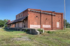 Kelly Millslisted 2008
 Reno County Courthouselisted 1987
 St. Theresa's Catholic Churchlisted 1994
 Terminal Stationlisted 1983
 US Post Office-Hutchinsonlisted 1989
 Frank D. Wolcott Houselisted 1994
Population over time
2 figuresHutchinson fell from 42,080 to 40,006 between 2010 and 2020. These are the recorded population figures Wikidata holds for this place, reached through the Geographic Names Information System number this page is keyed on rather than by name, so they belong to this place and not to another of the same name. Most are census counts, but not all are: an early figure may be a founding or settlement estimate, and an estimate published within five years of a census is left out. The change column is computed, and is left blank where more than 20 years separate a figure from the one before it, because a gap that long is not a change between two counts.
| Year | People | Change |
|---|---|---|
| 2010 | 42,080 | |
| 2020 | 40,006 | -2,074 (-5%) |
Topographic sheets covering this place
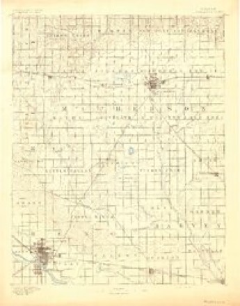
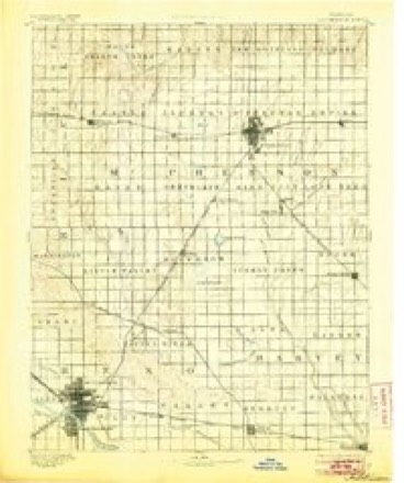
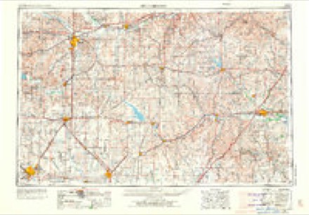
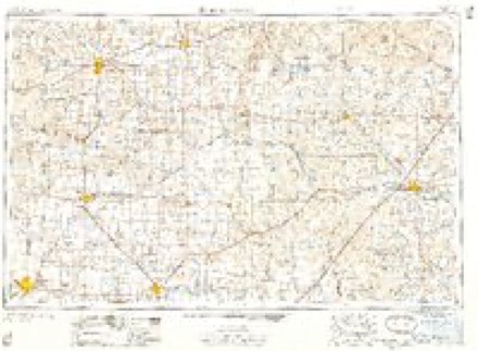
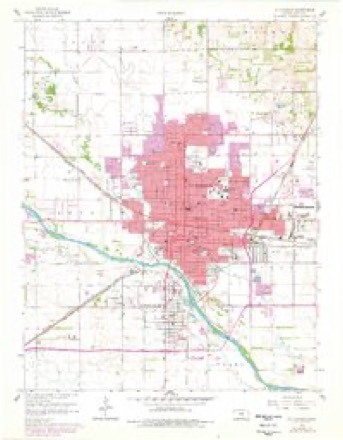
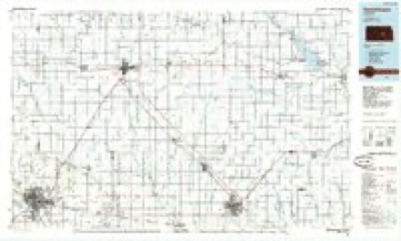
6 surveys from 15 printed sheetsMatched by testing this settlement's coordinate against the published boundary of every sheet in the United States Geological Survey's historical collection. Each opens the scanned sheet at the Survey.
- 1891 USGS Hutchinson quadrangle1:125000
- 1893 USGS Hutchinson quadrangle1:125000, 5 printings
- 1955 USGS Hutchinson quadrangle1:250000, 3 printings
- 1959 USGS Hutchinson quadrangle1:250000, 2 printings
- 1960 USGS Hutchinson quadrangle1:24000, 2 printings
- 1985 USGS Hutchinson quadrangle1:100000, 2 printings
Fires near this place
189 since 2004Regional context, not property-specific evidence. The federal wildfire occurrence database lists 189 fires within 5 miles of Hutchinson between 2004 and 2019, burning about 210 acres in total. 5 started naturally. 13 were recorded as arson. Distance is straight-line from the map coordinates, so a fire counted here may appear on a neighbouring settlement's page as well.
| Reported cause | Fires |
|---|---|
| Missing data/not specified/undetermined | 82 |
| Debris and open burning | 34 |
| Equipment and vehicle use | 19 |
| Smoking | 15 |
| Arson/incendiarism | 13 |
| Power generation/transmission/distribution | 12 |
| Natural | 5 |
| Other causes | 3 |
| Misuse of fire by a minor | 3 |
| Fireworks | 3 |
The most recent of them, most recent first, with the day each was reported and the service that recorded it.
| Date | Cause | Size | Reported by | Name on the report |
|---|---|---|---|---|
| 7 September 2017 | Debris and open burning | under an acre | Reno County | 3144 |
| 6 September 2018 | Debris and open burning | under an acre | Kansas Forest Service | 3424 |
| 30 September 2015 | Missing data/not specified/undetermined | under an acre | Kansas Forest Service | 3359 |
| 29 September 2015 | Missing data/not specified/undetermined | under an acre | Kansas Forest Service | 3336 |
| 25 September 2015 | Debris and open burning | 150 acres | Kansas Forest Service | 80 |
| 20 September 2017 | Equipment and vehicle use | under an acre | Reno County | 3338 |
| 14 September 2017 | Debris and open burning | 2.0 acres | Reno County | 3246 |
| 9 August 2015 | Missing data/not specified/undetermined | under an acre | Kansas Forest Service | 2715 |
Settlements close enough to share some of these fires:
Mines and quarries near this place
1 within 5 milesRegional context, not property-specific evidence. The federal mineral resources record lists 1 working within 5 miles of Hutchinson: 1 producer. All of them still produce. What was taken out: Salt. Distance is straight-line from the map coordinates, so a quarry counted here may appear on a neighbouring settlement's page as well.
| Where | Site | Commodity | Status | Recorded |
|---|---|---|---|---|
| Carey Interpace Salt Mine & Mill | Salt | Producer |
Storms near this place
60 of 302 shownRegional context, not property-specific evidence. The National Weather Service names Hutchinson in 302 storm reports between 1993 and 2025: 167 hail, 101 thunderstorm wind, 11 flash flood, 11 flood. The reports record 2 injuries. Each account below is quoted exactly as the forecast office filed it, from the NOAA Storm Events Database, and each date opens the federal record of that event.
| When | Event | Place named | Harm | What the report says |
|---|---|---|---|---|
| June 2009 | Thunderstorm Wind | South Hutchinson | 1 hurt, $550,000 | A microburst with winds estimated to 100 mph damaged 5 buildings in a one mile radius in South Hutchinson along a northwest to southeast path. Buildings damaged included the southern wing of a bus manufacturing plant, an apartment complex, a food processing plant and a motel. Six apartments were condemned and two of the three motel buildings were a total loss. 16 people had to be evacuated from the apartments, with one person transported to the hospital with a head and neck injury. |
| June 2008 | Thunderstorm Wind | South Hutchinson | 1 hurt, $80,000 | A semi-truck trailer was blown over near the intersection of K-96 and 6th Avenue on the southwest edge of Hutchinson. Additionally, an empty trailer parked at Tyson Foods rolled over. Furthermore, the storm knocked out power to about 7,000 customers across Reno County. Four 69,000-volt transmission line structures were lost because of the wind, and at least 6 power poles were downed across the county. Several fireworks tents were blown down in and around Hutchinson, and several traffic signals were damaged around the city. |
| May 2007 | Flood | Hutchinson | $6,500,000 | Numerous, slow-moving thunderstorms produced widespread 4 to 5 inches of rain across the northwestern two-thirds of Reno County from the afternoon hours on May 23rd, to the early morning hours on May 24th. Particularly hard hit were locations from roughly near Arlington to Hutchinson to Buhler, where a narrow swath of rainfall measuring 7 to 8 inches occurred. Excessive runoff from this heavy rainfall caused the Arkansas River and several creeks and streams to rise above flood stage. Consequently, widespread flooding continued for days across Reno County. At least 60 homes and businesses were flooded. Damage to roads was rather extensive, and two bridges were in need of replacement. The Arkansas River levee breached at five separate locations between Yoder and the Sedgwick County line, causing extensive road and agricultural damage. The Hutchinson Zoo remained closed for several days due to a nearby flooded pond. Twenty-five animals were evactuated, but none were injured. Public property suffered roughly $3.5 million in damages, and private property likely around $3 million in damages. |
| May 2007 | Flash Flood | Hutchinson | $2,500,000 | Law enforcement reported major flooding on the Cow Creek in Hutchinson. Numerous water rescues were also performed along the creek. Roads throughout the county have been flooded. Damage to public roads, bridges and structures was estimated at 2.5 million dollars. |
| August 2013 | Flash Flood | South Hutchinson | $1,440,000 | Extreme street flooding and flash flooding occurred across the area, as 6 to 7 inches of rainfall fell over Hutchinson and Nickerson during the early morning hours. Numerous cars stalled out and were abandoned on city streets, with widespread basement flooding reported. During a 90 minute period, between 130am and 3am, some locations in Hutchinson picked up 3 to 5 inches of rainfall. At least 325 homes in the city of Hutchinson reported some property damage due to flooding, with 10 to 24 of the homes receiving major damage. 150 residents from a nursing home in Northwest Hutchinson were evacuated to a local hospital, because water was coming into the building. The water on city streets was so deep, at times, that large military type vehicles could not venture down the roads. |
| August 2002 | Thunderstorm Wind | Hutchinson | $1,000,000 | Occurred at intersection of Highway 50/K-96. Nearby, 26 empty Union Pacific freight cars, of which 24 were covered hoppers and two were auto-carriers, were blown off a siding. Two mobile homes were destroyed. Three single-family homes (of which one was unroofed) and three mobile homes sustained major damage. Downed power lines and power poles severed power to 7,315 residents, of which 1,215 were without power the following morning. Approximately 25 structures received minor damage. A state of disaster emergency was declared by Governor Graves. Area newspapers contributed greatly to this report. |
| June 2009 | Thunderstorm Wind | South Hutchinson | $750,000 | Damaging winds estimated to be 90 mph moved across most of Hutchinson causing extensive damage. One of the worst hit areas was an area that was hit 8 days before by mircoburst winds in South Hutchinson (see June 7th, 2009), including damage to the same bus manufacturing plant, motel and storage facility. This set of storms finished what the previous storms started, removing more walls and larger portions of the roof. Three of the four buildings at a motel were considered a total loss. Downtown Hutchinson also received significant damage, including removing a 100 foot by 30 foot section of roof to one business, and a portion of a roof to a loft. A warehouse downtown suffered so much damage that it had to be demolished. A power works building lost three of its overhead doors and an animal shelter had some roof damage. A large number of power of poles were also knocked down, especially near the state fairgrounds, where poles had to replaced from 17th to 30th Avenues on Plum Street. 30 to 40 percent of the city had tree limb damage. The storm knocked out power to 7300 people. |
| May 2009 | Flood | South Hutchinson | $500,000 | Several roads were washed out from what was reported as a gully washer of rainfall. 3 to 4 bridges experienced heavy damage and one was completely washed out. A rain gauge in Pleasantville, Kansas reported almost 2 inches of rainfall with some estimates up to 4 inches. |
| July 1994 | Thunderstorm Wind | Hutchinson | $500,000 | Sixty to eighty mile an hour winds passed across mainly the northern half of Reno County. There was widespread damage to trees. In Hutchinson, windows were shattered, two dozen utility poles were snapped, street signals were blown over and the showroom of a car dealership was blown off. In Buhler, a machine shed was destroyed. In Haven, a tractor-semitrailer was overturned, a grain bin was flattened and a bus barn near Yoder lost its roof. |
| May 2019 | Flash Flood | Hutchinson | $100,000 | Water was reported over several roads. Water rescues occurred due to stalled cars. |
| July 2016 | Thunderstorm Wind | Hutchinson | $100,000 | Downed power lines and power poles caused power outages to as many as 50 residences. Westar Energy and KSN Channel 3 contributed greatly to this narrative. |
| August 2013 | Flash Flood | Hutchinson | $100,000 | Significant flooding occurred along Cow Creek in Hutchinson, with numerous evacuations from high water. |
| March 2006 | Tornado (F0) | Hutchinson | $80,000 | Touched down sporadically along a 3 mile path on the east side of Hutchinson in the vicinity of highway K-61. The tornado caused some tree damage, destroyed a carport, and damaged a business sign. A number of other properties suffered minor damage. It also caused windshield damage to roughly 150 vehicles parked at the hospital. |
| July 2003 | Hail | Hutchinson | $75,000 | The following sustained damage: Five fire trucks, seven county sheriff's cars, and one police cruiser (which was "devastated"). Hutchinson News contributed greatly to this narrative. |
| July 2001 | Thunderstorm Wind | Hutchinson | $75,000 | Extensive tree damage, barn blown down as were power lines. |
| May 2019 | Flash Flood | South Hutchinson | $40,000 | Numerous roads were closed due to flooding. A water rescue occurred near Kansas highway 14. |
| May 2012 | Thunderstorm Wind | Hutchinson | $30,000 | Downed power lines and power poles. Much of Hutchinson without power. |
| May 2006 | Lightning | South Hutchinson | $30,000 | A lightning strike set a South Hutchinson home ablaze. Lightning struck a 100-foot tall radio antenna located in a field just north of the home. The antenna was connected to a radio in the affected home by a cable. The fire rendered the home uninhabitable. Fortunately, no one was injured. Information is courtesy of the Hutchinson News. |
| May 2000 | Lightning | Hutchinson | $30,000 | The chimney of an Episcopal church was struck "sometime early Friday morning", breaking off numerous bricks, some of which fell through the roof. |
| March 2002 | Thunderstorm Wind | Hutchinson | $25,000 | Downed power lines severed power to approximately 155-160 residences. |
| June 2005 | Thunderstorm Wind | South Hutchinson | $20,000 | House unroofed. |
| July 2012 | Thunderstorm Wind | Hutchinson | $15,000 | Roof and shed damage in South Hutchinson. Trees uprooted with numerous downed limbs and branches. Time is estimated from Doppler data. |
| August 2011 | Thunderstorm Wind | Hutchinson | $15,000 | Winds estimated from 70 to 80 mph downed multiple power poles about one mile north of Hutchinson. |
| August 2007 | Thunderstorm Wind | South Hutchinson | $15,000 | High winds knocked several power lines down causing of power outages in the southern half of Hutchinson. |
| August 2014 | Thunderstorm Wind | Hutchinson | $10,000 | Multiple power lines were blown down on U.S. Highway 50. The time off occurrence is based on report of gust in the vicinity. |
| August 2013 | Thunderstorm Wind | Hutchinson | $10,000 | A tree had been blown down onto a house. |
| July 2013 | Thunderstorm Wind | Hutchinson | $10,000 | A large flag pole fell onto two trucks parked at Midway Motors on 30th Street. |
| June 2005 | Thunderstorm Wind | Hutchinson | $10,000 | Unspecified number of traffic light-hanging poles downed. |
| June 2005 | Thunderstorm Wind | Hutchinson | $10,000 | Downed power lines across the city. |
| August 2001 | Thunderstorm Wind | Hutchinson | $10,000 | Five cottonwoods blown down, one of which punched a hole in the roof of a home. |
| July 2000 | Thunderstorm Wind | Hutchinson | $10,000 | Several power poles broken. |
| May 2014 | Flood | Hutchinson | $5,000 | The 2.04 inches measured by the observer caused street flooding across the south side of Hutchinson. |
| August 2010 | Heavy Rain | Hutchinson | $5,000 | Heavy rainfall of 2 to 3 inches during the predawn hours on the 24th resulted in flooding at Faris Elementary School in Hutchinson. The school was closed on the 24th after plugged drains in the school courtyard allowed the heavy rain to accumulate and eventually penetrate the gymnasium, cafeteria, two corridors and six classrooms. Damage was relatively minimal, confined mainly to wet carpet. The Hutchinson News contributed to this report. |
| June 2008 | Thunderstorm Wind | South Hutchinson | $5,000 | Strong winds caused extensive damage to a greenhouse. |
| June 2006 | Thunderstorm Wind | Hutchinson | $5,000 | Some roof damage was reported across the city of Hutchinson. |
| March 1993 | Hail | Hutchinson | $5,000 | no account filed |
| March 1993 | Hail | Hutchinson | $5,000 | no account filed |
| March 1993 | Hail | Hutchinson | $5,000 | no account filed |
| April 2008 | Thunderstorm Wind | Hutchinson | $3,000 | A barn door was blown off and some roof damage occurred west of Hutchinson. |
| July 2013 | Thunderstorm Wind | Hutchinson | $2,500 | A large Cottonwood tree was blocking 69th Street near Old K-61. |
| July 2003 | Thunderstorm Wind | Hutchinson | $2,000 | Large limbs downed, one of which fell onto a car. |
| October 2018 | Flood | Hutchinson | $500 | Several rural roads were flooded across the county. |
| May 2019 | Flood | Hutchinson | $100 | County dispatch reported numerous road closures due to high water. |
| May 2018 | Flood | Hutchinson | $100 | Street flooding was reported near 23rd Street north. |
| August 2013 | Flash Flood | Hutchinson | $100 | Multiple streets flooded and numerous cars flooded and stalled, throughout town, blocking streets. |
| April 2025 | Hail | Hutchinson | - | Report was sent via mPING. |
| June 2024 | Thunderstorm Wind | Hutchinson | - | Ten-inch diameter tree branches down around the area. Power also knocked out. |
| October 2024 | Hail | Hutchinson | - | The report of quarter sized hail was received from the public via social media. |
| August 2023 | Thunderstorm Wind | Hutchinson | - | Down tree reported with lights flickering. |
| August 2023 | Thunderstorm Wind | South Hutchinson | - | Measured wind gust of 52kts. |
| August 2023 | Thunderstorm Wind | Hutchinson | - | Measured ASOS gust of 64kts. |
| August 2023 | Thunderstorm Wind | Hutchinson | - | Power outages with some large tree damage. No hail noted with the very heavy rain or wind. |
| April 2022 | Hail | Hutchinson | - | This was reported on the north side of Hutchinson along with 50 mph winds. |
| June 2022 | Heavy Rain | South Hutchinson | - | A Cocorahs station 6 miles south southwest of Hutchinson reported 1.33 inches of rainfall in 24 hours. |
| June 2022 | Heavy Rain | Hutchinson | - | A Cocorahs station 2.5 miles west of Hutchinson reported 1.12 inches of rainfall in 24 hours. |
| May 2021 | Hail | Hutchinson | - | Report from Mping. |
| August 2021 | Hail | Hutchinson | - | Report from mPing. |
| May 2020 | Hail | South Hutchinson | - | Lots of small hail was reported, with some larger stones mixed in. It was hailing so hard the spotter thought the window would break, but the largest size stone was only nickel size. |
| July 2020 | Thunderstorm Wind | Hutchinson | - | Numerous tree limbs were blown down. |
| July 2020 | Thunderstorm Wind | Hutchinson | - | Several trees were blown down across town. |
Nearest settlements
The eight closest, with where each one stands in the county. Distances are straight-line, computed from the Geographic Names Information System coordinates.
| Map | Place | Distance | Sheets |
|---|---|---|---|
| South Hutchinson | 2.3 miles | 15 | |
| Obeeville | 4.3 miles | 15 | |
| Willowbrook | 4.4 miles | 15 | |
| Yaggy | 4.9 miles | 16 | |
| Whiteside | 5.8 miles | 16 | |
| Cruppers Corner | 6.3 miles | 13 | |
| Elmer | 6.3 miles | 13 | |
| Medora | 7.5 miles | 14 |
Elsewhere
Matched on this settlement's Geographic Names Information System number rather than its name, so it cannot be a different place of the same name in another state.
| Wikipedia article on Hutchinson | An encyclopaedic summary. Its text is share-alike, so it is linked here rather than copied. |
| Wikidata item Q958555 | The structured record the population and elevation above come from. Public domain (CC0). |
Provenance
This settlement is recorded in the Geographic Names Information System as feature 477947. The sheet list is computed by point-in-boundary test against the United States Geological Survey's historical topographic inventory. Both are works of the United States government and carry no copyright under 17 U.S.C. 105.
Wildfire. Short, Karen C. 2022. Spatial wildfire occurrence data for the United States, 1992-2020 [FPA_FOD_20221014]. 6th Edition. Fort Collins, CO: Forest Service Research Data Archive. https://doi.org/10.2737/RDS-2013-0009.6 Collected with United States Government funding and usable without additional permissions or fees.
Mines and quarries. USGS Mineral Resources Data System (MRDS) https://mrdata.usgs.gov/mrds/ A work of the United States government, no copyright under 17 U.S.C. 105.
Storms. NOAA National Centers for Environmental Information, Storm Events Database https://www.ncei.noaa.gov/stormevents/ A work of the United States government, no copyright under 17 U.S.C. 105. Narratives are quoted verbatim from the National Weather Service report and are not edited or summarised.