 Block
Stockton, Kansas
14 topographic sheets cover this place, the earliest surveyed in 1896 and the latest in 1985. It stands in Township 2. It lies in ZIP code area 67669. It stands on Dibble Creek. The Survey maps it on the Stockton quadrangle. 1,480 people lived here at the 2020 count. It stands 1,801 feet above sea level.
Research this city
On record in Stockton
Buildings and businesses the archive holds for this place. Each opens its own page, with the source record it came from.
On the National Register 2 records
 Rooks County Courthouselisted 2002
- Rooks County Record Buildinglisted 2005
Population over time
2 figuresStockton grew from 1,329 to 1,480 between 2010 and 2020. These are the recorded population figures Wikidata holds for this place, reached through the Geographic Names Information System number this page is keyed on rather than by name, so they belong to this place and not to another of the same name. Most are census counts, but not all are: an early figure may be a founding or settlement estimate, and an estimate published within five years of a census is left out. The change column is computed, and is left blank where more than 20 years separate a figure from the one before it, because a gap that long is not a change between two counts.
| Year | People | Change |
|---|---|---|
| 2010 | 1,329 | |
| 2020 | 1,480 | +151 (+11%) |
Topographic sheets covering this place
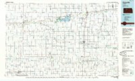
5 surveys from 14 printed sheetsMatched by testing this settlement's coordinate against the published boundary of every sheet in the United States Geological Survey's historical collection. Each opens the scanned sheet at the Survey.
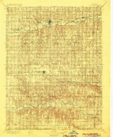
- 1896 USGS Plainville quadrangle1:125000, 3 printings
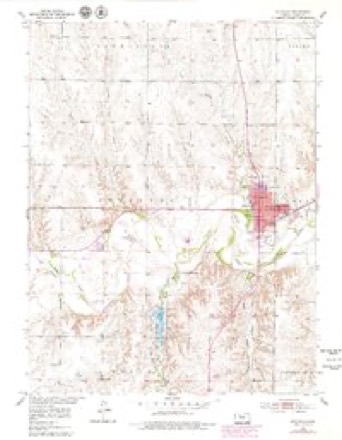
- 1953 USGS Stockton quadrangle1:24000, 3 printings
- 1955 USGS Beloit quadrangle1:250000, 3 printings
- 1959 USGS Beloit quadrangle1:250000, 3 printings
- 1985 USGS Plainville quadrangle1:100000, 2 printings
Mines and quarries near this place
1 within 5 milesRegional context, not property-specific evidence. The federal mineral resources record lists 1 working within 5 miles of Stockton: 1 producer. All of them still produce. What was taken out: Sand and Gravel, Construction. Distance is straight-line from the map coordinates, so a quarry counted here may appear on a neighbouring settlement's page as well.
| Where | Site | Commodity | Status | Recorded |
|---|---|---|---|---|
| Simons Pit | Sand and Gravel, Construction | Producer |
Storms near this place
60 of 114 shownRegional context, not property-specific evidence. The National Weather Service names Stockton in 114 storm reports between 1993 and 2025: 58 hail, 41 thunderstorm wind, 5 tornado, 4 flash flood. The reports record 1 injury. Each account below is quoted exactly as the forecast office filed it, from the NOAA Storm Events Database, and each date opens the federal record of that event.
| When | Event | Place named | Harm | What the report says |
|---|---|---|---|---|
| July 1994 | Thunderstorm Wind | Stockton | 1 hurt, $50,000 | Wind estimated to 70 mph tore down power lines, branches. A horse barn at the fairgrounds lost a roof. One person was injured by flying debris at the fairgrounds. Funnel clouds were observed east of Codell with this storm. |
| June 2022 | Hail | Stockton | $3,000,000 | The local newspaper reported that the combination of wind and hail that pummeled the area broke numerous home and vehicle windows, damaged siding and roofs, ruined gardens and stripped trees of leaves. |
| June 2005 | Tornado (F1) | Stockton | $300,000 | A tornado began near Stockton and skipped northeast through town, and eventually lifted a few miles northeast of town. |
| April 2008 | Hail | Stockton | $250,000 | Quarter to softball sized hail was reported across the northern portion of Stockton. This caused a lot of window and siding damage. There were also scattered reports of power outages. |
| June 2000 | Hail | Stockton | $250,000 | no account filed |
| August 1996 | Thunderstorm Wind | Stockton | $230,000 | no account filed |
| May 2001 | Tornado (F0) | Stockton | $120,000 | no account filed |
| June 2023 | Hail | Stockton | $100,000 | There were two reports of ping pong ball size hail in this area south of Stockton, including a social media report of broken windows at a business near Highway 183. |
| August 2011 | Hail | Stockton | $100,000 | Large hail resulted in tree damage, dented aluminum siding, and a couple broken windshields. |
| June 2008 | Thunderstorm Wind | Stockton | $100,000 | Wind gusts estimated at 100 mph. Numerous power lines down including high tension wires. Two trees were blown onto houses. |
| July 2004 | Thunderstorm Wind | Stockton | $100,000 | no account filed |
| June 2002 | Thunderstorm Wind | Stockton | $75,000 | no account filed |
| September 2012 | Thunderstorm Wind | Stockton | $50,000 | Wind gusts estimated near 70 mph caused tree damage in town, knocked over a shed, and ripped a roof off of a garage. |
| June 2011 | Hail | Stockton | $50,000 | no account filed |
| July 2015 | Flash Flood | Stockton | $35,000 | Heavy rainfall fell across the area, with the highest totals near 6 inches. This rain resulted in numerous roads with water running over them. Some of the gravel roads had enough water running over them to wash away the rock covering. |
| August 2014 | Thunderstorm Wind | Stockton | $25,000 | Measured gust at Rooks County Regional Airport. |
| June 2008 | Thunderstorm Wind | Stockton | $25,000 | Winds estimated at 70 to 80 mph. |
| July 2016 | Hail | Stockton | $25,000 | no account filed |
| May 2012 | Hail | Stockton | $25,000 | no account filed |
| May 2012 | Hail | Stockton | $25,000 | no account filed |
| May 2012 | Hail | Stockton | $25,000 | no account filed |
| September 2003 | Hail | Stockton | $25,000 | no account filed |
| August 1997 | Hail | Stockton | $25,000 | no account filed |
| June 1999 | Thunderstorm Wind | Stockton | $20,000 | no account filed |
| June 1996 | Hail | Stockton | $20,000 | no account filed |
| August 2014 | Flood | Stockton | $15,000 | Bow Creek was out of its banks for roughly one quarter mile on the north side of the Highway 183 bridge area. In addition, County Road A along the Rooks and Phillips County line, just east of Highway 183 was blocked due to flood water. The bulk of rain fell between 9 p.m. and midnight CDT on August 27th. Water was also reported over area county roads of Rooks County, including street flooding in Stockton. |
| August 2014 | Heavy Rain | Stockton | $15,000 | Approximately the northwestern one-third of Rooks County received 2-5 inches of rain, with locally higher totals. A total of 3.5 inches of rain was reported just within a three-hour period (between 753 pm CDT and 1053 CDT), about 6 miles north of Stockton. Also, an event-total of 5.78 fell 10 miles west-northwest of Stockton per a CoCoRaHS observer. Also, minor street flooding was reported in Stockton during this time period, as well as other nearby county roads. The bulk of rain occurred between 9 pm CDT and midnight CDT. |
| June 2010 | Flash Flood | Stockton | $15,000 | no account filed |
| May 1999 | Tornado (F1) | Stockton | $15,000 | no account filed |
| July 2012 | Thunderstorm Wind | Stockton | $12,000 | Rooks County airport south of Stockton recorded a wind gust of 69 mph. Wind damage was reported approximately 14 miles to the west-southwest of Stockton. At least 4 power poles were damaged, multiple tree limbs were knocked down, and tin was removed from an outbuilding. |
| April 2008 | Thunderstorm Wind | Stockton | $10,000 | This wind gust was measured by weather equipment at the grade school in Stockton. |
| May 2001 | Tornado (F0) | Stockton | $10,000 | Brief touchdown with minor damage |
| August 2006 | Hail | Stockton | $5,000 | no account filed |
| May 2008 | Thunderstorm Wind | Stockton | $2,000 | no account filed |
| July 1998 | Hail | Stockton | $2,000 | no account filed |
| August 2025 | Thunderstorm Wind | Stockton | - | A wind gust of 59 MPH was measured by a mesonet station located one mile south-southwest of Stockton. |
| August 2025 | Thunderstorm Wind | Stockton | - | A wind gust of 59 MPH was measured by the Rooks County Airport AWOS. |
| May 2023 | Thunderstorm Wind | Stockton | - | A wind gust of 71 MPH was measured by a mesonet station located one mile south-southwest of Stockton. |
| August 2023 | Thunderstorm Wind | Stockton | - | A wind gust of 64 MPH was measured by the Stockton Airport AWOS. |
| April 2022 | Thunderstorm Wind | Stockton | - | A wind gust of 67 MPH was measured by a mesonet station located one mile south-southwest of Stockton. |
| June 2022 | Heavy Rain | Stockton | - | An unofficial personal weather station in Stockton measured 4.39 inches of rain between 2:30-6:00 p.m. CDT, of which 3.29 fell during the initial 90 minutes. Including other rain that fell several hours before/after this main event, the calendar day total for June 5th was 5.38. |
| May 2021 | Flood | Stockton | - | Delete me. |
| May 2021 | Hail | Stockton | - | Hail size was estimated based on a highway camera which caught the falling hail at the Bow Creek bridge. |
| June 2021 | Thunderstorm Wind | Stockton | - | A wind gust of 58 MPH was measured by a mesonet station located at the Rooks County Sheriff's office in Stockton. |
| July 2021 | Thunderstorm Wind | Stockton | - | A wind gust of 58 MPH was recorded by a mesonet station located 5 miles south-southwest of Stockton. |
| August 2021 | Thunderstorm Wind | Stockton | - | A wind gust of 60 MPH was measured by the AWOS at Rooks County Regional Airport. |
| August 2021 | Thunderstorm Wind | Stockton | - | A wind gust of 58 MPH was measured by a mesonet station located on the south side of Stockton. |
| June 2020 | Thunderstorm Wind | Stockton | - | Measured at Rooks County Regional Airport. |
| August 2019 | Thunderstorm Wind | Stockton | - | A 65 MPH wind gust was measured by a mesonet station located 5 miles south-southwest of Stockton. |
| August 2019 | Thunderstorm Wind | Stockton | - | A 59 MPH wind gust was measured by a mesonet station located 1 mile south-southwest of Stockton. |
| June 2015 | Hail | Stockton | - | Hail was starting to cover the ground during the report. |
| June 2015 | Hail | Stockton | - | Very little wind occurred. A rain total of 0.91 inches occurred as of the time of the report. |
| August 2014 | Thunderstorm Wind | Stockton | - | Measured gust at Rooks County Regional Airport. |
| June 2013 | Hail | Stockton | - | Quarter size hail fell for a few minutes. Wheat fields were damaged from the hail. |
| April 2013 | Hail | Stockton | - | Hail covered the ground, with some stones reaching the size of quarters. |
| April 2013 | Hail | Stockton | - | The ground was completely covered with pea to penny size hail. |
| April 2013 | Hail | Stockton | - | Pea to penny size hail completely covered the ground. |
| June 2012 | Thunderstorm Wind | Stockton | - | The Stockton Airport AWOS measured a wind gust of 63 mph. |
| August 2012 | Hail | Stockton | - | Nickel size hail fell along with 60 mph wind gusts. |
| August 2012 | Thunderstorm Wind | Stockton | - | Wind gusts up to 60 mph occurred along with nickel size hail. |
Nearest settlements
The eight closest, with where each one stands in the county. Distances are straight-line, computed from the Geographic Names Information System coordinates.
| Map | Place | Distance | Sheets |
|---|---|---|---|
| Woodston | 9.1 miles | 13 | |
| Webster (historical) | 9.4 miles | 13 | |
| Plainville | 14.1 miles | 12 | |
| Laton | 14.5 miles | 12 | |
| Zurich | 16.8 miles | 12 | |
| Codell | 17.5 miles | 12 | |
| Damar | 18.7 miles | 13 | |
| Palco | 20.3 miles | 13 |
Elsewhere
Matched on this settlement's Geographic Names Information System number rather than its name, so it cannot be a different place of the same name in another state.
| Wikipedia article on Stockton | An encyclopaedic summary. Its text is share-alike, so it is linked here rather than copied. |
| Wikidata item Q2901346 | The structured record the population and elevation above come from. Public domain (CC0). |
Provenance
This settlement is recorded in the Geographic Names Information System as feature 472238. The sheet list is computed by point-in-boundary test against the United States Geological Survey's historical topographic inventory. Both are works of the United States government and carry no copyright under 17 U.S.C. 105.
Mines and quarries. USGS Mineral Resources Data System (MRDS) https://mrdata.usgs.gov/mrds/ A work of the United States government, no copyright under 17 U.S.C. 105.
Storms. NOAA National Centers for Environmental Information, Storm Events Database https://www.ncei.noaa.gov/stormevents/ A work of the United States government, no copyright under 17 U.S.C. 105. Narratives are quoted verbatim from the National Weather Service report and are not edited or summarised.