 Block
Wheeler, Kansas
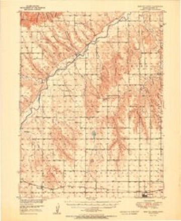
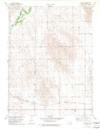
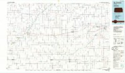
9 topographic sheets cover this place, the earliest surveyed in 1951 and the latest in 1985. It stands in Orlando Township. It lies in ZIP code area 67756. The Survey maps it on the Wheeler quadrangle.
Topographic sheets covering this place
6 surveys from 9 printed sheetsMatched by testing this settlement's coordinate against the published boundary of every sheet in the United States Geological Survey's historical collection. Each opens the scanned sheet at the Survey.
- 1951 USGS Bird City North quadrangle1:62500, 2 printings
- 1954 USGS Goodland quadrangle1:250000
- 1956 USGS Goodland quadrangle1:250000
- 1957 USGS Goodland quadrangle1:250000, 2 printings
- 1978 USGS Wheeler quadrangle1:24000
- 1985 USGS St. Francis quadrangle1:100000, 2 printings



Fires near this place
9 since 2015Regional context, not property-specific evidence. The federal wildfire occurrence database lists 9 fires within 5 miles of Wheeler between 2015 and 2019, burning about 7,002 acres in total. 1 started naturally. None was recorded as arson. Distance is straight-line from the map coordinates, so a fire counted here may appear on a neighbouring settlement's page as well.
| Reported cause | Fires |
|---|---|
| Fireworks | 3 |
| Missing data/not specified/undetermined | 3 |
| Debris and open burning | 1 |
| Equipment and vehicle use | 1 |
| Natural | 1 |
The most recent of them, most recent first, with the day each was reported and the service that recorded it.
| Date | Cause | Size | Reported by | Name on the report |
|---|---|---|---|---|
| 24 August 2015 | Equipment and vehicle use | under an acre | Kansas Forest Service | 82415 |
| 4 July 2017 | Fireworks | under an acre | Cheyenne County | 74171 |
| 29 June 2017 | Natural | under an acre | Cheyenne County | 170629 |
| 6 March 2017 | Missing data/not specified/undetermined | 600 acres | Cheyenne County | 3617 |
| 6 March 2017 | Missing data/not specified/undetermined | under an acre | Cheyenne County | 36171 |
| 5 March 2017 | Fireworks | 400 acres | Cheyenne County | 3517 |
| 28 December 2018 | Debris and open burning | under an acre | Kansas Forest Service | 122818 |
| 23 December 2018 | Fireworks | 2.0 acres | Kansas Forest Service | 122318 |
Settlements close enough to share some of these fires:
Storms near this place
60 of 92 shownRegional context, not property-specific evidence. The National Weather Service names Wheeler in 92 storm reports between 1994 and 2025: 49 hail, 27 thunderstorm wind, 8 tornado, 5 flash flood. No death or injury is recorded in these reports. Each account below is quoted exactly as the forecast office filed it, from the NOAA Storm Events Database, and each date opens the federal record of that event.
| When | Event | Place named | Harm | What the report says |
|---|---|---|---|---|
| August 2004 | Lightning | Wheeler | $100,000 | Lightning stuck a rural farm house 3 miles south of Wheeler, KS during the night. The house burned completely to the ground. The house was built in 1895 but had been remodeled several times over the years. |
| August 2019 | Tornado (EF1) | Wheeler | $50,000 | A tornado struck a farmstead southeast of Wheeler, KS. This tornado produced damage consisting of trees either uprooted or snapped, and damage to farm machinery from flying debris, being tossed, or the strength of the wind itself. A sturdy farm outbuilding collapsed and several lean-to shelters collapsed. Many fences were blown over. A grain bin was blown more than a tenth of a mile away. |
| September 2016 | Flash Flood | Wheeler | $40,000 | Eight feet of road was washed out around a culvert on CR 19 between CR BB and CR AA. The washout also exposed a phone line running under the road. The culvert had to be replaced. |
| August 2019 | Thunderstorm Wind | Wheeler | $10,000 | St. Francis, Bird City, McDonald and Atwood were without power due to thunderstorm wind gusts. |
| July 2020 | Thunderstorm Wind | Wheeler | $4,500 | Emergency Manager reported three wooden power poles down due to strong wind gusts. |
| June 2018 | Hail | Wheeler | $3,000 | The hail measured 1.5 by 0.75. Windows were broken on the north side of the house. |
| August 2014 | Flash Flood | Wheeler | $2,000 | County Road 19 washed out at the intersection of Road W. The time of report is approximate. |
| June 2010 | Hail | Wheeler | $1,500 | Hail up to baseball size broke windows in house and outbuildings. |
| July 2009 | Thunderstorm Wind | Wheeler | $1,500 | Multiple power poles and power lines down in the area. |
| July 2009 | Hail | Wheeler | $1,500 | Windows were broken at neighboring houses. |
| July 2009 | Thunderstorm Wind | Wheeler | $1,500 | Several power poles and power lines were down north of Wheeler, Kansas. Doppler radar estimates place the time of the event around 5:55-6:00 pm CST. |
| September 1997 | Thunderstorm Wind | Wheeler | $1,000 | Winds estimated to 70 mph damaged antenna mounting brackets on county communication tower. |
| July 2009 | Thunderstorm Wind | Wheeler | $250 | Eight inch diameter tree limbs down. |
| May 2025 | Hail | Wheeler | - | Off duty NWS employee reports hailstones still on the ground up to 2 inches in size. |
| June 2025 | Thunderstorm Wind | Wheeler | - | AWN site 1730 Rd Q reported a 62 mph wind gust. |
| October 2025 | Hail | Wheeler | - | Public report of 1 inch hail in Wheeler. |
| April 2024 | Hail | Wheeler | - | Trained spotter reports pea to nickel size hail. |
| July 2024 | Hail | Wheeler | - | Hail was larger than nickel but smaller than quarter in size. |
| September 2023 | Hail | Wheeler | - | Multiple reports received of ping pong ball to hen egg sized hail reported in Wheeler. |
| August 2023 | Hail | Wheeler | - | Report received of golf ball sized hail on Road 17 around one mile south of the Kansas/Nebraska border. |
| August 2022 | Flood | Wheeler | - | Report received of Hackberry Creek running out of its banks north of St. Francis. Location and duration of event are estimated. |
| June 2022 | Hail | Wheeler | - | Accumulating hail up to golf ball in size. |
| March 2021 | Tornado (EFU) | Wheeler | - | Landspout tornado reported near the Wheeler landfill. Key impacts: tornado. |
| July 2021 | Hail | Wheeler | - | Report received of hail ranging from a half inch to a half dollar in size at location. |
| July 2021 | Hail | Wheeler | - | Report received of hail ranging from peas to quarters in size at location. |
| August 2020 | Hail | Wheeler | - | Multiple reports received from trained spotters of various sized hail in Wheeler ranging from pea to quarter in size. |
| July 2020 | Thunderstorm Wind | Wheeler | - | Spotter estimated the wind gusts to be 50-60 MPH. |
| June 2020 | Thunderstorm Wind | Wheeler | - | A trained spotter observed an estimated 60 mph wind gust as a strong precipitation embedded thunderstorm moved over the location. |
| August 2019 | Flash Flood | Wheeler | - | Six inches of water flowing over the county road on the north side of Wheeler. |
| May 2016 | Hail | Wheeler | - | Nickel to quarter size hailstones were covering Highway 27. |
| June 2016 | Thunderstorm Wind | Wheeler | - | Mesonet site is located 1.5 miles east of county road W and 15 intersection. |
| September 2016 | Flash Flood | Wheeler | - | Runoff from prolonged heavy rainfall caused the roadway, which cuts several feet into the hill, to be washed out. The washout was two and a half to three feet deep down the hill. This is in the vicinity of CR 19 and CR CC. |
| September 2016 | Flash Flood | Wheeler | - | Runoff from prolonged heavy rainfall caused a draw on the east side of CR 19 to washout back across onto the road. The washout was eight to twelve feet deep. |
| July 2016 | Hail | Wheeler | - | Measured 3.2 inches. Photo relayed through social media. |
| November 2015 | Thunderstorm Wind | Wheeler | - | Near zero visibility reported due to blowing rain and dirt. |
| July 2014 | Hail | Wheeler | - | A similar report was also received from law enforcement. |
| August 2014 | Tornado (EF0) | Wheeler | - | Emergency manager relayed a public report of a brief tornado near road I and Road 20. No damage was reported. |
| June 2013 | Hail | Wheeler | - | Time estimated from Doppler radar. |
| July 2011 | Thunderstorm Wind | Wheeler | - | Spotter estimated peak wind gusts of 70 mph. |
| July 2009 | Hail | Wheeler | - | Spotter also reported 0.70 inches of precipitation. |
| July 2009 | Thunderstorm Wind | Wheeler | - | Three inch diameter tree limbs were broken. |
| July 2006 | Heavy Rain | Wheeler | - | Storm total precipitation measured 4.30 inches. |
| June 2004 | Tornado (F0) | Wheeler | - | Brief touchdown. No known damage. |
| June 2004 | Tornado (F0) | Wheeler | - | Brief touchdown. No known damage. |
| June 2004 | Thunderstorm Wind | Wheeler | - | Small outbuilding picked up and tossed 100 ft. Time estimated from nearby reports. |
| June 2004 | Thunderstorm Wind | Wheeler | - | Two large trees down. Time estimated from nearby reports. |
| September 2004 | Thunderstorm Wind | Wheeler | - | Six-inch tree limbs broken off. |
| July 2003 | Thunderstorm Wind | Wheeler | - | Ten-inch diameter tree limb down. |
| August 2002 | Tornado (F0) | Wheeler | - | Brief touchdown. No known damage. |
| September 2023 | Hail | Wheeler | - | no account filed |
| April 2021 | Hail | Wheeler | - | no account filed |
| May 2021 | Hail | Wheeler | - | no account filed |
| July 2020 | Thunderstorm Wind | Wheeler | - | no account filed |
| April 2019 | Hail | Wheeler | - | no account filed |
| August 2019 | Hail | Wheeler | - | no account filed |
| July 2018 | Thunderstorm Wind | Wheeler | - | no account filed |
| August 2015 | Hail | Wheeler | - | no account filed |
| July 2014 | Hail | Wheeler | - | no account filed |
| August 2014 | Hail | Wheeler | - | no account filed |
| April 2013 | Hail | Wheeler | - | no account filed |
Nearest settlements
The eight closest, with where each one stands in the county. Distances are straight-line, computed from the Geographic Names Information System coordinates.
| Map | Place | Distance | Sheets |
|---|---|---|---|
| Saint Francis | 4.6 miles | 12 | |
| Bird City | 9.6 miles | 9 |
Provenance
This settlement is recorded in the Geographic Names Information System as feature 470978. The sheet list is computed by point-in-boundary test against the United States Geological Survey's historical topographic inventory. Both are works of the United States government and carry no copyright under 17 U.S.C. 105.
Wildfire. Short, Karen C. 2022. Spatial wildfire occurrence data for the United States, 1992-2020 [FPA_FOD_20221014]. 6th Edition. Fort Collins, CO: Forest Service Research Data Archive. https://doi.org/10.2737/RDS-2013-0009.6 Collected with United States Government funding and usable without additional permissions or fees.
Storms. NOAA National Centers for Environmental Information, Storm Events Database https://www.ncei.noaa.gov/stormevents/ A work of the United States government, no copyright under 17 U.S.C. 105. Narratives are quoted verbatim from the National Weather Service report and are not edited or summarised.