 Block
From the record
One of 44 National Register listings published here for Riley County · listed in 2020 · category: Building.
Sources: the National Register database, National Park Service
Listed on the National Register of Historic Places in 2020.
One of 44 National Register listings published here for Riley County · listed in 2020 · category: Building.
Sources: the National Register database, National Park Service
Regional context, not property-specific evidence. The federal wildfire occurrence database lists 139 fires within 5 miles of Pioneer Log Cabin between 2006 and 2020, burning about 3,062 acres in total. 1 started naturally. 6 were recorded as arson. Distance is straight-line from the map coordinates, so a fire counted here may appear on a neighbouring settlement's page as well.
| Reported cause | Fires |
|---|---|
| Missing data/not specified/undetermined | 53 |
| Debris and open burning | 47 |
| Fireworks | 12 |
| Smoking | 8 |
| Arson/incendiarism | 6 |
| Equipment and vehicle use | 5 |
| Power generation/transmission/distribution | 5 |
| Recreation and ceremony | 2 |
| Natural | 1 |
The most recent of them, most recent first, with the day each was reported and the service that recorded it.
| Date | Cause | Size | Reported by | Name on the report |
|---|---|---|---|---|
| 9 September 2017 | Smoking | under an acre | Riley County | 1674 |
| 6 September 2015 | Missing data/not specified/undetermined | under an acre | Kansas Forest Service | 241 |
| 30 September 2015 | Debris and open burning | under an acre | Kansas Forest Service | 264 |
| 5 August 2018 | Recreation and ceremony | 33 acres | Kansas Forest Service | 18507 |
| 3 August 2018 | Missing data/not specified/undetermined | under an acre | Kansas Forest Service | 1379 |
| 29 August 2018 | Missing data/not specified/undetermined | under an acre | Kansas Forest Service | 1570 |
| 7 July 2018 | Fireworks | under an acre | Kansas Forest Service | 1193 |
| 7 July 2018 | Fireworks | under an acre | Kansas Forest Service | 1194 |
Regional context, not property-specific evidence. The federal mineral resources record lists 1 working within 5 miles of Pioneer Log Cabin: 1 producer. All of them still produce. What was taken out: Stone, Crushed/Broken. Distance is straight-line from the map coordinates, so a quarry counted here may appear on a neighbouring settlement's page as well.
| Where | Site | Commodity | Status | Recorded |
|---|---|---|---|---|
| Reichling Quarry | Stone, Crushed/Broken | Producer |
Regional context, not property-specific evidence. The National Weather Service names Manhattan, the town this property stands in, in 201 storm reports between 1993 and 2025: 98 hail, 60 thunderstorm wind, 18 flash flood, 17 lightning. The reports record 1 death and 1 injury. Each account below is quoted exactly as the forecast office filed it, from the NOAA Storm Events Database, and each date opens the federal record of that event.
| When | Event | Place named | Harm | What the report says |
|---|---|---|---|---|
| August 1999 | Lightning | Manhattan | 1 killed | Eyewitnesses claimed a lightning bolt directly struck a 41 year old woman as she was on an early morning jog along a street in Manhattan. She never regained consciousness and died 16 days later at a local hospital. |
| July 2002 | Lightning | Manhattan | 1 hurt | Light struck a trailer in Manhattan and injured a woman touching the trailer. |
| June 2022 | Tornado (EF2) | Manhattan | $10,000,000 | Two surveys were done by NWS for this damage. It appears that a very short path narrow tornado occurred embedded on the northeast flank of small enhanced downburst that created widespread damaging north to northwest winds. Several homes were heavily damaged with the debris field blown to the northeast or approximately perpendicular to the movement. It appears the tornado was narrow and only 25-50 yards at the widest. |
| April 2002 | Thunderstorm Wind | Manhattan | $5,000,000 | A bow echo moved east across Riley county producing strong winds and large hail. Winds reached a speed of 82 mph at the Manhattan airport. The strong winds knocked out power and did widespread damage in Manhattan to many homes and businesses. The Walmart store had severe roof damage that resulted in store closure for several days until repairs could be made. Total damage estimates from Riley county officials were 5 million dollars. |
| July 1994 | Thunderstorm Wind | Manhattan | $500,000 | High winds moved across the county from north to south producing widespread damage to trees, power lines and some buildings. Power was out in some areas for several days. |
| August 1993 | Thunderstorm Wind | Manhattan | $500,000 | High winds knocked down trees and power lines in an early morning thunderstorm. Heavy rain in a short time caused some temporary flooding problems also. |
| June 1998 | Hail | Manhattan | $400,000 | no account filed |
| June 2001 | Lightning | Manhattan | $370,000 | Lightning struck a house and started a fire that destroyed the structure. |
| June 2005 | Flash Flood | Manhattan | $200,000 | Flash flooding was reported with four to six inches of rain. Cars were stranded by fast flowing water across Tuttle Creek Boulevard. A mudslide also occurred but no injuries or damage were reported from the mud slide. |
| May 2007 | Lightning | Manhattan | $150,000 | Lightning struck a home. The two occupants escaped safely before a fire broke out. Nearly half of the home was a total loss. |
| June 2005 | Heavy Rain | Manhattan | $150,000 | Heavy rain of 4 to 5 inches caused urban and small stream flooding in Manhattan. Numerous stranded vehicles but no injuries were reported. |
| October 2005 | Heavy Rain | Manhattan | $100,000 | Heavy rain of two to three inches in a short period of time brought urban and small stream flooding to Manhattan. |
| June 2001 | Lightning | Manhattan | $90,000 | Lightning struck a house and started a fire that destroyed the house and its contents. This was the last in a series of lightning strikes over a 25 hour period which caused nearly 1 million dollars total damage over northeast Kansas. |
| May 1996 | Heavy Rain | Manhattan | $90,000 | no account filed |
| June 1998 | Thunderstorm Wind | Manhattan | $85,000 | no account filed |
| July 2009 | Thunderstorm Wind | Manhattan | $75,000 | Damage was observed on the extreme northwestern edge of town. The damage path went right through the center of town and created the worst damage to the center part of town just south and southeast of town. A roof was blown off of a motel and caused damage to cars in the parking lot. Numerous trees, up to 48 inches in diameter were snapped at the base, and some fell on cars and houses. The visible damage path ended on the southeast part of town. |
| June 1998 | Lightning | Manhattan | $70,000 | no account filed |
| April 2025 | Flash Flood | Manhattan | $50,000 | Relayed by Kansas State EM. A foot of water on the roadways at Kansas State and in Manhattan. |
| July 2009 | Thunderstorm Wind | Manhattan | $50,000 | Portion of roof removed off Holiday Inn near Anderson and 17th Street. Portion of roof landed on vehicles in parking lot. Water damage to several of the rooms with trees blown down. |
| May 2007 | Flash Flood | Manhattan | $50,000 | Butterfield road in northeast Manhattan under water. Water over a number of street curbs in town. Some sandbagging occurring in town. |
| May 2007 | Flash Flood | Manhattan | $50,000 | K-18 closed near the town of Wabaunsee. Water over the highway. |
| May 2006 | Thunderstorm Wind | Manhattan | $40,000 | A bow echo moved through Riley County around 11PM CST and caused sporadic damage in the Manhattan area. The most severe damage was reported along K18 Highway where one building was destroyed and 2 others sustained structural damage. Debris was scattered more than 100 feet into a nearby field. A telephone pole was uprooted at the same location. Elsewhere there were reports of a pole barn and gazebo being destroyed. Damage amounts estimated. |
| July 2009 | Thunderstorm Wind | Manhattan | $30,000 | There are reports of downed trees and power lines. Roof of apartment building on west side of town is partially removed. |
| July 2007 | Flash Flood | Manhattan | $30,000 | Streets were flooded on the west side of Manhattan. Nearly 2.45 inches of rain in approximately one hour near the intersection of Kimball and Dennison avenues. |
| June 2004 | Lightning | Manhattan | $28,000 | Lightning struck a house and started a fire that did major damage. |
| July 2006 | Lightning | Manhattan | $15,000 | Lightning struck and fell some power lines in the city of Manhattan causing a loss of power to around 2100 customers. |
| July 2002 | Lightning | Manhattan | $10,000 | Lightning struck the roof of a restaurant and ignited a fire that did serious damage. |
| April 2001 | Thunderstorm Wind | Manhattan | $10,000 | Thunderstorm winds overturned boat docks at Tutle Creek resevoir totally destroying them. Six boats were also damaged. |
| October 1997 | Thunderstorm Wind | Manhattan | $10,000 | no account filed |
| May 2006 | Lightning | Manhattan | $7,000 | Lightning struck and damaged a mobile home. |
| July 1996 | Thunderstorm Wind | Manhattan | $6,000 | no account filed |
| July 2002 | Flash Flood | Manhattan | $5,000 | Heavy rains caused rapid runoff that flooded some businesses between Ogden and Manhattan. |
| September 1998 | Lightning | Manhattan | $5,000 | Lightning struck a transformer near Kansas Stata University and knocked out power to much of the campus for a time. |
| August 2004 | Thunderstorm Wind | Manhattan | $3,000 | Strong winds blew down trees and power lines in Manhattan. |
| August 2002 | Lightning | Manhattan | $3,000 | Lightning struck at Kansas State University and blew out a transformer, burnt some wiring, and broke a lightning arrester. |
| May 2007 | Lightning | Manhattan | $2,000 | A lightning strike caused a power outage for 1,100 customers for nearly 2 hours. A second lightning strike knocked a tree onto powerlines, which knocked out power to 1,375 customers for more than an hour. |
| July 2002 | Lightning | Manhattan | $2,000 | Lightning struck the roof of a building and started a fire that did 2 thousand dollars damage. |
| July 2002 | Lightning | Manhattan | $1,500 | Lightning struck an electrical plant and started a fire that did some damage. |
| May 2007 | Heavy Rain | Manhattan | $1,000 | Deep Creek reported out of its banks near Zeandale and ponding of water on K-18 west of Zeandale due to heavy rain. |
| July 1996 | Thunderstorm Wind | Manhattan | $1,000 | no account filed |
| July 2002 | Lightning | Manhattan | $450 | Lightning struck a home in Manhattan and ignited a fire that did minor damage. |
| March 2024 | Hail | Manhattan | - | Report from mping. |
| March 2024 | Hail | Manhattan | - | Report from mping. |
| March 2024 | Hail | Manhattan | - | Report from mping, on Highway 177 south of Manhattan. |
| May 2024 | Tornado (EF0) | Manhattan | - | Damage survey revealed an overturned irrigation pivot and a narrow area of substantial tree damage along a short path northeast before it appeared to have lifted near the Kansas river. |
| June 2024 | Thunderstorm Wind | Manhattan | - | Social media report shows an 8 inch tree limb down on a home. |
| June 2024 | Hail | Manhattan | - | Delayed report via social media showing a hailstone measuring 3.5 inches in diameter. |
| June 2024 | Hail | Manhattan | - | Via social media. |
| April 2023 | Thunderstorm Wind | Manhattan | - | Report from mping of small one inch tree limbs broken or shingles blown off. |
| April 2023 | Hail | Manhattan | - | Quarter sized hail reported. |
| June 2023 | Hail | Manhattan | - | Quarter sized hail reported via social media. |
| June 2023 | Hail | Manhattan | - | Quarter sized hail reported. |
| July 2023 | Thunderstorm Wind | Manhattan | - | Picture on social media showed a large tree limb around a foot in diameter broken. Tree appeared healthy. |
| July 2023 | Thunderstorm Wind | Manhattan | - | Multiple reports of power lines down in Manhattan. |
| June 2022 | Thunderstorm Wind | Manhattan | - | Received social media pictures showing damage to the chi omega and kappa alpha chapter building in manhattan. Damage was associated with a tornado, per nws storm survey results. |
| June 2022 | Thunderstorm Wind | Manhattan | - | Emergency manager received a report of a 70 mph estimated wind gust. |
| June 2022 | Thunderstorm Wind | Manhattan | - | Damage to residential homes including portions of roofs blown off, per NWS storm survey on June 12. Winds estimated at 90 to 100 mph. |
| June 2022 | Thunderstorm Wind | Manhattan | - | Tree limbs 5 inches in diameter down and debris in the streets. |
| May 2021 | Thunderstorm Wind | Manhattan | - | Report of tree uprooted near Bluemont Elementary School. |
| May 2021 | Thunderstorm Wind | Manhattan | - | Tree limbs 1 inch in diameter broken, shingles blown off. |
No historic map-sheet match is published for this property yet. That does not mean no map exists. This record needs a coordinate-quality review before it can be joined to a sheet boundary. Browse the county's mapped places while that work is pending.
Other National Register properties close enough to walk or drive between, ordered by distance from this one. Both positions come from the same geocoding pass that matched these properties to their map sheets.
| Photograph | Property | Distance | Listed |
|---|---|---|---|
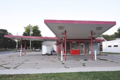 | Dawson's Conoco Service Station | 0.2 miles | 2021 |
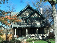 | Leslie A. Fitz House | 0.2 miles | 2005 |
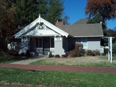 | Woman's Club House | 0.3 miles | 1980 |
| Rex Arms Apartments | 0.3 miles | 2025 | |
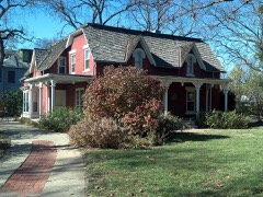 | Robert Ulrich House | 0.4 miles | 1978 |
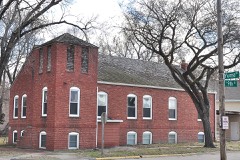 | Second Baptist Church | 0.4 miles | 2012 |
| National Archives record | The nomination case file for reference 100002969 in Record Group 79. |
| Riley County | All 44 listed properties in this county. |