 Block
From the record
2 National Register listings published here.
Sources: the National Register database, National Park Service
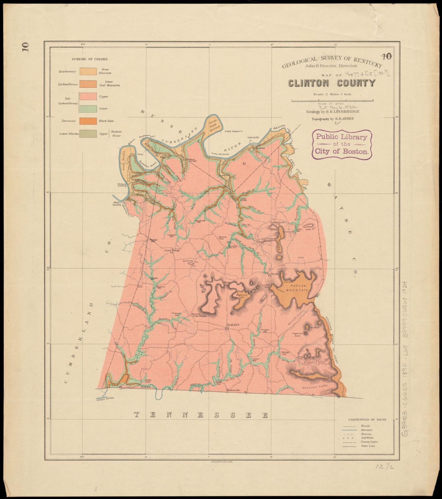
40 topographic sheets cover 49 settlements here, and 2 properties are on the National Register of Historic Places.
2 National Register listings published here.
Sources: the National Register database, National Park Service
Every property in this county listed on the National Register of Historic Places, with the year it was listed and the federal nomination document.
| Photograph | Property | Type | Listed | Reference |
|---|---|---|---|---|
 | Judge Killis Huddleston House | building | 1994 | 93001583 |
 | Jesse Noland House | building | 2003 | 03000711 |
Selected from the Digital Public Library of America's 2 image records catalogued for this county. Every one shown here carries a public-domain status or a licence that permits reuse on a site that carries advertising; non-commercial, share-alike and restricted images are excluded. The selection is spread across the county's towns (at most eight per town), so no single institution's bulk upload crowds out the rest. Each opens the holding library's record, and the complete set at the Digital Public Library of America is one click away.

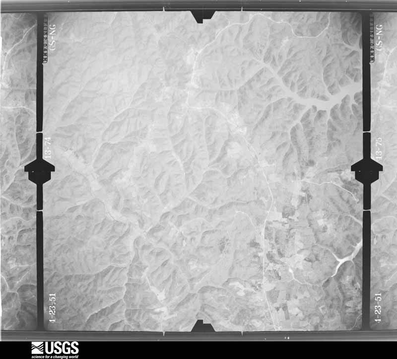
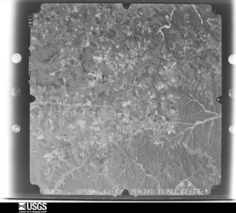
Flown by the U.S. Geological Survey between 1937 and 1989, the Aerial Photo Single Frames collection is the definitive mid-century view of the land: fields, roads and rivers as the camera saw them. The Survey holds 281 frames inside the rectangle that bounds this county; the 12 frames below were taken over the county itself, chosen across the decades of flights (at most four a year from that rectangle), so one flight cannot crowd out the rest. The full set is free to browse and download at EarthExplorer under the dataset Aerial Photo Single Frames.










The thermometers that kept this county's weather, as the federal records hold them. The extremes below are measured values from those records, not estimates.
Who lived here in 1950, one enumeration district at a time, as the Census Bureau described each district. Each row opens its official National Archives result, with Population Schedules and ED Maps available there.
Every wildfire the federal occurrence database records inside this county: 173 of them, burning about 3,572 acres. None started naturally and 23 were recorded as arson. Each settlement page carries the fires within five miles of it.
| Reported cause | Fires |
|---|---|
| Debris and open burning | 84 |
| Missing data/not specified/undetermined | 41 |
| Arson/incendiarism | 23 |
| Recreation and ceremony | 12 |
| Railroad operations and maintenance | 7 |
| Smoking | 3 |
| Equipment and vehicle use | 2 |
| Misuse of fire by a minor | 1 |
The five largest, by the area the report gives. Two of them were set deliberately.
| Date | Cause | Size | Reported by | Name on the report |
|---|---|---|---|---|
| 28 February 2007 | Debris and open burning | 527 acres | Kentucky Division of Forestry | COAL BANK MT |
| 10 November 2001 | Arson/incendiarism | 450 acres | Kentucky Division of Forestry | not named |
| 9 March 2007 | Debris and open burning | 217 acres | Kentucky Division of Forestry | HIGH WALL |
| 23 October 2010 | Debris and open burning | 175 acres | Kentucky Division of Forestry | CLIFF LINE |
| 31 October 2000 | Arson/incendiarism | 100 acres | Kentucky Division of Forestry | not named |
| 25 September 2008 | Debris and open burning | 98 acres | Kentucky Division of Forestry | not named |
| 23 October 2012 | Debris and open burning | 95 acres | Kentucky Division of Forestry | PEACOCK FI |
| 29 June 2012 | Railroad operations and maintenance | 90 acres | Kentucky Division of Forestry | DEEP MINE |
Every settlement page carries the fires within five miles of it - see the settlement index below.
The NOAA Storm Events Database holds 174 reports for this county, causing 9 deaths, 68 injuries and about $1,619,530 in recorded property damage. Each settlement page carries the reports that name it.
| Kind of event | Reports |
|---|---|
| Thunderstorm Wind | 111 |
| Hail | 28 |
| Tornado | 18 |
| Flash Flood | 13 |
| Flood | 3 |
| Lightning | 1 |
The most serious of them, by death, then injury, then recorded damage. The accounts are quoted exactly as the forecast office filed them.
| When | Event | Place named | Harm | What the report says |
|---|---|---|---|---|
| April 1974 | Tornado (F4) | not stated | 8 killed, 63 hurt | no account filed |
| January 1997 | Tornado (F1) | Albany | 1 killed, 2 hurt, $50,000 | no account filed |
| June 1994 | Thunderstorm Wind | not stated | 3 hurt, $500,000 | High winds capsized two houseboats on Lake Cumberland. Three people received non-life threatening injuries. A trailer was ripped from its foundation and a porch was blown off another trailer on Indian Creek Road. |
| April 2008 | Tornado (EF2) | Narvel | $200,000 | The fourth touchdown in this family of tornadoes produced by a cyclic supercell did the most damage in Clinton County as it hit several residences in a rural subdivision along Pleasure Ridge Road. After moving through uninhabited hillside for a mile, uprooting and snapping trees in a nearly quarter-mile wide path, the tornado tore the roof of a ranch-style brick home and destroyed its nearby outbuildings. Continuing along parallel to Pleasure Ridge Road, the tornado destroyed a mobile home, barn, and grain silo in its path, and heavily damaged at least three other homes before exiting the county. |
| April 2008 | Thunderstorm Wind | Cumberland City | $200,000 | Homes were damaged and barns were destroyed by thunderstorm wind gusts. |
| May 2010 | Flash Flood | Wago | $100,000 | Numerous roads across the county were closed due to flash flooding. A total of seven to ten inches of rain fell across Clinton county from May 1-2. |
| August 2000 | Lightning | Central Portion | $80,000 | A house was struck by lightning and burned down. No injuries were reported. The exact location of the fire could not be determined. |
| April 2008 | Tornado (EF2) | Cartwright | $75,000 | As the storm continued eastward, several homes and outbuildings were heavily damaged by the third tornado touchdown produced by the supercell. In addition to the structural damage covering nearly 1 1/2 miles, scores of trees were downed as were utility lines. A witness at the end of this tornado's path reported seeing two tornadoes on the ground simultaneously, as the fourth tornado produced by this supercell touched down about 1/4 mile north of the ending point of the third twister. |
| April 2008 | Tornado (EF1) | Browns Xrds | $50,000 | An EF-1 tornado touched down west of Highway 639 south of Wago, moving east-northeast for approximately .4 mile before lifting. The tornado destroyed a barn and heavily damaged a grain silo along Highway 639, and downed several large trees. Trees were felled on a farmhouse and a late model SUV just north of the silo, destroying the SUV and doing extensive damage to the home. Other minor damage was sustained east of Highway 639 to several outbuildings. |
| May 2002 | Thunderstorm Wind | Shipley | $50,000 | The roof was blown off a building. |
| May 1995 | Thunderstorm Wind | Albany | $50,000 | Trees down and power lines down county wide. A roof was blown off a mobile home in Huntersville. |
| May 1994 | Thunderstorm Wind | not stated | $50,000 | Police reported several downed trees along with two porches being blown away from mobile homes. |
| April 2000 | Thunderstorm Wind | Countywide | $35,000 | At Shipley, a barn was blown down, a mobile home was damaged, and several trees were downed. Mobile homes were damaged at Albany, and several trees were downed. |
| November 2005 | Thunderstorm Wind | Albany | $30,000 | An unoccupied mobile home was destroyed. |
| May 2017 | Thunderstorm Wind | Albany | $25,000 | State officials reported that severe thunderstorm winds blew off a portion of a metal roof of a business. |
| April 1982 | Tornado (F1) | not stated | $25,000 | no account filed |
| June 2019 | Thunderstorm Wind | Albany | $20,000 | Trees and power lines were reported down across Clinton County, mainly near Albany. |
| March 2003 | Thunderstorm Wind | Albany | $20,000 | A thunderstorm wind gust blew the roof off a home. |
| July 2003 | Thunderstorm Wind | Cumberland City | $20,000 | Trees were uprooted. Some of the trees were blown on to cars. An outbuilding was overturned. Power lines were downed. |
| May 2000 | Thunderstorm Wind | Shipley | $15,000 | Houses were damaged by thunderstorm winds. |
| September 2018 | Thunderstorm Wind | Wago | $10,000 | There was damage to an outbuilding near Albany. |
| May 2016 | Thunderstorm Wind | Albany | $5,000 | Clinton County dispatch reported power outages mainly from the Shipley community due to severe thunderstorm winds. |
| April 2016 | Thunderstorm Wind | Watauga | $3,000 | The Clinton County emergency manager reported downed trees on a power line which resulted in 1000 customers without power. |
| October 2014 | Tornado (EF1) | Desda | $3,000 | The tornado touched down and skipped through a wooded area, snapping and uprooting many trees along an west to east path roughly along State Highway 127. The only non-tree damage surveyed was to several power poles along the west side of the road. After tracking for just over 2 miles, the tornado finally lifted right over State Highway 127 on the shore of Lake Cumberland 2 miles southwest of Wolf Creek Dam. |
| April 2008 | Tornado (EF1) | Snow | $2,000 | The second touchdown of a tornado in with a storm that moved across Clinton County produced EF-1 damage in a path just under 1/2 mile. Four utility poles were snapped along U.S. Highway 127, as were several large diameter trees in a narrow path on a wooded hill to the east of the highway. |
| April 2000 | Tornado (F0) | Albany | $1,500 | A piece of scaffolding and a cement mixer pan were moved 50 yards at Ootens Store. |
| August 1987 | Tornado (F0) | not stated | $30 | no account filed |
| March 2026 | Tornado (EF1) | Albany | - | The National Weather Service conducted a storm survey on Wednesday, March 18th for the storms that occurred early Monday morning, March 16th. A tornado was determined to have occurred in Clinton County with max winds of 100 MPH (EF1).||Storm damage was first observed along Wright Parish Road southwest of Albany near Wolf River Dock Road. A line of cedar trees had extensive damage, with several treetops and branches pointing to the north, east, and opposite of the northeast storm |motion to the southwest. Some branches showed signs of being ripped and twisted from the trees as well, which was indicative of rotation from a tornado. ||The tornado continued uphill to a nearby residence with several outbuildings. One barn was completely moved from the foundation with roof damage lofted into nearby fields. The damage direction was mainly to the east, pointing toward the tornadic circulation |that was moving to the northeast. Another section of barn damage was pointing to the north, indicating the right side of the circulation nearby. A drone flight confirmed this information. A nearby residence had awning damage that was moved to the northeast, with the most notable damage being a couple of wood plank impalements that were driven into the ground facing the opposite direction of the storm motion to the southwest. The max wind speed near this damage along Rice Road and Wolf River Dock |Road was 100 mph.||The tornado continued to the northeast and damage to trees and outbuildings occurred along Hay Road, Huntersville Road, and Robert Page Road. Several trees were snapped and a barn was leveled, and the convergent signature of the tree damage to the |north and east directions were noted. The tornado continued northeast along Robert Page Road where a residence had roof and siding damage that was lofted to the northeast away from the property. The debris went up to US Highway 127, and no other |damage was observable past this point. |
| March 2026 | Thunderstorm Wind | Albany Arpt | - | Multiple trees were blown down and the roof was blown off of a trailer along Wisdom Dock Road. |
| March 2026 | Thunderstorm Wind | Albany Arpt | - | Trees were blown down along Kentucky Route 639. |
| March 2025 | Flash Flood | Snow | - | State Garage Road was closed. |
| March 2025 | Flash Flood | Highway | - | Miller Road was closed. |
| May 2024 | Tornado (EF1) | Cannons Mill | - | The National Weather Service conducted a storm survey and found a|tornado occurred on Sunday, May 26th, 2024. A small short lived|tornado started east of Albany along Central Union Road with tree damage along a tree line just east of Branham Road. The|tornado continued and left tree damage to another tree line|between two farms south of Central Union Road. A barn had|significant damage consistent with EF1 winds that was completely|demolished. The barn damage was sent in varying directions|consistent with a tornado. The tornado then continued toward|Branham Road where a residence had a two by four wood plank sent through|the kitchen window and tree damage at the home was in varying|directions. The tornado then lifted just beyond the residence|where no other damage was observed. |
| May 2024 | Thunderstorm Wind | Albany | - | Several trees were uprooted across Albany and Clinton County. |
| May 2024 | Tornado (EF1) | Albany Arpt | - | The National Weather Service conducted a storm survey and found a|tornado occurred on Sunday, May 26th, 2024. Damage was observed|to have started just north of the intersection of Wisdom Dock|Road and Charlie Murray Road near Shipley where there were|uprooted trees in farm fields consistent with EF0 85 mph wind|speeds. The tornado then crossed Littles Road where damage to a|residence porch occurred with more tree damage. The most notable|tree damage occurred along Littles Lane where two barns were|destroyed at a residence with winds consistent with 105 mph winds.|Damage was thrown in varying directions, but the most notable was|several impalements of two by four wood planks into the nearby corn|field. Eyewitnesses also had pictures of the tornado from just|to the north of this location that clearly showed rotation. The|tornado ended just north of a neighborhood along Schooner Landing|Road. |
| May 2024 | Thunderstorm Wind | Albany | - | Trees were downed along West Harper Lane, including one tree which fell onto a mobile home. |
| May 2024 | Tornado (EF1) | Hobart | - | The National Weather Service conducted a storm survey and found a tornado occurred on Sunday, May 26th, 2024. This tornado reached a peak intensity of EF1 with 95 mph estimated peak winds, crossing through portions of southern Cumberland and Clinton County.||The tornado crossed into Clinton county across Dale Hollow Lake at the Wisdom|Dock location where extensive tree damage was consistent with|EF1 wind speeds between 100 and 105 mph. Minor shingle damage to|homes was also observed along Wisdom Dock Road. The tornado|continued up Wisdom Dock Road and did more tree damage before ending just south|of Charlie Murray Road. |
| September 2024 | Hail | Watauga | - | Half dollar sized hail was reported near Cumberland City. |
| September 2024 | Hail | Cumberland City | - | Golf ball sized hail was observed near Cumberland City. |
| August 2024 | Thunderstorm Wind | Aaron | - | There were numerous trees down along US 127 in the northern part of the county. |
| August 2024 | Thunderstorm Wind | Static | - | There were trees down on Beatty Creek Road. |
| July 2024 | Thunderstorm Wind | Albany | - | Trees and power lines were downed by strong winds across Albany. |
| June 2023 | Thunderstorm Wind | Albany | - | There were several trees down on roads in Albany. |
| June 2023 | Thunderstorm Wind | Albany | - | There were numerous reports of tree and power line damage across Clinton County. |
| January 2022 | Thunderstorm Wind | Seminary | - | Trees were down along Highway 90 near Ida. |
| January 2022 | Thunderstorm Wind | Huntersville | - | One tree was removed from Huntersville Road. |
| August 2022 | Thunderstorm Wind | Upchurch | - | There were multiple trees down and a porch roof blown off on Old Monticello Road near Smith Chapel Church. |
| July 2022 | Thunderstorm Wind | Cumberland City | - | Trees were down in Cumberland City. |
| July 2022 | Thunderstorm Wind | Albany | - | A roof was blown off a diner in downtown Albany. |
| July 2022 | Thunderstorm Wind | Albany | - | Power lines and trees were down, resulting in the closure of Highway 738 in Albany. |
| February 2021 | Thunderstorm Wind | Cumberland City | - | Several structures were damaged along Highway 558. |
| February 2021 | Tornado (EF1) | Cumberland City | - | The National Weather Service in conjunction with Clinton County Emergency Management conducted the storm damage assessment survey. ||The initial tornado touchdown was on the western edge of Cumberland City, approximately 5 miles northeast of Albany. There were several snapped trees along with roof damage at several homes, before more extensive structural damage occurred at 5250 Hwy 558.||Several large barns were destroyed or had at least 70% of their walls blown out. A brand new (1 month old) 64' x 56' barn was totally destroyed. The debris from the barn was thrown over a quarter of a mile down wind to the northeast. Another 60' x 43' barn that had recently been remodeled and upgraded had three walls blown out. A Kubota UTV weighing 2500 pounds was moved 30 yards and rotated 180 degrees. There was also extensive snapping and uprooting of trees. Winds were estimated to be 110 mph.||Farther to the northeast, a large 50' x 60' barn was destroyed, and debris went at least a half of a mile down wind. A mobile home along Hwy 829 was lifted off its foundation, and there were several trees uprooted and snapped.||The tornado crossed 829 and then crossed 1009 with extensive tree damage along both sides of the road. A large barn on 1009 had two walls blown out with debris thrown over a half of a mile downwind into Wayne county.||The tornado continued into far western portions of Wayne county.||Clinton County Emergency Management Director Lucas Abner and Dr. Bill Fountain, the Extension Specialist from the University of Kentucky Extension helped with the survey. |
| March 2020 | Flash Flood | Cumberland City | - | Flash flooding was reported across portions of county and state roads in the northern part of Clinton County. |
| March 2020 | Thunderstorm Wind | Cumberland City | - | There were trees down on Mill Road. |
| January 2020 | Thunderstorm Wind | Albany | - | A dispatcher reported numerous trees were down across the county. |
| February 2019 | Flash Flood | Wago | - | Dickens Chapel Road was closed due to flooding. |
| June 2019 | Flood | Snow | - | Water flowed over Miller Road near Highway 90. |
| June 2019 | Thunderstorm Wind | Highway | - | Dispatch reports a couple of trees down along Highway 1590 near Hay Road and Highway 1351. |
| August 2018 | Thunderstorm Wind | Albany | - | There was a tree down on Fairgrounds road in Albany. Trees were also down on Lynnview Drive and State Highways 1076 and 558 out in the county. |
| May 2018 | Thunderstorm Wind | Bug | - | The public reported a tree down near South Clearfork Road. |
The Survey's mineral resources record lists 3 workings inside this county. All of them still produce. Each settlement page carries the workings within five miles of it.
| Commodity | Workings |
|---|---|
| Sand and Gravel, Construction | 2 |
| Stone, Crushed/Broken | 1 |
The least common of them first, because a county's hundredth gravel pit says nothing its first ten did not.
| Where | Site | Commodity | Status | Recorded |
|---|---|---|---|---|
| Albany Quarry | Stone, Crushed/Broken | Producer | ||
| Bald Rock Mine | Sand and Gravel, Construction | Producer | ||
| Bald Rock Mine | Sand and Gravel, Construction | Producer |
Named settlements recorded in the Geographic Names Information System, each with the topographic sheets covering it. Villages, hamlets and abandoned places alike. Each is shown with the nearest named watercourse or landform and the survey quadrangle it falls on.
Cumberland City census division · 42602 · Near Desda Ridge · Wolf Creek Dam quadrangle
11 sheets, 1953 to 1985
Albany census division · 42602 · On Tuggle Creek · Albany quadrangle
12 sheets, 1929 to 1985
Albany census division · 42602 · On McIver Creek · Savage quadrangle
11 sheets, 1929 to 1985
No longer a settlement
Albany census division · 42602 · By Little Cliff · Savage quadrangle
11 sheets, 1929 to 1985
No longer a settlement
Albany census division · 42602 · Near Hogback Ridge · Albany quadrangle
12 sheets, 1929 to 1985
Albany census division · 42602 · Near Duvall Valley · Savage quadrangle
11 sheets, 1929 to 1985
Cumberland City census division · 42602 · Near Jacks Knob · Cumberland City quadrangle
10 sheets, 1954 to 1985
Albany census division · 42602 · On Cedar Knob · Savage quadrangle
11 sheets, 1929 to 1985
Albany census division · 42602 · On Clear Fork Branch · Albany quadrangle
12 sheets, 1929 to 1985
No longer a settlement
Albany census division · 42602 · On Duvall Creek · Savage quadrangle
11 sheets, 1929 to 1985
No longer a settlement
Cumberland City census division · 42602 · Cumberland City quadrangle
10 sheets, 1954 to 1985
Cumberland City census division · 42602 · Near Bully Ridge · Wolf Creek Dam quadrangle
11 sheets, 1953 to 1985
Cumberland City census division · 42602 · Near Malone Ridge · Wolf Creek Dam quadrangle
11 sheets, 1953 to 1985
Albany census division · 42602 · On Caney Branch · Albany quadrangle
12 sheets, 1929 to 1985
No longer a settlement
Albany census division · 42602 · Albany quadrangle
12 sheets, 1929 to 1985
No longer a settlement
Albany census division · 42602 · Near Petty Knob · Albany quadrangle
12 sheets, 1929 to 1985
Albany census division · 42602 · On Tuggle Creek · Albany quadrangle
12 sheets, 1929 to 1985
Albany census division · 42717 · Near Lucky Hollow · Frogue quadrangle
15 sheets, 1924 to 1985
Albany census division · 42602 · Near Albany Rock · Albany quadrangle
12 sheets, 1929 to 1985
No longer a settlement
Albany census division · 42602 · On Ewing Branch · Byrdstown quadrangle
12 sheets, 1929 to 1985
Cumberland City census division · 42602 · Near Harper Mountain · Wolf Creek Dam quadrangle
11 sheets, 1953 to 1985
Albany census division · 42602 · On Hays Creek · Savage quadrangle
11 sheets, 1929 to 1985
Albany census division · 42602 · On Groce Spring Branch · Albany quadrangle
12 sheets, 1929 to 1985
No longer a settlement
Albany census division · 42602 · On Lettered Oak Ridge · Albany quadrangle
12 sheets, 1929 to 1985
No longer a settlement
Cumberland City census division · 42602 · On Marlow Creek · Cumberland City quadrangle
10 sheets, 1954 to 1985
Albany census division · 42602 · Near Cedar Knob · Savage quadrangle
11 sheets, 1929 to 1985
No longer a settlement
Cumberland City census division · 42603 · Near Cedar Knob · Cumberland City quadrangle
10 sheets, 1954 to 1985
Cumberland City census division · 42602 · Near Cedar Knob · Cumberland City quadrangle
10 sheets, 1954 to 1985
Albany census division · 42602 · On Tuggle Creek · Albany quadrangle
12 sheets, 1929 to 1985
No longer a settlement
Albany census division · 42602 · Albany quadrangle
12 sheets, 1929 to 1985
No longer a settlement
Cumberland City census division · 42602 · On Simpsons Branch · Wolf Creek Dam quadrangle
11 sheets, 1953 to 1985
Albany census division · 42602 · Near Lettered Oak Ridge · Albany quadrangle
12 sheets, 1929 to 1985
Albany census division · 42602 · Near Huddleston Mountain · Wolf Creek Dam quadrangle
11 sheets, 1953 to 1985
Albany census division · 42602 · Near Cedar Knob · Moodyville quadrangle
11 sheets, 1929 to 1985
Cumberland City census division · 42602 · Near Jacks Knob · Savage quadrangle
11 sheets, 1929 to 1985
Cumberland City census division · 42602 · Cumberland City quadrangle
10 sheets, 1954 to 1985
Cumberland City census division · 42602 · Near Agee Ridge · Wolf Creek Dam quadrangle
11 sheets, 1953 to 1985
No longer a settlement
Albany census division · 42602 · Near Med Hollow · Albany quadrangle
12 sheets, 1929 to 1985
No longer a settlement
Cumberland City census division · 42602 · On Hayes Creek · Cumberland City quadrangle
10 sheets, 1954 to 1985
No longer a settlement
Cumberland City census division · 42602 · On Dicken Branch · Wolf Creek Dam quadrangle
11 sheets, 1953 to 1985
Albany census division · 42602 · Near Bully Ridge · Wolf Creek Dam quadrangle
11 sheets, 1953 to 1985
No longer a settlement
Albany census division · 42602 · On Sulphur Creek · Albany quadrangle
12 sheets, 1929 to 1985
The vanished settlements of Clinton County: the places named above that are no longer on the map.